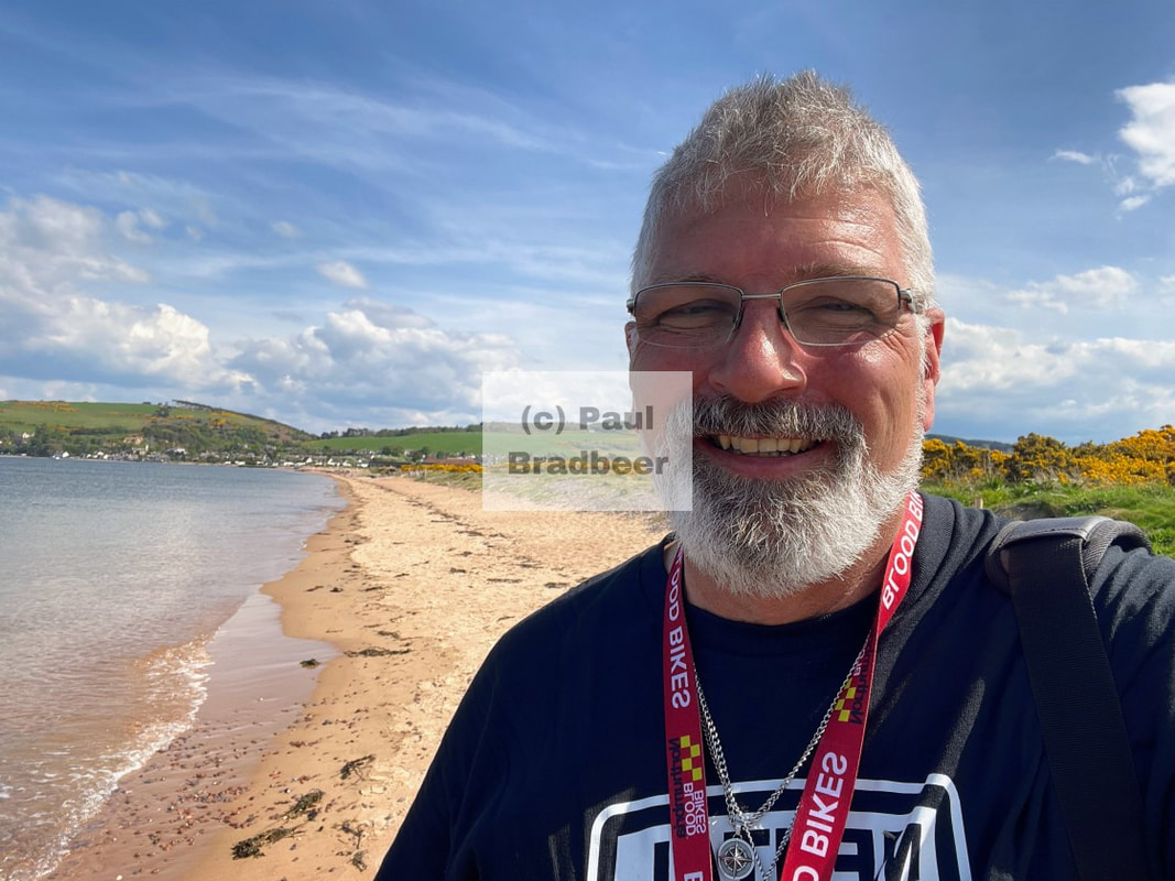
Beyond The Shore 2024-2025
From the point of ignition.
To the final drive.
The point of the journey is not to arrive.
Anything can happen.
From the point of entry.
Until the candle is burned.
The point of departure.
Is not to return.
Anything can happen.
(Neil Peart, Prime Mover)
Twenty Twenty Five - 2025

Yorkshire, Cumbria and Ayreshire
Motorcycle touring of the Yorkshire Coast, Yorkshire Dales, Cumbria and Culzean Castle in Ayreshire
Scotland
Motorcycle tour of the West coast of Scotland taking in the Isle of Arran, Kintyre, Skye and then East to the Black Isle and North to John O'Groats

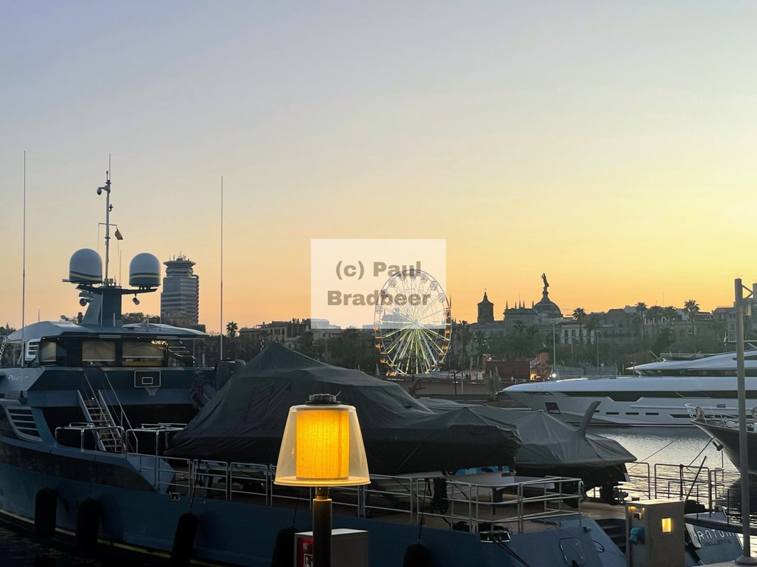
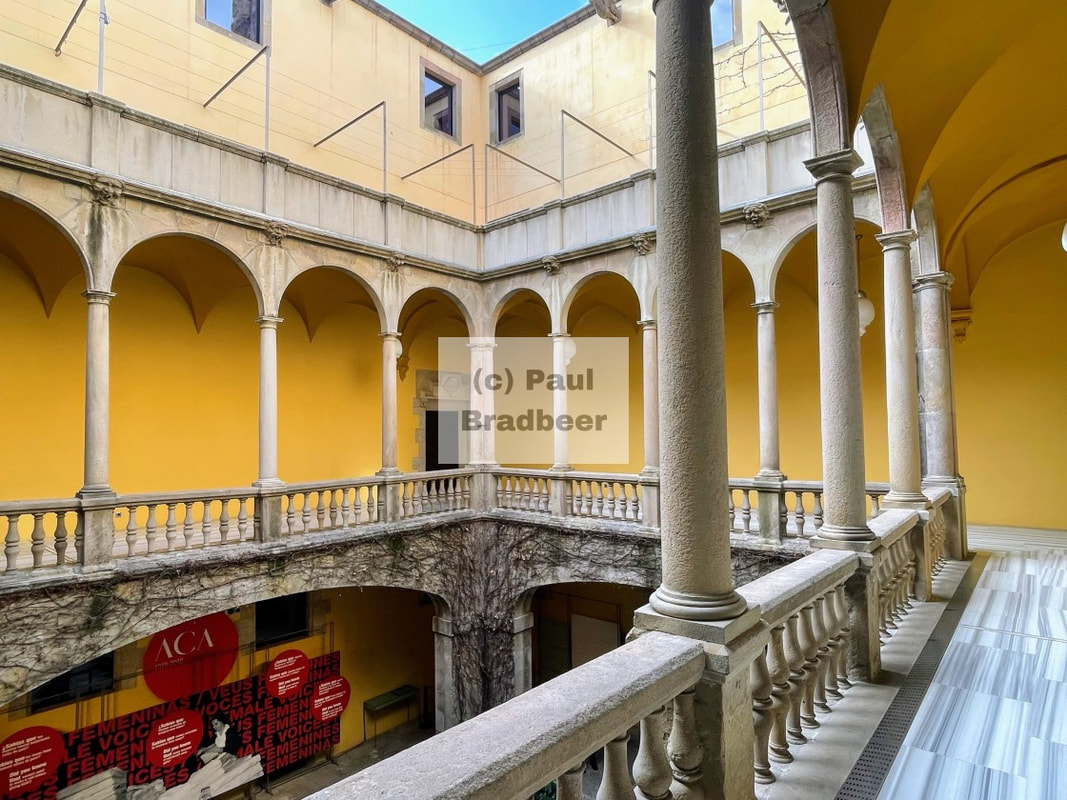
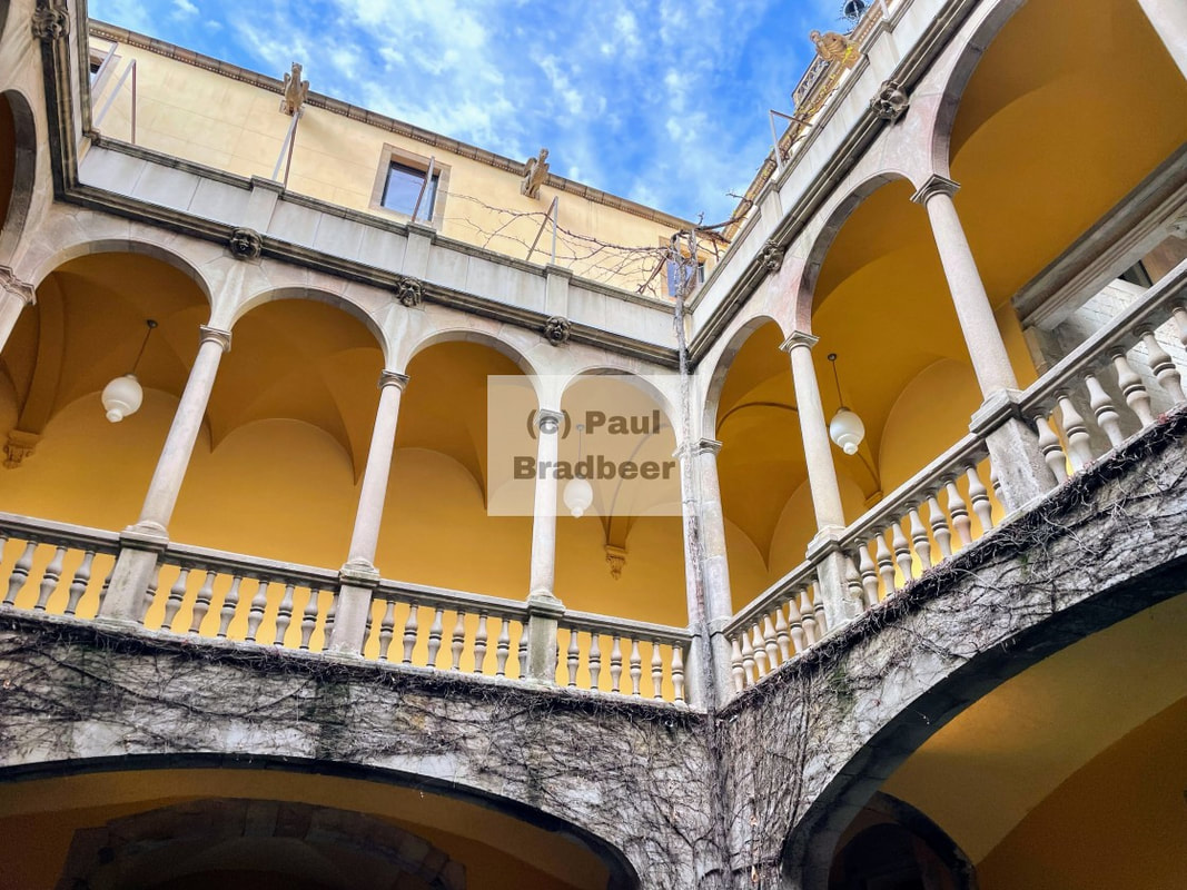
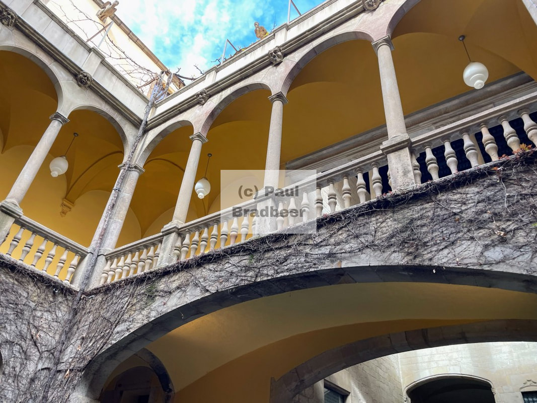
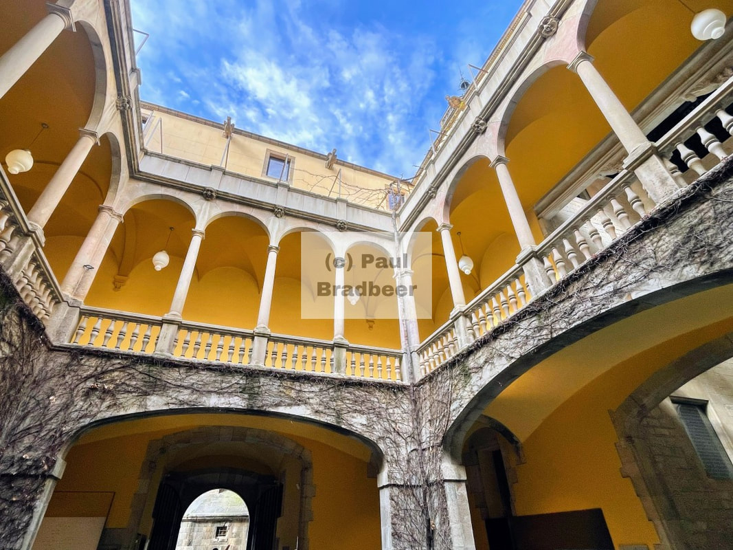
Barcelona - Competition Is For Losers
A few days in Barcelona taking in the food, culture and history. Unique, enjoyable and would return.
2025 - Summer / Autumn
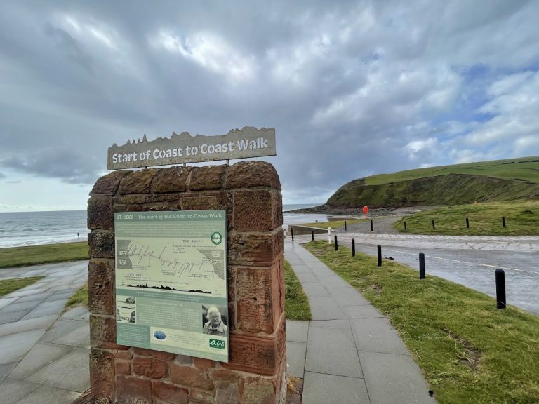
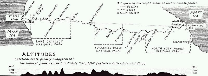
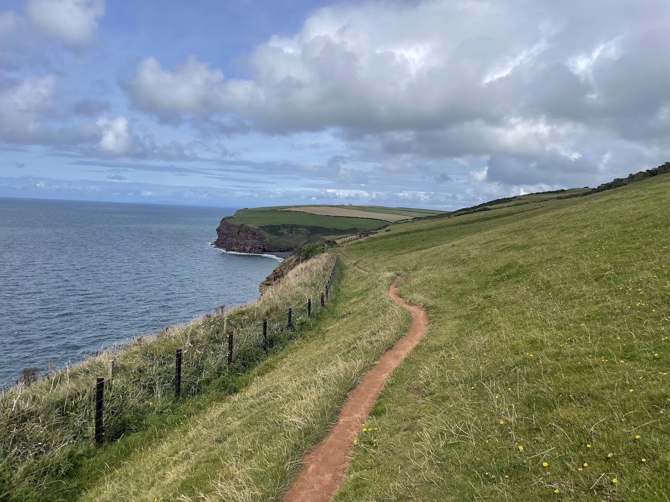
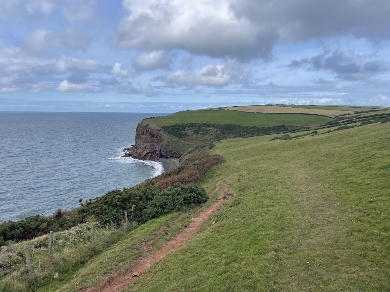
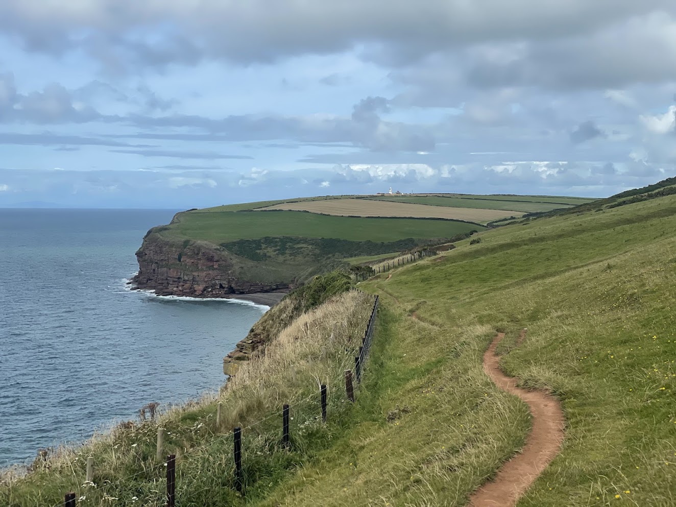
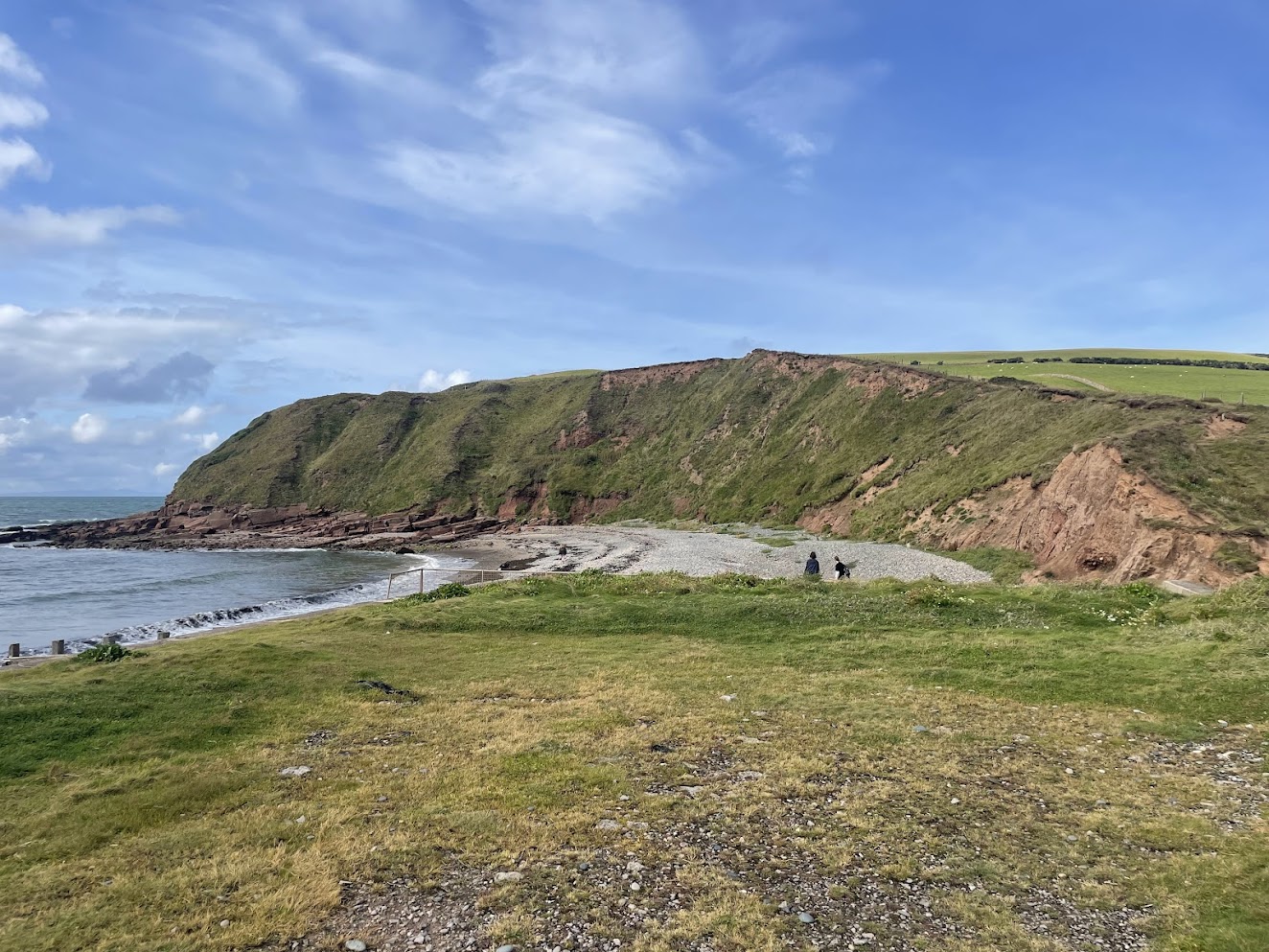
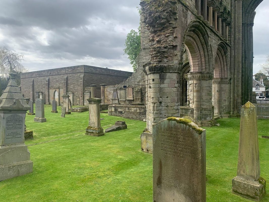
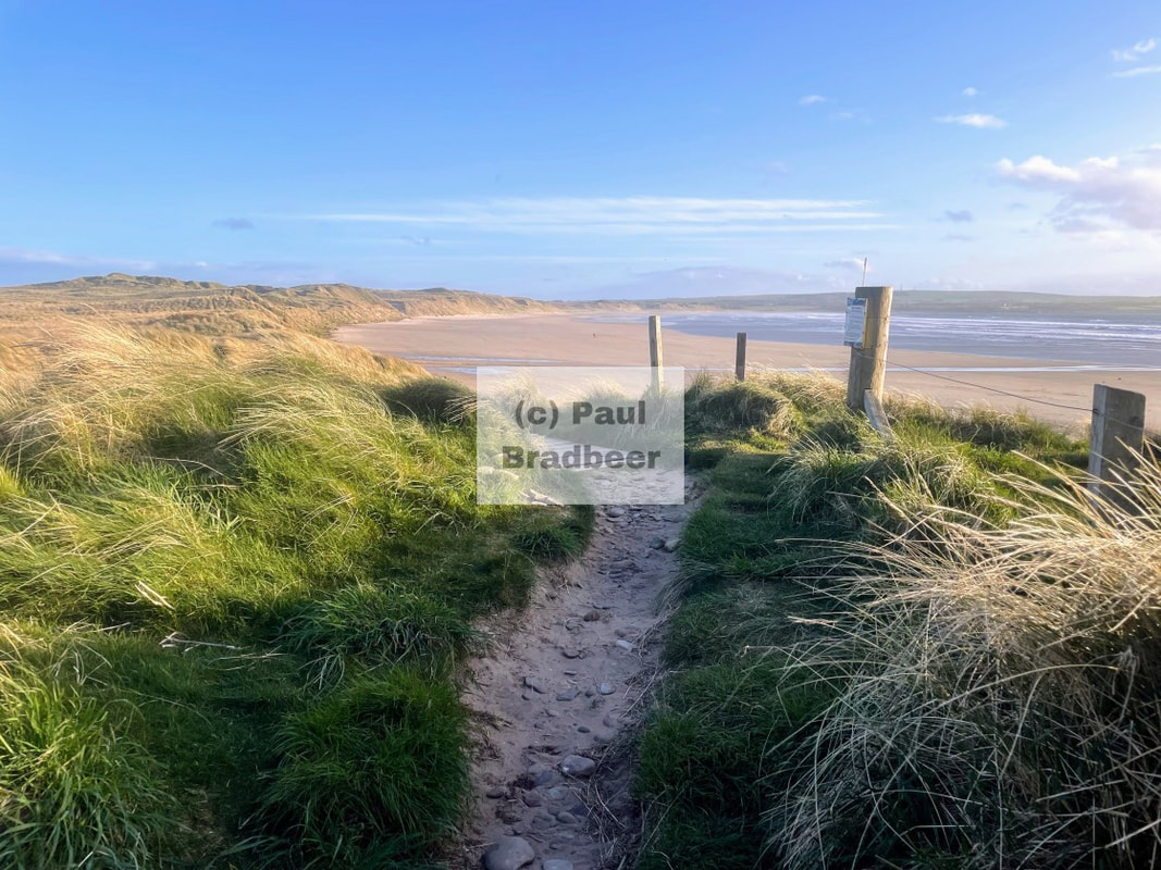
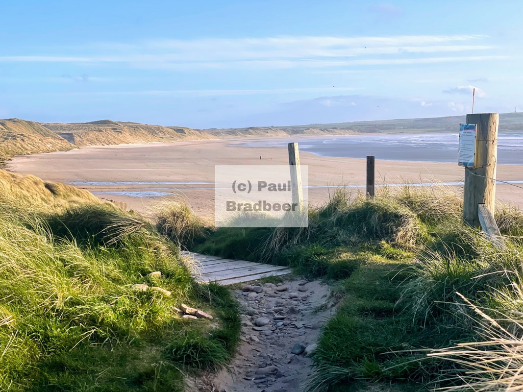
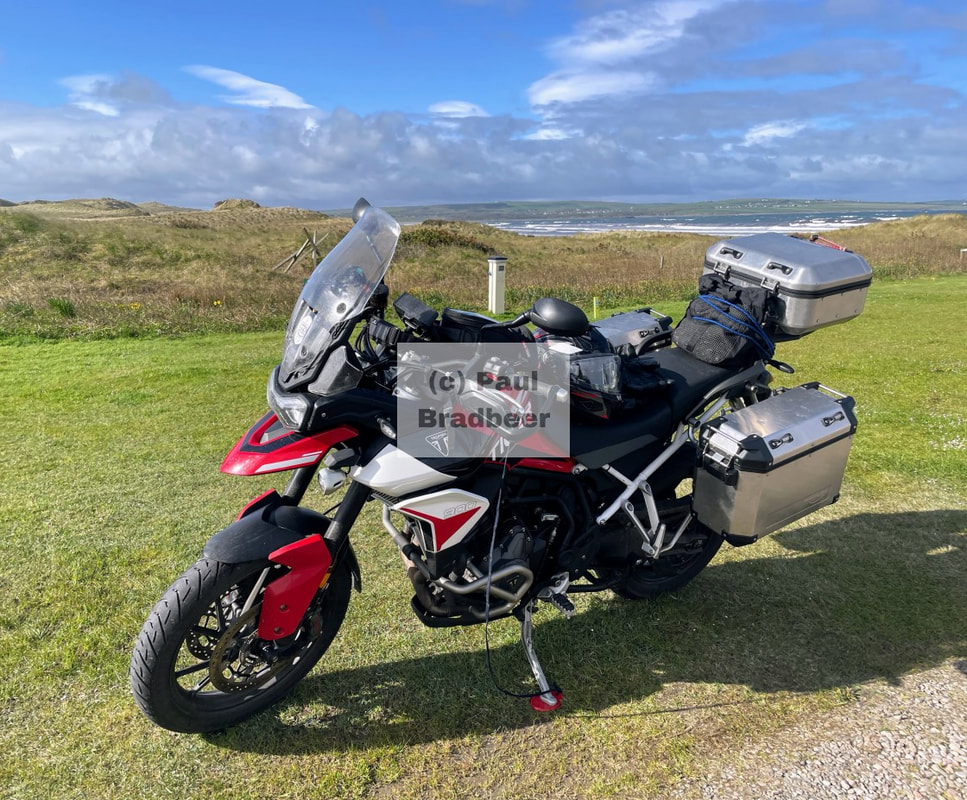
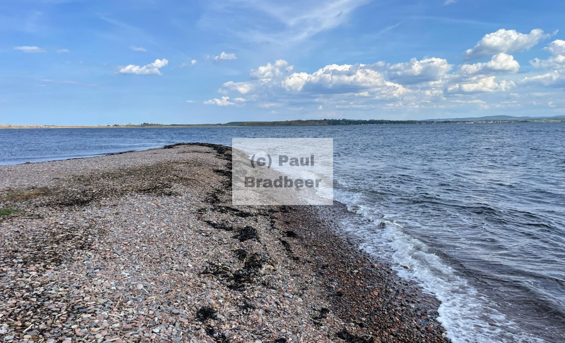
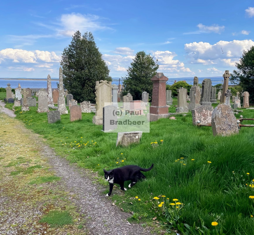
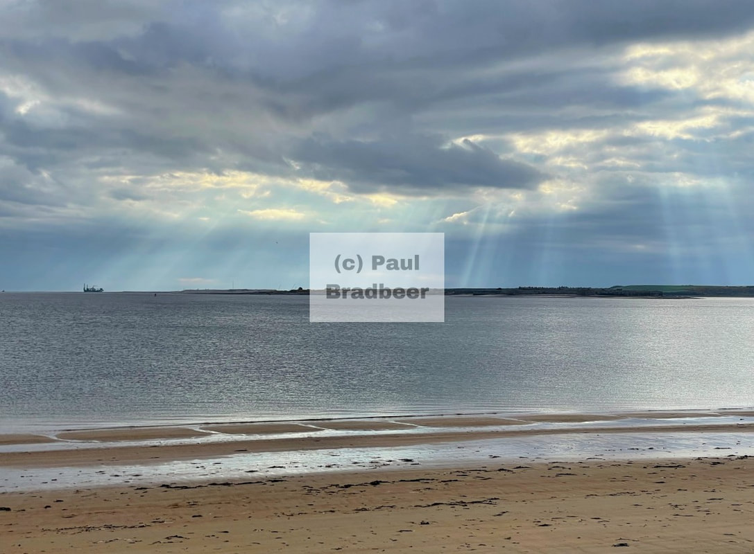
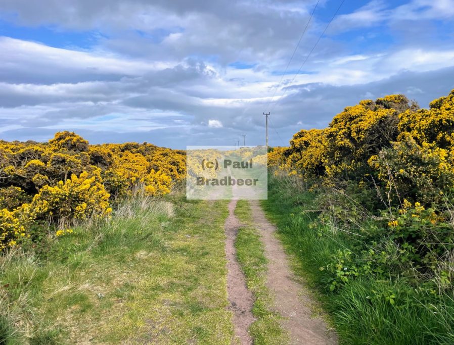
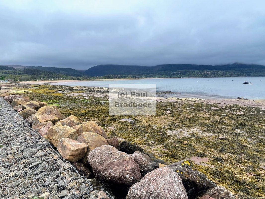
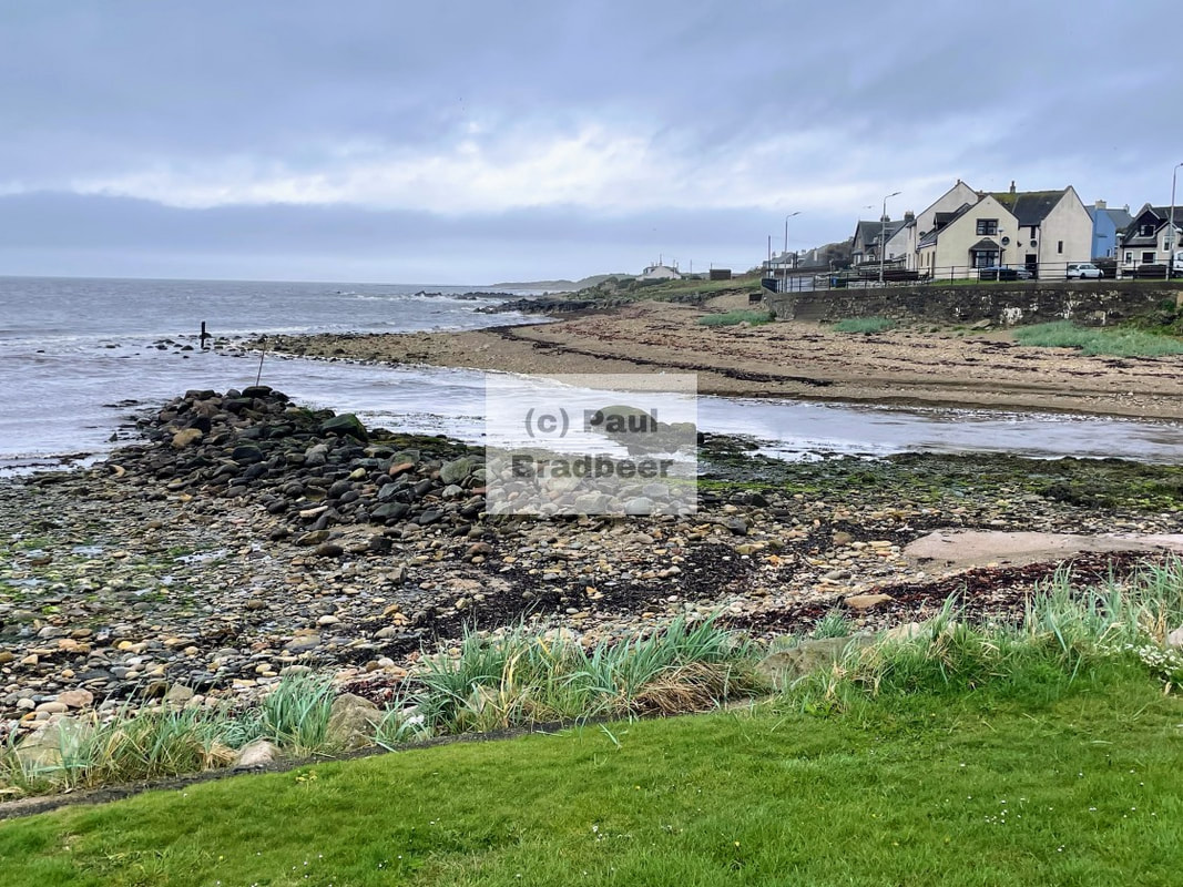
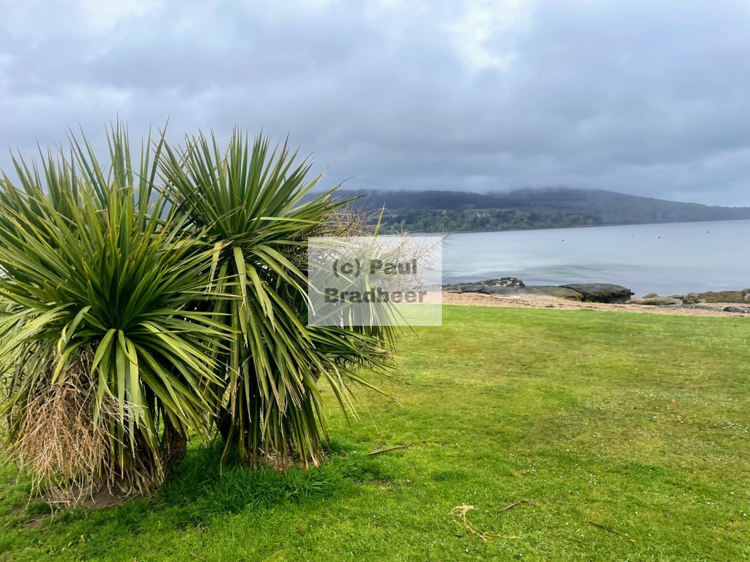
September 2025 - St. Bees Head
St. Bees Head, a magnificent piece of headland renowned for spectacular views and bird populations, which also happens to be the start of the famous 182 mile West to East stomp across Northern England.

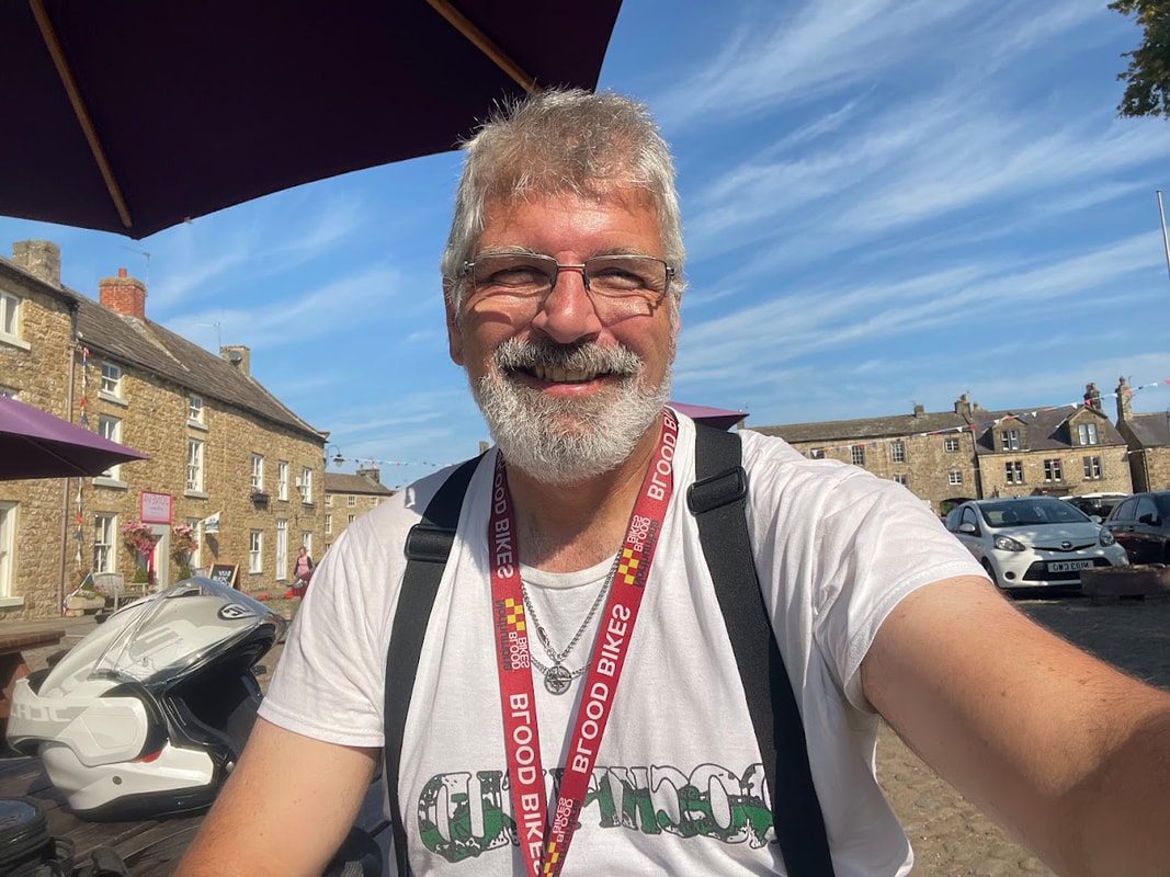
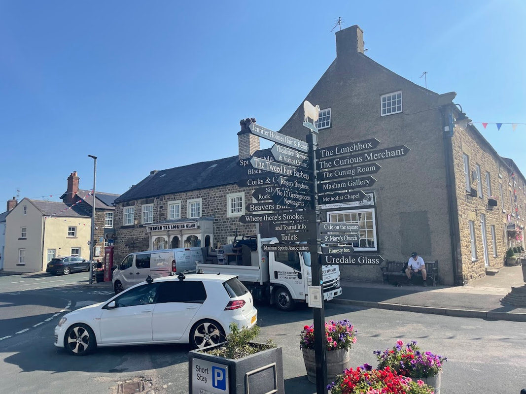
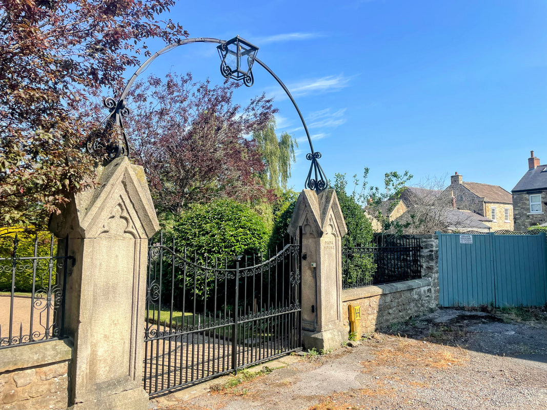
August 2025 - Masham, North Yorkshire
Masham, a market town in North Yorkshire, nestled next to the River Ure. The town is home to not one, but two classic Yorkshire Breweries - Theakston and Black Sheep.

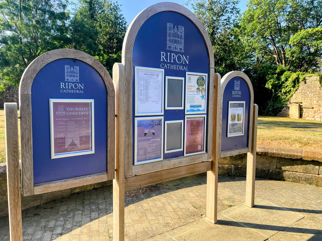
August 2025 - Ripon, North Yorkshire
One of the smallest cities in the UK; Ripon, the cathedral city of the dales - known for its 7th century cathedral, ancient market square replete with horn blowing traditions, and rich legal history.

August 2025 - Ilkley, North Yorkshire
A blend of beautiful natural landscapes and town amenities with good connections to Leeds to the South, York to the East and the Yorkshire Dales to the North, Ilkley has a lot to offer.
August 2025 - Boroughbridge, North Yorkshire
Situated close to York and on the edge of Nidderdale and the Yorkshire Dales, this was historically an important stop for the stagecoaches travelling from London to Edinburgh along the Great North Road. In time the A1, the longest road in the United Kingdom, and the main road from London to Edinburgh, would pass through the town until it was bypassed in 1963.
August 2025 - Yorkshire Coast
Destination Boroughbridge in North Yorks. - a good base from which to explore West Yorkshire and the Yorkshire Dales. As in life, when motorcycle touring, the point of the journey is not to arrive, and so a significant detour via the Yorkshire Coast and North Yorks Moors was undertaken.
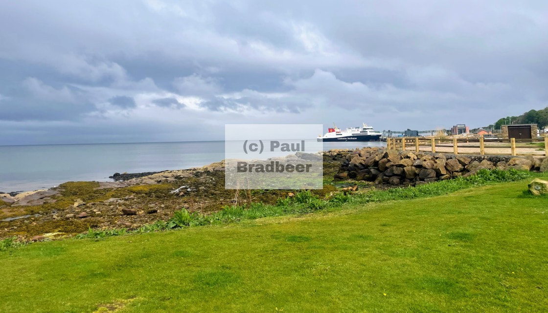
August 2025 - Ayr to Alnmouth Coast to Coast
A coast-to-coast ride from Ayr to Alnmouth in Northumberland which would give me the opportunity to sample the delights of the magnificent Moffat to Selkirk borders route, joining with other borders roads I was already familiar with through Kelso.
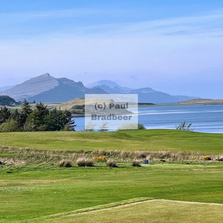
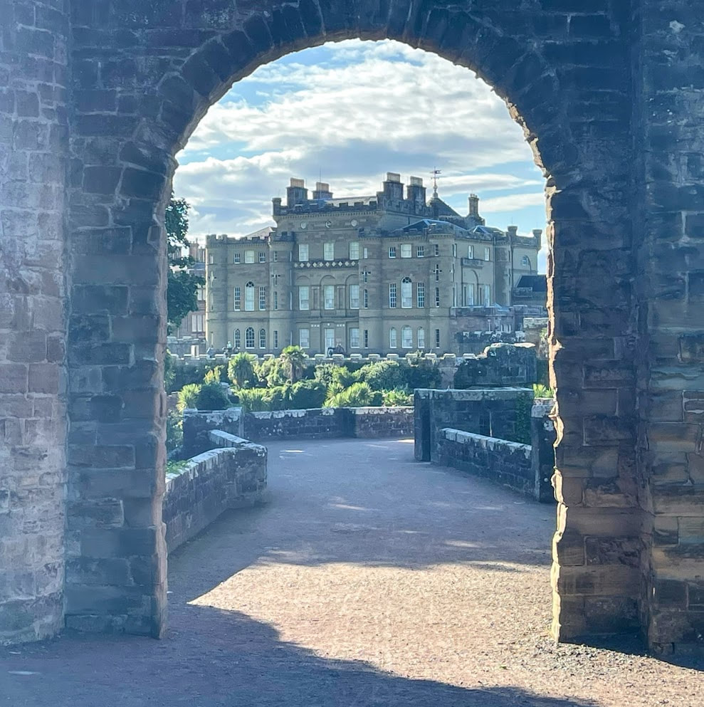
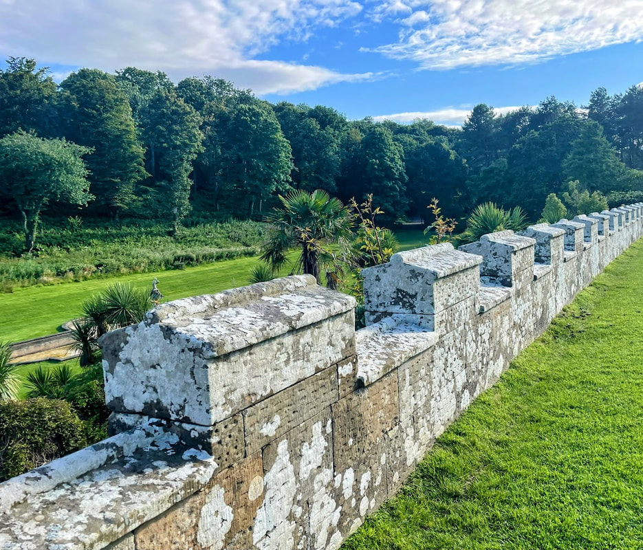
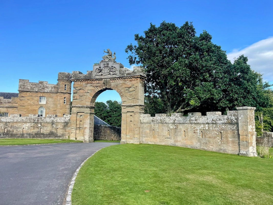
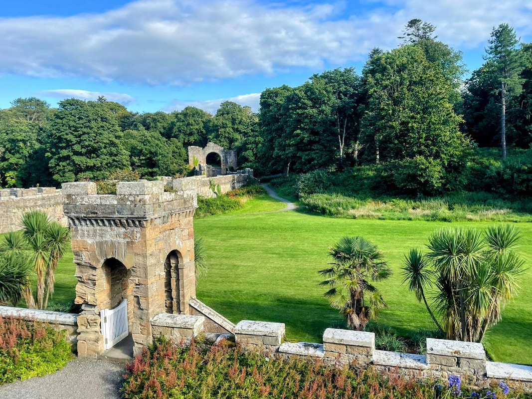
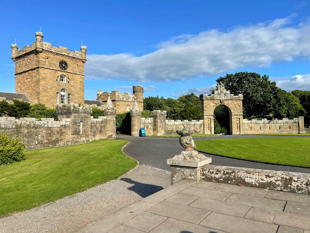
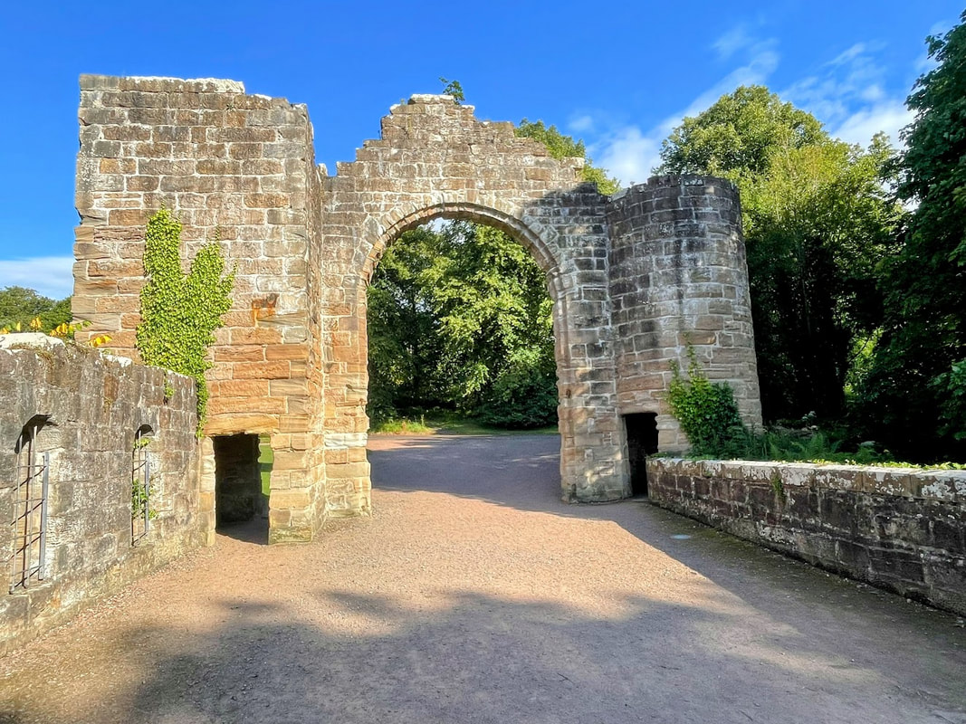
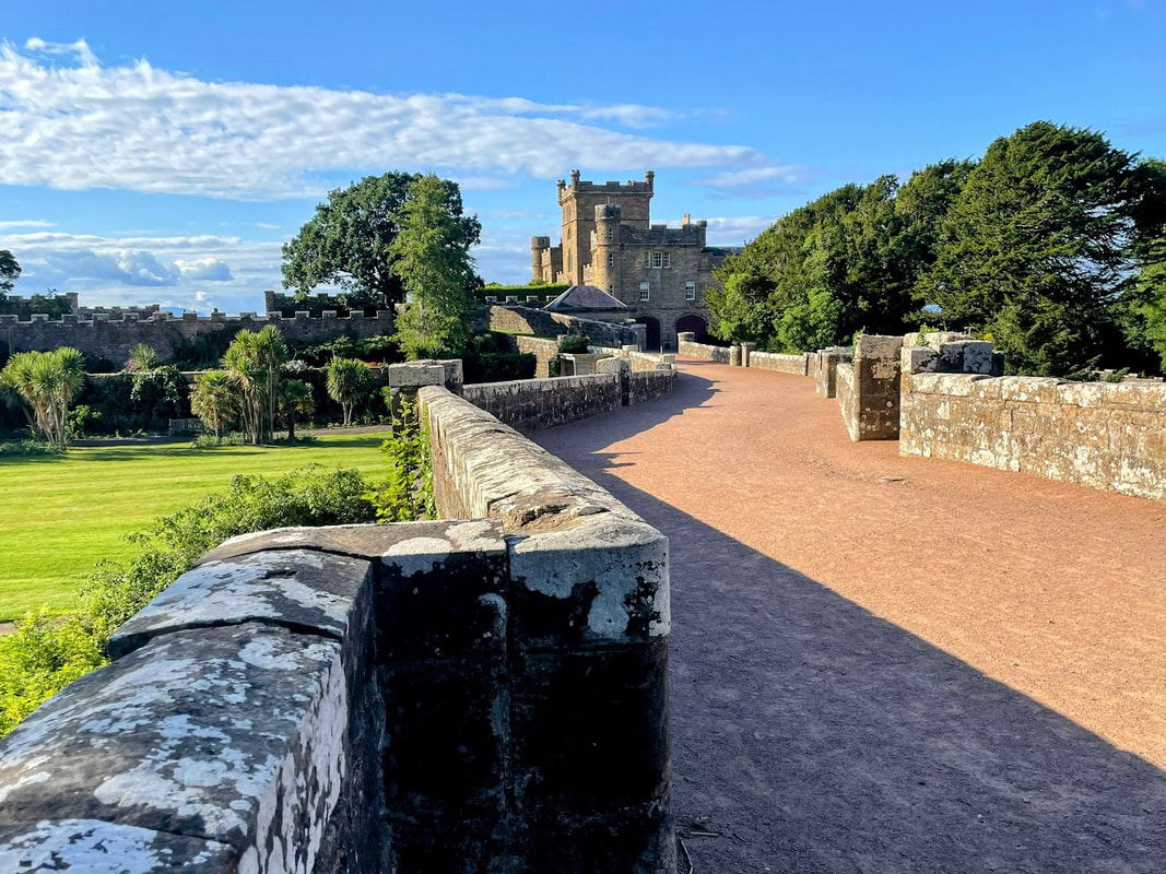
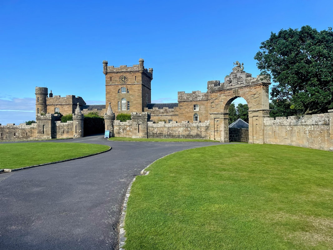
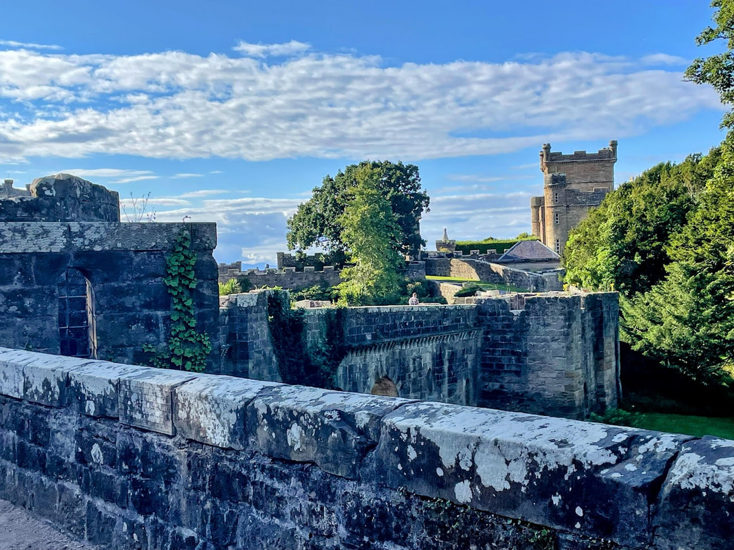
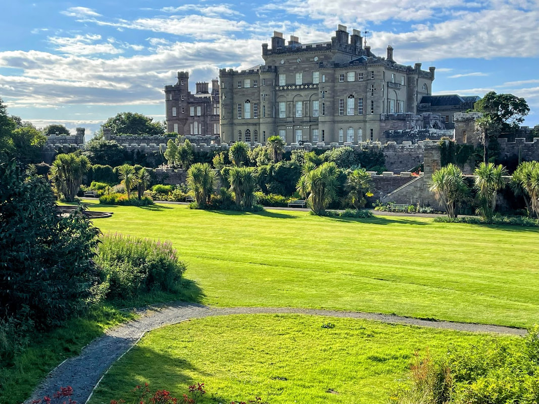
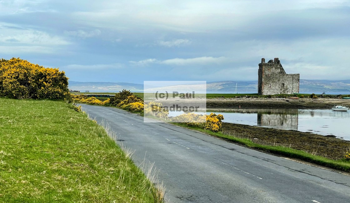
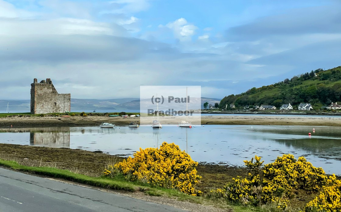
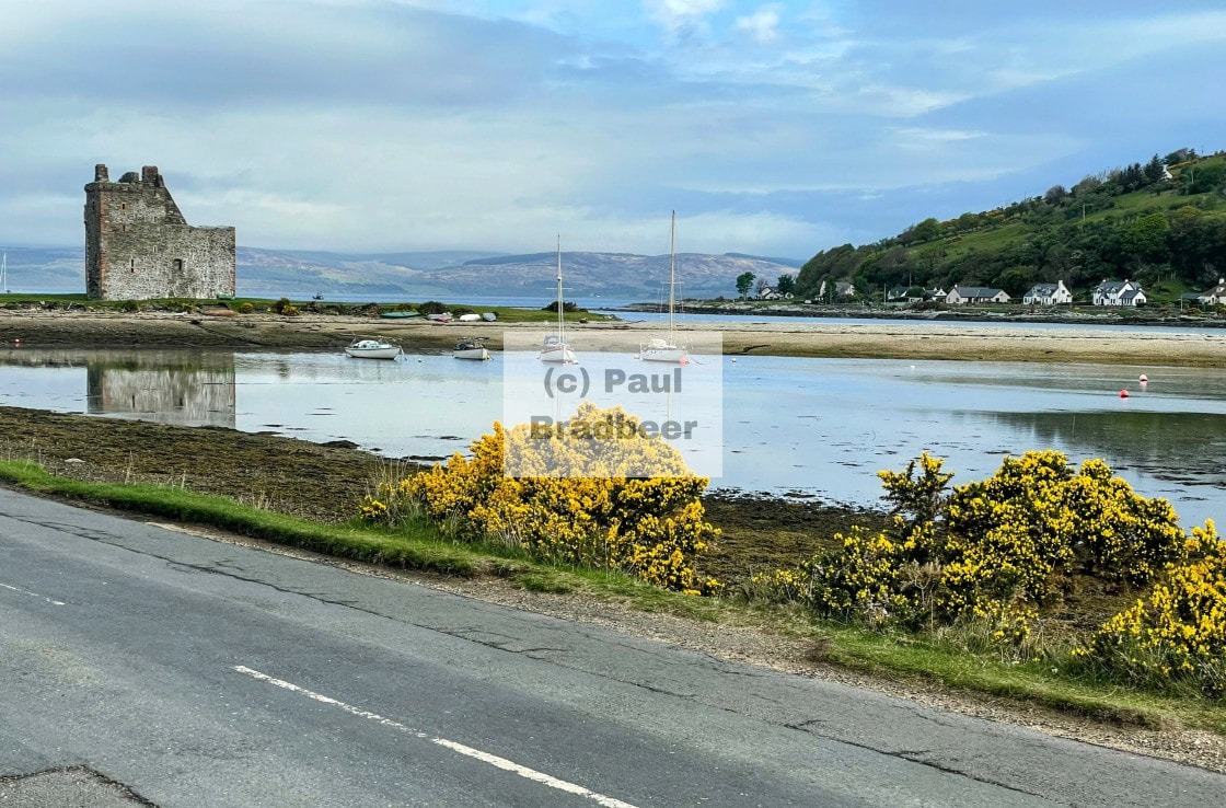
August 2025 - Culzean Castle, Ayreshire
Destination Culzean Castle (pronounced culane); located on cliff tops above the beautiful Ayrshire coastline with views over the Isle of Arran. I had wanted to stay here and explore previously but had always just been passing through.
June 2025 - Kirkby Stephen, Cumbria
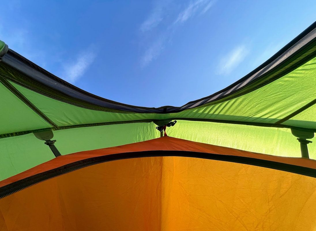
A few days retreat camping in Kirkby Stephen. Still on the cb500x since the Tiger was written off when a car drove into me in Yorkshire; not so much luggage space, but enough for a few days travel and the camping kit.
2025 - Spring - Scotland

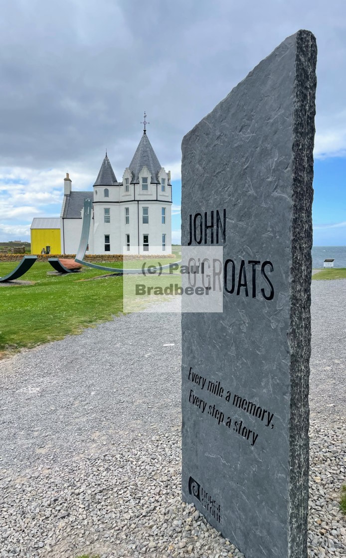
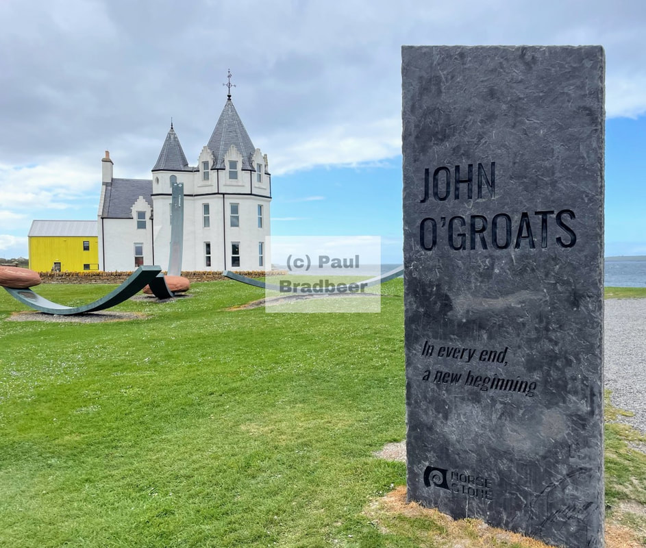
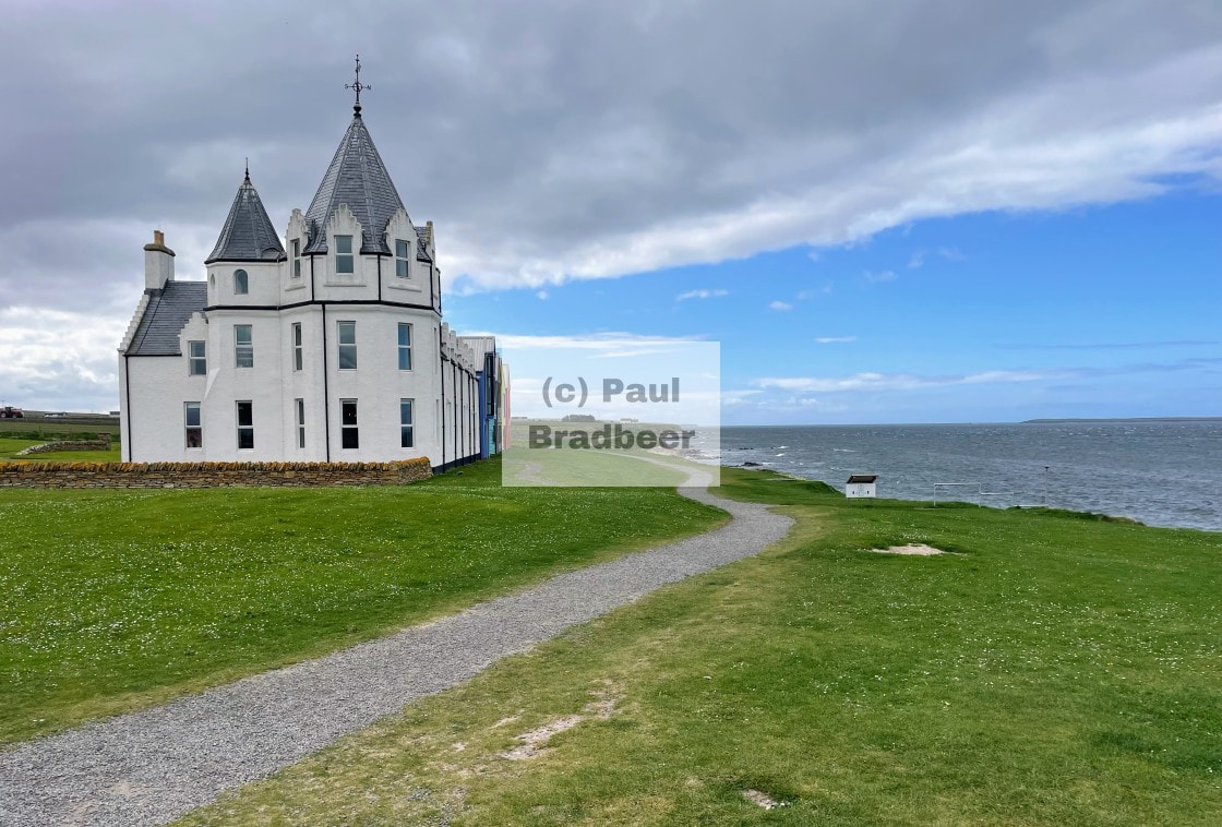
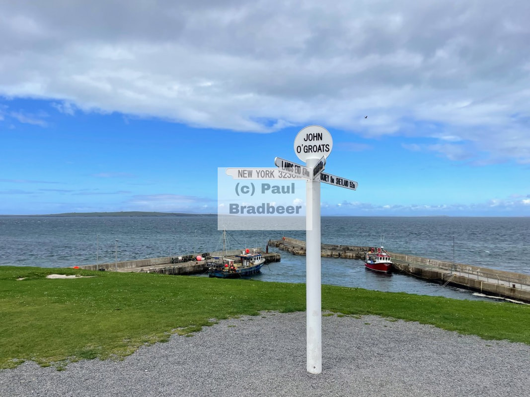
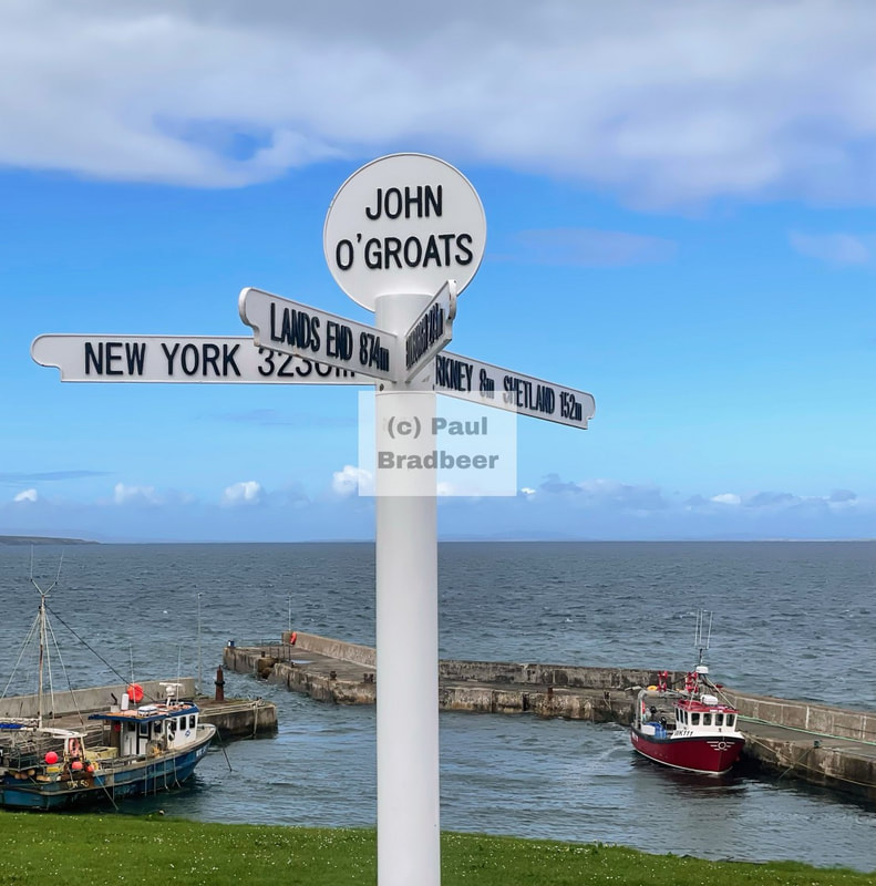
May 2025 - John O'Groats and Dunnet
Heading North from the Black Isle up the East Coast A9 to the infamous John O'Groats landmark and then an overnight stop atop Dunnet Bay.

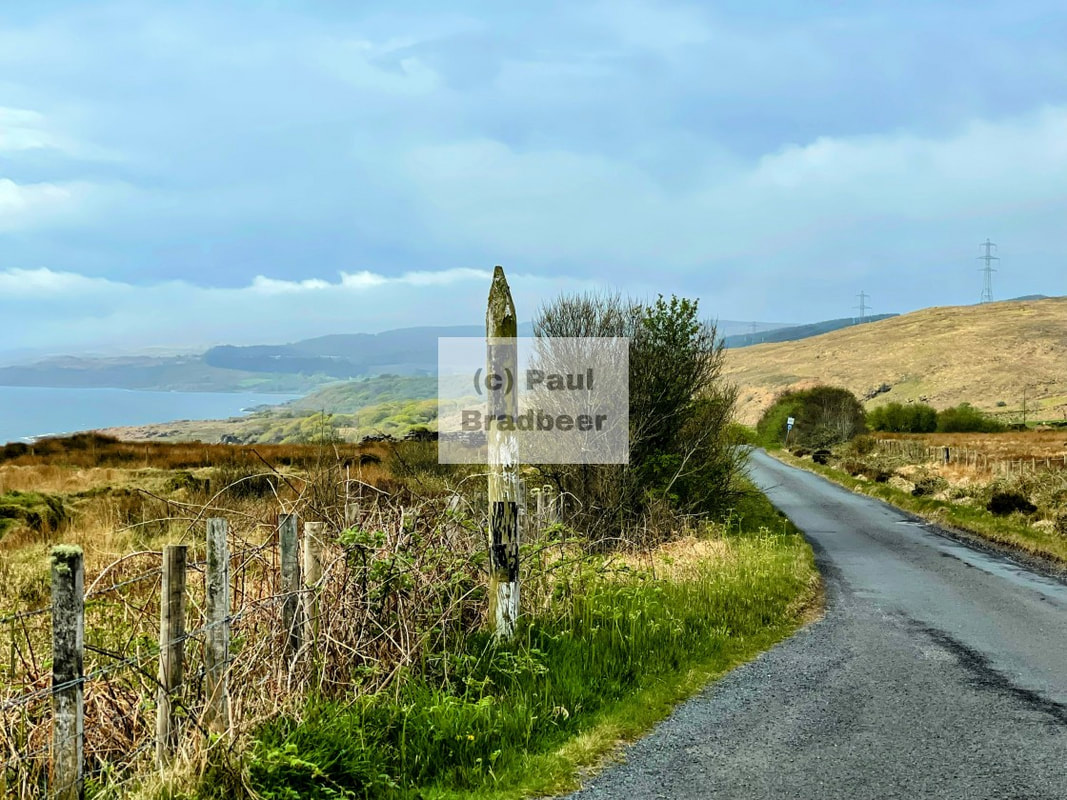
April 2025 - The Black Isle
The Black Isle, a peninsula on the East coast located just North of Inverness, is neither black nor an island! It is surrounded on three sides by the sea. The name is thought to allude to its dark, fertile soil and its appearance in winter, where it contrasts starkly against the snow-covered hills surrounding it, making it look black.
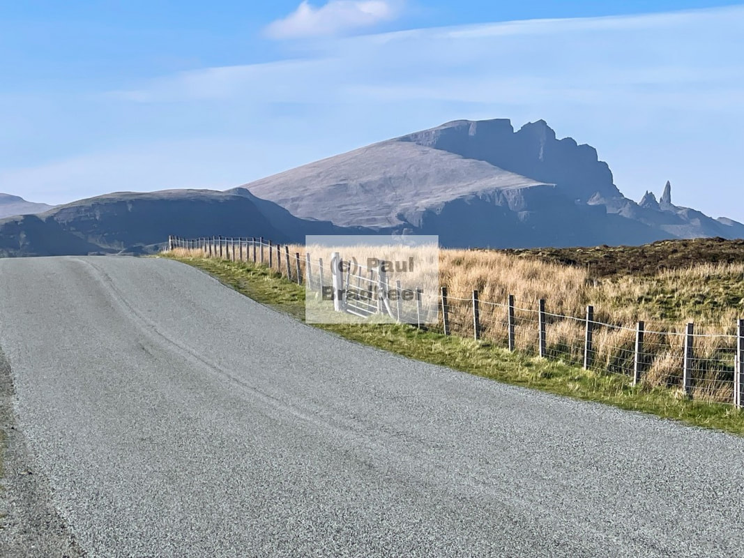
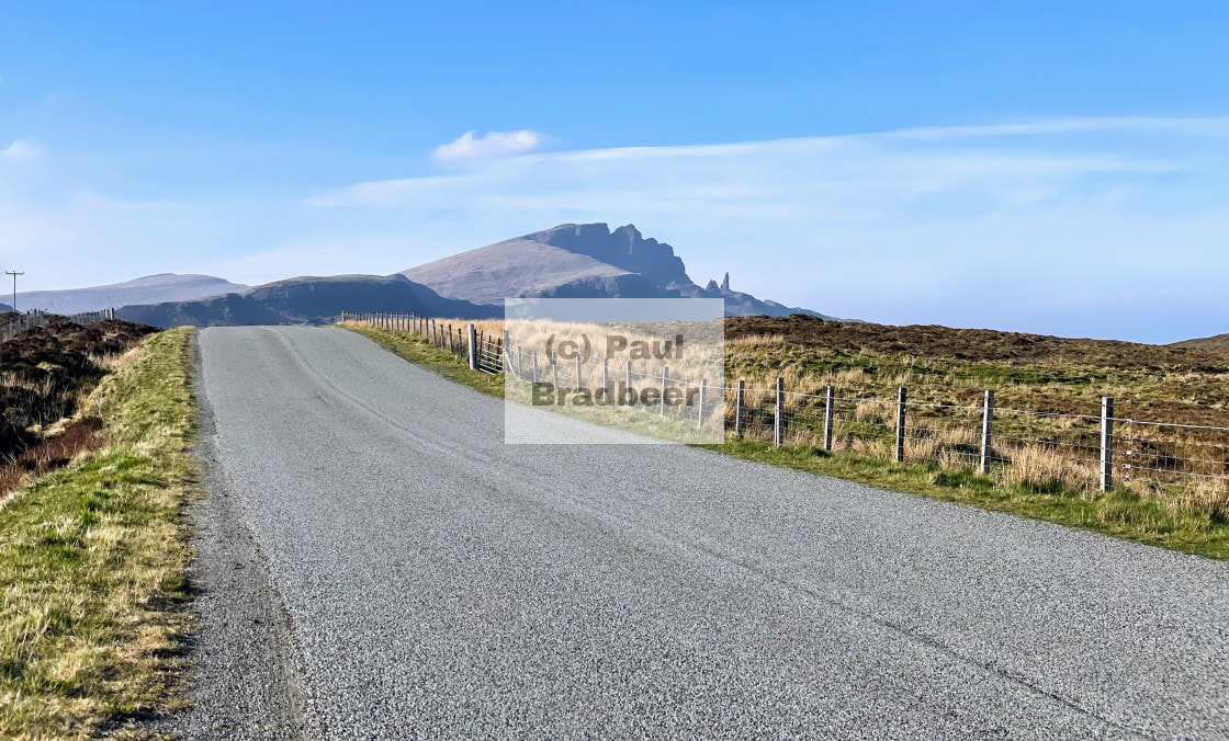
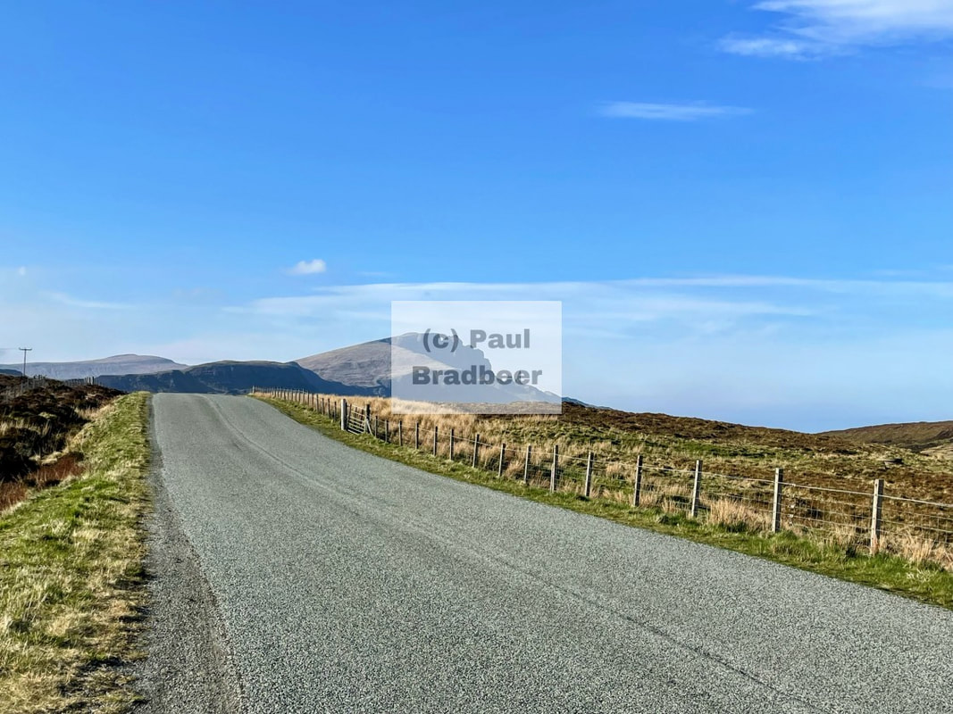
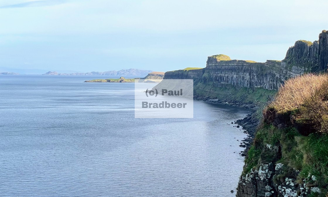
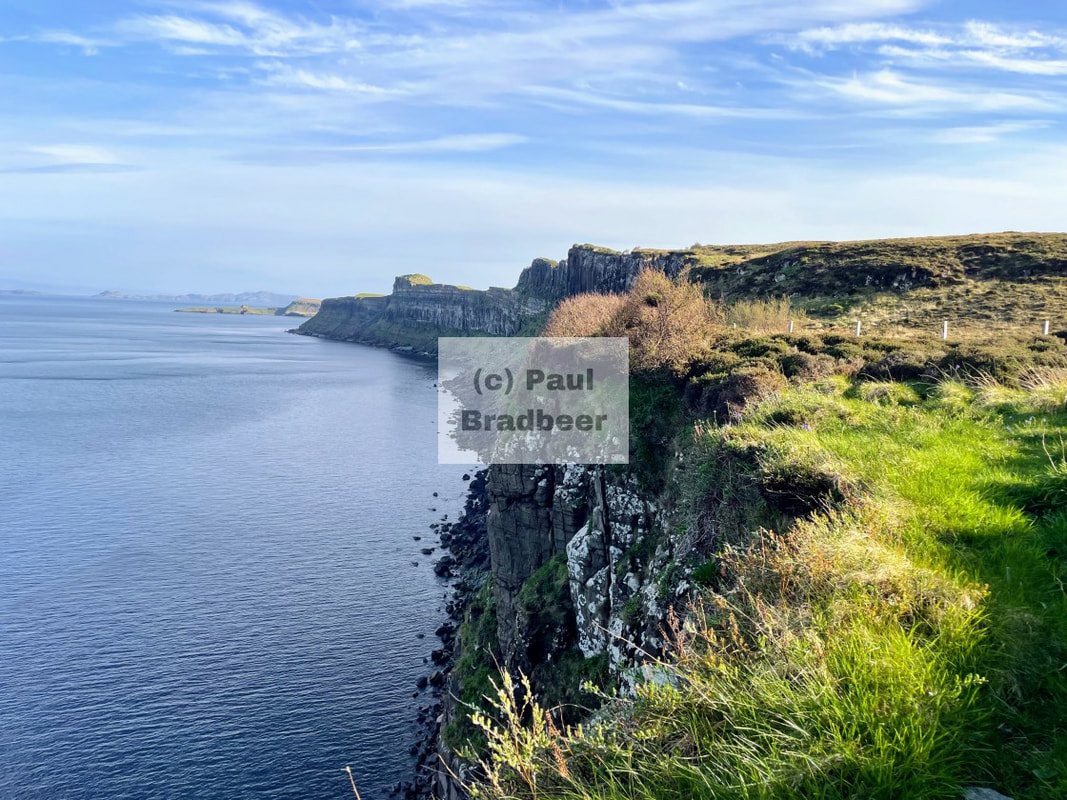
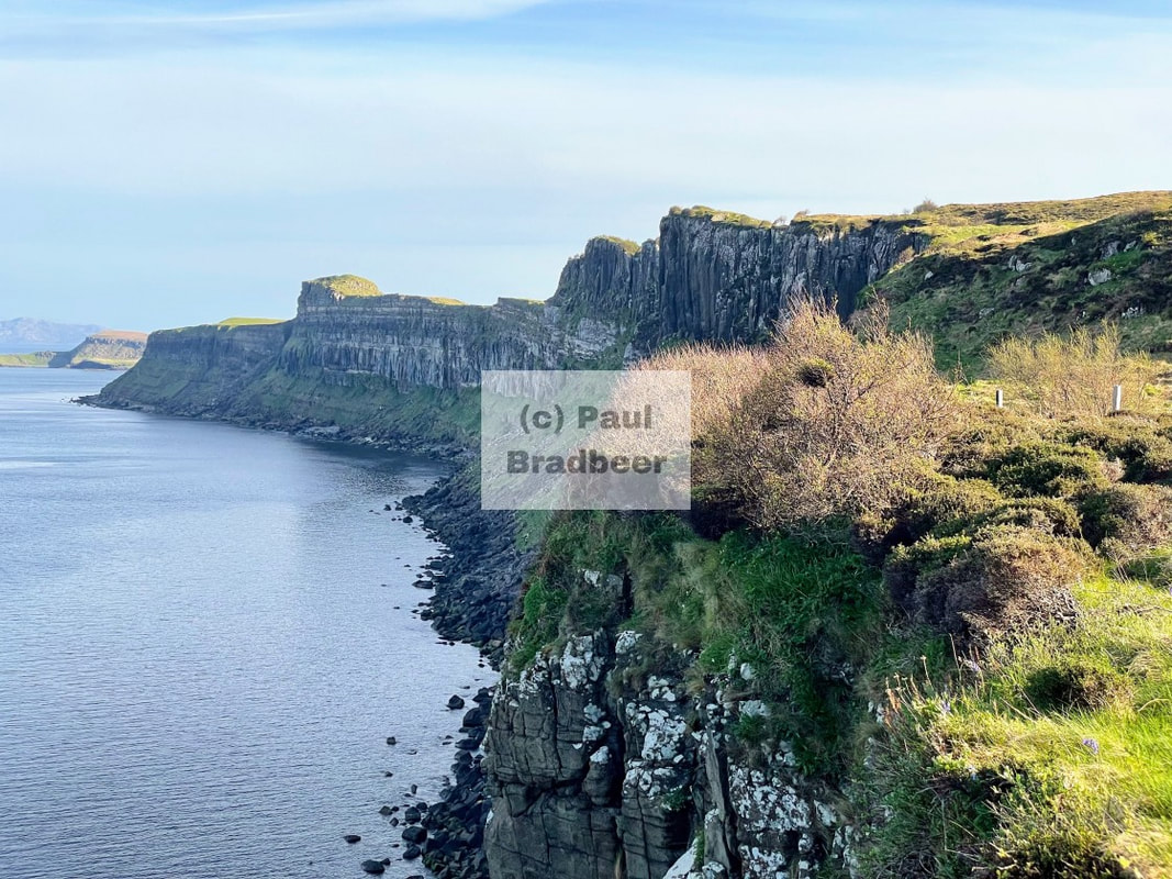
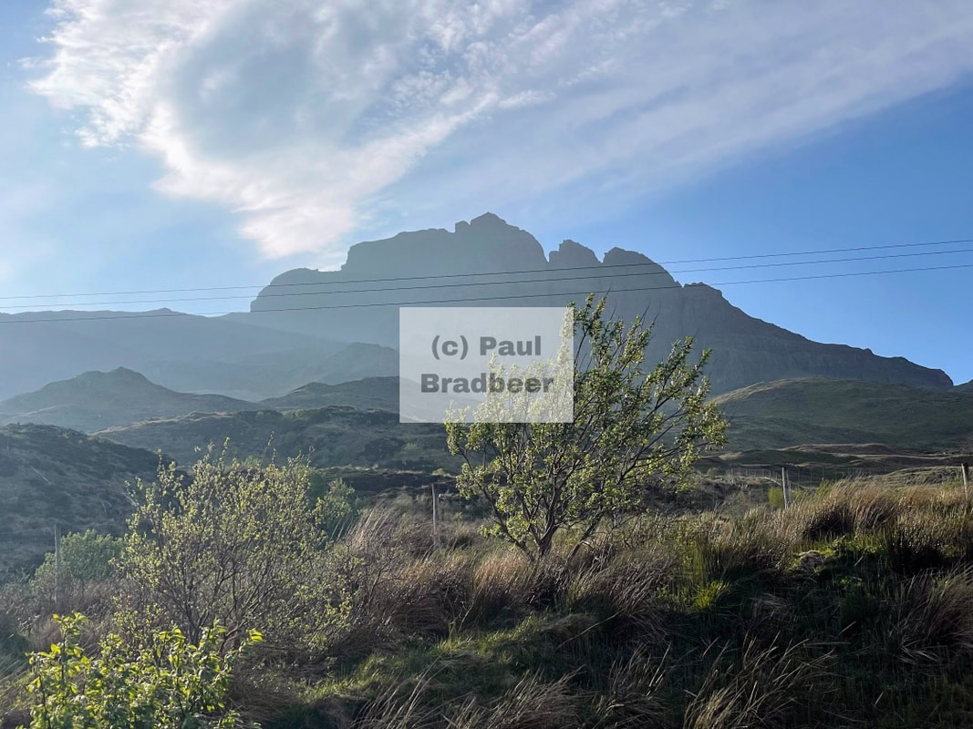
April 2025 - The Isle of Skye
A magnificent roller coaster of a ride which just seemed to get better and better the nearer to Skye I got. Blessed with good weather, some of the views were incredible. Camping in Broadford and exploring the North West of the Island. Amazing!
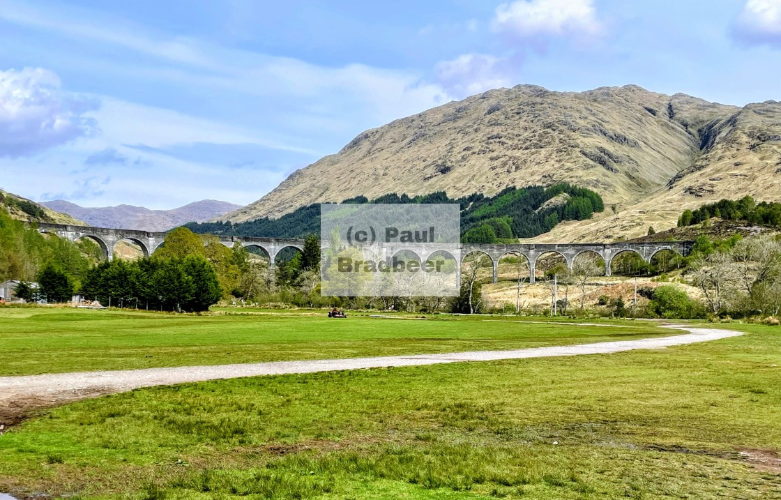
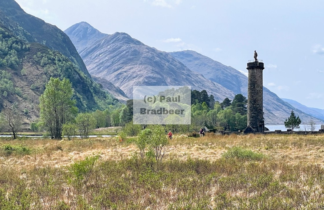
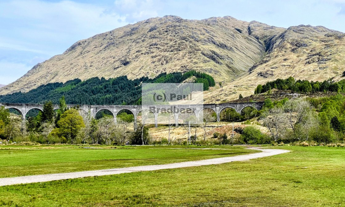
April 2025 - Glencoe, Fort William and Glenfinnan
Experiencing the memorable Glencoe Valley an infamous motorcycling hotspot in Scotland. Lunch in Fort William and a visit to the distinctive Glenfinnan Viaduct.

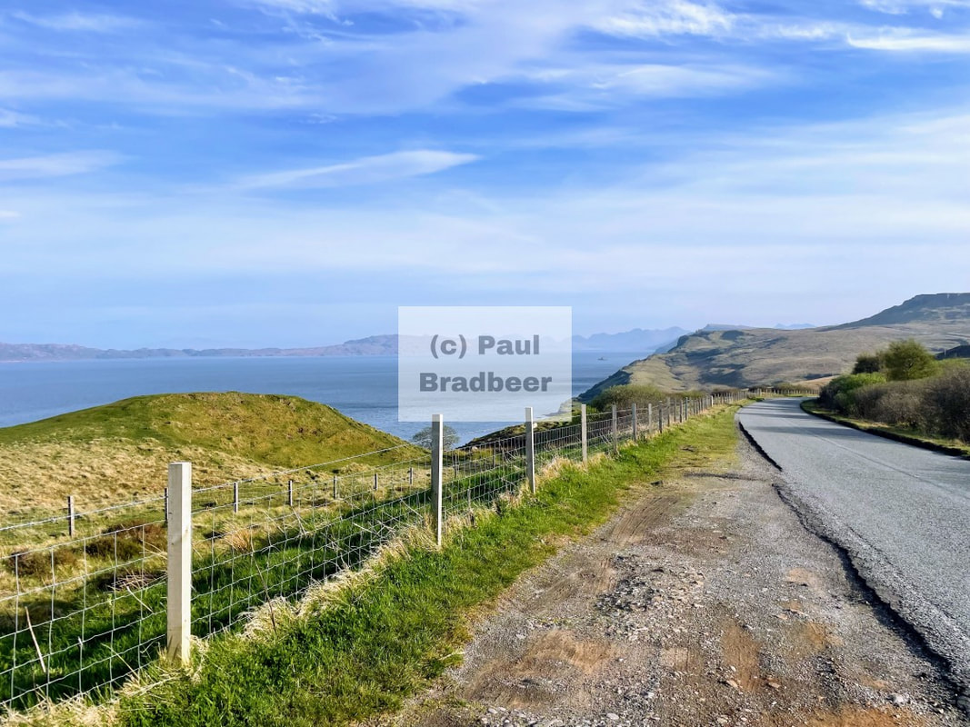
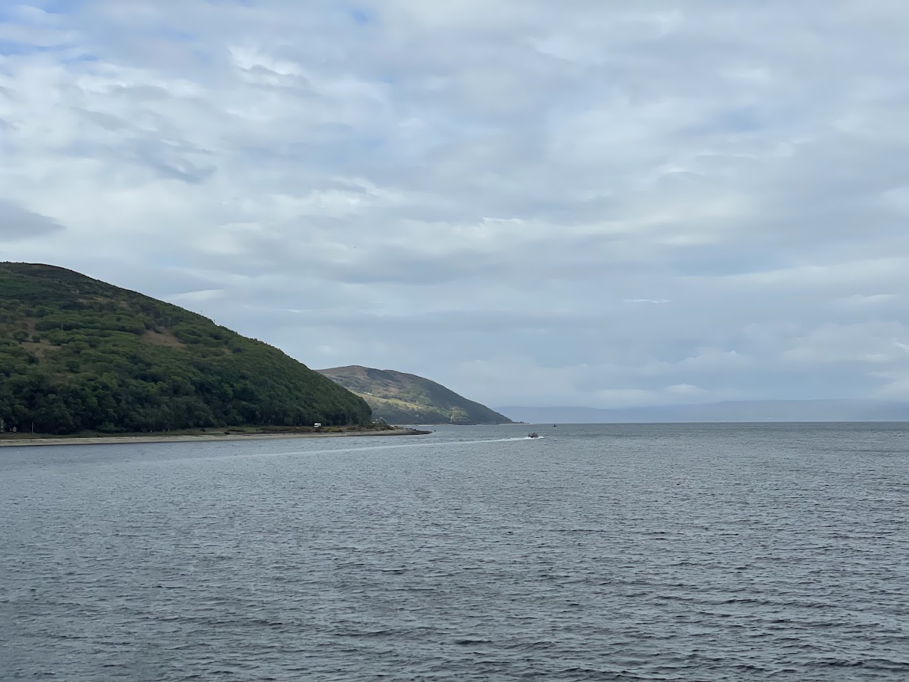
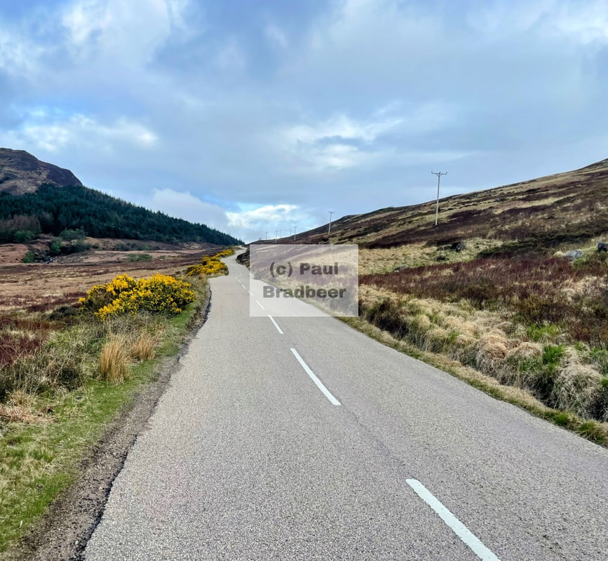
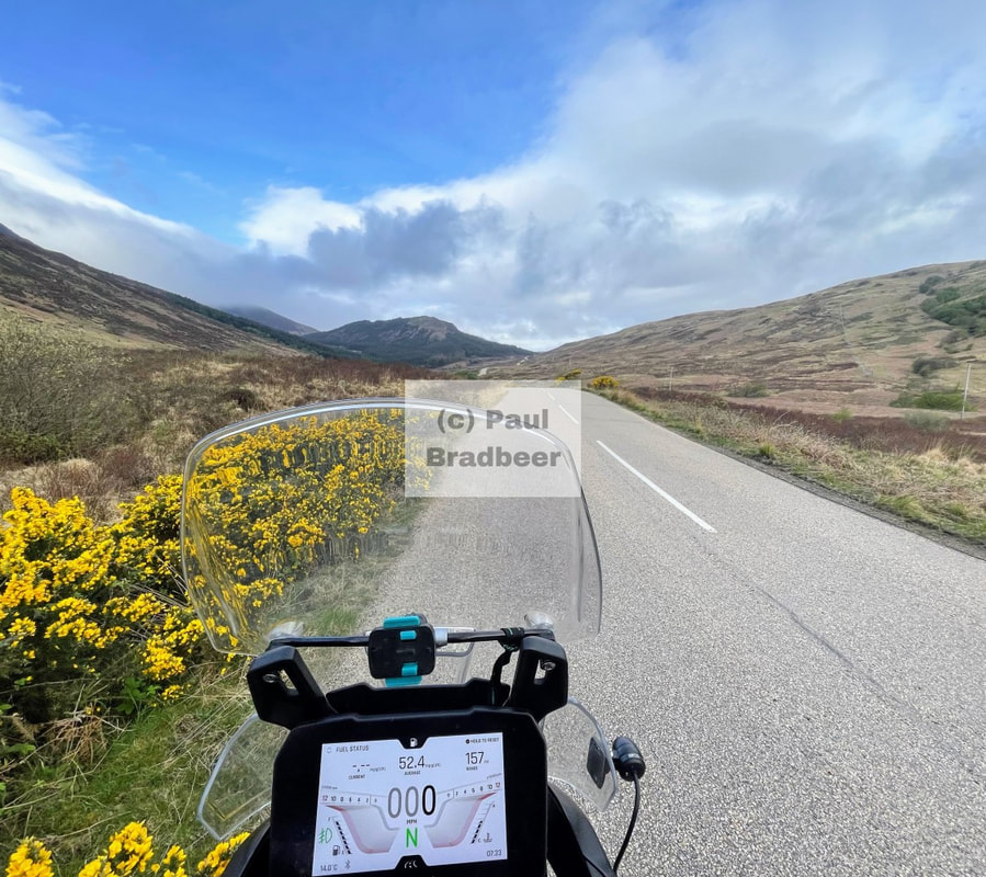
April 2025 - The Kintyre Peninsula
The Kintyre peninsula is situated on the dramatic Atlantic Seaboard of Scotland’s Highlands and Islands. It comprises a long arm of hilly country about 45 miles long and 8 miles wide and is the southernmost point of the county of Argyll.
Taking the ferry from Lochranza on Arran across to the peninsula I explore down the Eastern flank, through Campbeltown for lunch, and then North on the Western seaboard.

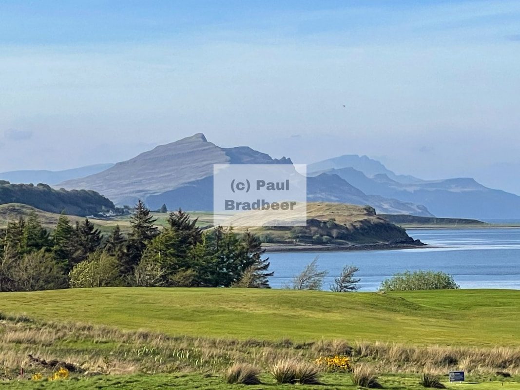
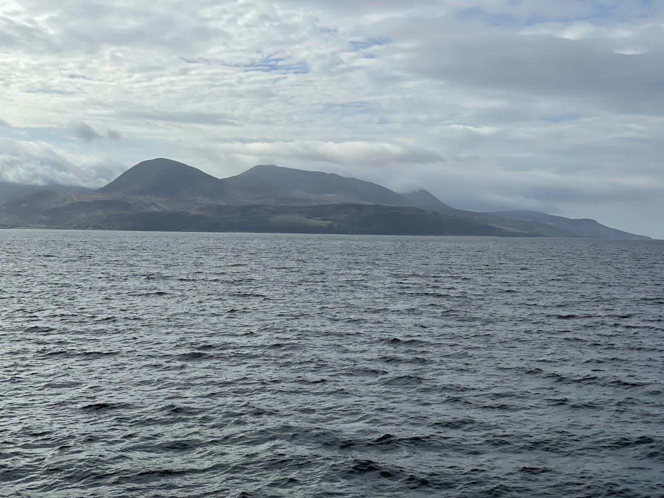
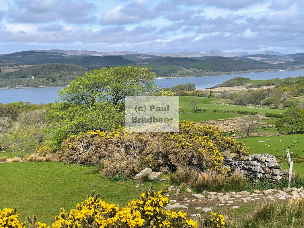
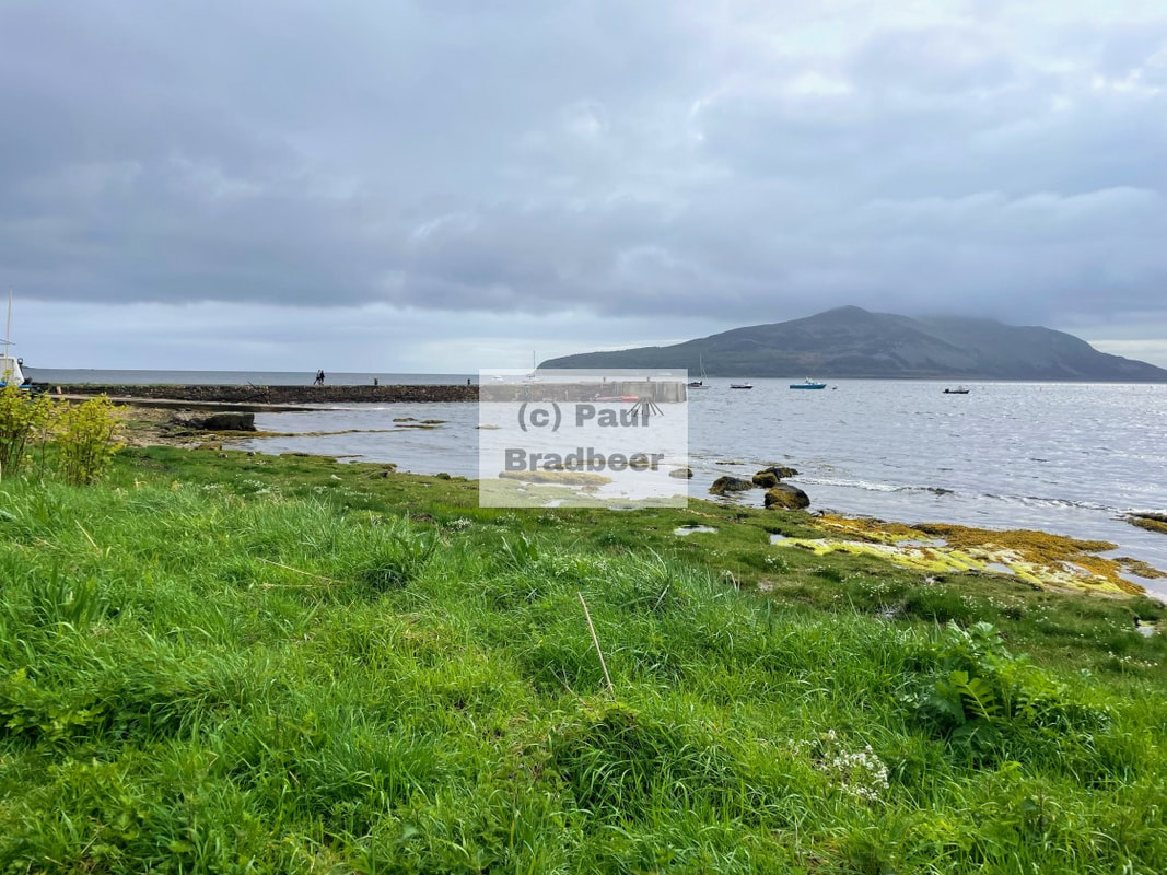
April 2025 - The Isle of Arran
Arran is a beautiful island off the west coast of Scotland and includes miles of coastal pathways, numerous hills and mountains, forested areas, rivers, small lochs and beaches.
Often referred to as "Scotland in Miniature", the Island is divided into highland and lowland areas by the Highland Boundary Fault. I toured the island over a couple of days in April 2025.
Twenty Twenty Four - 2024
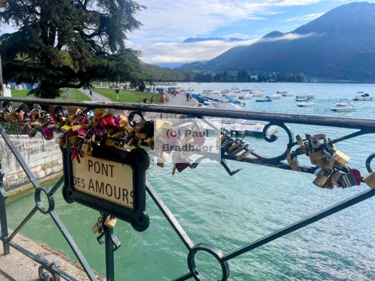
September 2024 - Annecy
The "Pearl of the French Alps" and "Venice of the Alps". Three canals and the Thiou river run through the old quarter which combined with the history, culture and some of the older buildings provide an idyllic location to dine, walk and enjoy the passing of time. Roughly 26 miles around the lake on the largely very good cycle paths is a pleasant trip with a number of villages and eateries en-route to choose from. It is one the the cleanest urban lakes in Europe and has an inspiring Carribean style blue/green colour which is hard to beat.

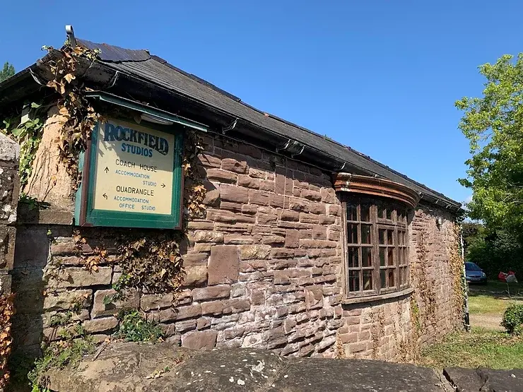
June 2024 - The Magic of Rockfield
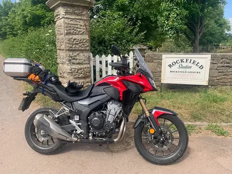
A visit and tour of Rockfield Studios in Monmouth which has hosted many names over the years including Queen, Rush, Black Sabbath, Coldplay, The Stone Roses and many more.
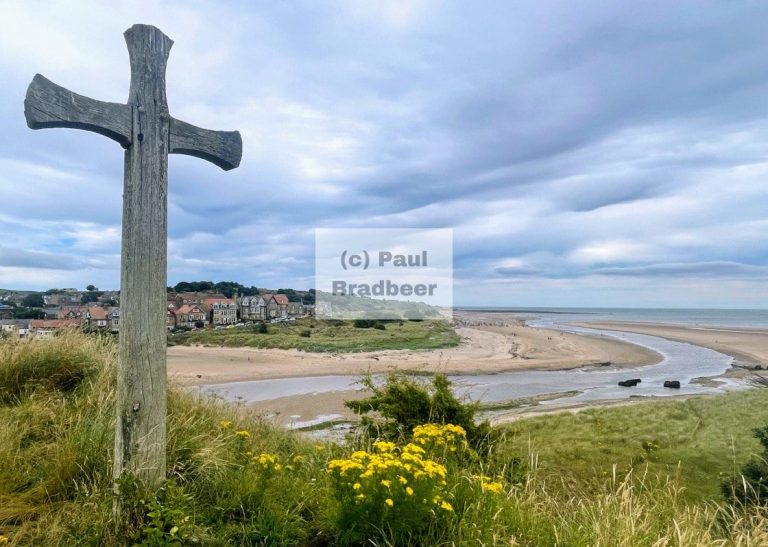
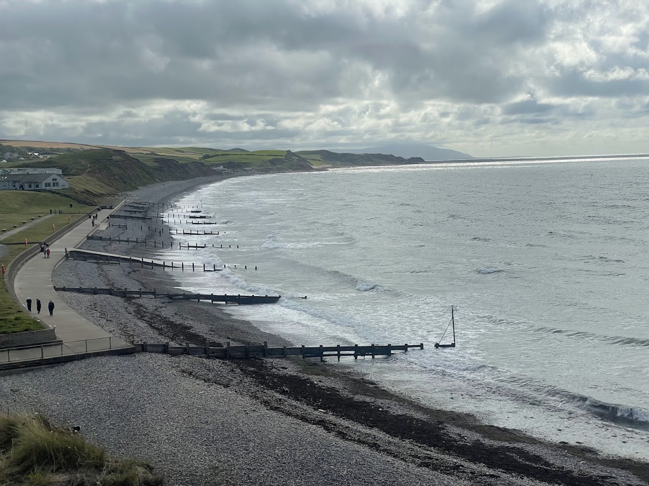
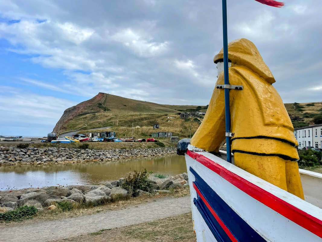
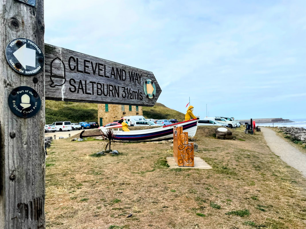
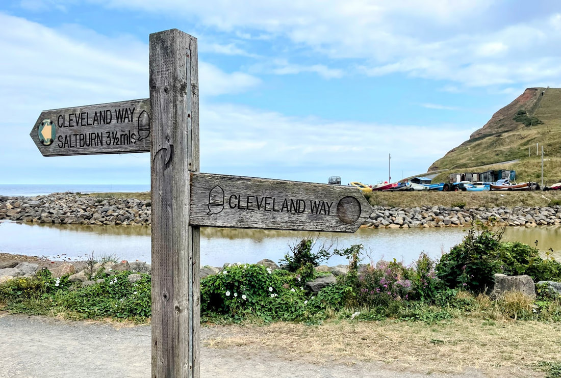
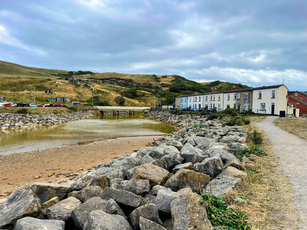
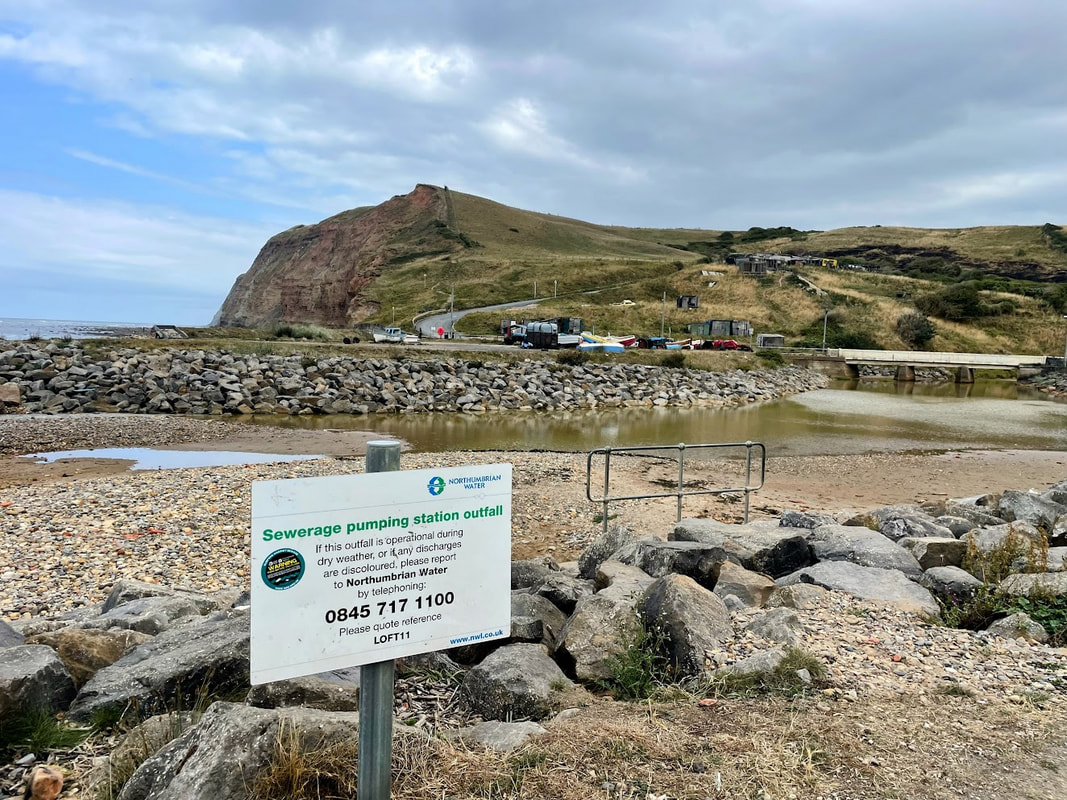
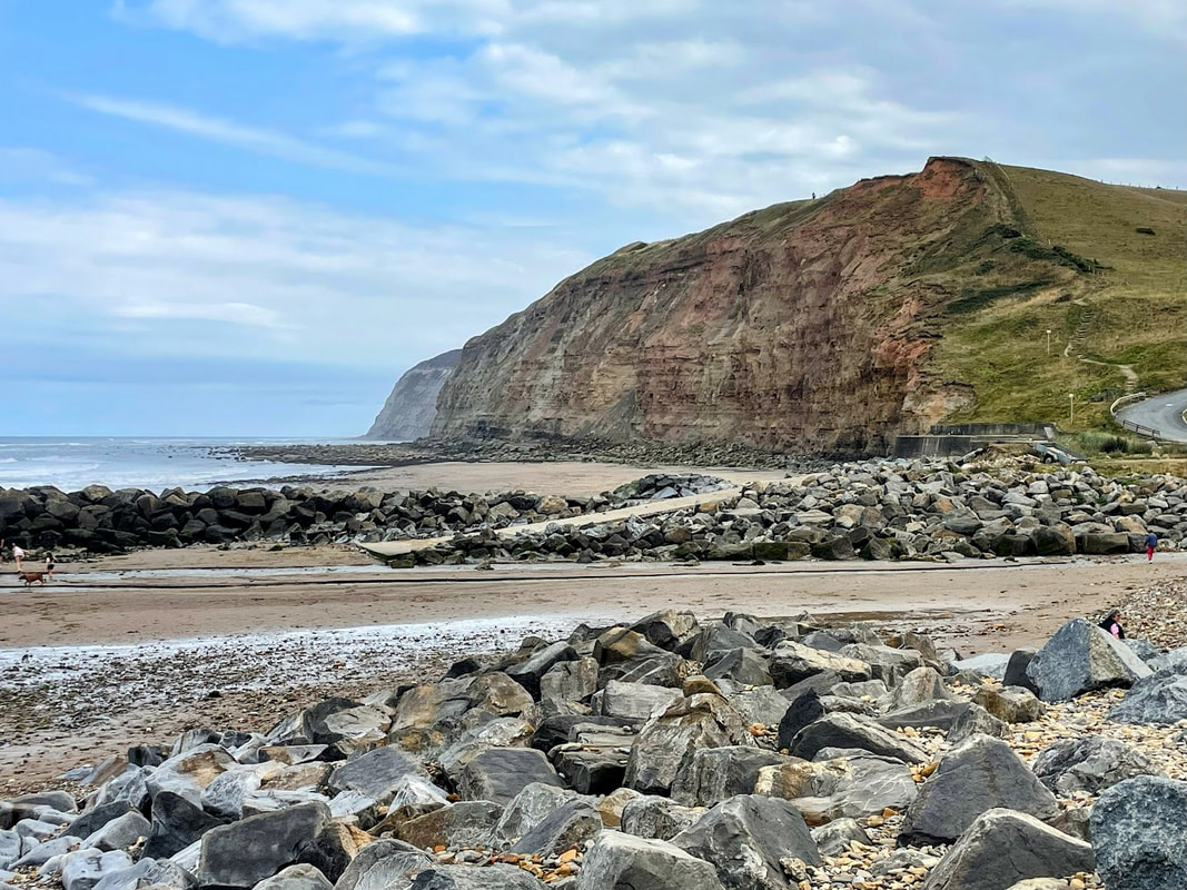
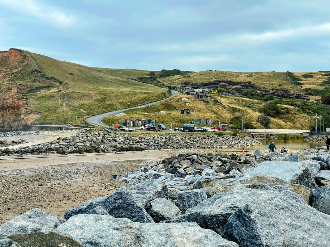
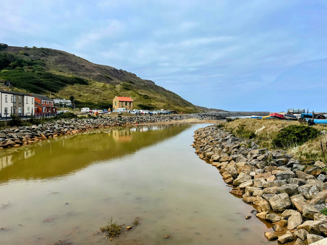
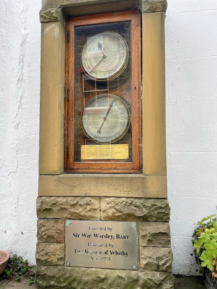
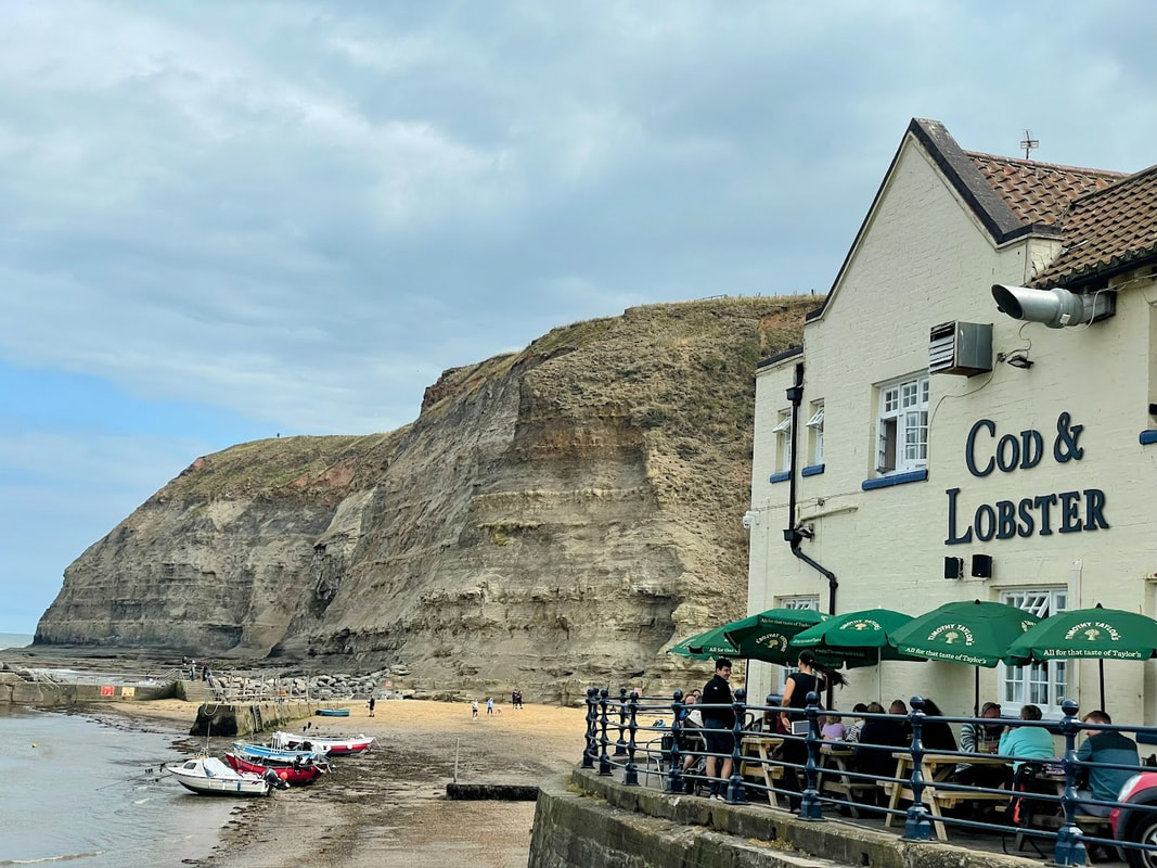
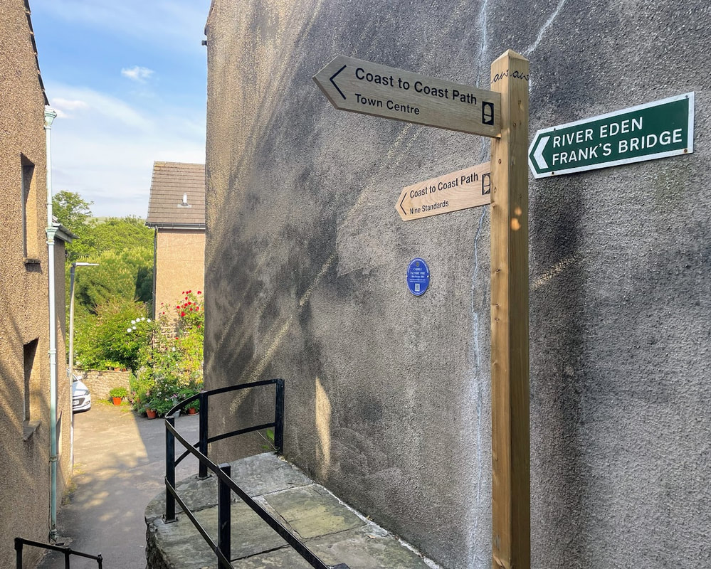
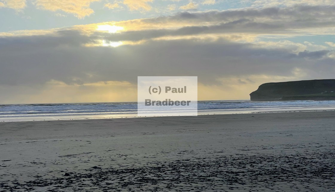
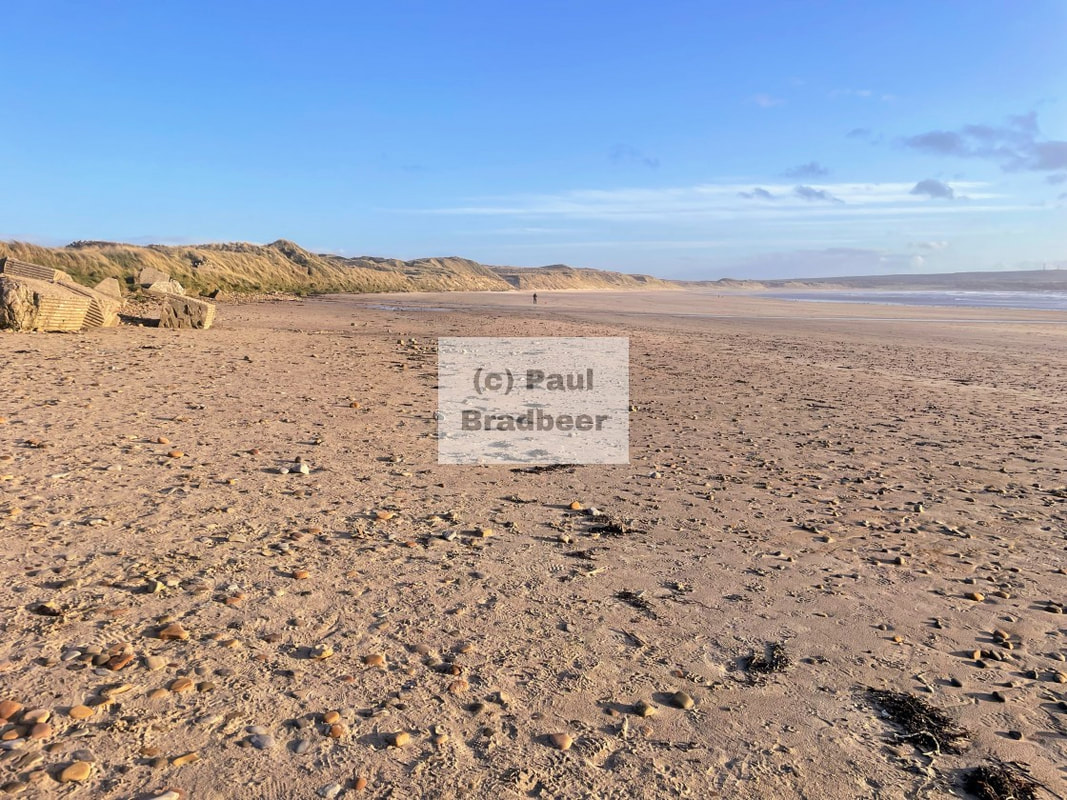
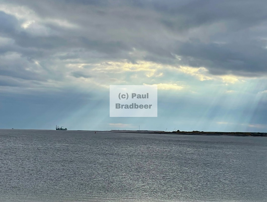
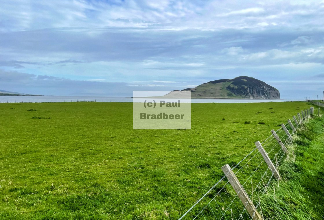
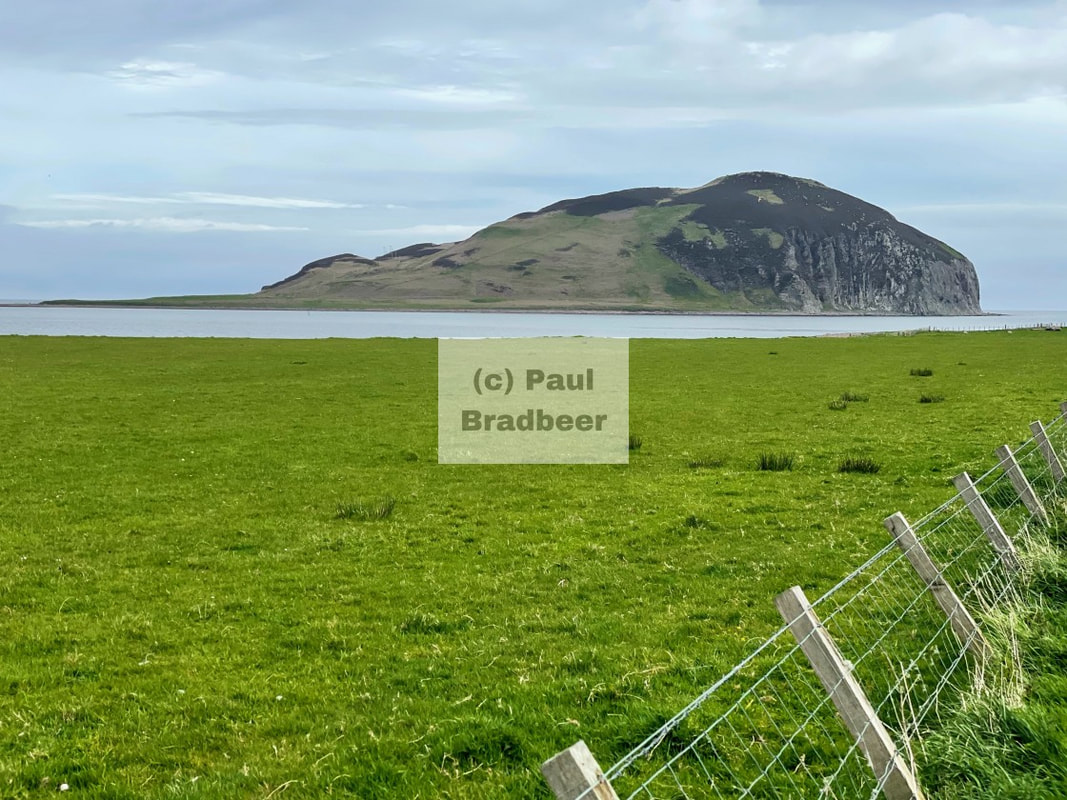
September 2025 - St. Bees Head, Cumbria
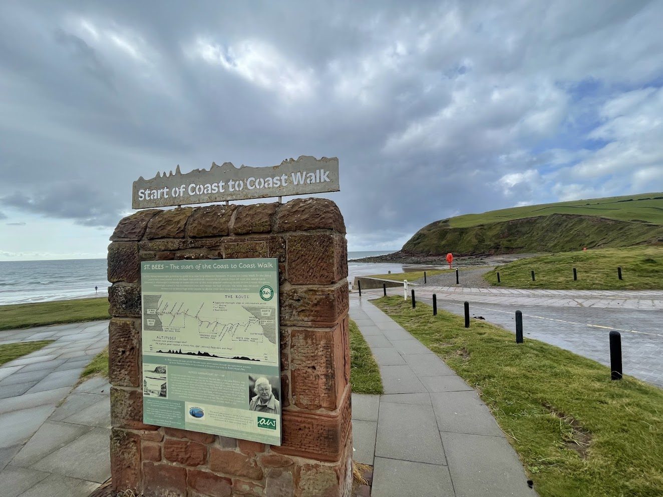
No, I wasn't about to start a very long walk.
I was visiting St. Bees Head, a magnificent piece of headland renowned for spectacular views and bird populations, and which also happens to be the start of the famous 182 mile West to East stomp across Northern England.
The Coast to Coast route was originally described by Alfred Wainwright in his 1973 book A Coast to Coast Walk - from St. Bees in the West to Robin Hoods Bay in the East - devised as a more scenic alternative to the older Pennine Way. It takes in three roller coaster National Parks - Lake District, Yorkshire Dales and North York Moors - which all happen to be great places to motorcycle as well as to walk. The route was designed to break into 12 daily, manageable stages (around 10–19 miles) for a two week holiday, often passing through towns with accommodation.
The shape of the metal banner on the top of the "wall" sign matches the height profile across the walk.
I was here taking on considerably less height and distance; enough to stretch the legs and feed the soul for a half day, with the remainder to be spent travelling back home.
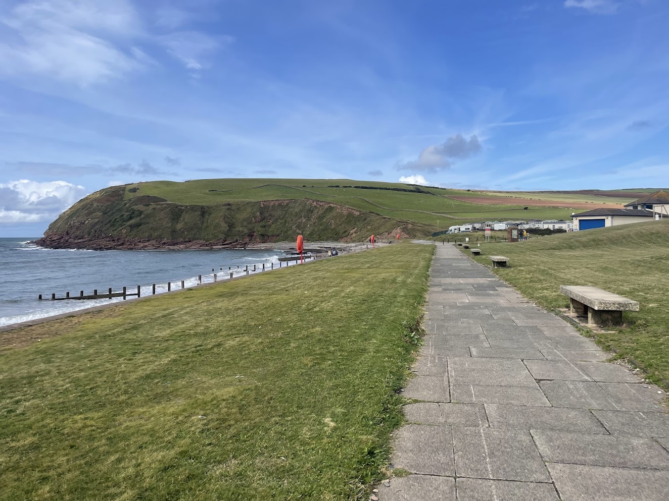
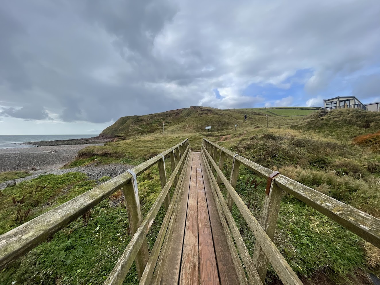
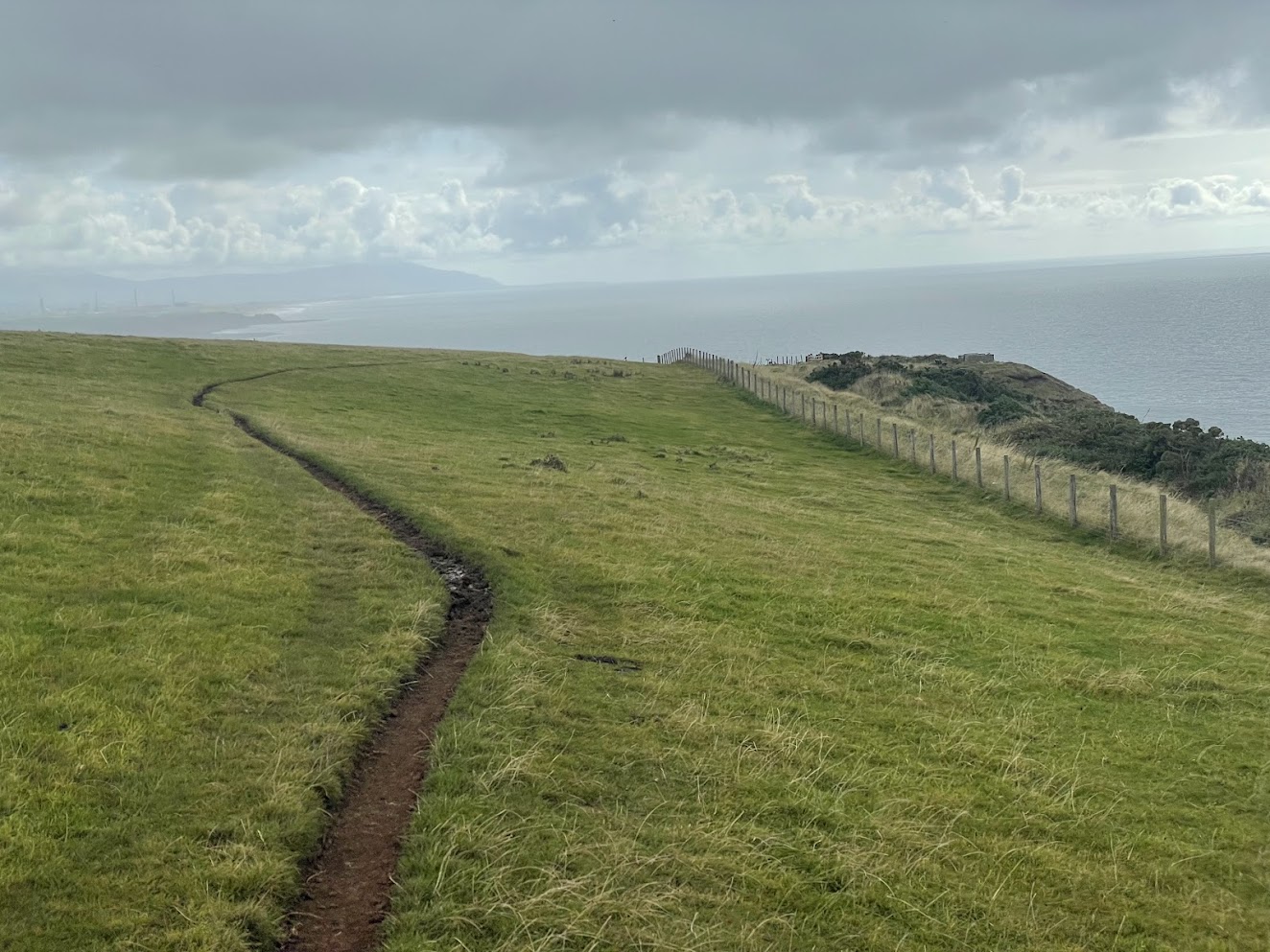
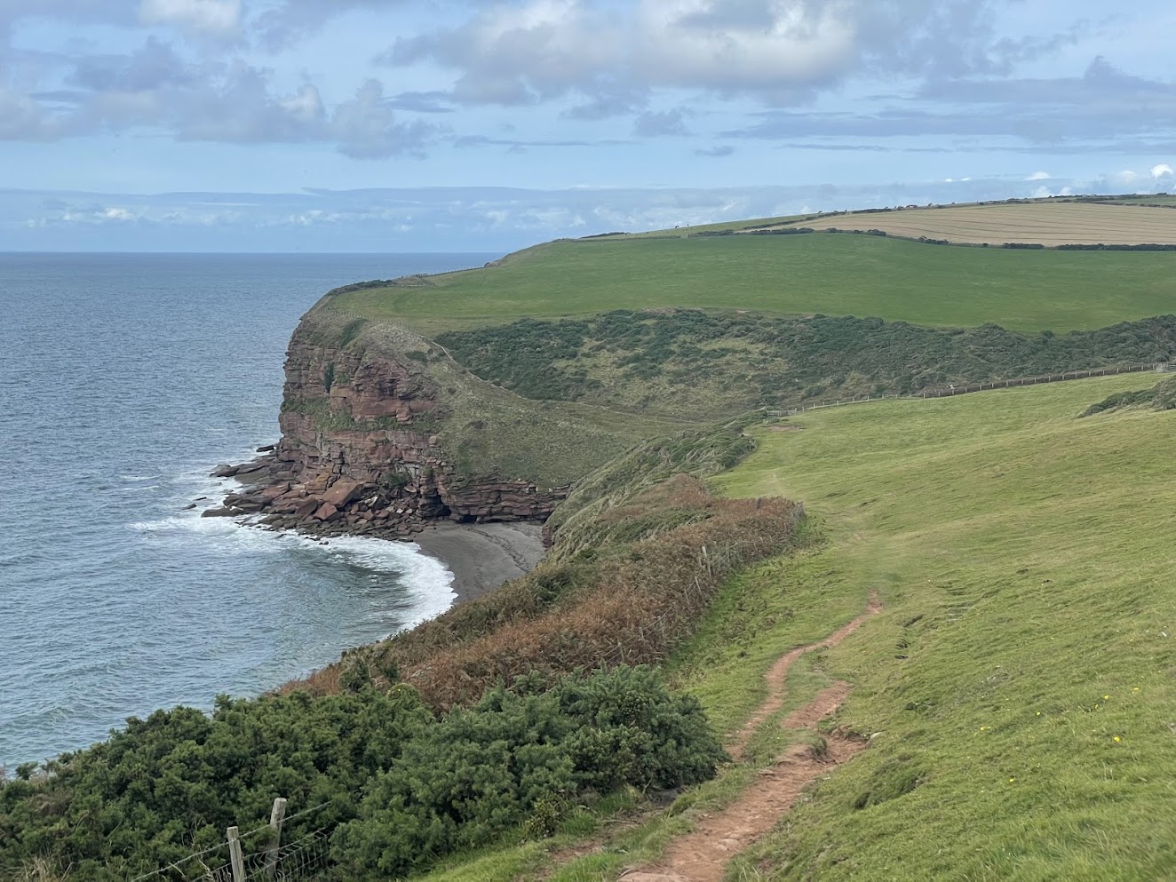
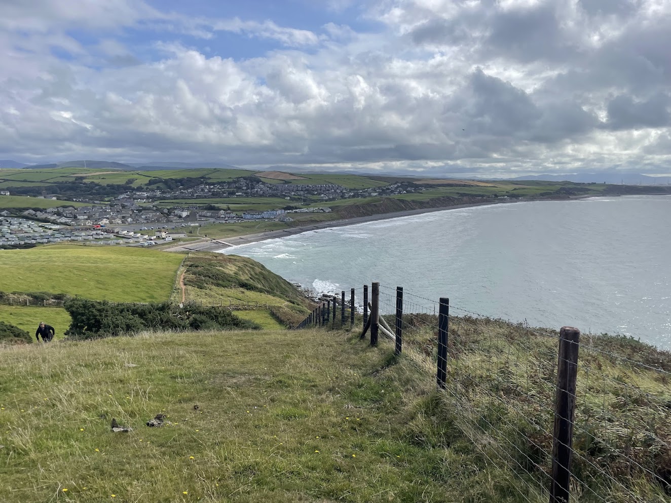
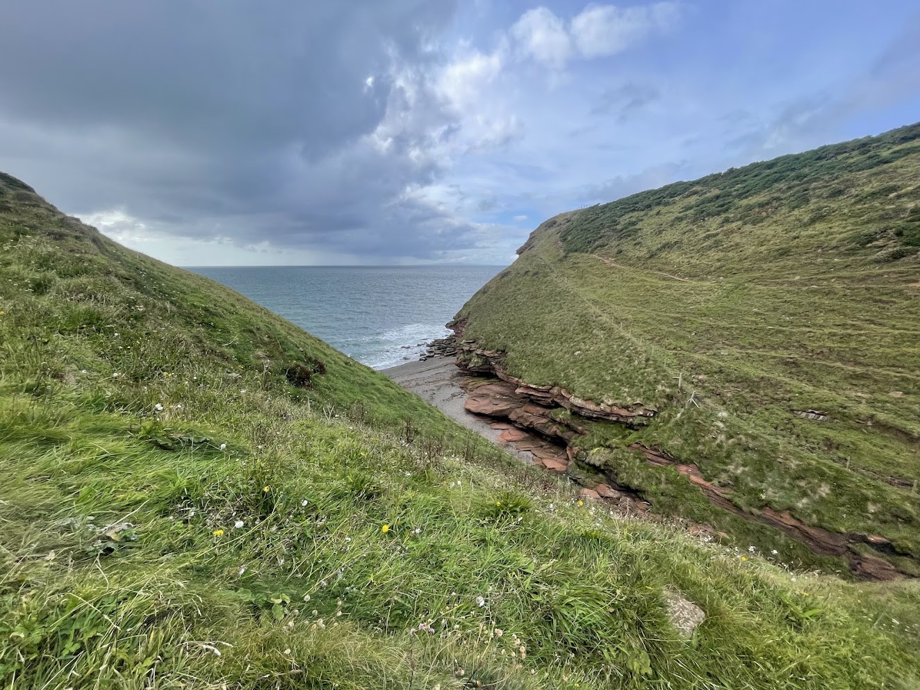
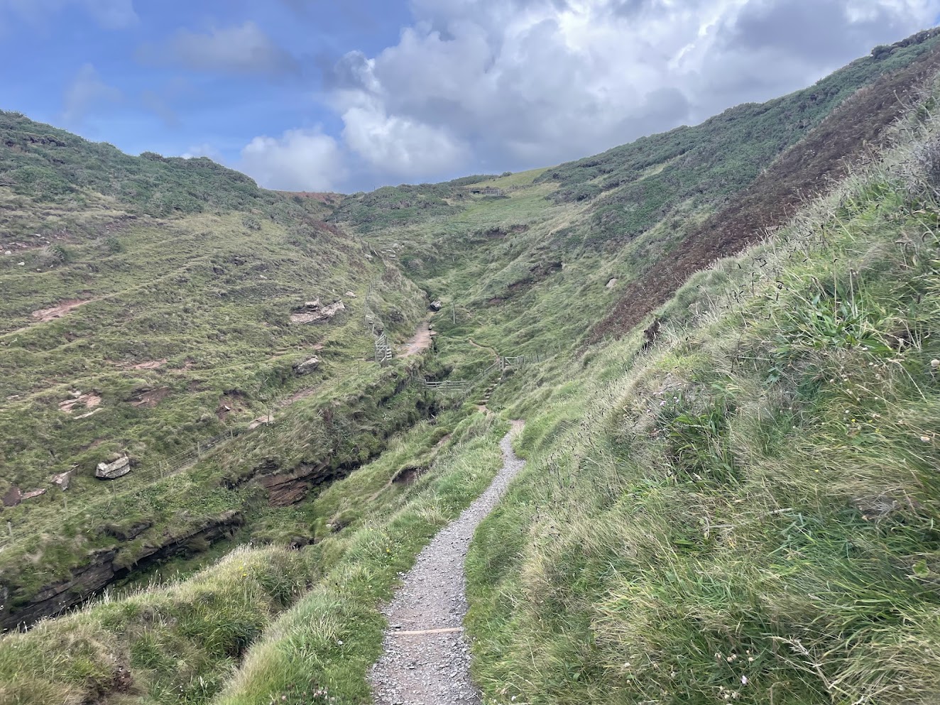
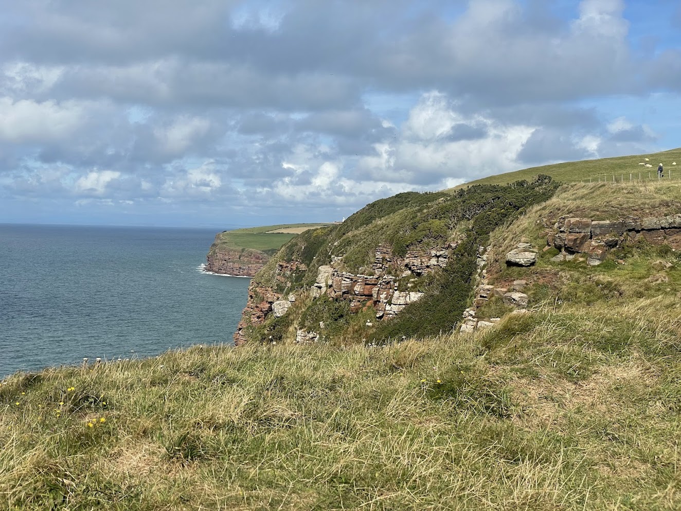
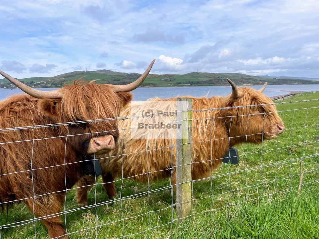
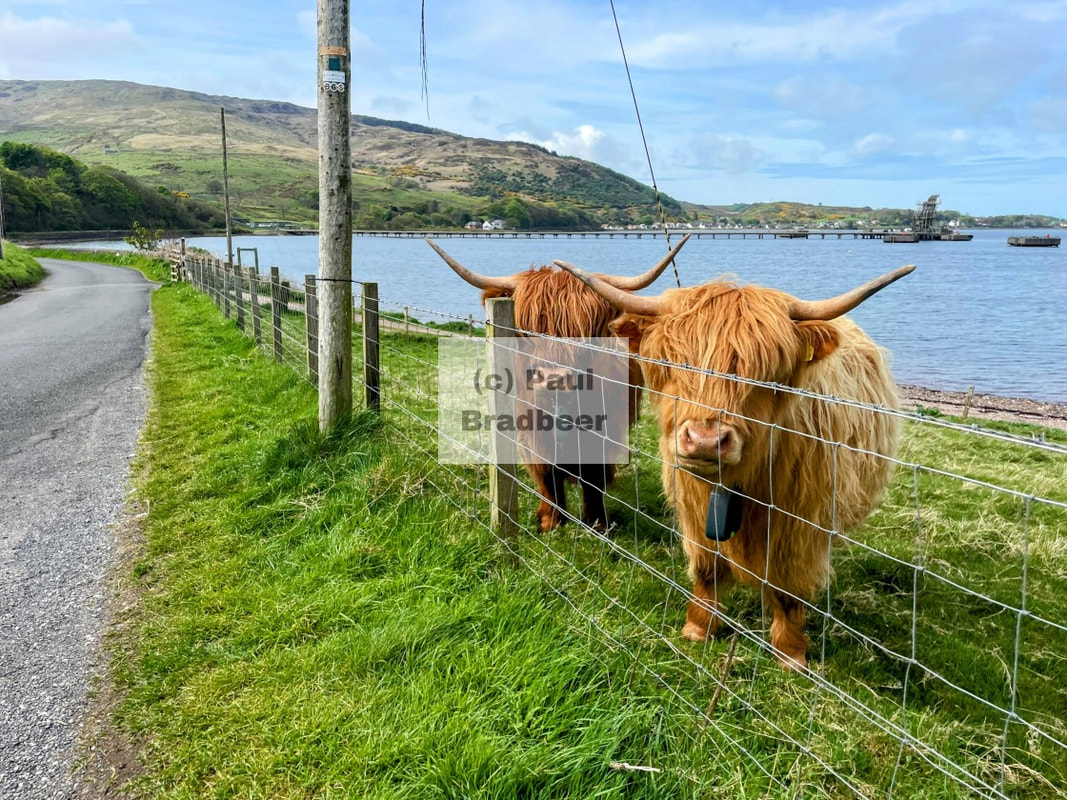
It was a pleasant walk with moderate effort to gain the initial height, complete with a number of rewarding view points revealing the Southern Scottish coastline looking Northwards, and the Isle of Man looking out to the West. Watch out for the coos and their unintended consequences on the way up! (you've been warned :-)
Beyond the long bay curving Southwards you can find Sellafield, originally built in the 1940s for plutonium production to feed the British atomic weapons programme. In time, in 1956, it became home to the worlds first nuclear power station feeding a national grid.
Just one year later, in 1957, it was the site of a serious fire, one of the world's first major nuclear incidents. The fire burned for three days and released radioactive fallout which spread across the UK and the rest of Europe.
At the time of the incident, no one was evacuated from the surrounding area, but milk from about 500 square km (190 square miles) of the nearby countryside was destroyed for about a month afterwards due to concerns about it being contaminated. The UK government played down the events at the time, and reports on the fire were subject to heavy censorship by the UK government.
Today the site is primarily used for reprocessing and storing nuclear waste, while its legacy facilities are dismantled.
I am struck by the juxtaposition of all this nuclear industry and history alongside the beautiful Cumbrian coastline and scenery - an incongruence for sure - although ironically it was its very remoteness away from major populations which, among other factors, made it an attractive location for such an operation. No doubt the engineering involved in creating it was a thing of beauty.
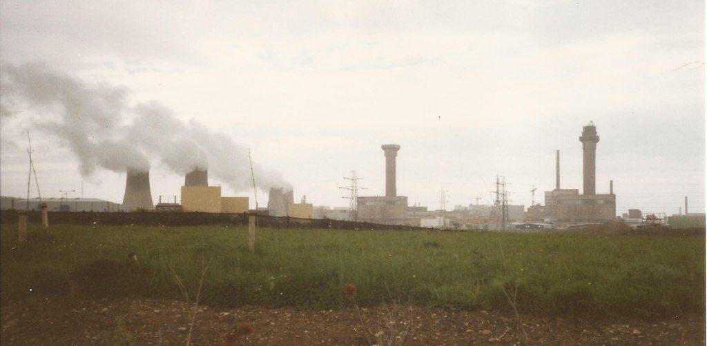
Sellafield photograph is © Copyright Dave Pickersgill and licensed for reuse under this Creative Commons Licence
https://www.geograph.org.uk/photo/3435355
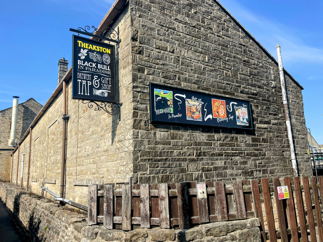
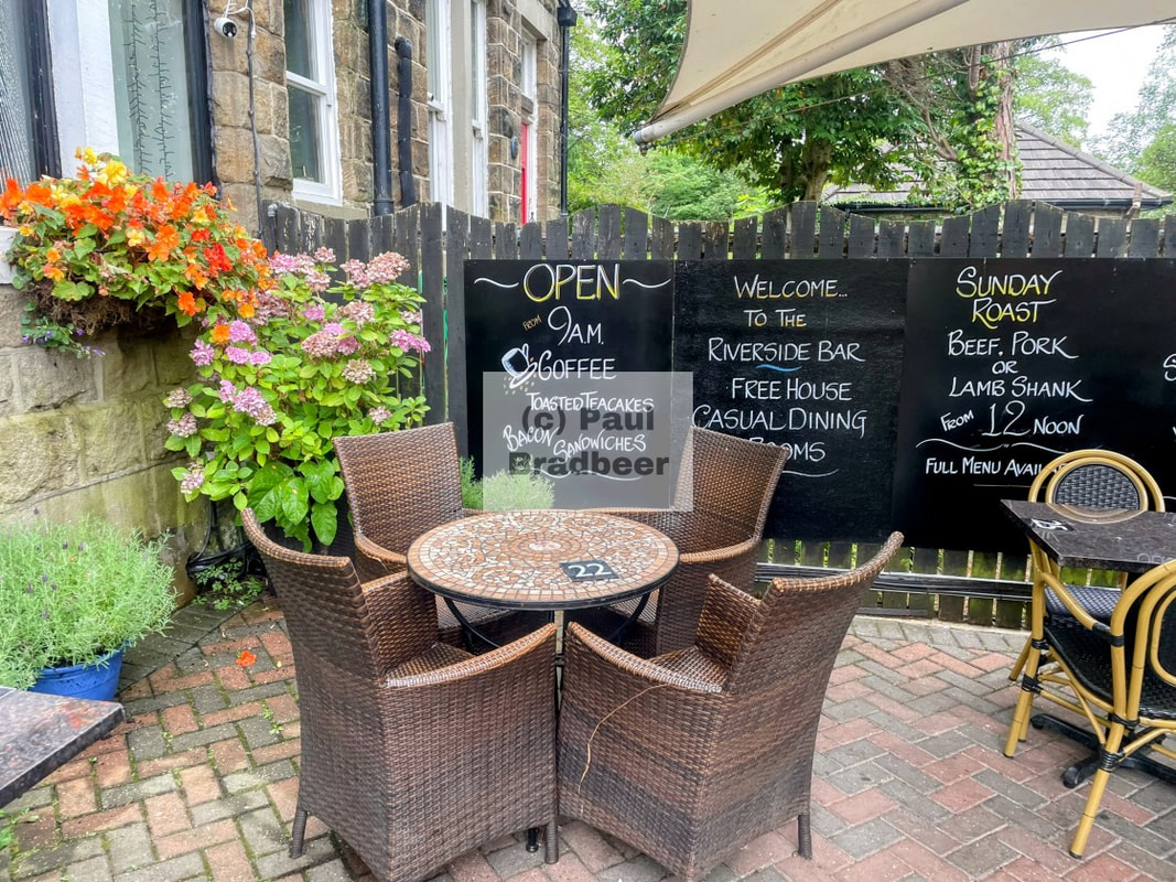
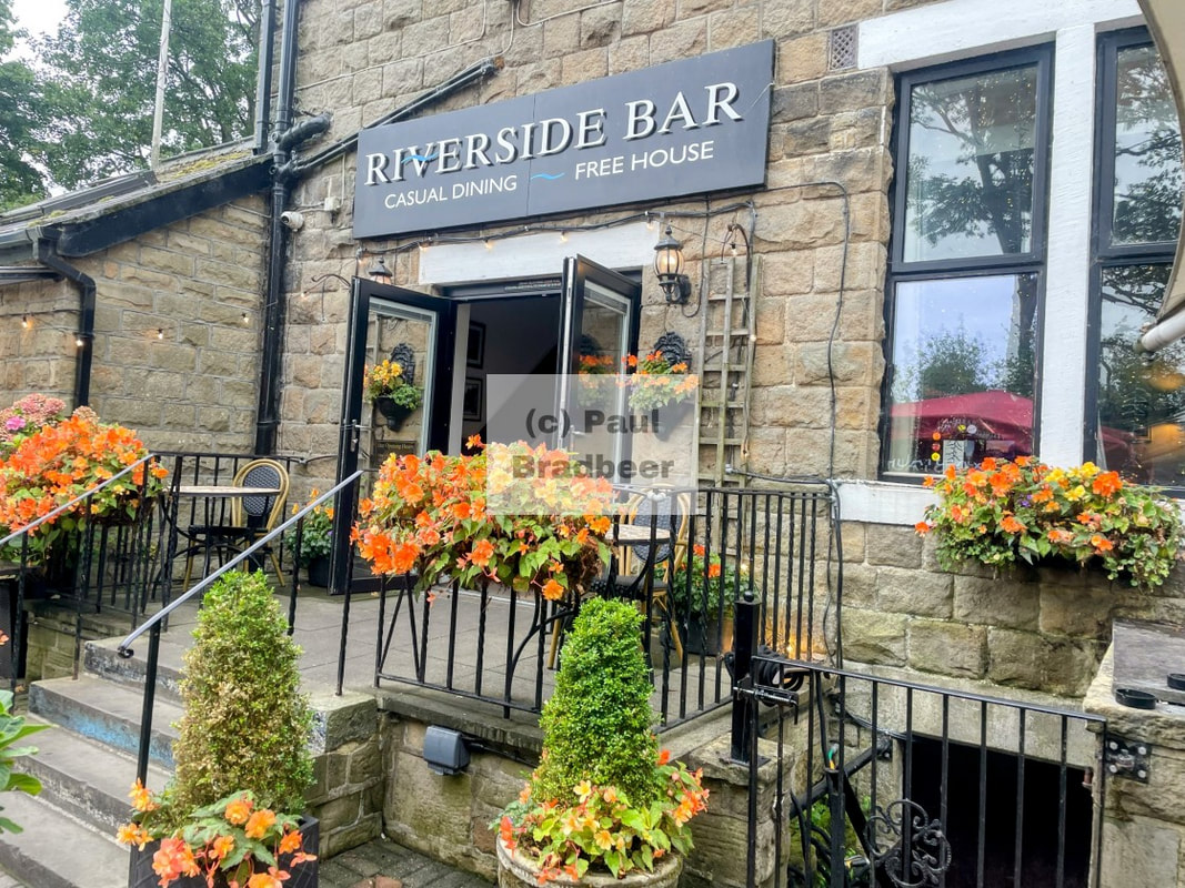
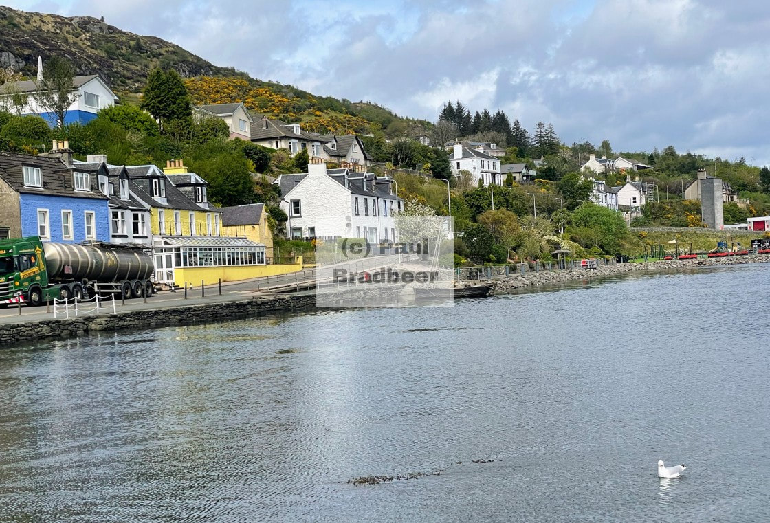
August 2025 - Masham, North Yorkshire
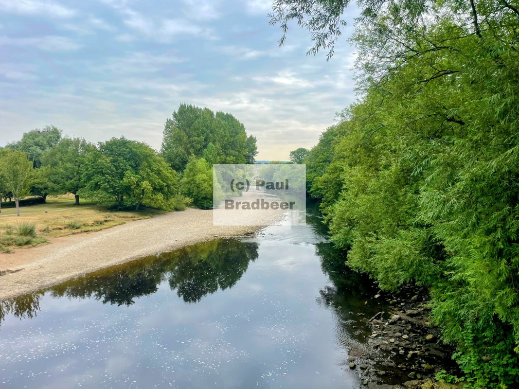
I took the short 10 mile ride from Ripon to Masham, a market town in North Yorkshire, nestled next to the River Ure. An unhurried passage through some wonderful countryside.
The name Masham originates from the Anglo Saxon phrase "Mæssa's Ham" meaning the homestead, farm, or village belonging to a person named Mæssa, an Old English personal name.
The town is home to not one, but two classic Yorkshire Breweries - Theakston and Black Sheep. The latter formed by Paul Theakston following disagreements within the family and the selling off the Theakston brewery due to financial distress. You can make of the name what you will. The Theakston brewery was returned to family control following a buy back by Simon Theakston and his brothers.
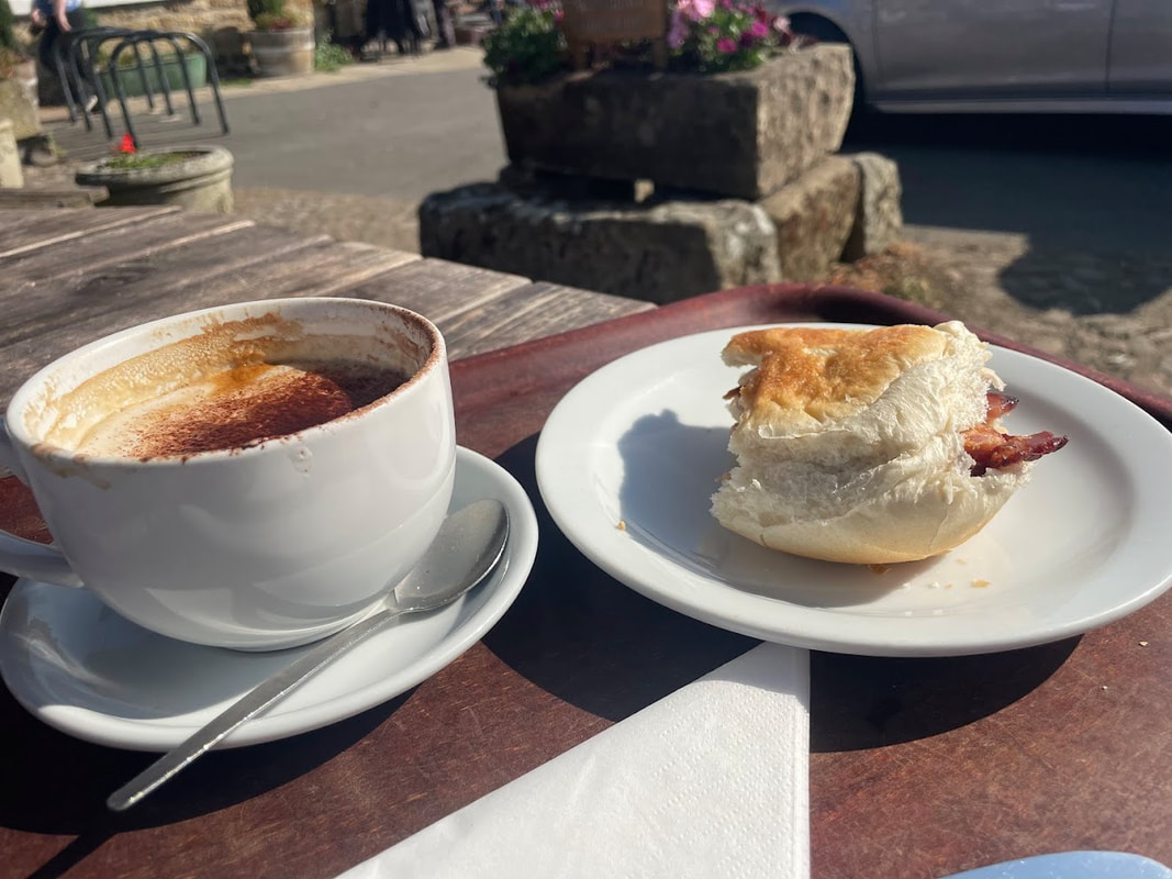
The allure of a bacon sandwich and coffee in the market square, basking in the sunshine, was too much to resist. While I don't eat a lot of red meat, I am a firm believer in moderation over abstinence, and that holiday calories don't count! These small, everyday moments provide consistent feelings of happiness and well being; I would argue often more so than the glitter of gold or the transient illusion of power or position.
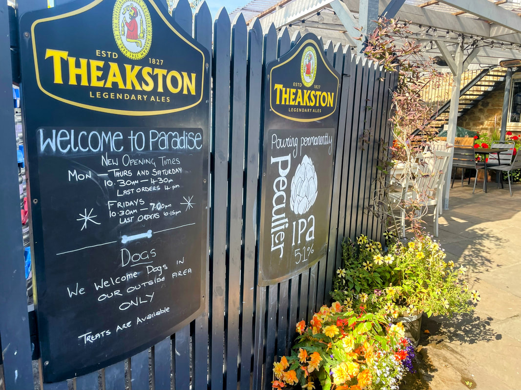
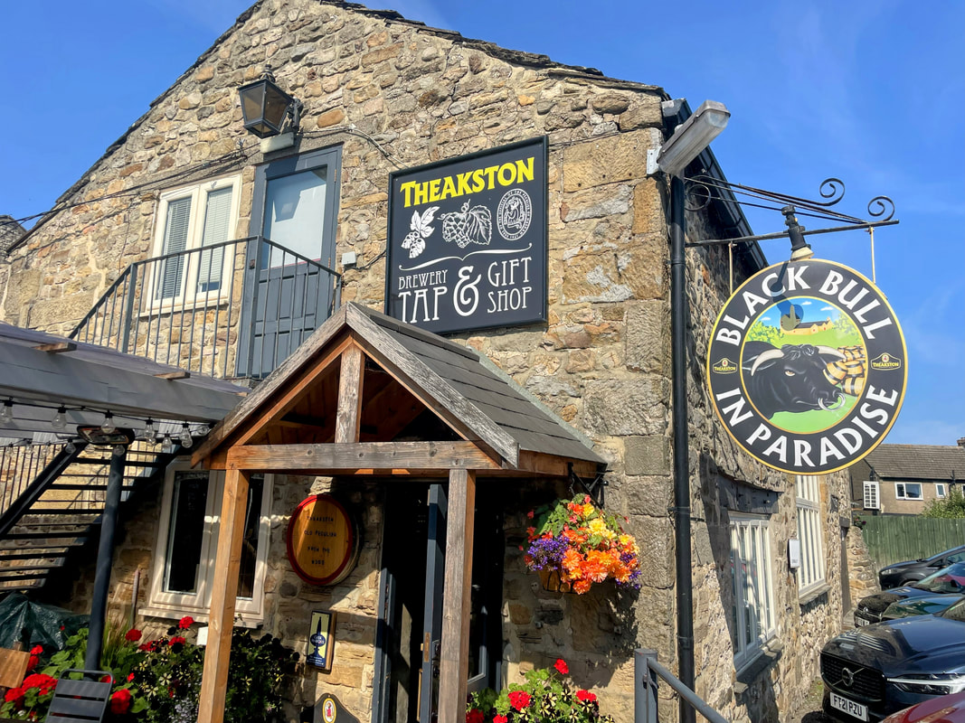
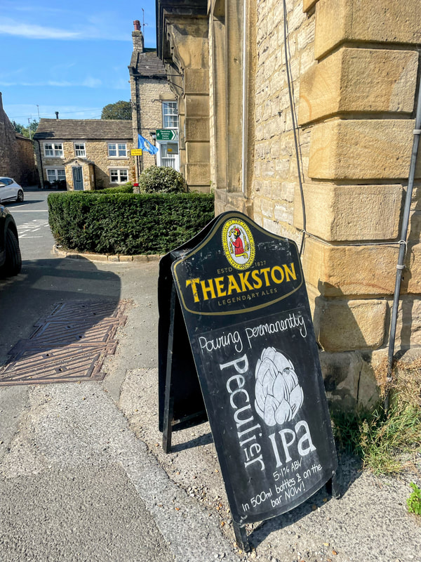
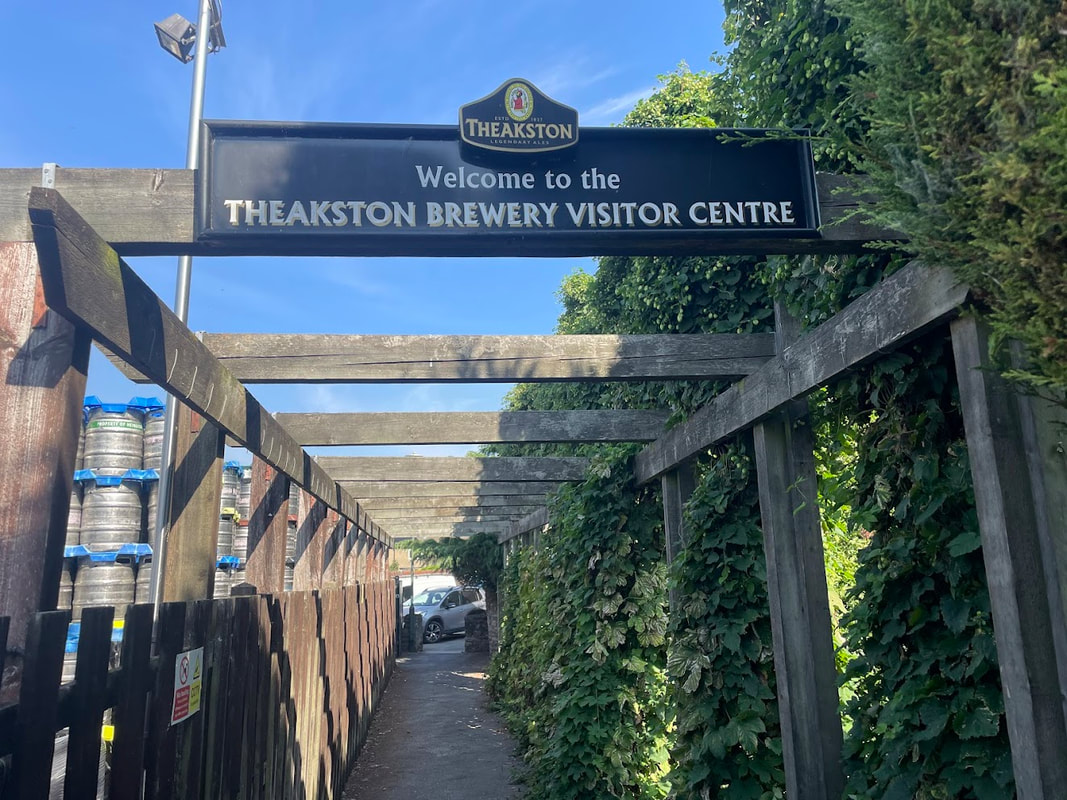
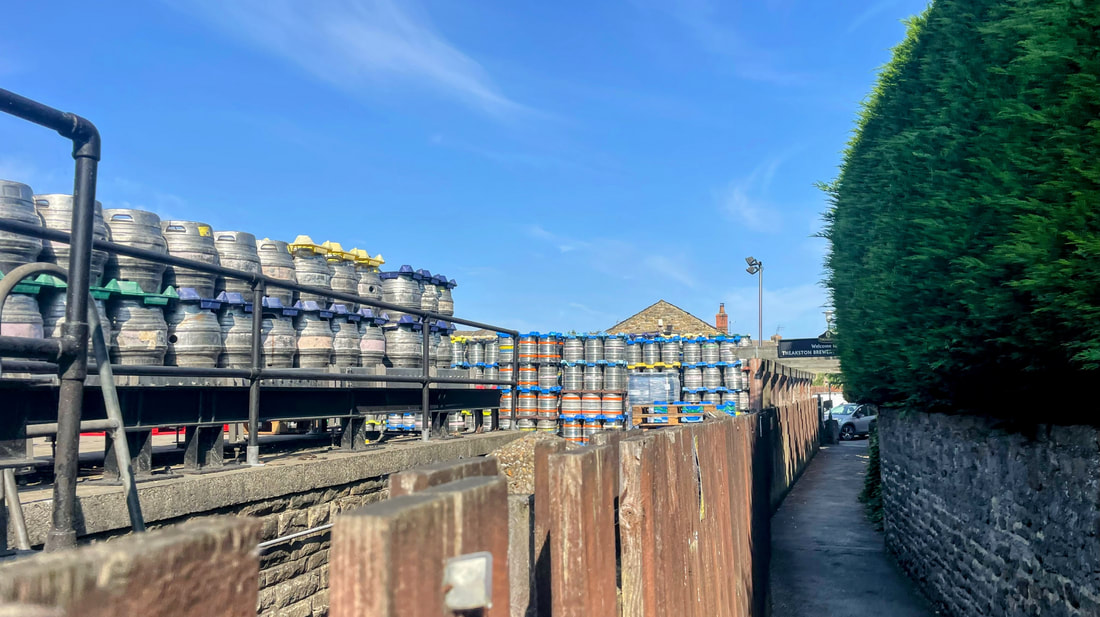
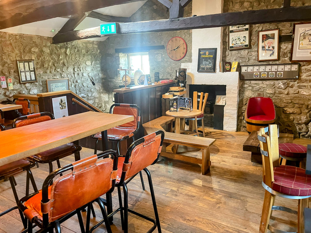
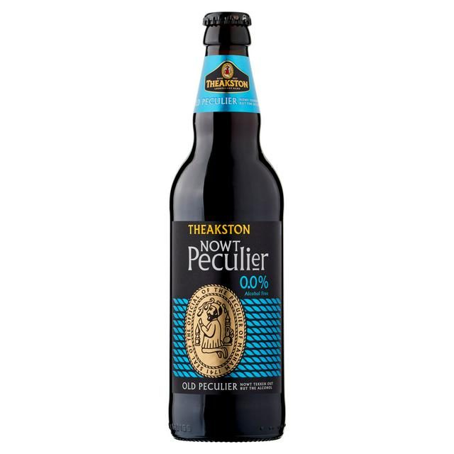
I wandered back across the square and quickly found the main Theakston Brewery. Noticing the signage at the entrance (pictured), I thought "Welcome to paradise" was a bold claim for the temporary effects of alcohol on the human body. Although "Pouring permanently peculiar" definitely had appeal - something different to normal and routine. Something to stimulate rather than dull the senses.
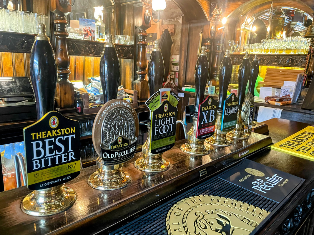
The pub offered a selection of all the main lines of the brewery, bottled and draught. Chatting with William Theakston, one of the family owners, I got a sense of how the brewery were modernising and exploring low/no alcohol beers; the view was very much that people want options these days, and from a business perspective, it keeps people consuming their products and gets them into the pubs.
Nowt Peculier.
Returning to the motorbike, somehow finding room in the luggage for a couple of bottles, I take to the road for another magical ten miles of the Dales as I charted a course towards Leyburn.
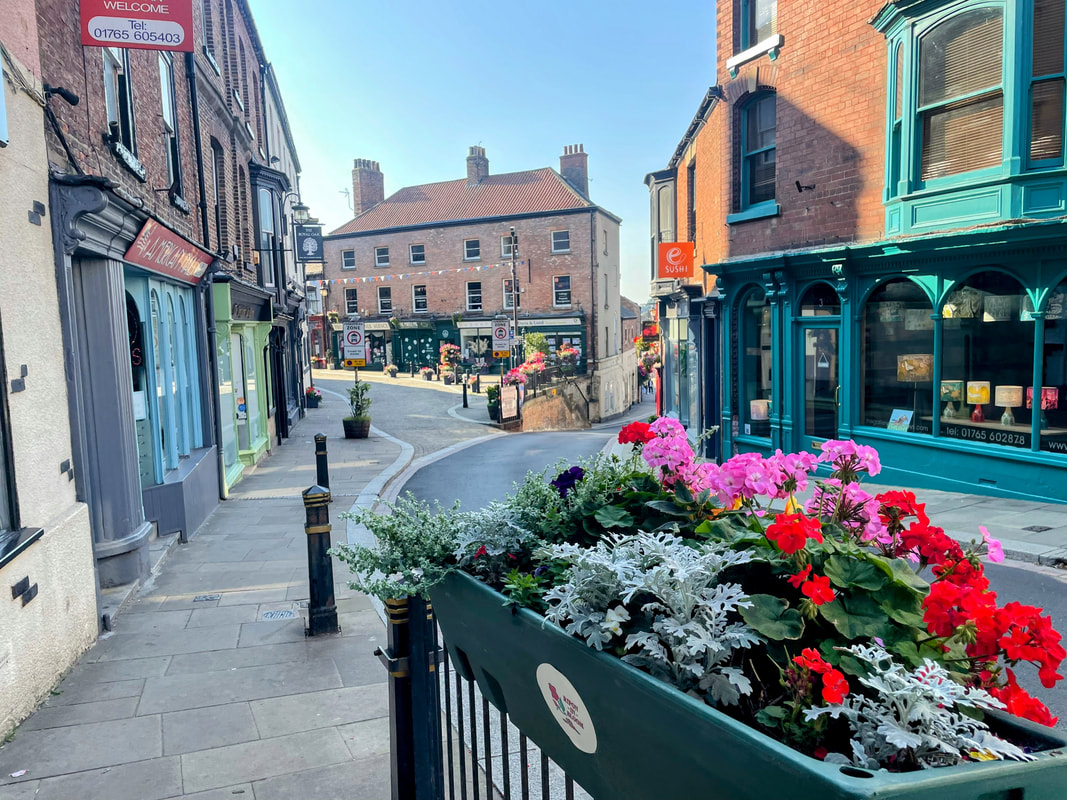
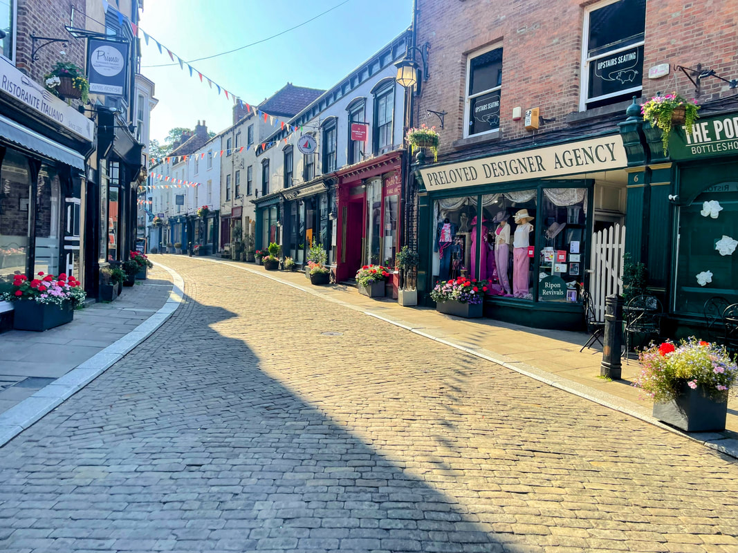
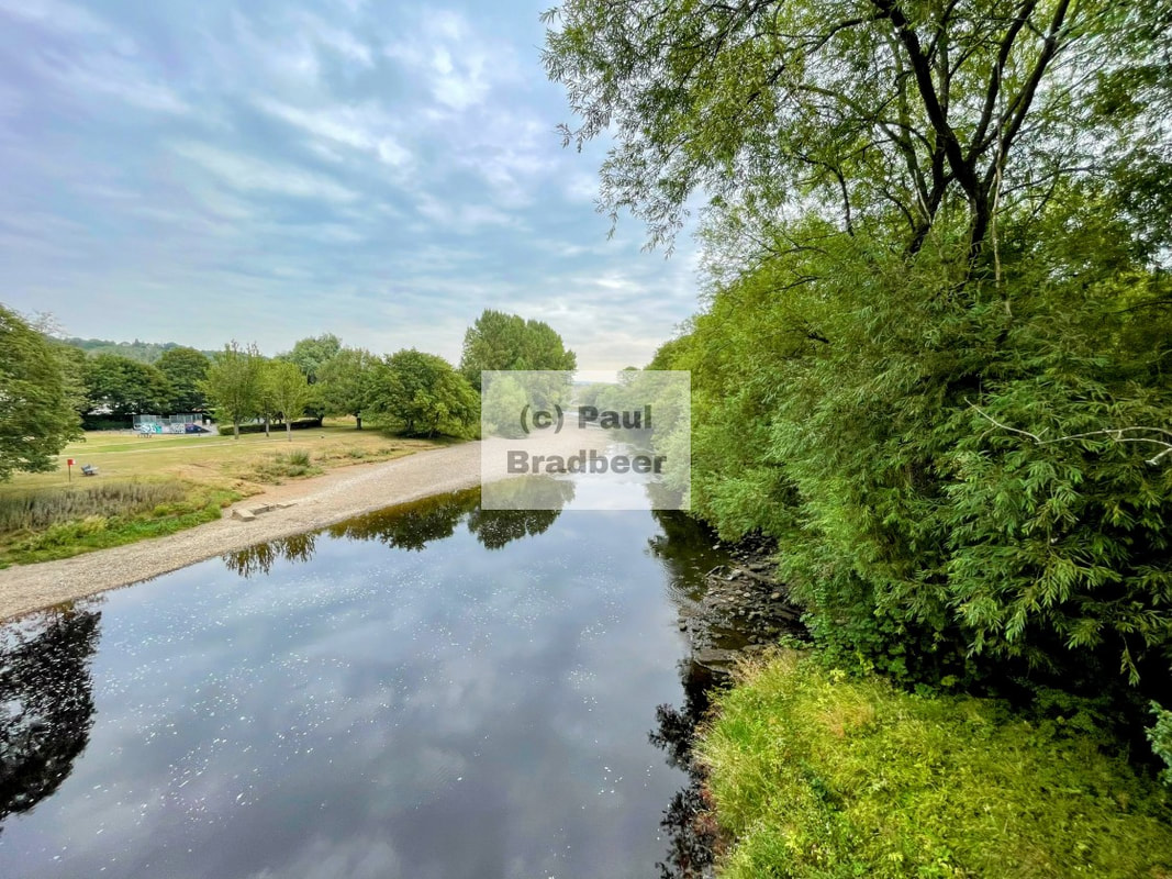
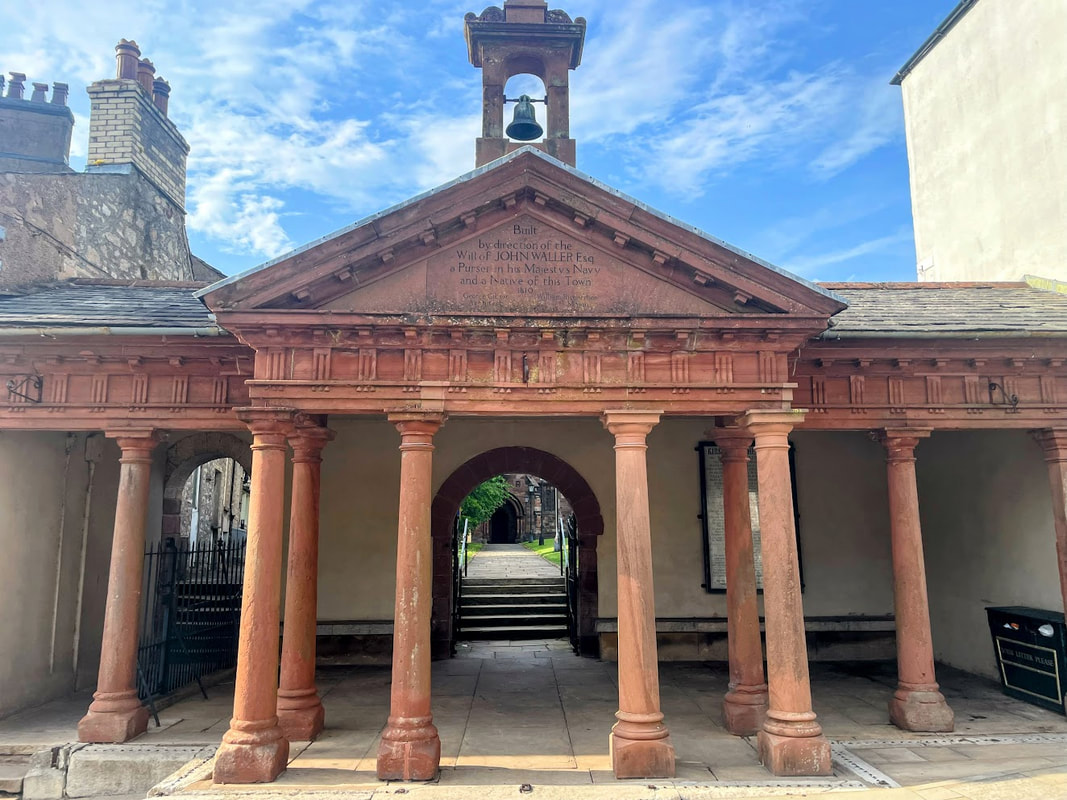
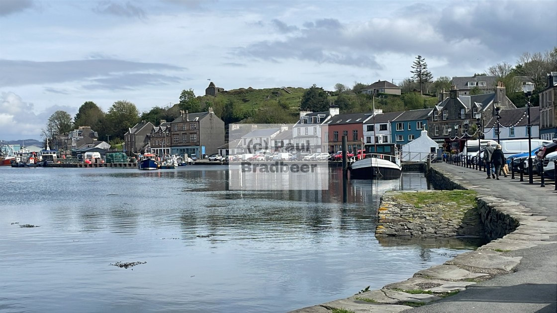
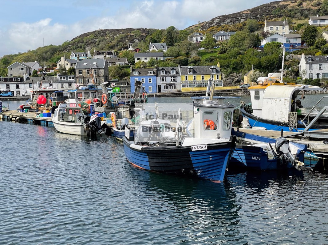
August 2025 - Ripon, North Yorkshire
Travelling up stream for a few miles, the River Ure passes by one of the smallest cities in the UK; Ripon, the cathedral city of the dales - known for its 7th century cathedral, ancient market square replete with horn blowing traditions, and rich legal history.
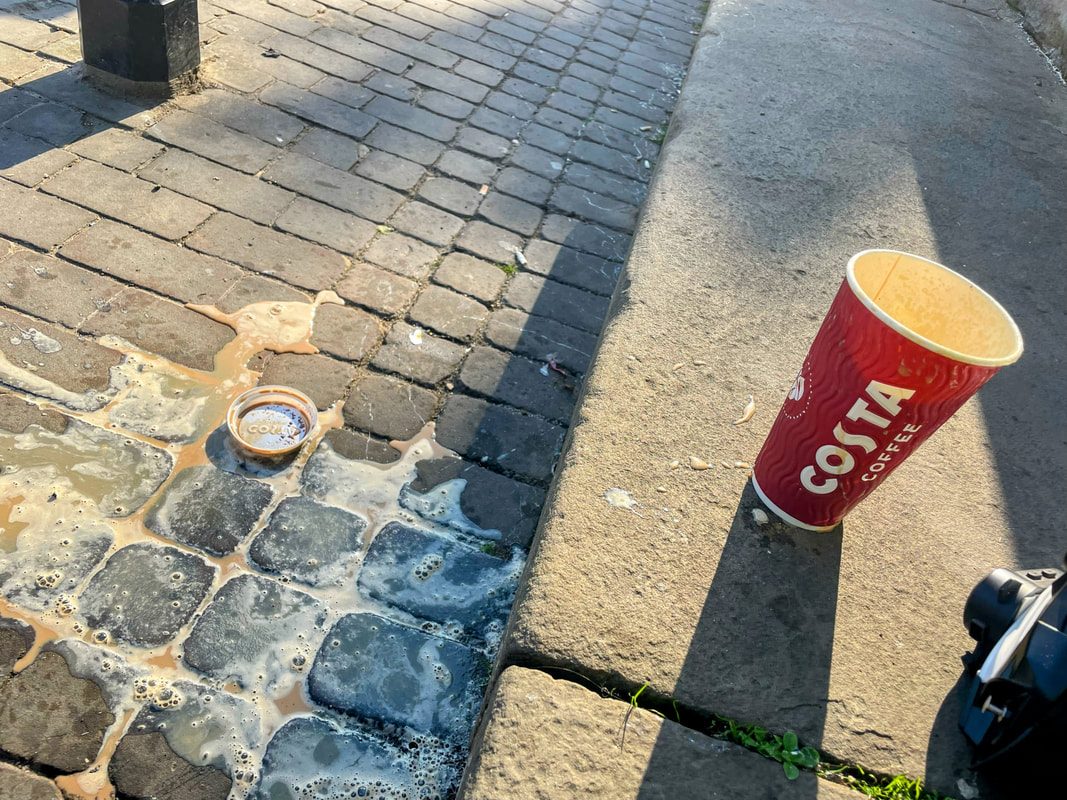
I easily parked up at the edge of the market square and the initial order of business was to refuel with coffee from Costa. Sadly a badly placed helmet rolled over and took out my caffeine fix. I don't cry over spilt milk, but spilt coffee tests my resolve. Regaining my composure I enjoyed some time in the bright morning sunshine. The hour was still early; there was time to stop and smell the flowers.
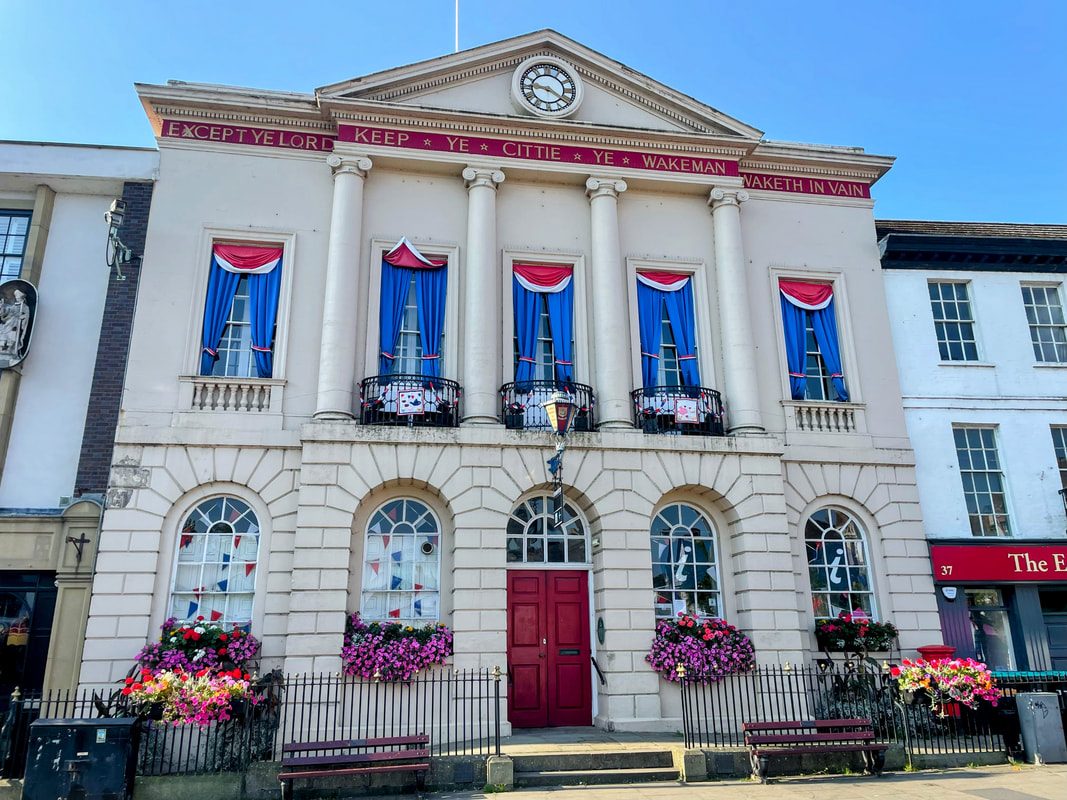
To the South of the market square is Ripon Town Hall, a grade two listed building constructed in 1799. The front facade showing the following words.
"Except Ye Lord. Keep Ye Cittie Ye Wakeman. Waketh in Vain"
Which is based on a passage from Psalm 127.
"Unless the Lord builds the house, the builders labour in vain.
Unless the Lord watches over the city, the guards stand watch in vain."
A wakeman was a medieval official responsible for watching over the city at night, sounding a horn at 9pm and organising the night watch to deter crime. A role which is still commemorated today by the Ripon Hornblower tradition; one of England's oldest continuous ceremonies, dating back to 886 AD, when King Alfred granted Ripon a charter and a horn for protection against Vikings.
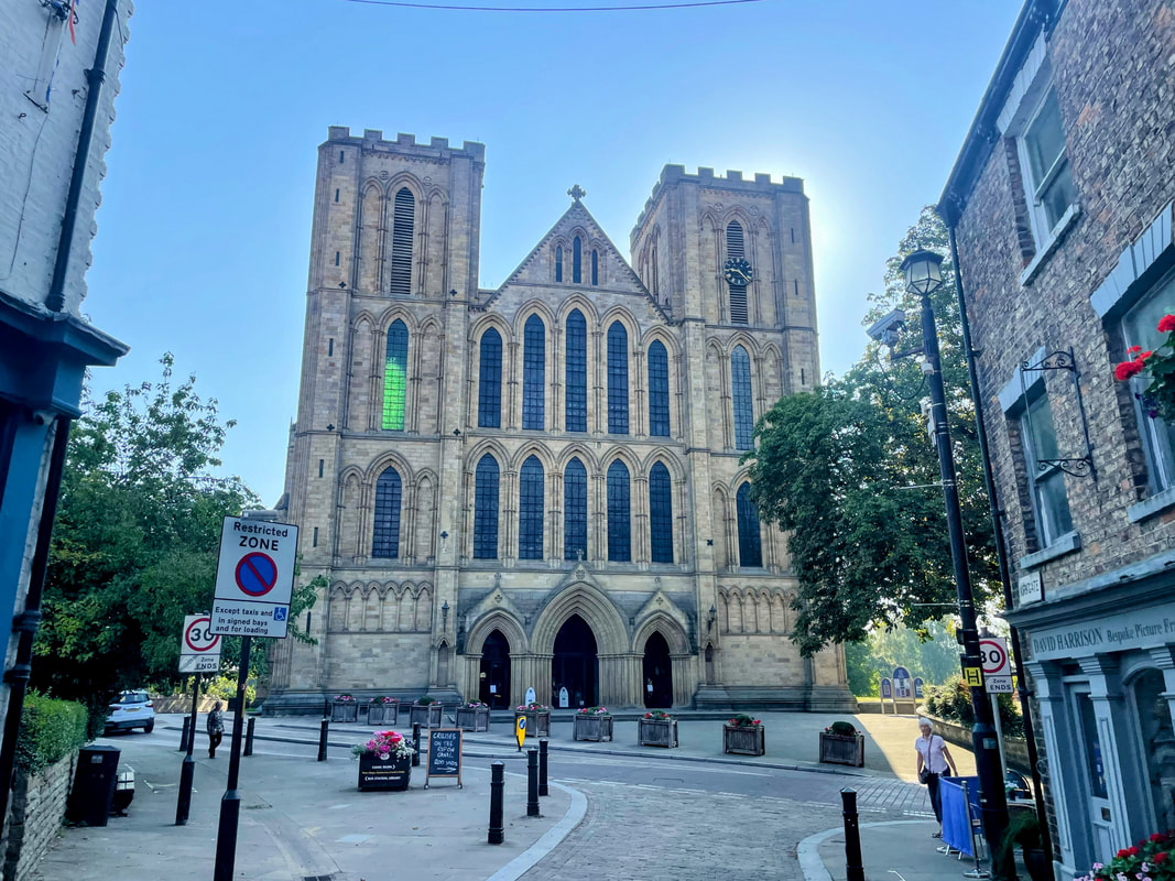
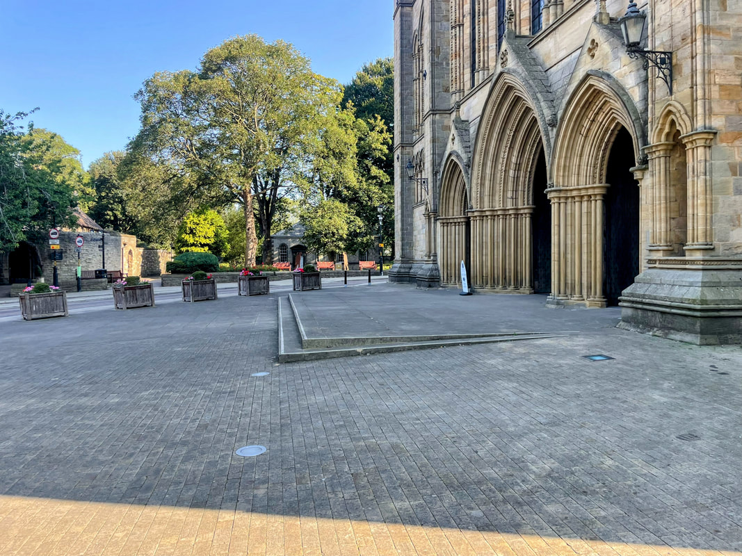
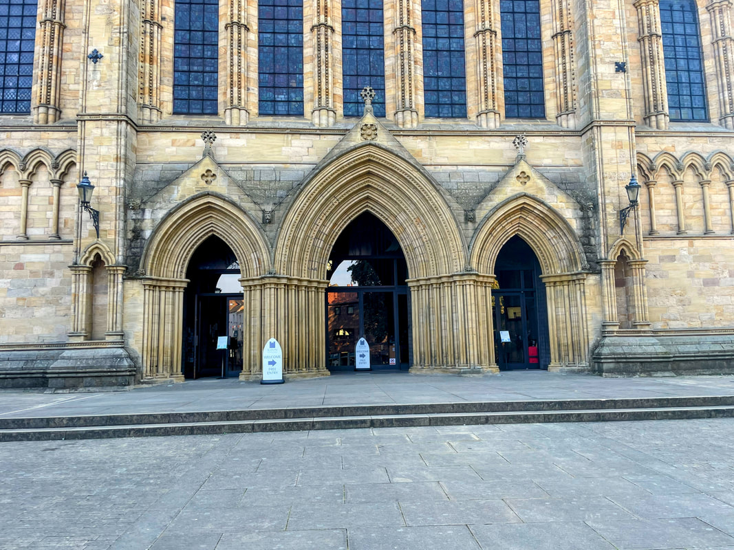
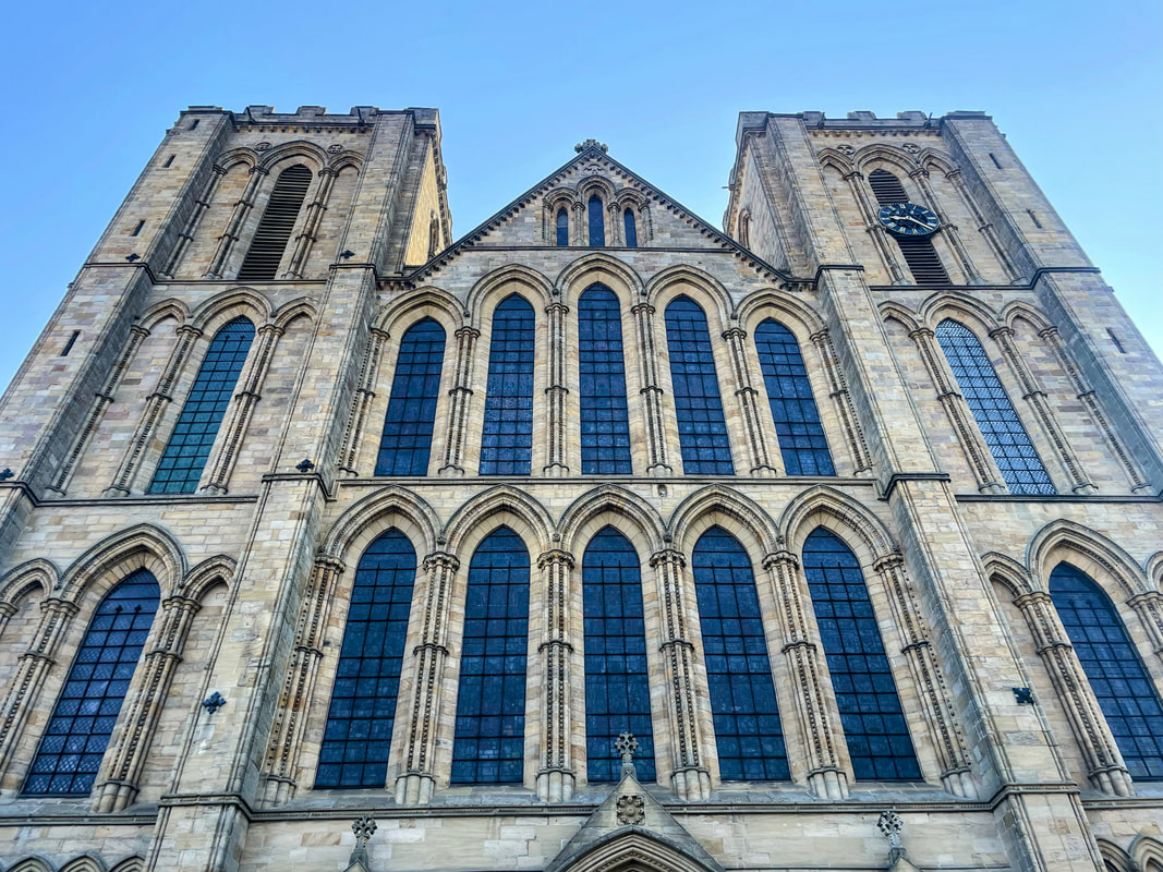
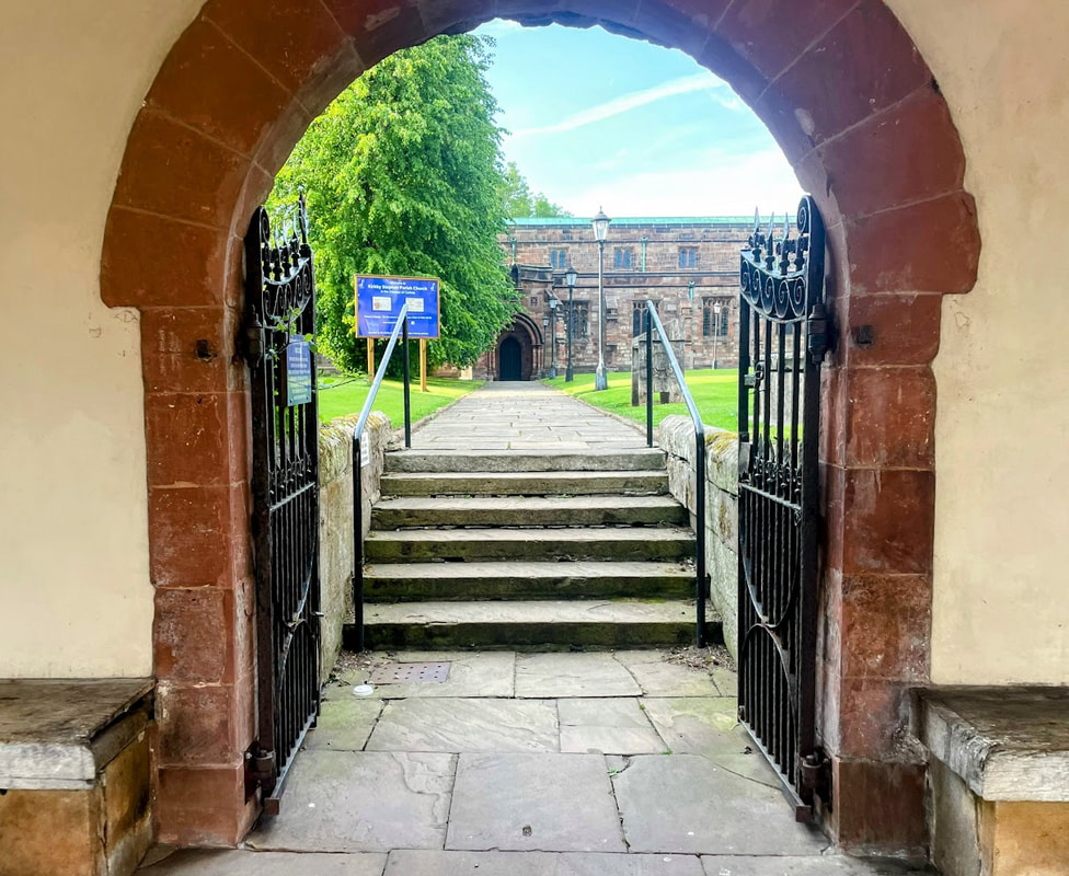
A meander down Kirkgate lead me to Minster Road and the front of the beautiful Cathedral.
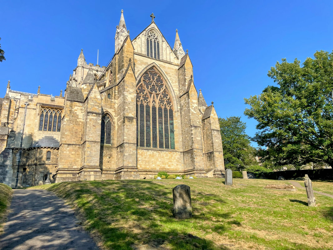
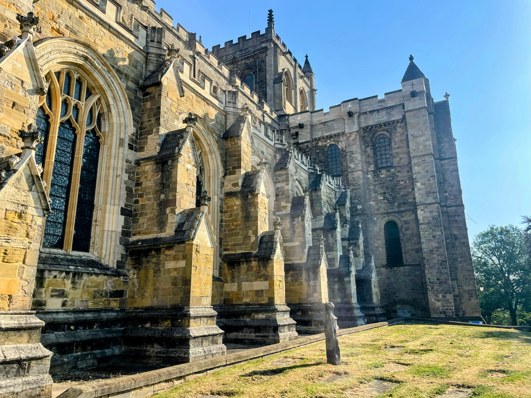
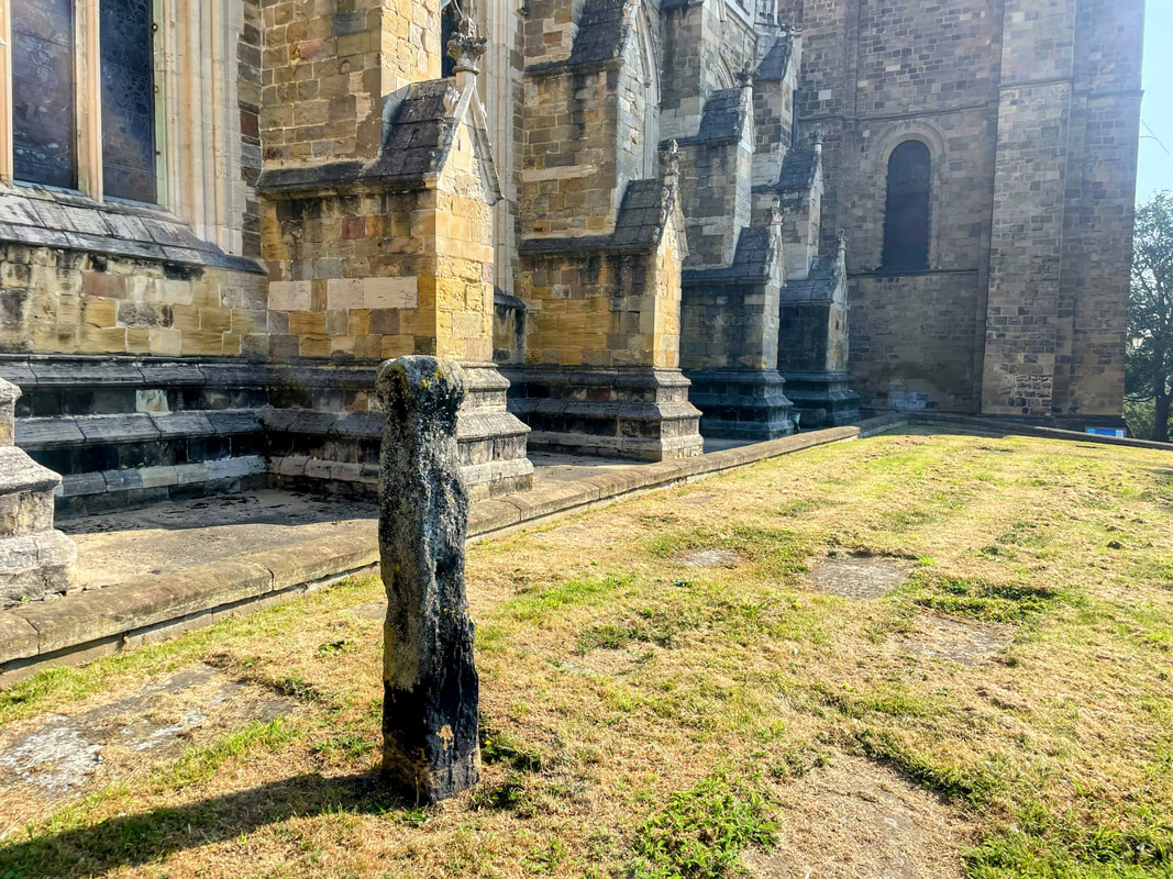
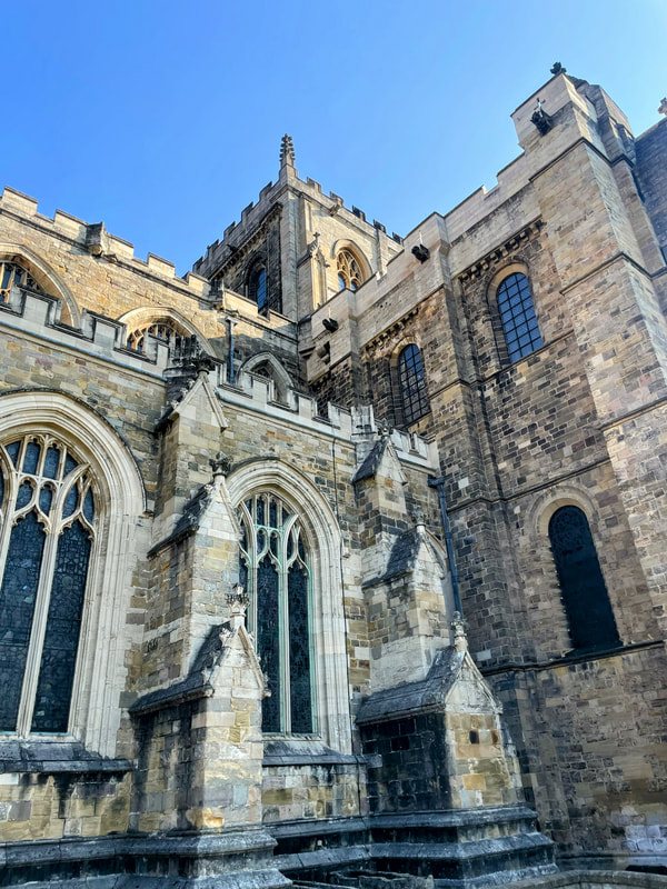
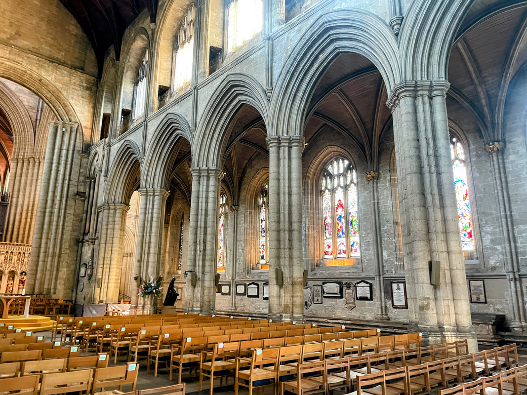
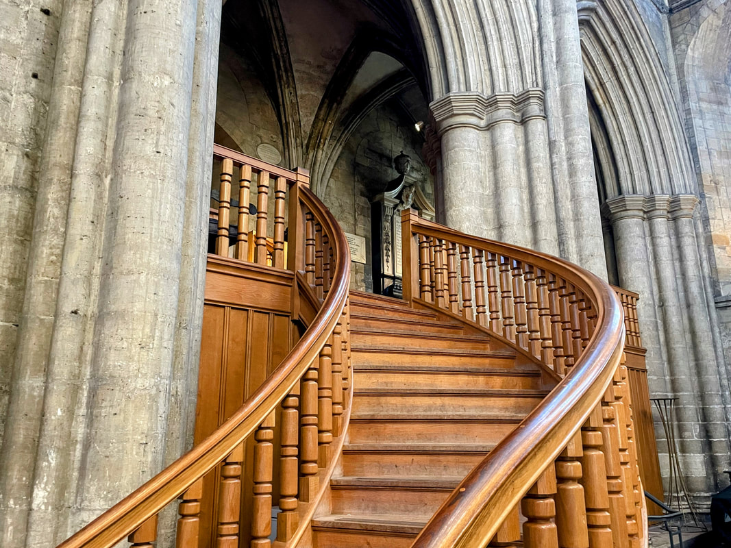
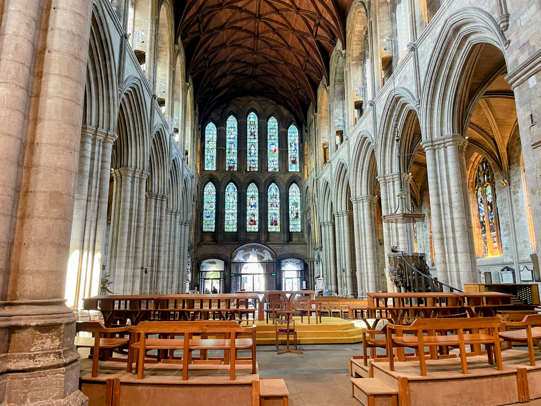
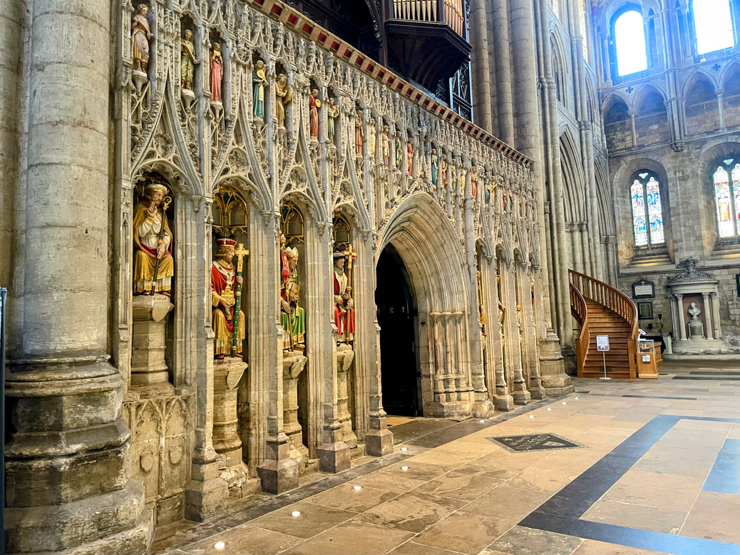
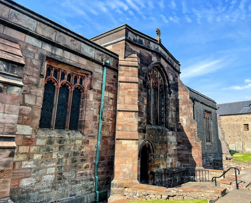
The Cathedral Church of St Peter and St Wilfrid which dates back to the 7th Century originating as a monastery founded by Celtic monks. It was later developed by St. Wilfrid whose crypt remains the oldest structure in any English cathedral. The current gothic building was developed on the same site between the 12th and 16th centuries.
The building is made up of a mix of Anglo Saxon, Norman and Gothic styles. The intricate medieval wood carvings and misericords in the choir stalls at the rear were distinctive.
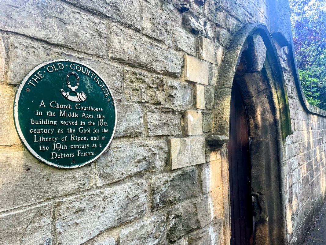
Exiting the front of the Cathedral and crossing over to join an alleyway back into the centre I passed a plaque marking the location of The Old Courthouse; a Gaol for the Liberty of Ripon during the 18th century and later during the 19th century as the local debtors prison.
It was a stark reminder of the dim view taken of debt and insolvency back then and the grim consequences for those affected.
Debtors faced imprisonment where they languished indefinitely until debts were paid, often with families in tow, enduring horrific conditions and corruption. It wasn't until the reforms of the 1869 Debtors Act which put the focus on punishing only fraudulent non payers rather than mere insolvency.
The contrast to today's Western societal norms couldn't be more stark with active encouragement of debt, ever increasing credit limits, rampant consumerism and the intentional breeding of an ever competitive materialistic mentality.
My visit was during August 2025 but I write this in early January 2026, right off the back of the Christmas festive period, when the pressure to impress and consume seems greater than ever. As the saying goes, people spending money they don't have, buying things they don't need to impress people they don't like.
Perhaps we've gone too far the other way?
A new, more balanced, normal sounds great until you realise how deeply entrenched the existing systems are and the pain of transition required to be paid for passage. And yet as a collective we carry on as if infinite growth and endless consumption of the planet's resources is achievable without consequence.
I can imagine the positives and negatives of everyone stopping spending to excess would be massive - environment, well being, emphasis on repair/reuse, with value placed on longevity and quality of goods as opposed to built in obsolescence, reduction of volume and power of advertising, shift from GDP as a metric of success towards well being, health and sustainability metrics. All good stuff, however the negatives would be massive and harsh - mass unemployment due to far less manufacture, reduced innovation, stock markets and pension funds collapse, massively reduced tax revenue for governments; the list goes on....
If you're still reading this, well done. I will leave you with some lyrics written by Neil Peart during the mid- 1980s, from a song called "Second Nature" which captures the sentiment nicely.
"It ought to be second nature -
I mean, the places where we live!
Let’s talk about this sensibly -
We’re not insensitive
I know progress has no patience -
But something’s got to give
I know you’re different -
You know I’m the same
We’re both too busy
To be taking the blame
I’d like some changes
But you don’t have the time
We can’t go on thinking
It’s a victimless crime
No one is blameless,
But we’re all without shame
We fight the fire
While we’re
Feeding the flames"
The lyrics were written nearly forty years ago. They don't feel dated.dit leo.
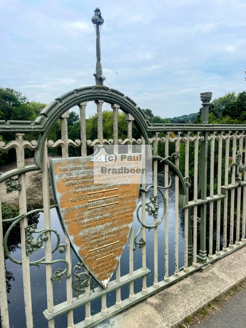
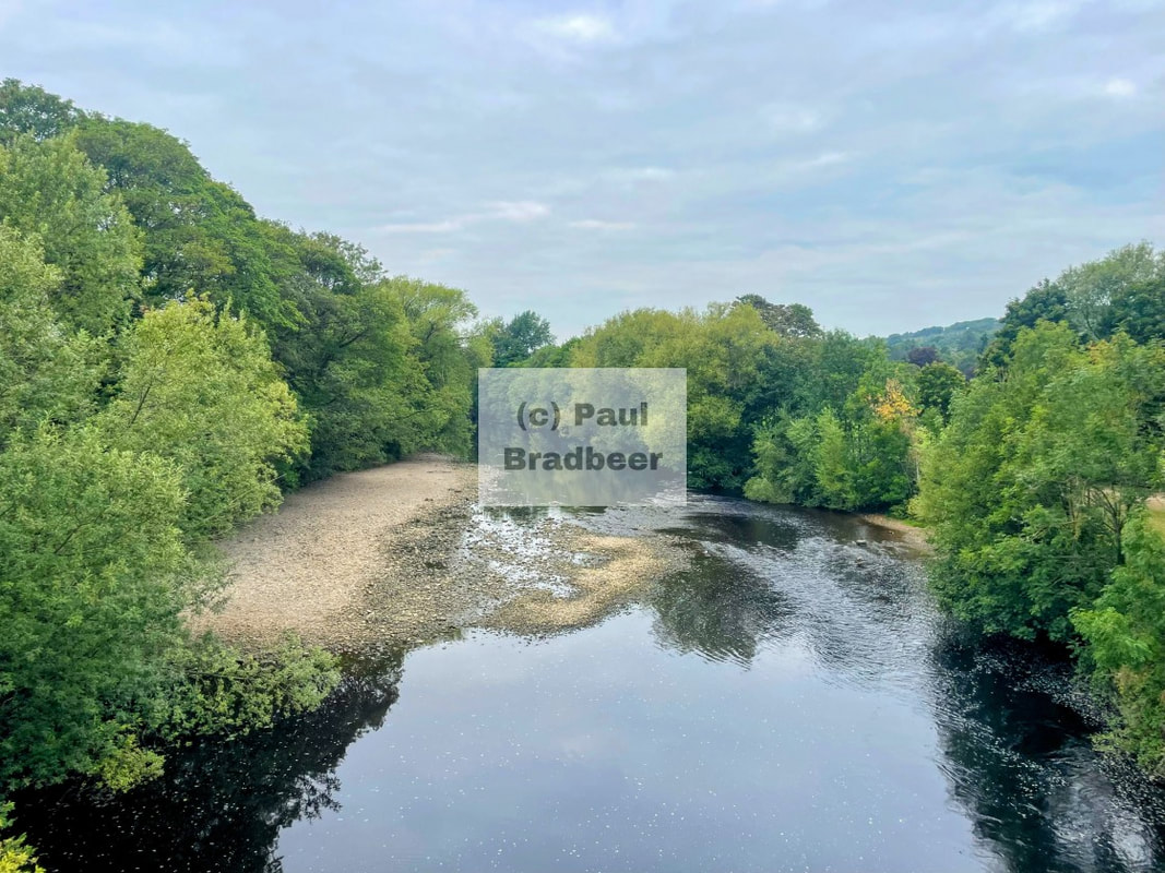
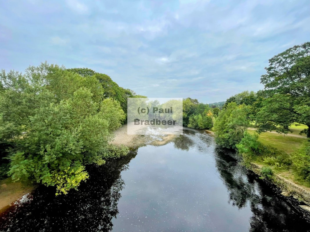
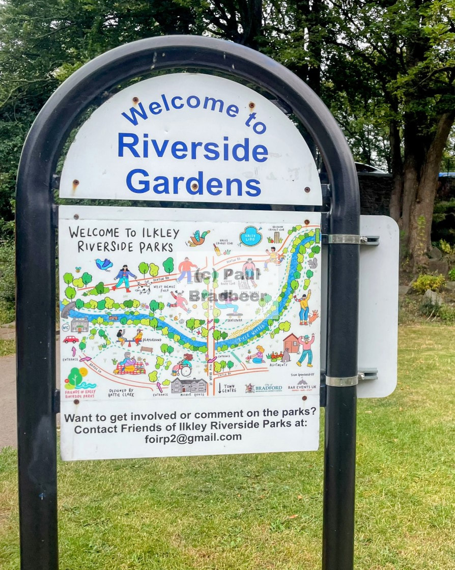
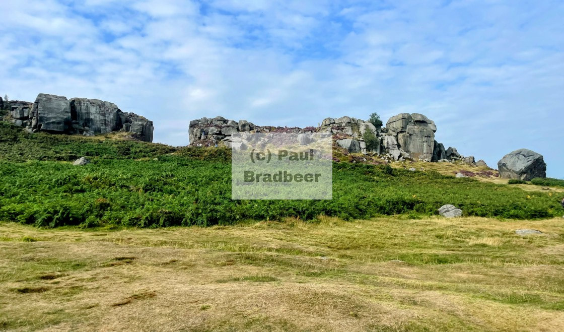
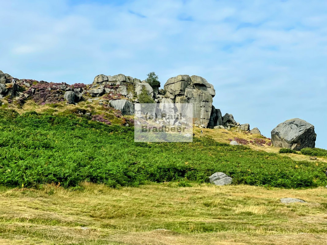
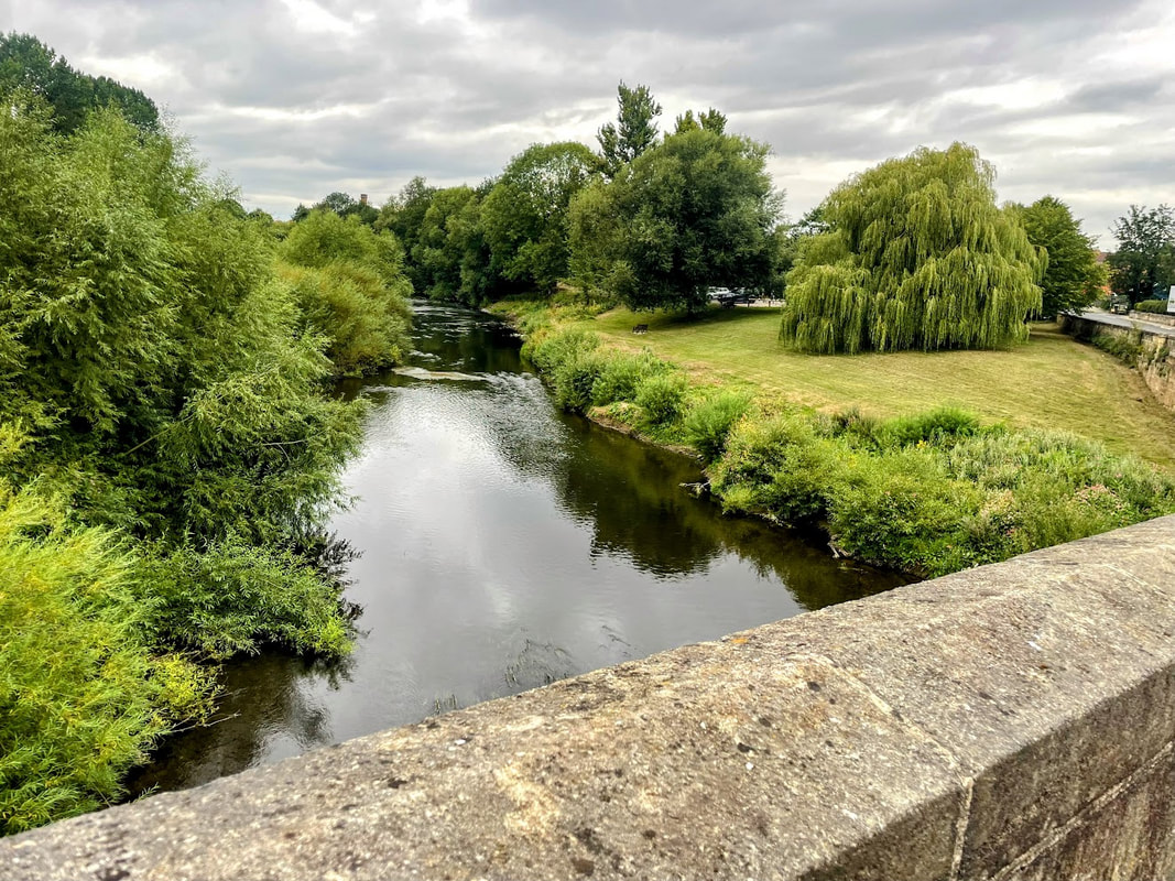
August 2025 - Ilkley, North Yorkshire
A blend of beautiful natural landscapes and town amenities with good connections to Leeds to the South, York to the East and the Yorkshire Dales to the North, Ilkley has a lot to offer.
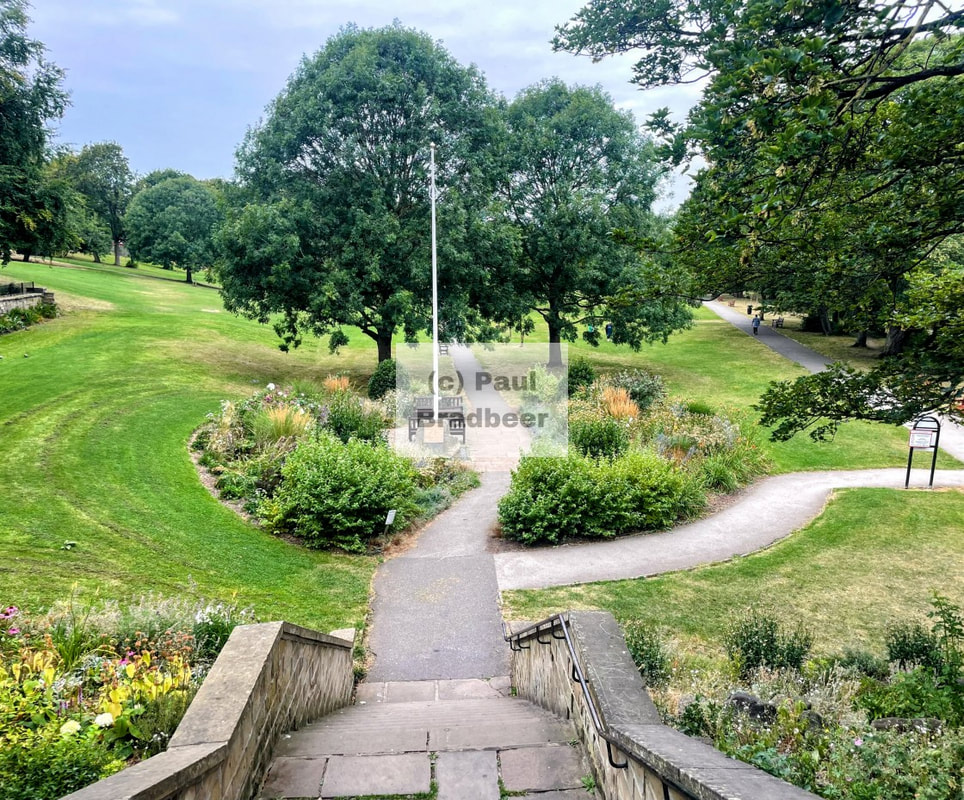
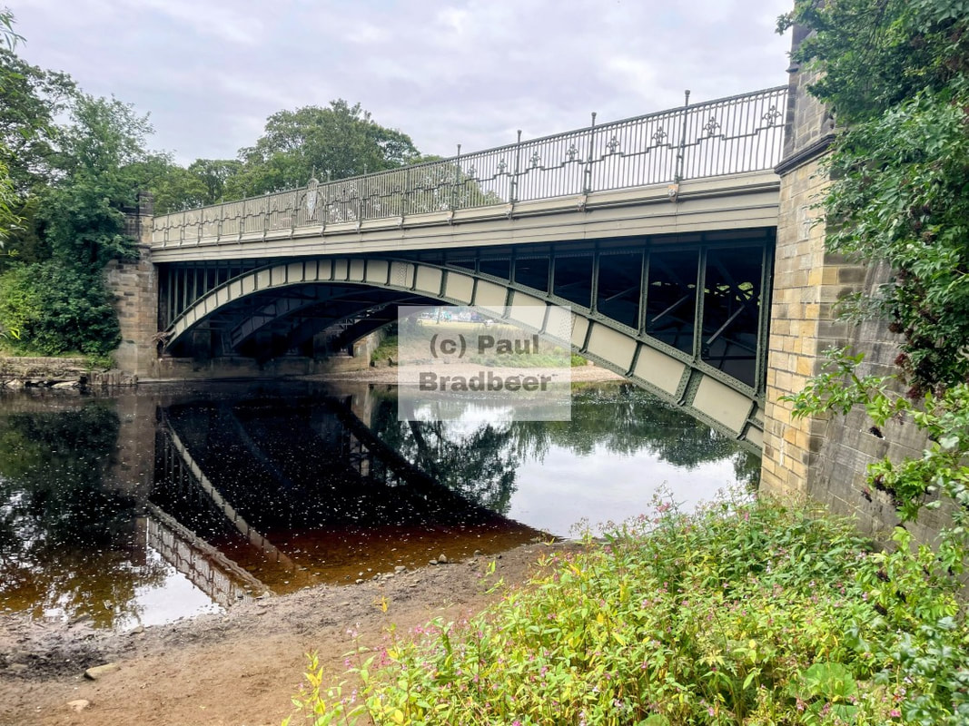
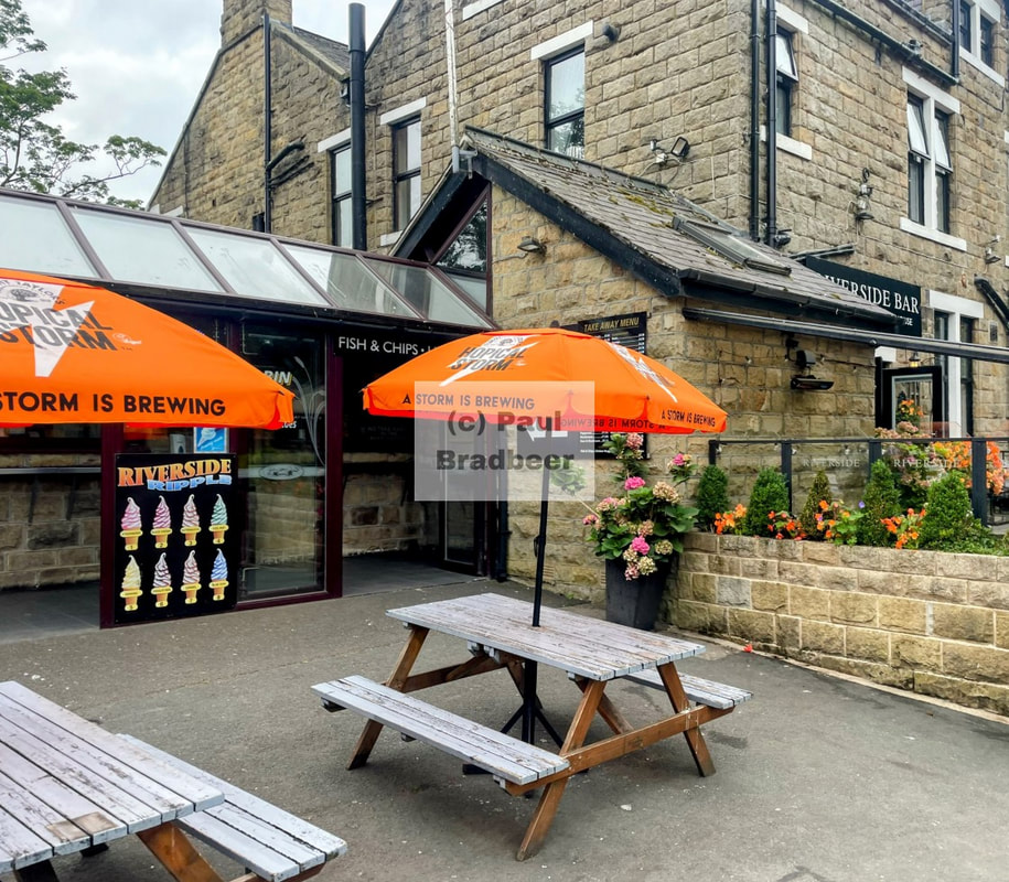
I parked atop the New Brook Street Bridge and walked a part of the Dales Way alongside the majestic River Wharfe within the Riverside Gardens Park, a well kept and well used green space. Chatting to some locals it was a warm welcome and it came across as a friendly place. The Riverside Cafe situated at the far end of the park was a fine place to while away 30 minutes and rest.
Famous for Ilkley Moor and the Cow and Calf rocks (pictured above), along with the refrain of "Ilkley Moor Baht' At" which, as the unofficial anthem of Yorkshire, tells the cautionary tale of a man's concern for a loved one out on Ilkley Moor without their hat. The song is said to originate from a chapel choir ramble in the late 19th century with the first few lines reputedly penned during a picnic under the cow and calf rocks situated on the moor.
The moors are reached by ascending through the residential streets in the South East of the town and on to Hangingstone Road. A lovely run out in the sunshine. The cow and calf car park was full but invent-a-space proved a decent strategy for the motorbike. I went briefly misty eyed during the stop which took me back to memories in my twenties when I occasionally visited the area. I rode out across the moors towards Keighley and then back on the main road to Skipton, an archetypal market town, then onwards into the Dales through Burnsall and Grassington, busier than ever on a sunny bank holiday weekend.
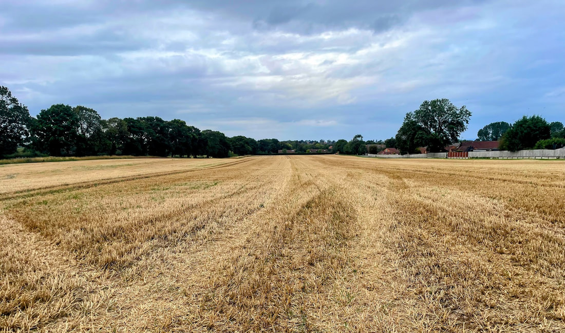
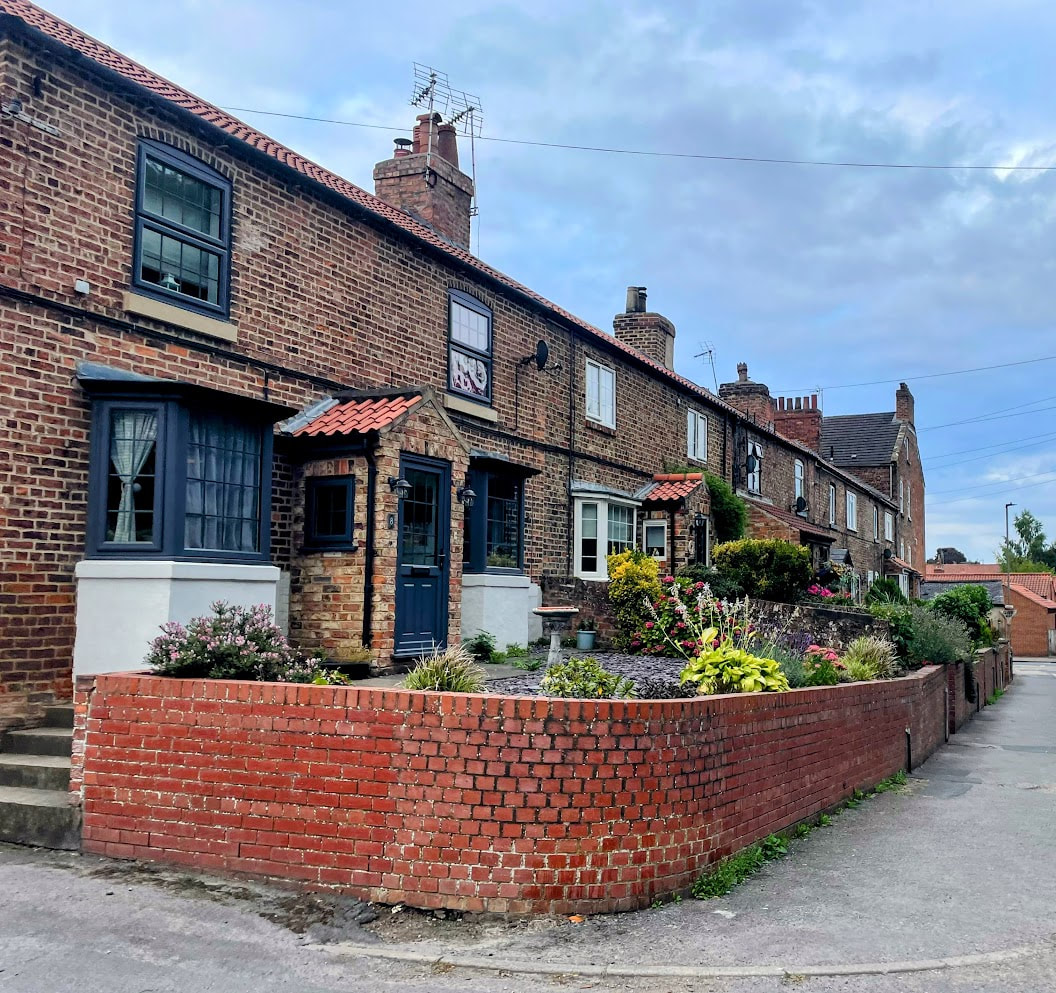
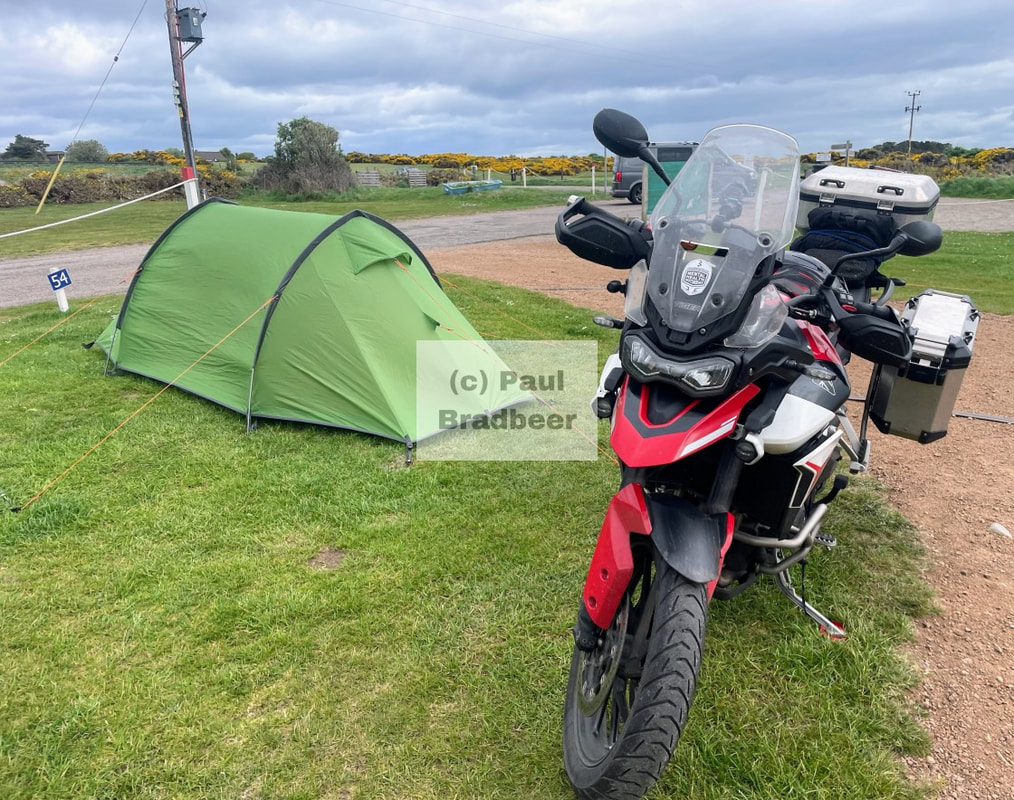
August 2025 - Boroughbridge, North Yorkshire
Situated close to York and on the edge of Nidderdale and the Yorkshire Dales, this was historically an important stop for the stagecoaches travelling from London to Edinburgh along the Great North Road. In time the A1, the longest road in the United Kingdom, and the main road from London to Edinburgh, would pass through the town until it was bypassed in 1963.
The town grew up around a crossing point on the river Ure which is significant, amongst other reasons, for the Battle of Boroughbridge in 1322 between the forces of the ineffectual King Edward II on the South side, led by Sir Andrew Harclay, and rebellious barons led by Thomas of Lancaster to the North. On this occasion, with documented numbers of circa 4000 royal soldiers to 700 rebels, the Royals easily won out securing a victory over the rebels. The encounter saw Harclay rewarded with lands and title, and Lancaster beheaded following a show trial for his misdemeanours. A plaque located on the bridge commemorates the occasion.
I was staying at the main camp site with my one hundred horses :-), about a mile out of the town centre. While there was a little noise from nearby roads and industry it was otherwise a really good and well run site. Largely flat and located next to the river Ure. It is worth noting that there were flood warning signs in place which could be "activated" should there be a risk of flooding.
As has been typical in most the camp sites I've visited in the last year or two, there were lots of caravans and campervans, and just a few tents. Roof box tents seem increasingly popular these days. I can see a number of advantages; you can camp without grass, easier setup and take down, no pegging out and they keep you off the ground at night. Some of the benefits of a campervan without the cost. It seems the downsides are the same as a campervan too; you need to pack away your tent to go anywhere in your vehicle - so brilliant for one night stop touring and not so good for multiple nights in a single place. I can imagine the occasional visit to the toilet in the middle of the night providing an entertaining or even dangerous dimension of difficulty involving bleary eyed encounters with ladders - for the men at least, a lenor bottle continues to hold appeal.

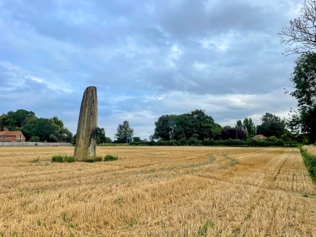
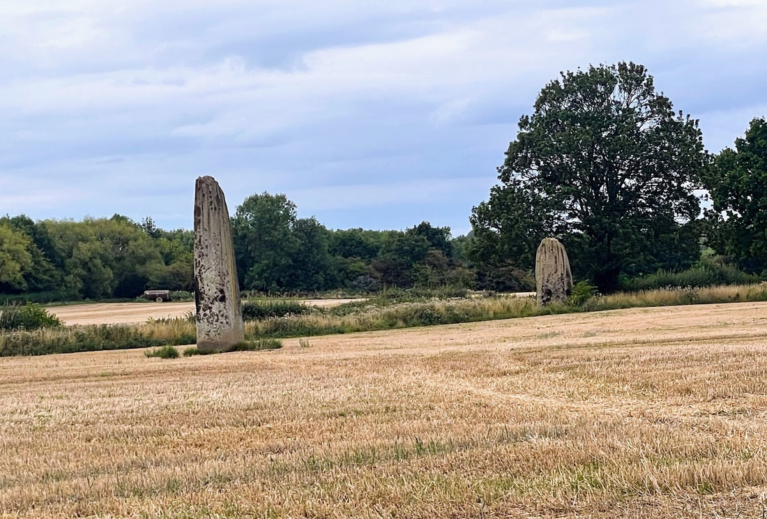
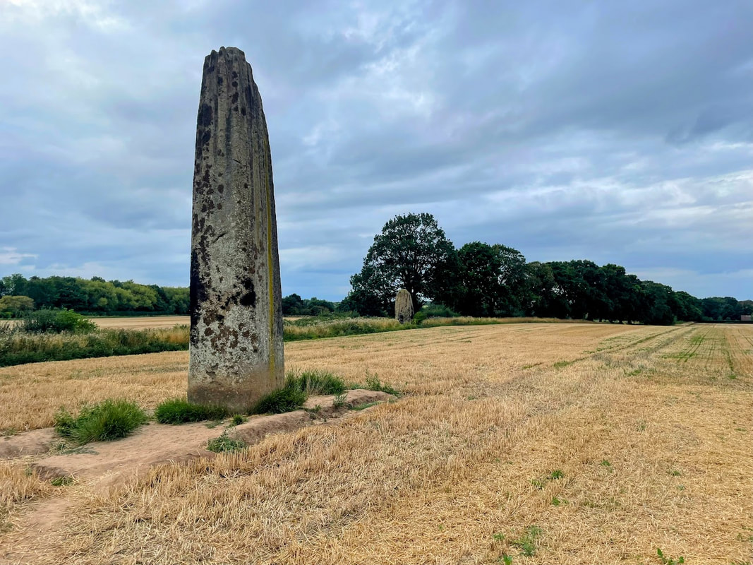
A sunny evening, I walked into the town to look around. On the map I saw some standing stones marked as "The Devil's Arrows" which were en-route.
There are three stones; one located on the main road into the town, and two inside a field opposite. Documented as some of the tallest in the United Kingdom, the stones had a distinctive groove pattern down them from the top, said to be caused by millennia of rain fall since they were erected during the Stone Age.
I've spent quite a lot of time in the Carnac/Quiberon area of Western France where there are significant collections of standing stones. Clearly it was done, but the mind boggles at how such monumentally huge stones were engineered into place without modern machinery; bearing in mind that a significant portion of the stone is under the ground. You can imagine systems involving rolling logs and a lot of ropes and levers etc.. being employed - it sounds like a tough gig. These must have been huge community driven projects involving a lot of people and collaboration; sometimes transporting stones large distances. Whatever the motivations, be it religious/ceremonial, astrological, boundary points or grave marking - the people concerned clearly attached massive importance to them and a commitment to something bigger. Such efforts are hardly in isolation when you consider the often decades or occasionally century long efforts to build cathedrals, priories or churches (e.g. notre dame), where workmanship and skills were handed down through generations and guilds, and the people working on the projects may not expect to live out to see the finished product. For the workers concerned, was it "just a wage"? or was it a level of commitment to a bigger picture which transcended the personal gratification/closure at having finished something, contributing to something of greater importance - legacy. Perhaps different strokes for different folks.
The town itself is pleasant with a selection of independent shops and plenty of nice looking eateries, cafes and pubs. which were busy There were areas which were signposted as "the old town" suggesting some sort of division, although the separation seemed unclear to me.
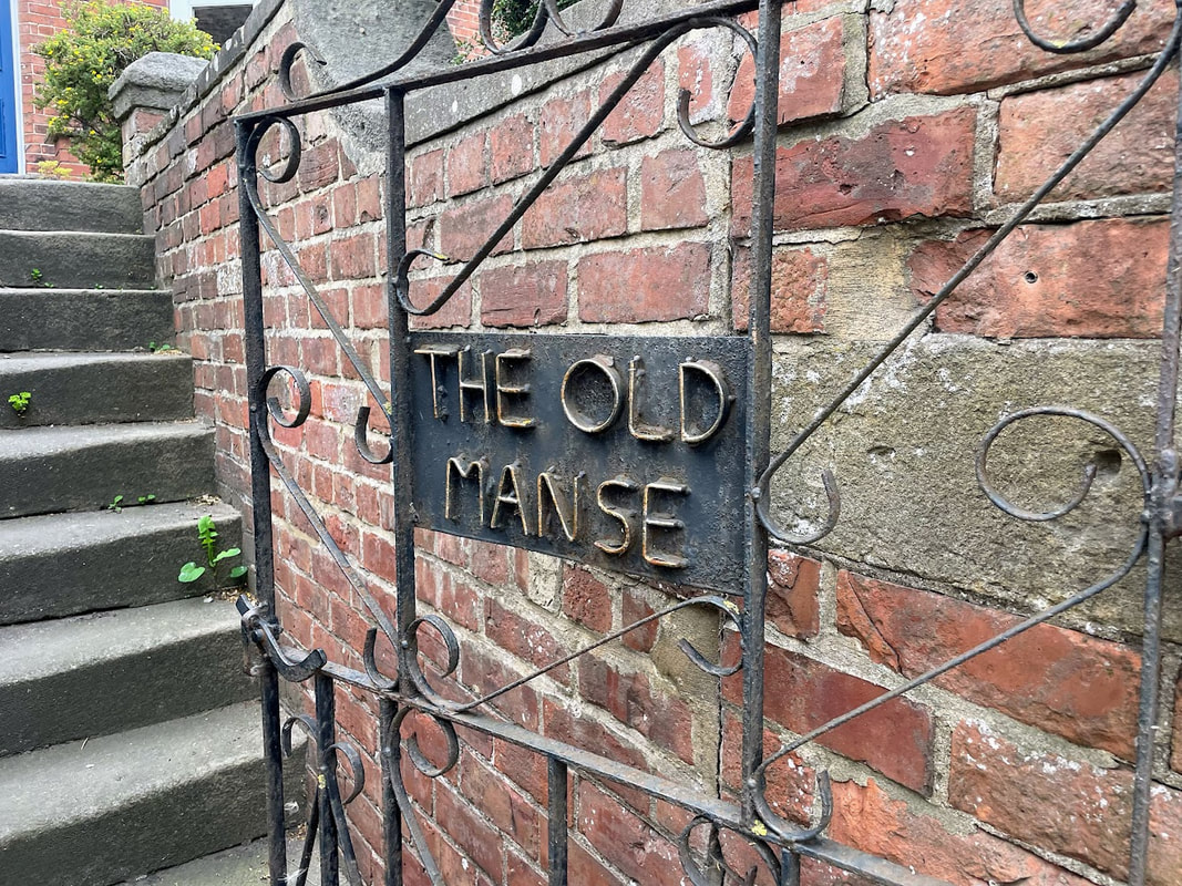
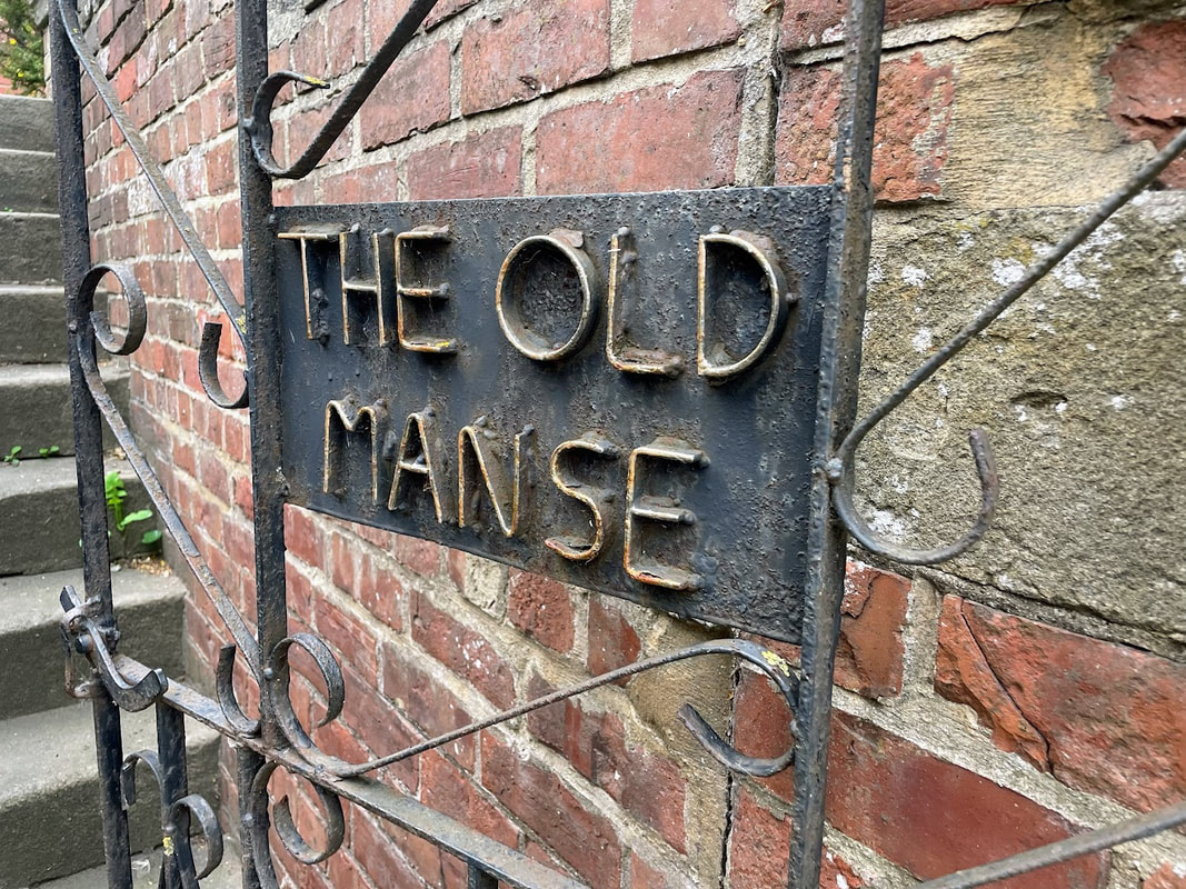
One house I came across, just outside of the centre, had a nicely crafted iron gate emblazoned with the words "The Old Manse". It looked a large detached property and had some distinctive character. I wasn't familiar with the term Manse and so did a little research. It seems a Manse is a house provided to a minister in a religious context. Coupled with this there is a tradition whereby when a Manse is sold on it is to be referred to as "The Old Manse". This may well be such an example, but I can't find any evidence for this; perhaps someone just liked the name having seen it elsewhere.
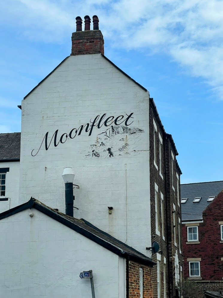
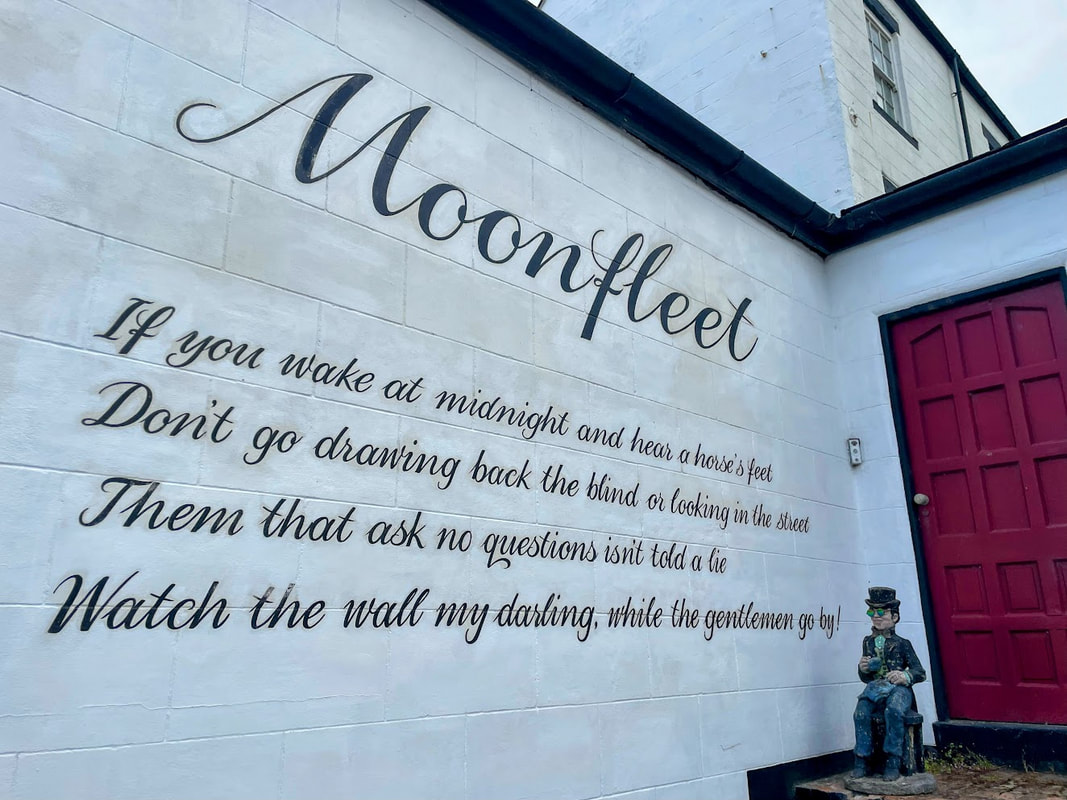
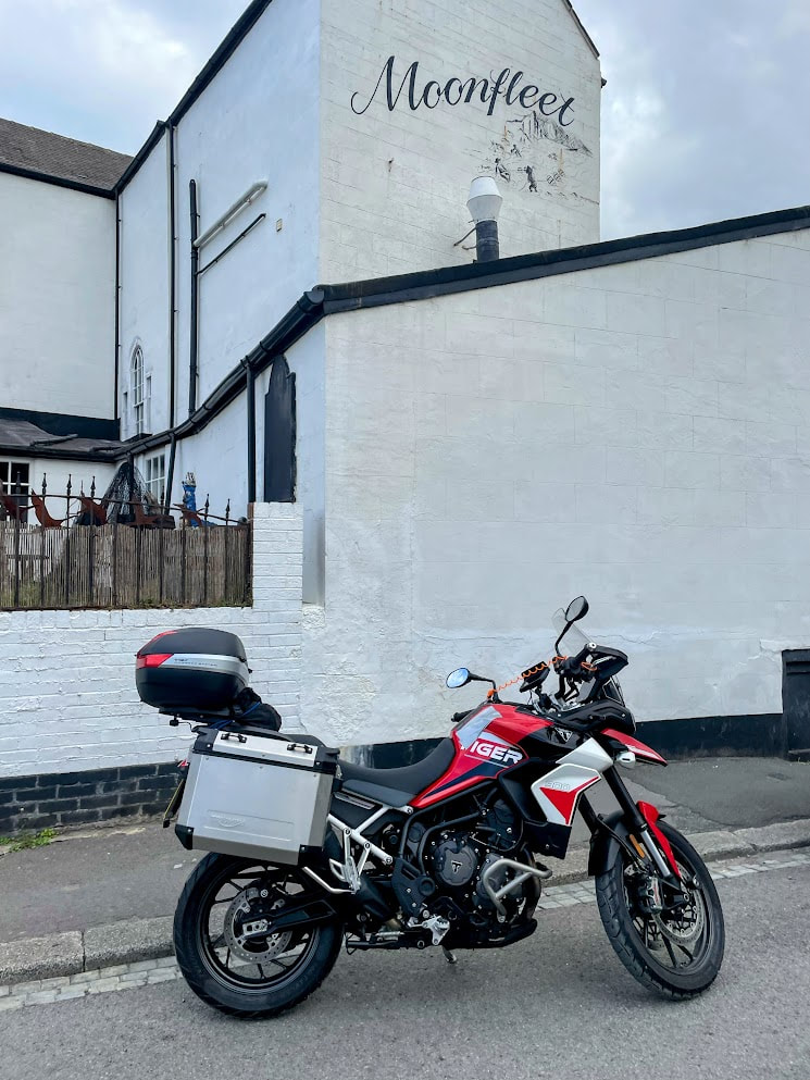
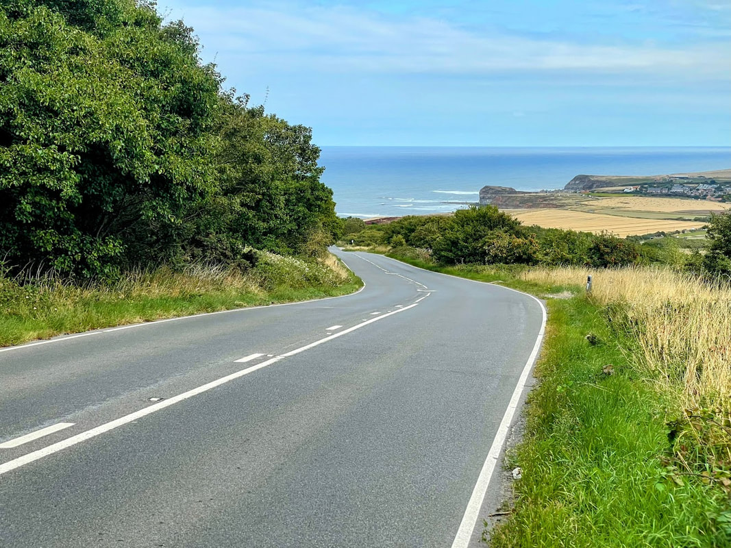
August 2025 - Yorkshire Coast
This was day 1 of a 3 day sojourn around North Yorkshire, West Yorkshire, Yorkshire Dales and a quick blast through Cumbria.
Destination Boroughbridge in North Yorks. - a good base from which to explore West Yorkshire and the Yorkshire Dales. As in life, when motorcycle touring, the point of the journey is not to arrive, and so a significant detour via the Yorkshire Coast and North Yorks Moors was undertaken.
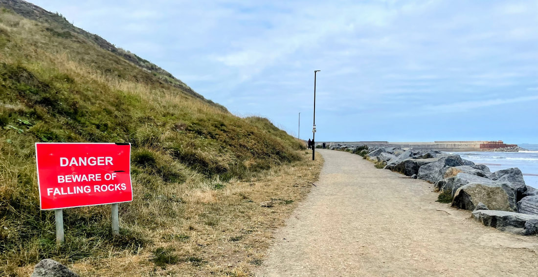
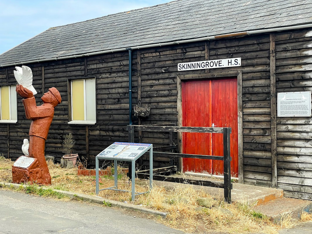
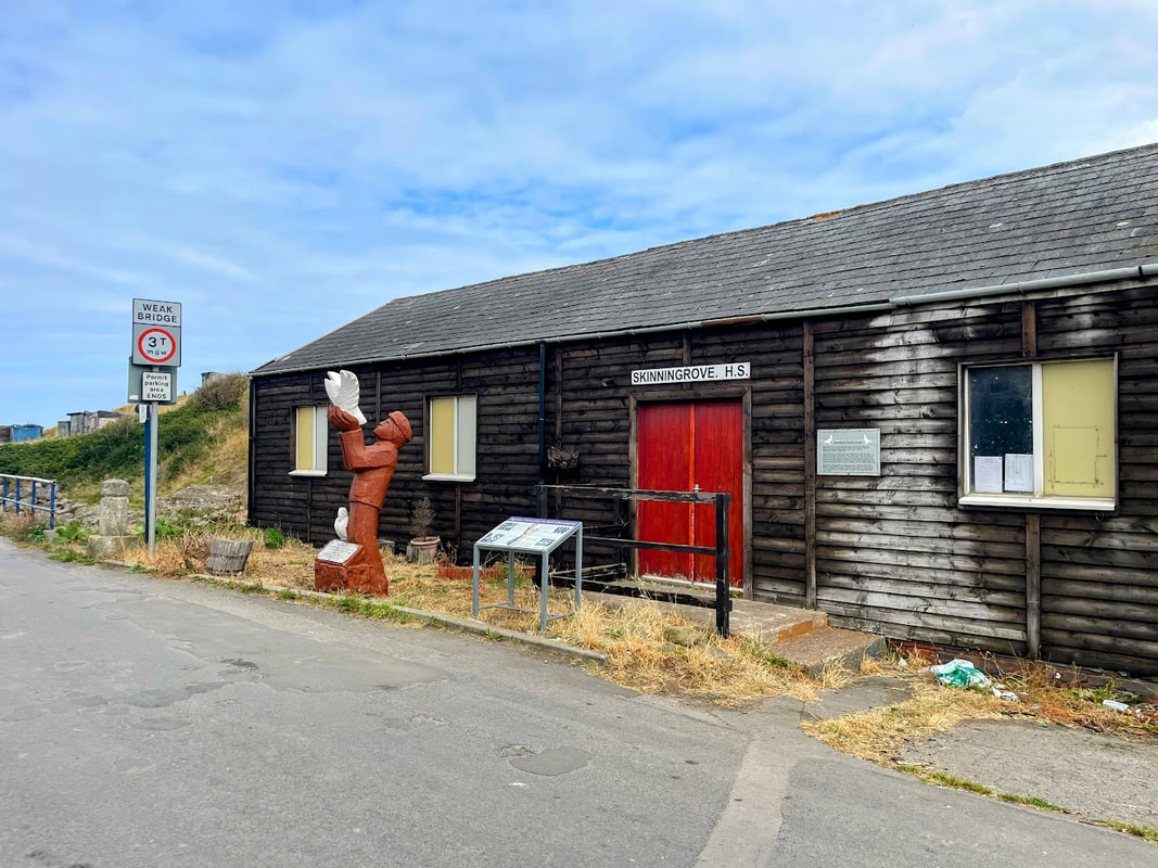
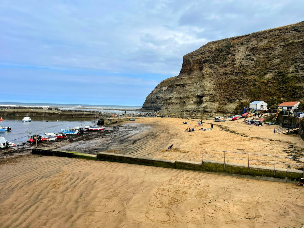
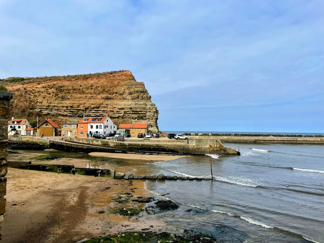
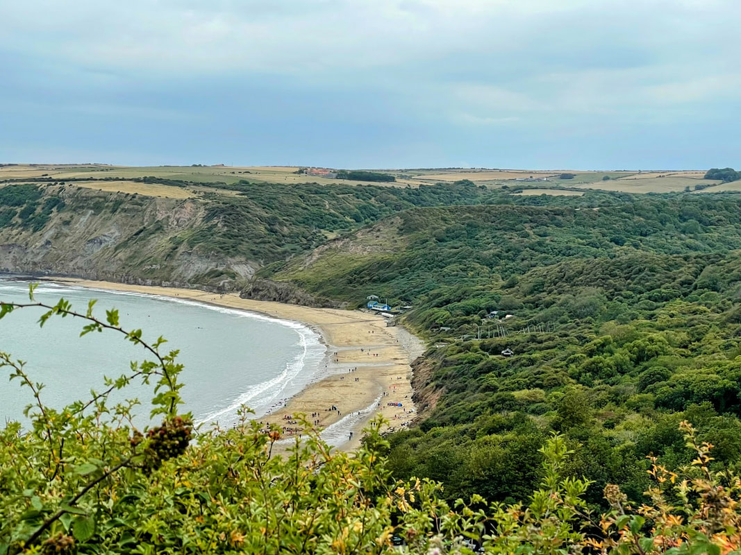
The first stop was Skinningrove. A village nestled on the Yorkshire Coast with a small beach and surrounded by rugged cliffs. The footpath along the coast here forms a part of the Cleveland Way and if walking is your thing you can enjoy miles of scenic coastline heading North or South.
On entering the village the first thing I noticed was the "Moonfleet" hotel which was distinctive and reminded me of Falkner's novel of smugglers in Dorset going by the same name. On one wall, and without attribution, is written out in large cursive script "The Smuggler's Song" by Rudyard Kipling. An elderly local resident who had lived in the village all of her life explained to me that it only recently became Moonfleet after being taken over, and that she enjoyed it as Timm's coffee house which was its previous incarnation.
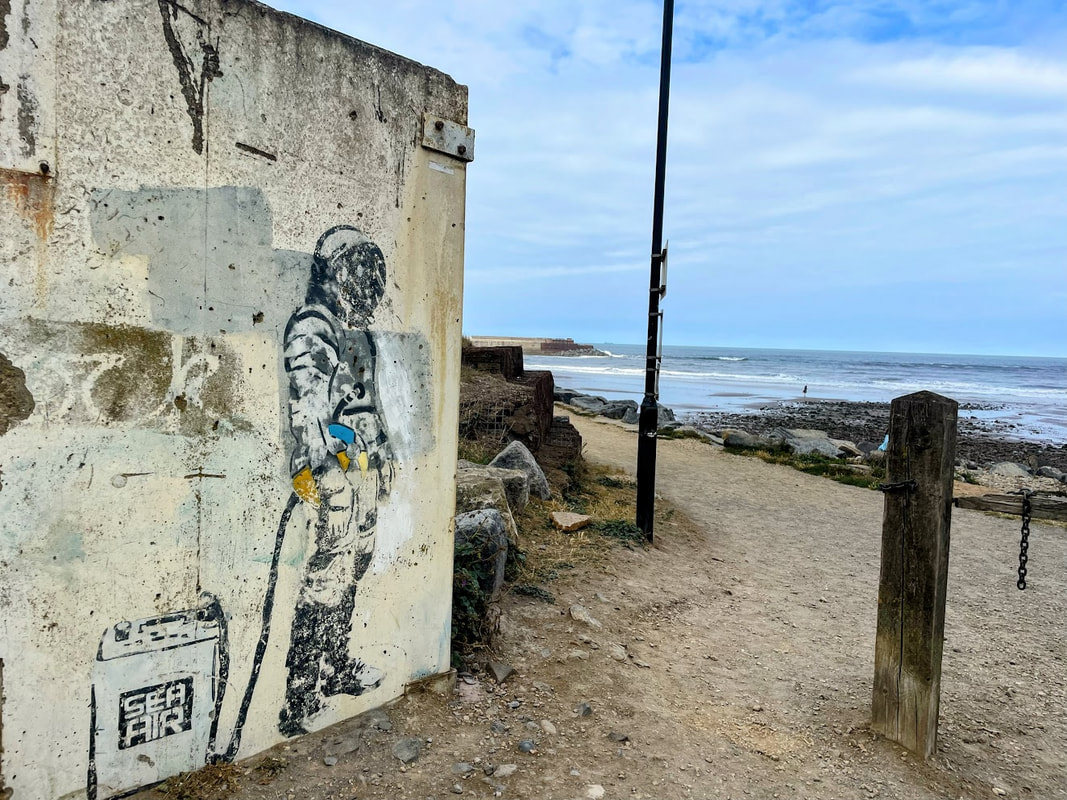
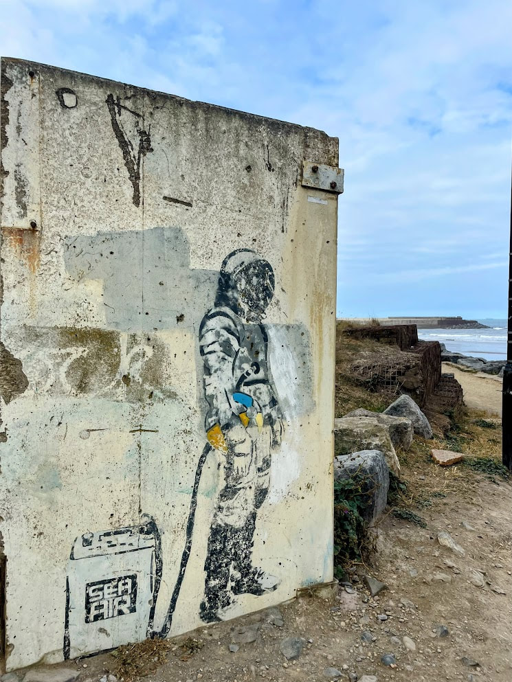
Parking proved challenging with the seafront car park full (even for a motorbike!), and most streets near the sea front being residents parking only. Parking further away I walked back to the shore line to explore. Within the car park at the Northern end was an interesting piece of street art depicting a person in a space suit carrying a beach ball and breathing from a container labelled "Sea Air". Brilliant! Some digging reveals the piece is by a local artist named Karl Striker. The piece was originally stencilled onto a barrier preventing access to an unsafe jetty, and later relocated to the car park for visitors to enjoy.
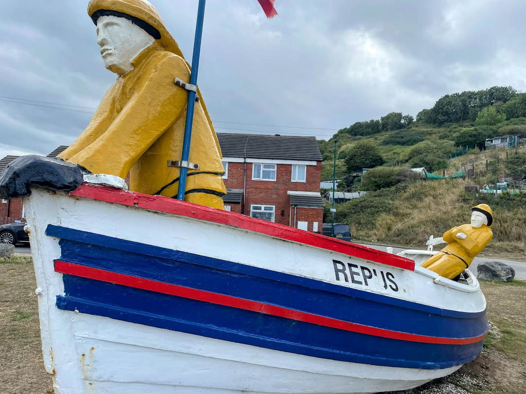
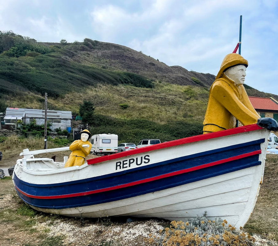
At the Southern end stands an old fishing coble called "The Repus" which previously belonged to a local fisherman named Wilber Cox. The boat was found in a bad state and it was relocated to Skinningrove, repaired and then positioned on the shore line with two wooden figures inside.
A coble is a style of fishing vessel used in the North East of England which had a flat bottom facilitating it landing and launching easily from the regions shallow sandy beaches, and with a high bow to provide some protection against stormy conditions.
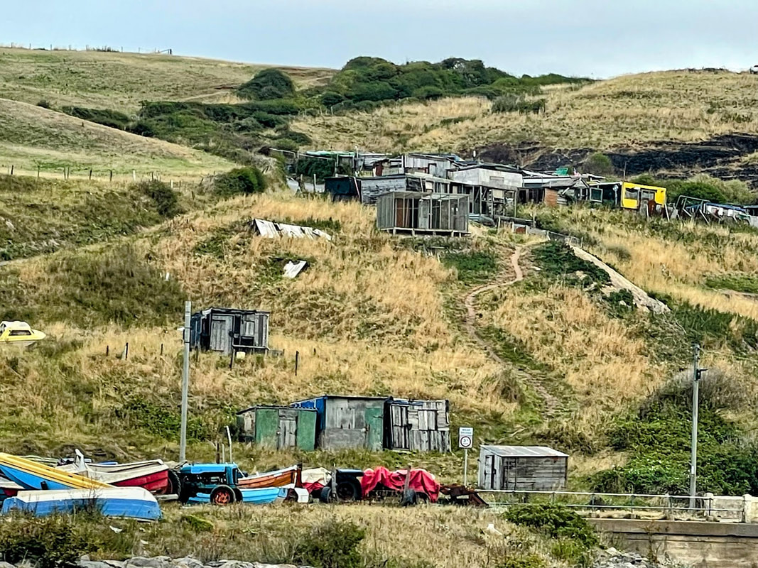
Looking South, the cliffs loom in the distance with the accompanying hill housing Skinningrove Bank Road which twists and turns while steeply gaining height exiting the village. Also on the slopes can be seen many ram-shackle shed like constructions which I later discovered were pigeon lofts connected with the sport of pigeon racing, of which a long tradition exists in the village.
Leaving Skinningrove by the bank road I headed South via country lanes to visit Staithes and Runswick Bay. Staithes is a very popular coastal town and on a fine weather bank holiday weekend was ram jam with people. Both well recommended for a visit.
Time waits for no man, and with plenty of miles left to do to Boroughbridge, I headed out on the ever popular moors roads taking in Pickering, Helmsley, Sutton Bank and Thirsk along the way to arrive at a sensible hour to get the tent setup and scout for beer and food.
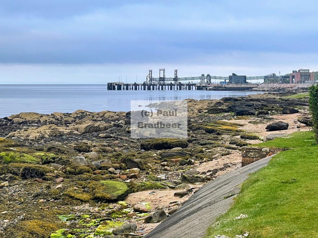
August 2025 - Ayr to Alnmouth Coast to Coast
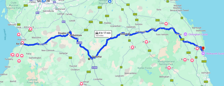
Approximately 160 miles from Ayr on the West coast of Scotland to Alnmouth on the East coast of England.
When arriving into Ayrshire I approached through Gretna to Dumfries and then taking the scenic A713 and B741 to Culzean - sections of which are part of the Galloway Tourist Route.
Seeking a different route back I embarked on a slightly longer coast-to-coast ride across to Alnmouth in Northumberland which would give me the opportunity to sample the delights of the magnificent Moffat to Selkirk borders route, joining with other borders roads I was already familiar with through Kelso.
From Ayr, I opted to take the A70 East to Douglas and then to avoid but track the A74 South to Moffat to then head East again.
The A70 was a mixed bag with some nice sections, but in and out of some towns along the way. Once at Douglas I joined the surprisingly pleasant B7078 South; a decent and fast stretch which crossed the A74 at Cold Chapel to become the A702 and in turn the B7076 which crossed back across the A74 again, to eventually turn East on the B719 to cross the A74 for a final time as you then head up the hillside gifting you views of the surrounding landscape before descending into Moffat. This collection of B roads closely tracked the A74, had hardly any traffic on them, and afforded fairly steady 60 mph speeds along its whole length. For the cost of an extra mile or two and losing the 70mph speed limit it was well worth it.
The Moffat to Selkirk section is something special which I had been wanting to do for some time. It did not disappoint and embodied motorcycling heaven! and it shows that you don't need to head to the highlands to tick the boxes. Starting in the spa town of Moffat you head East towards the border lands, past the famous Grey Mare's Tail waterfall and then on to St Mary's Loch and then onwards through Yarrow, an area known for a number of standing stones of note (The Yarrow Stone, The Glebe Stone and Warriors Rest), before finally reaching Selkirk.
You could easily make this stretch part of a circular route, but for myself I continued East through the village of Bonjedward. I've wondered at the naming of this place. The prefix Bon comes from the Gaelic term Bun and means "river mouth". The village is located right next to Jed Water which joins as a tributary flowing into the River Teviot having flowed past nearby Jedburgh - so the name literally means "river mouth at the Jed".
The short stretch to Kelso saw me rushing for refreshments (early closing on Sunday!). Parked up in on the cobbled market square, I arrived just in time for last orders for coffee and savoury goodness from the local Greggs.
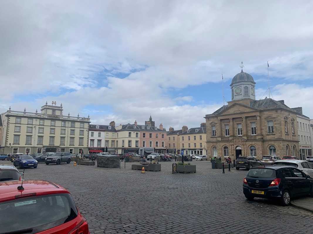
Kelso is one of the more interesting borders towns with plenty of commercial and tourist activity. Well worth a visit if you've not been before; it has a unique cobbled square fed by four cobbled roads and has a reputation as the largest in Scotland of its type. There was recent suggestion of the local authority wanting to tarmac over the cobbles to improve things for traffic. This was met with overwhelming opposition from residents who on the whole seem to want to preserve the traditional and unique character of the town. Host to a number of architecturally interesting buildings the town also boasts the beautiful Kelso Abbey which at the time of writing is free to visit.
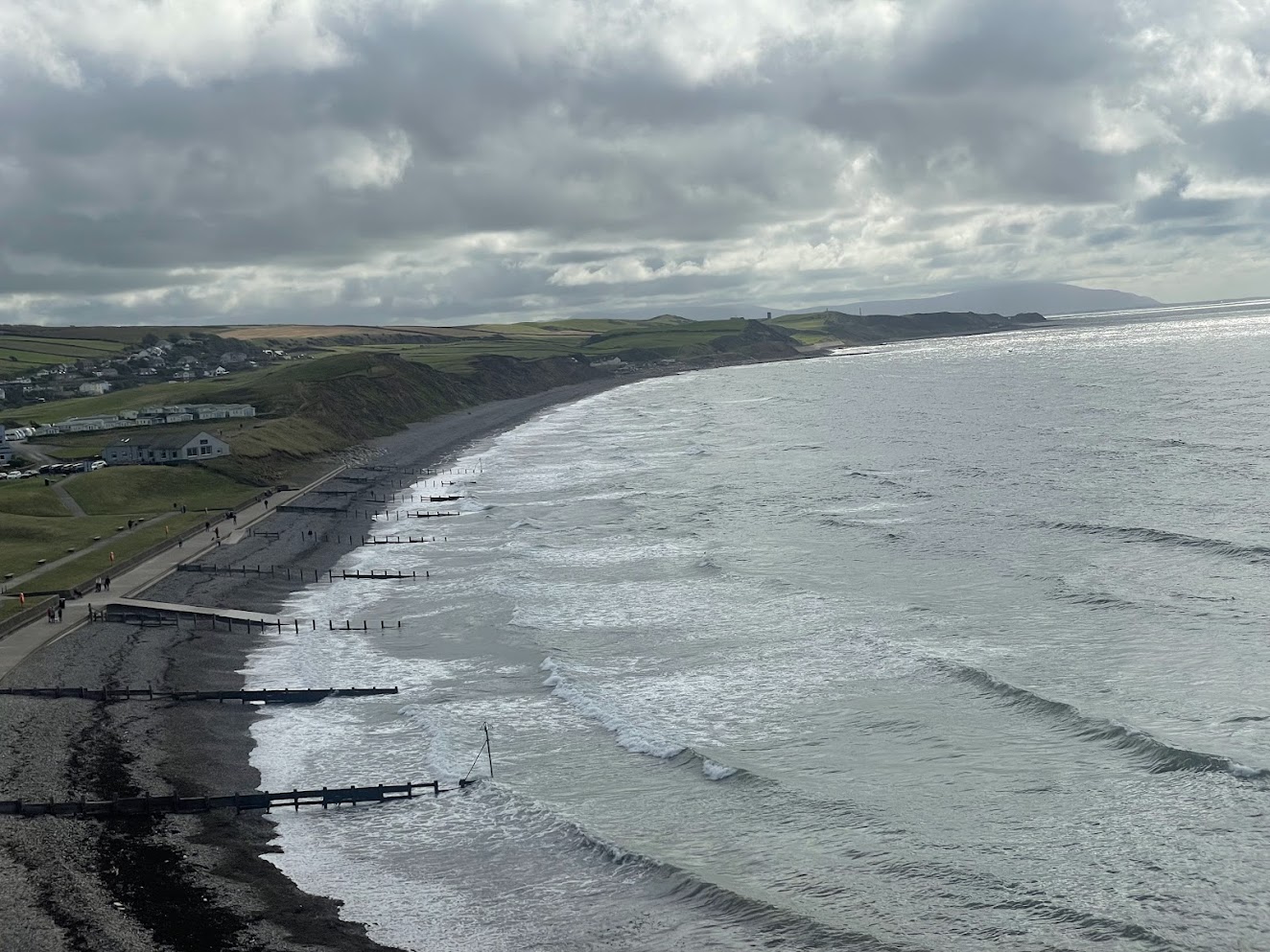
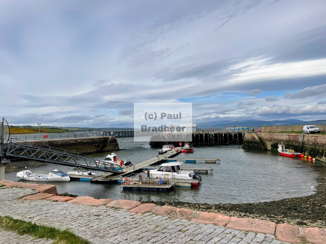
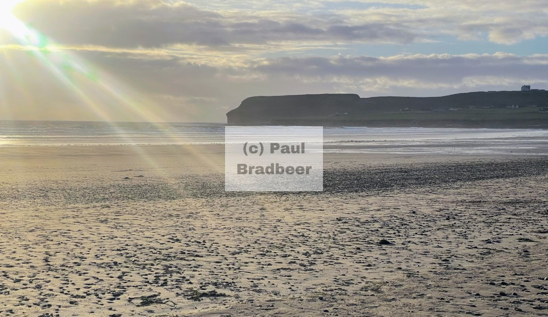
The final section across to Alnmouth is well ridden road for myself heading further East to join the A697 to Wooler, descending South to Alnwick and then the short hop to the coast at Alnmouth (pictured below from a separate visit). Alnmouth was originally a significant port town which grew in prosperity during the 17th and 18th centuries thanks to burgeoning domestic and foreign trade - notably grain leaving Northumberland by ship to feed other areas. The port would eventually decline rapidly it is claimed due to a re-landscaping which took place following a great storm on Christmas Day 1806. There are other factors - such as increasing rail links decreasing the demand on sea freight. Today it remains a beautiful tourist destination on the Northumberland coast with long golden stretches of sand, plenty of walking with views and local eateries and watering holes.

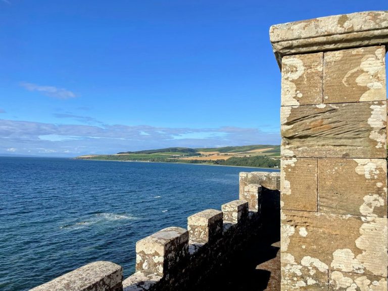
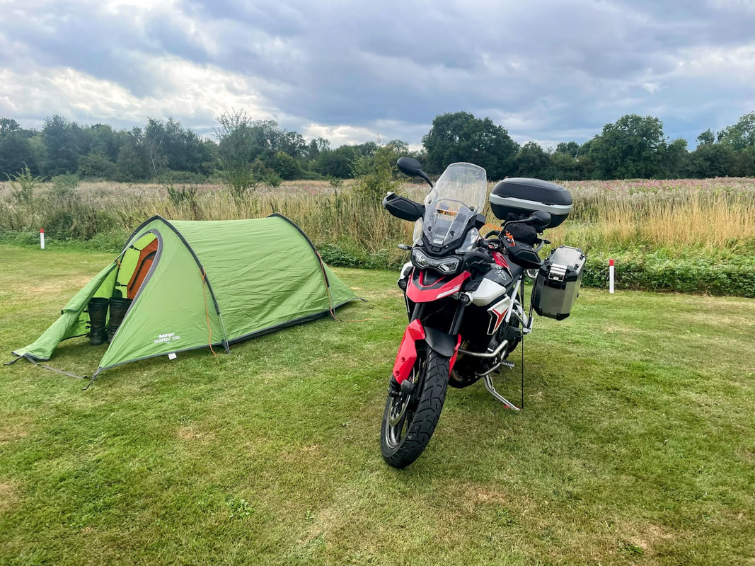
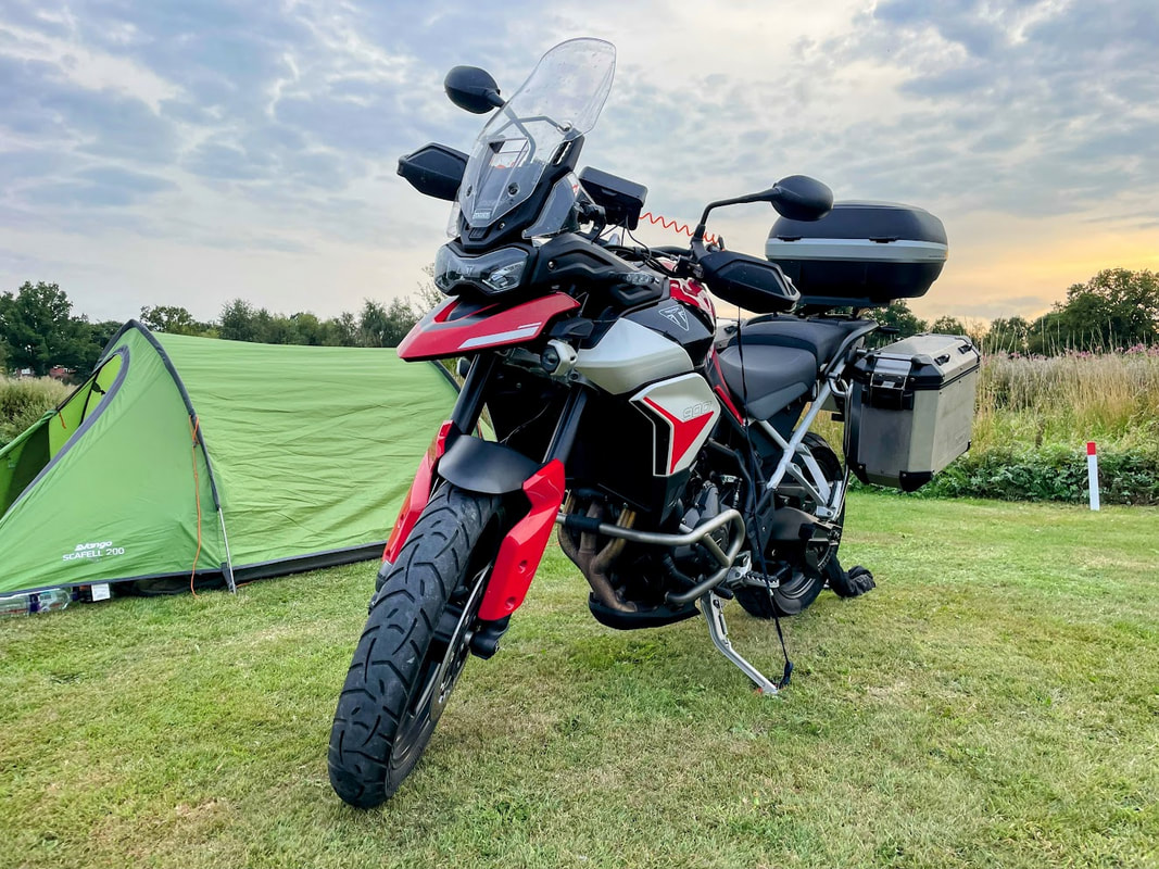
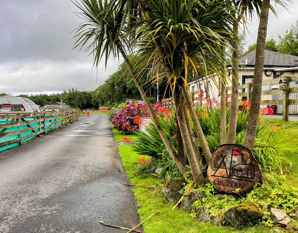
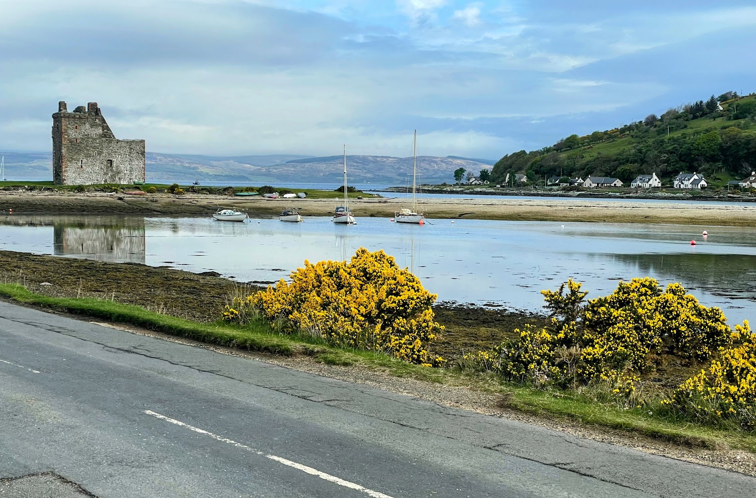
August 2025 - Culzean Castle, Ayrshire
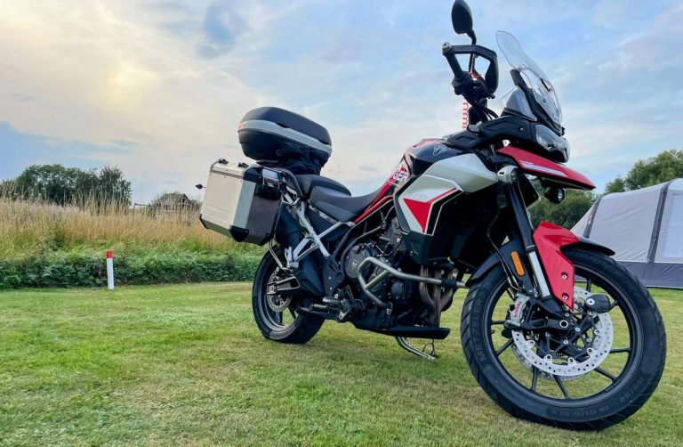
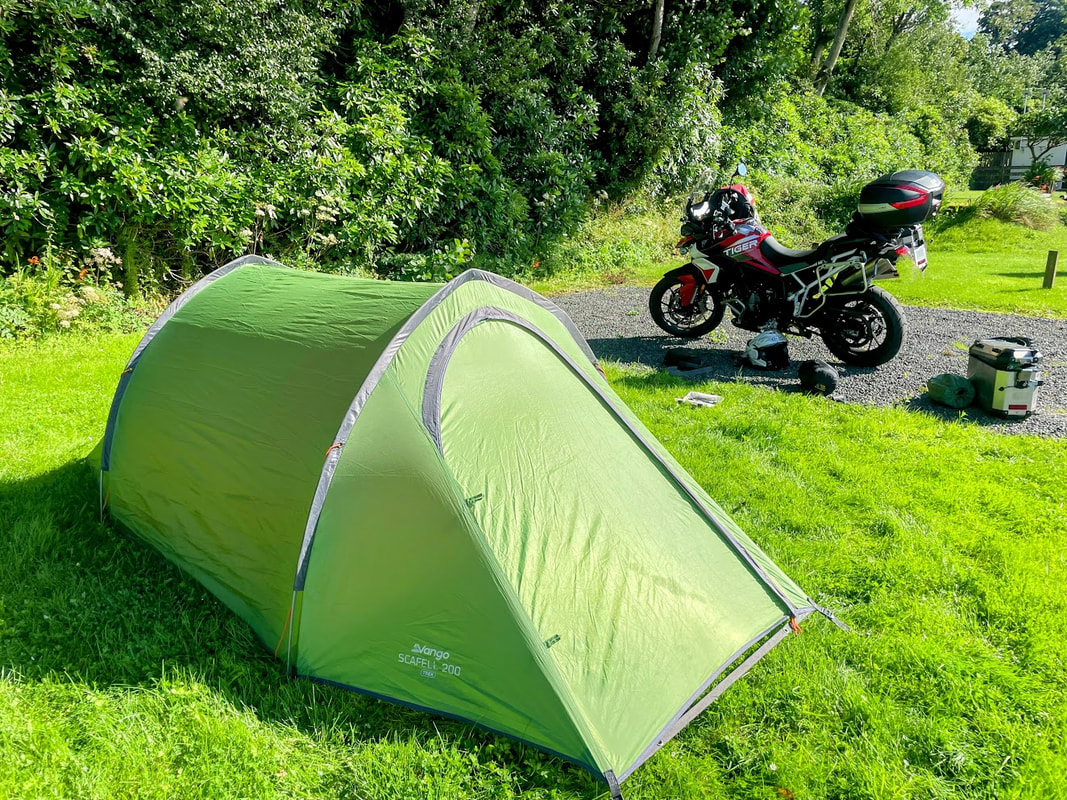
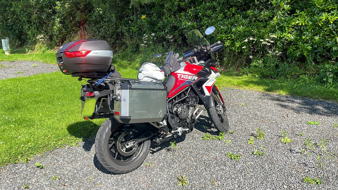
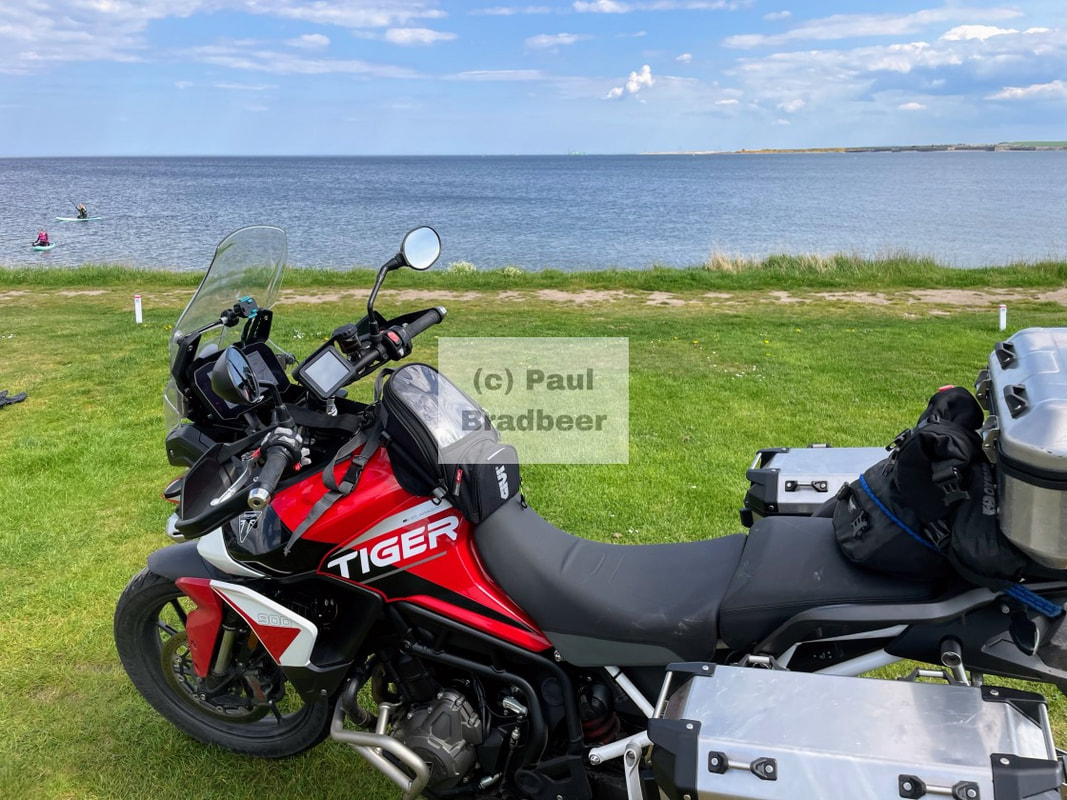
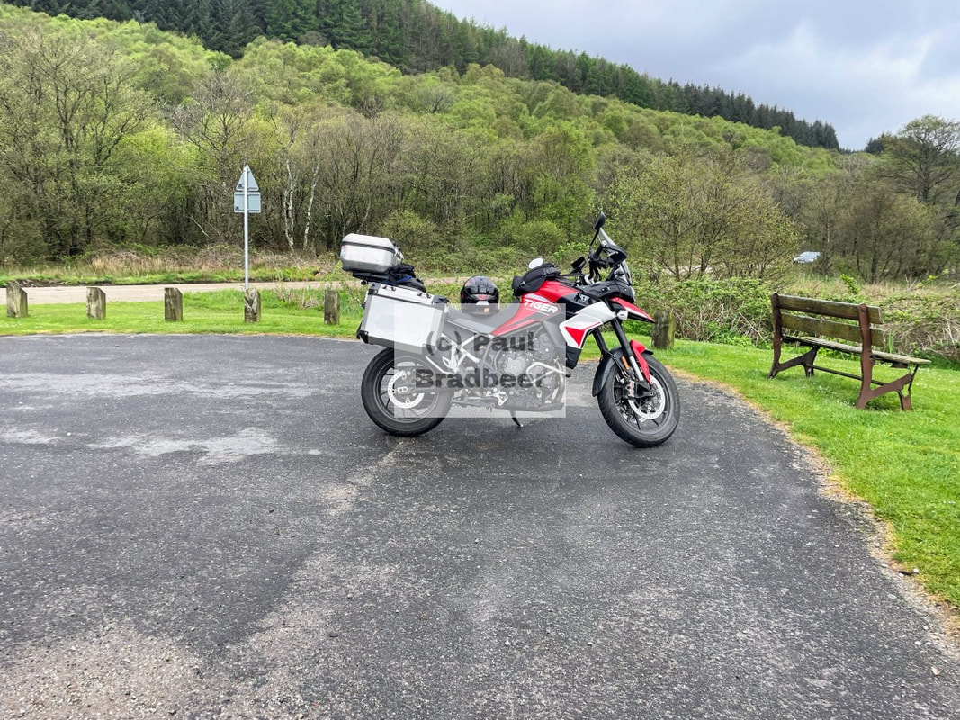
This was my first camping trip away on the replacement Tiger since the former was written off in a crash. I'd had the new bike for a few weeks now and with plenty of riding around the houses. Patience has been a virtue while the fitting of camera systems, ordering and fitting of luggage rails and panniers, and various other accessories took place. Now up and running it was destination Culzean Castle (pronounced culane); located on cliff tops above the beautiful Ayrshire coastline with views over the Isle of Arran. I had wanted to stay here and explore previously but had always just been passing through.
Summarised from wikipedia - The castle, originally constructed by order of the 10th Earl of Cassilis as the seat of his Earldom, was built in stages between 1777 and 1792. Notable features include a drum tower with a circular saloon, an oval staircase, and elegant apartments. It was the site of a prominent wedding in 1817 and later became associated with General Eisenhower, who stayed there multiple times after WWII having been gifted the apartment at the top of the castle by the Kennedy family as part of the terms of its transfer to National Trust Scotland in 1945. It also has ties to the Ayrshire Yeomanry regiment and underwent a major refurbishment in 2011 funded by American millionaire William Lindsay. It's a very popular tourist attraction and In 2024 it welcomed 247,602 visitors.

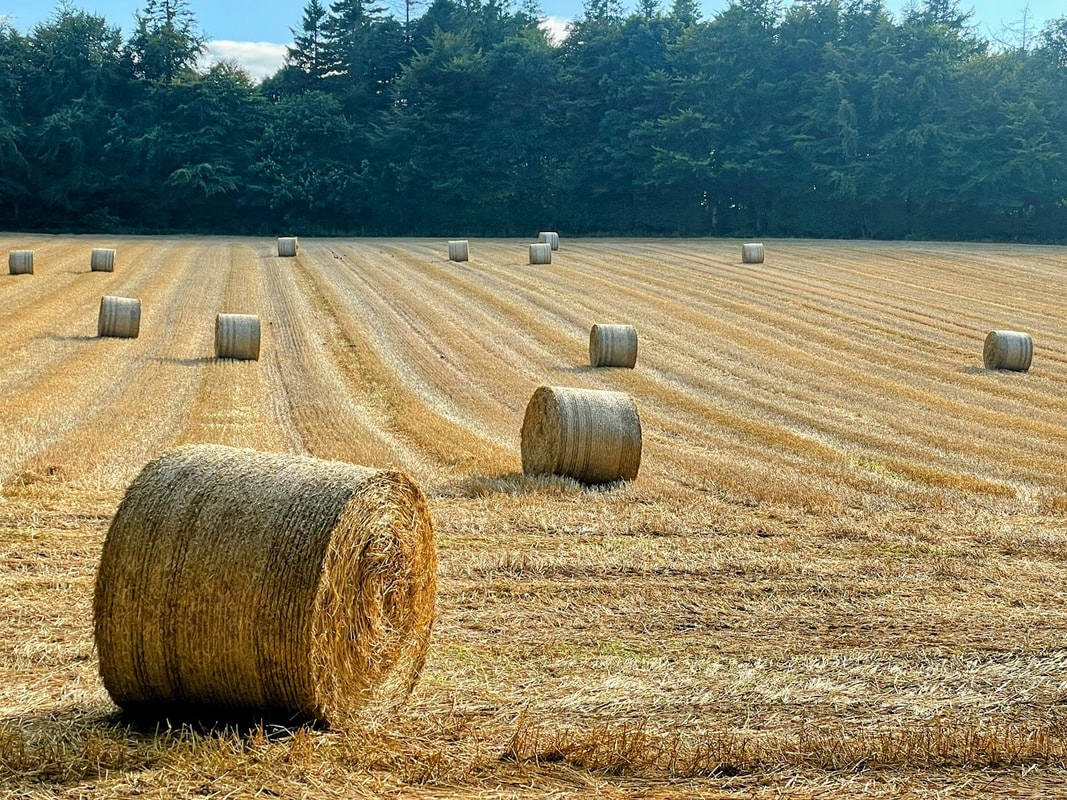
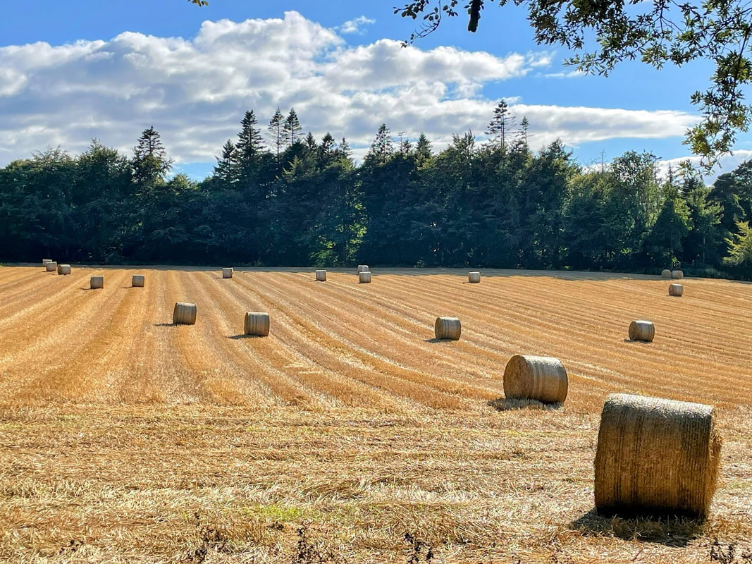
Farming activity was frenetic and bails of hay littered the landscape which adds a seasonal twist. I've learned to handle tractors with care when on the bike - they are large, slow, often with protruding accessories and prone to turning into fields at short notice where there is no obvious opening unless you know.
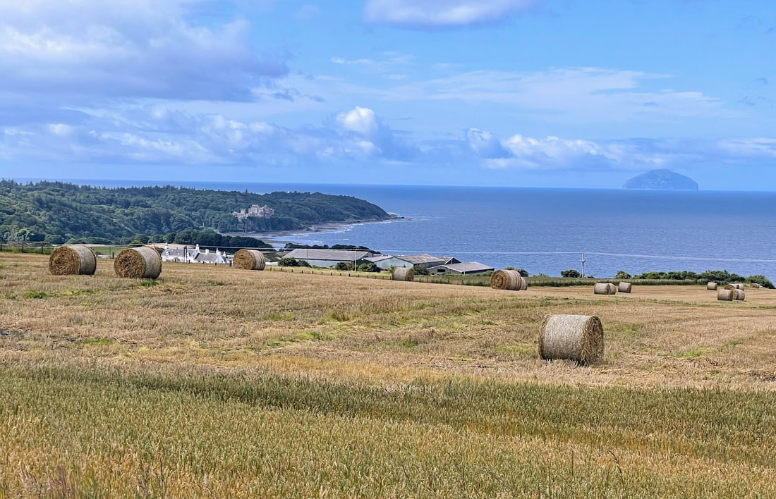
The coastline to the North between the castle and Ayr is stunning with a number of small country roads to ride; relatively slow but there is no need to rush with those views. To the South is the prolific coastal A77 stretching all the way to Stranraer and the adjacent peninsula.
It struck me as a high value place to live with all the coastline and countryside, the Isle of Arran on the doorstep, all the facilities of Ayr, Prestwick airport very nearby, Glasgow only 1 hour drive/ride away and the slightly extended daylight hours afforded to that more Northerly latitude (approximately an extra hour of daylight compared to London at the peak of the solstice and an extra 30 minutes in August).
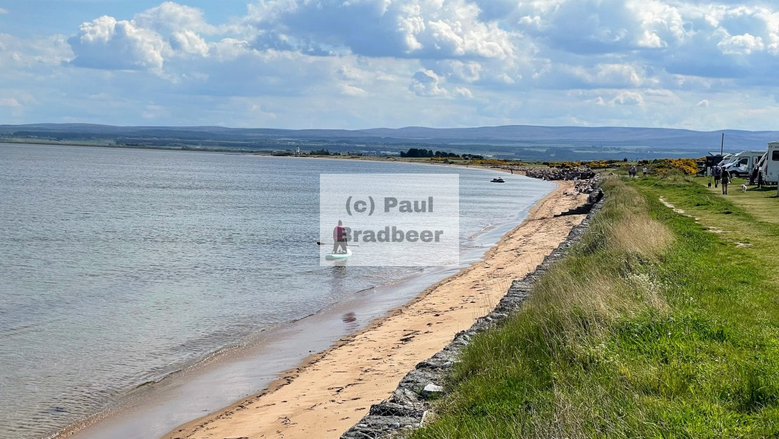
I travelled to Glasgow and back on the Saturday which aside from the last 5 miles into the city was a pleasant ride. I also visited the redeveloped harbour front at Irvine North of Ayr. It's looking good there with lots of free parking, the coastal views, pleasant bistros and cafes along with art studios selling their wares - a great lunch stop.
For the return journey I had in mind to go a long way around to explore some new roads and also to tick off a "coast to coast" route I had imagined from Ayr to Alnmouth which is circa 160-170 miles, and would take in the Moffat to Selkirk road I'd been wanting to do for quite some time, along with a stop in Kelso and a final leg through the Northumberland borders. (see Ayr to Alnmouth post)
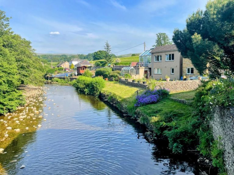
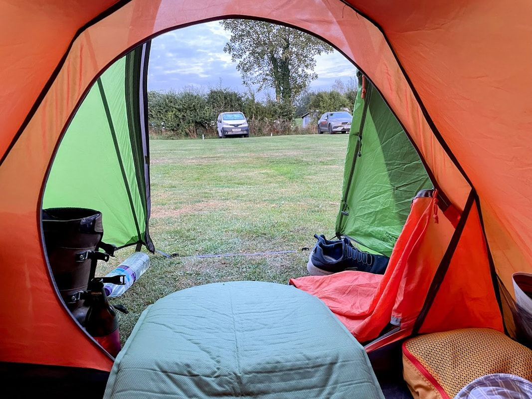
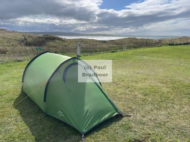
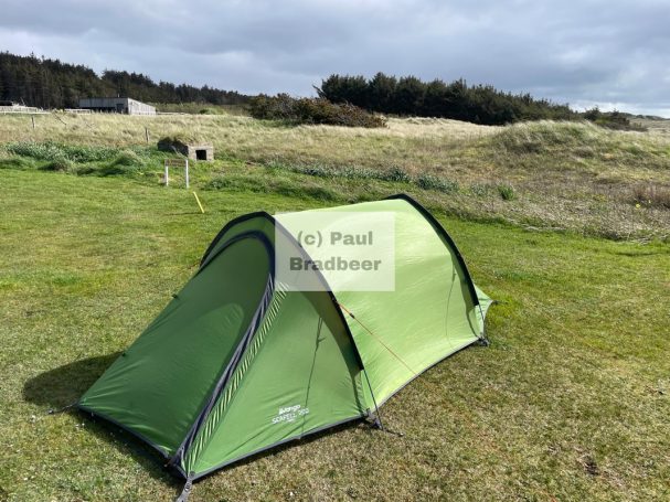
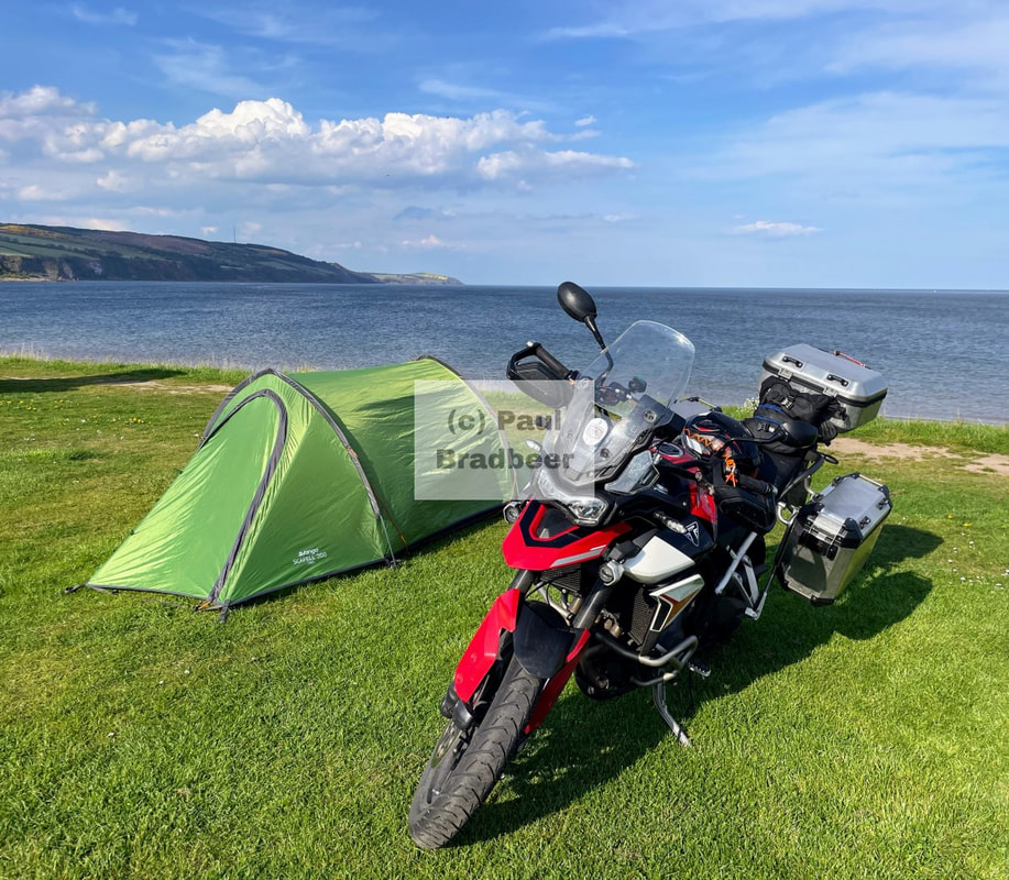
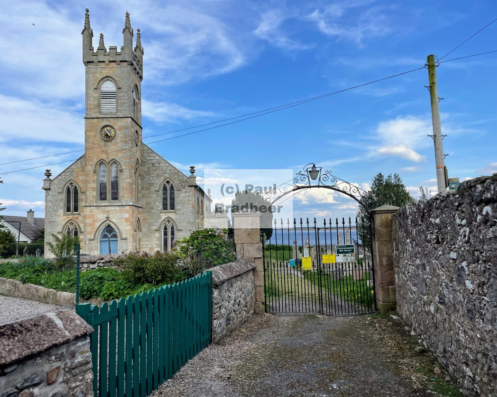
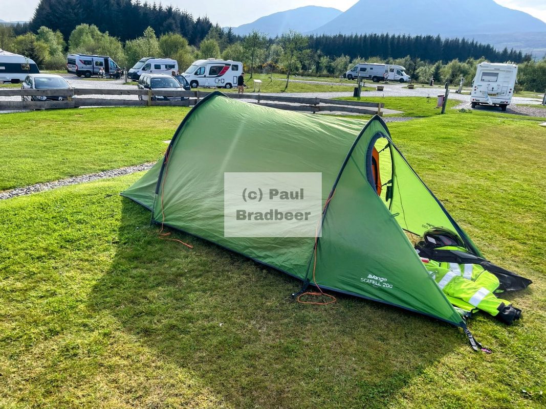
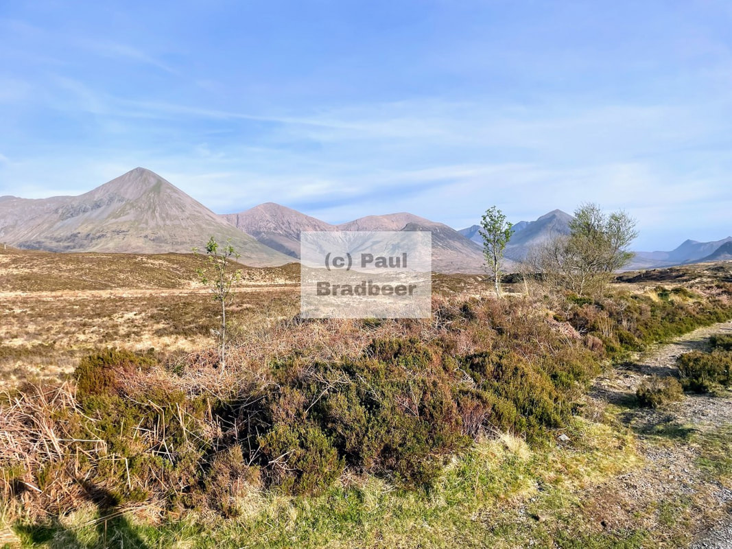
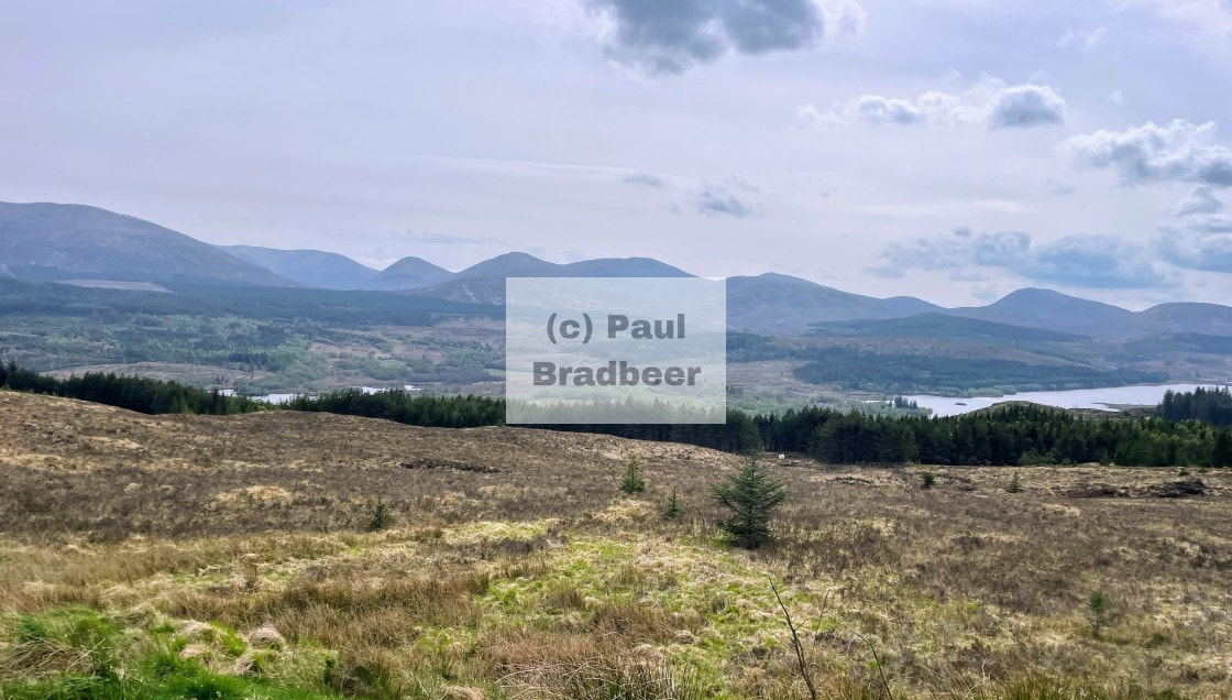
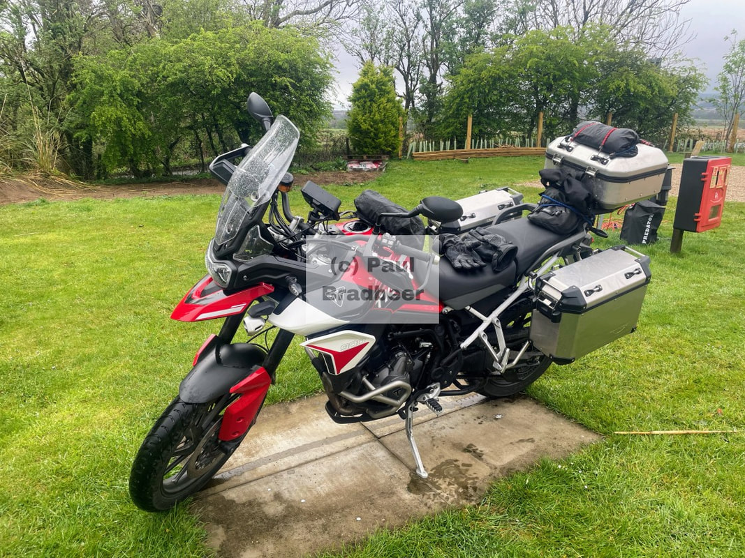
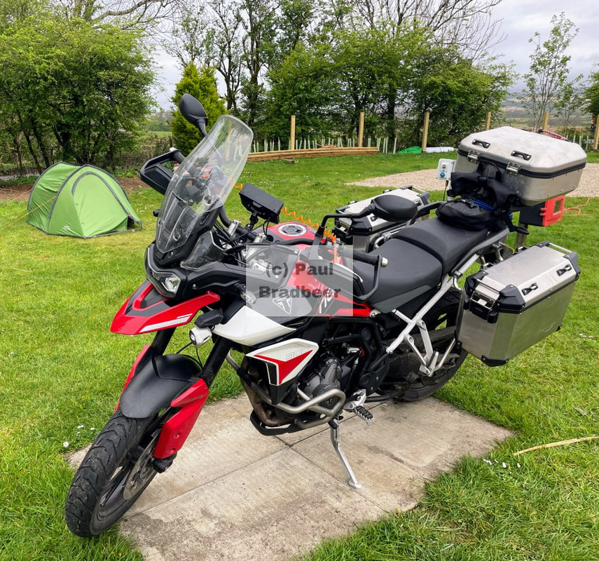
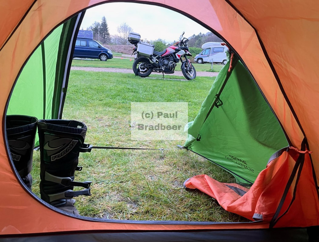
June 2025 - Kirkby Stephen, Cumbria
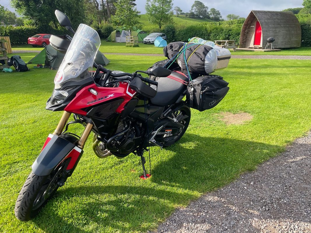
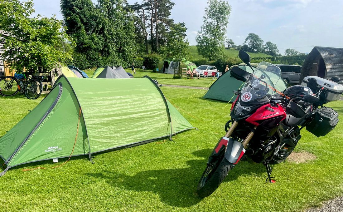
A few days retreat camping in Kirkby Stephen. Still on the cb500x since the Tiger was written off when a car drove into me in Yorkshire; not so much luggage space, but enough for a few days travel and the camping kit.
The journey over the Pennines was satisfying as usual. Up and over from Castleside to Stanhope and then up again over towards Middleton-in-Teesdale but bearing ride on the road to Brough.
The camp site and town were busy, alive with bustle and activity as Summer was unfolding.
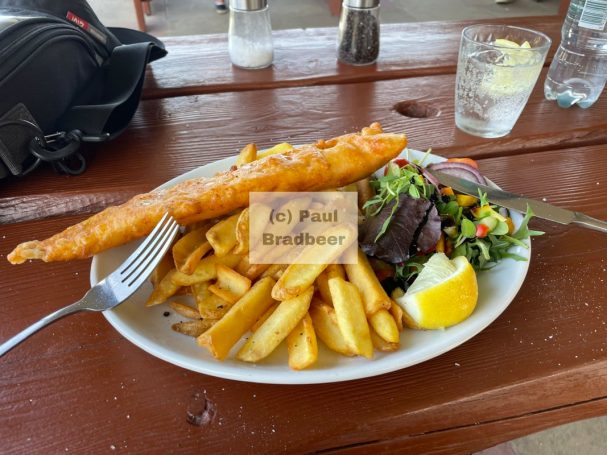
A take away enjoyed in the sunshine within the grounds of St Stephen's Church aka The Cathedral of the Dales, gave a satisfying dose of protein, carbs and fat in roughly equal measure.
Kirkby is a viking name which means 'church place'. Best guesses suggest it dates from between 900 and 950; according to the church history it is a time when Nordic people of Danish origin were spreading into the Eden Valley from the North-East and the Norwegian vikings were crossing from Ireland to settle in Western Cumbria. It is thought that these settlers built the first church here, on the knoll above the River Eden. The first mention of a church in recorded history comes shortly after 1092.
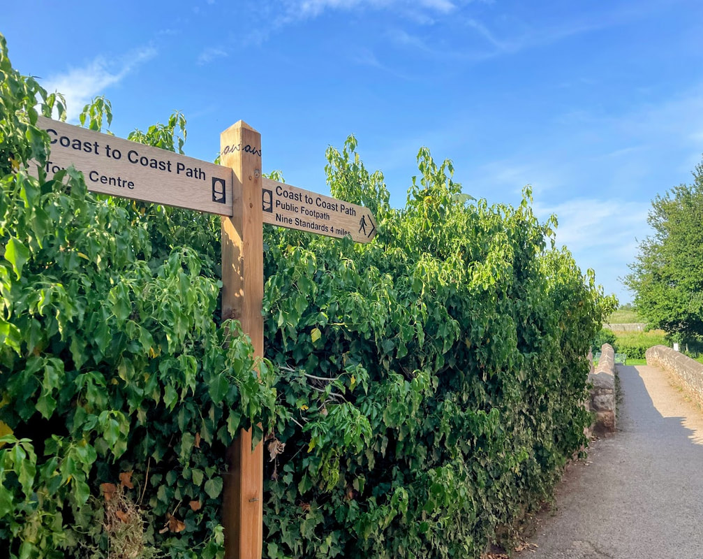
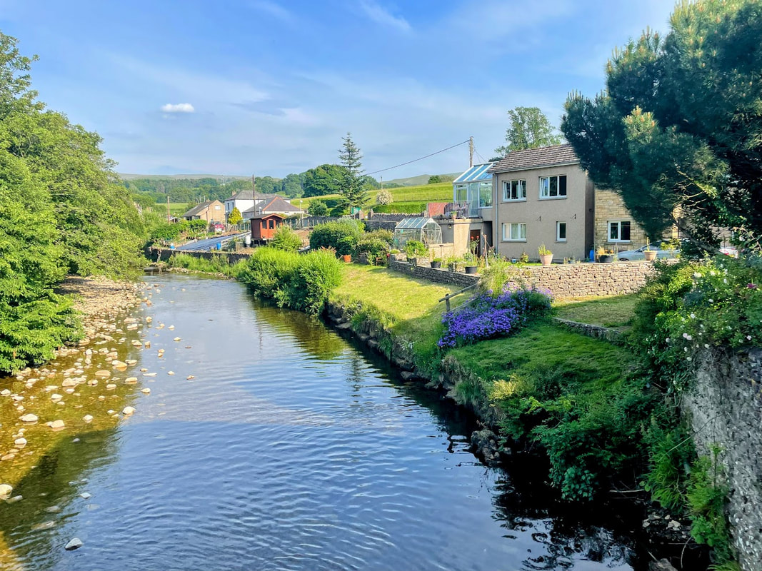
Walking down towards the River Eden took me along a small section of the Coast to Coast path to Frank's Bridge a stone built double arched pack horse bridge dating to the 17th century and now a grade II scheduled monument. It was a corpse lane bridge with its original purpose being to provide for the transport of coffins between the nearby villages of Hartley and Winton to St Stephen's Church.
The bridge is thought to be named after Francis Birkbeck who, in the early 19th century, was a philanthropist and popular local brewer. Many of the buildings on the Kirkby Stephen side of the bridge were once owned by his brewery, and since converted to housing stock.
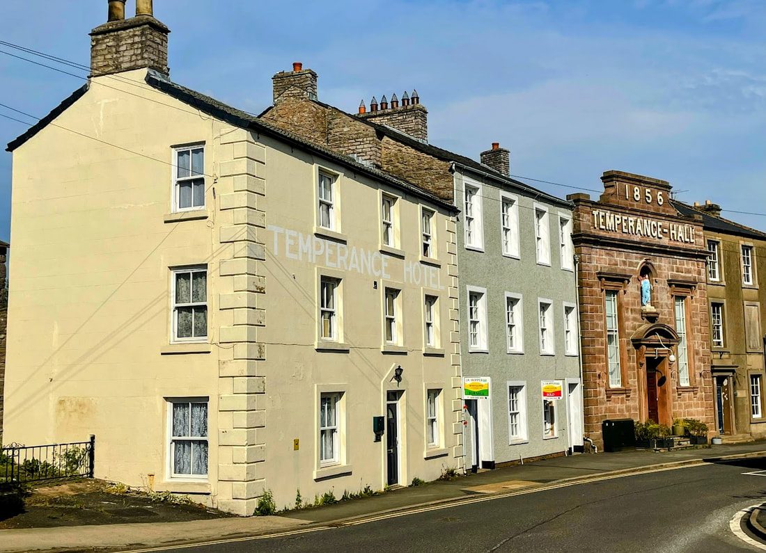
At the other end of town, the beginning of Nateby Road, once known as Saur Pow (meaning "sour water" or "pig pool"), was originally a pond and grazing area. It later became the site of tannery yards that discharged waste into an open sewer. In 1856, the Temperance Hall was built on this site, alongside the Temperance Hotel (pictured), to support those who had taken the temperance pledge.
The next day I would tour the Lake District, but those plans could wait. Lying half in, half out of my tent, soaking up the suns rays on my face and gazing aimlessly into the azure sky, time stood still for a while. After all the motion of the day, the peace was total. No clock ticking, no thought racing - just sunlight and sky. Magic!
May 2025 - John O'Groats and Dunnet Bay
It was around 120 miles from where I was camped on the Black Isle, up the A9 and A99 to John O'Groats. The weather had turned a little cooler while remaining bright; the further North I travelled the stronger the winds, or so it seemed. The A9 is a fast road and while traffic near Inverness was relatively busy, despite my early start, it quickly thinned out.
The landscape lacked the dramatics of the mountains and valleys of the West, but nevertheless had its own charm with lots of bright yellow broom/gorse peppering the landscape with splashes of colour and some interesting sections of curve and hill. Tain provided a fuel stop with a decent sized Tesco. Blasting passed Glenmorangie without a hint of a snifter, I stopped at Golspie and took lunch at the Coffee Bothy to thaw myself out over a pot of tea and a bacon and egg roll. Holiday calories don't count, right? Onwards passed Dunrobin castle and gardens to a stretch of coastline with some nice looking beaches, and finally onto the A99 through Wick and to the final section, which if I'm honest became bleaker and bleaker with each passing mile.
On reaching John O'Groats you quickly realise this is a place with notoriety for its location but actually very little here. There are a few guest houses, eateries and a large car park which affords an opportunity to do the obligatory photographs next to the sign post looking out to the Orkney Islands to the North. There was a lot of wind and I didn't wait around too long before heading West 10-15 miles along the top of the UK to Dunnet Bay camp site for an entertaining session putting up the tent while it tried to be a kite.
I made a good kite runner while pitching the tent - entertaining and challenging - onlooker versus participant perspectives. Definitely refined my game.
Dunnet Bay itself is a lovely stretch of sand and I had a walk as sunset approached. That night was difficult to sleep through with constant flapping noise, rain hammering against canvas and it was also fairly cold dipping down to about 5 degrees c at around 3-4am which was just within range of my sleeping bag and air mat. The tight fitting thermals I brought along were proving their worth!
April 2025 - The Black Isle
Leaving the Isle of Skye, rather than take the more popular A87/A82 route going along by Loch Ness, I took the more scenic road through the mountains via Loch Carron, Loch Alsh along the A835 by Loch Luichart. This was a brilliant mountain road avoiding many of the masses attracted to the Loch Ness area; I would complete the famous A82 route on my way back down South returning home.
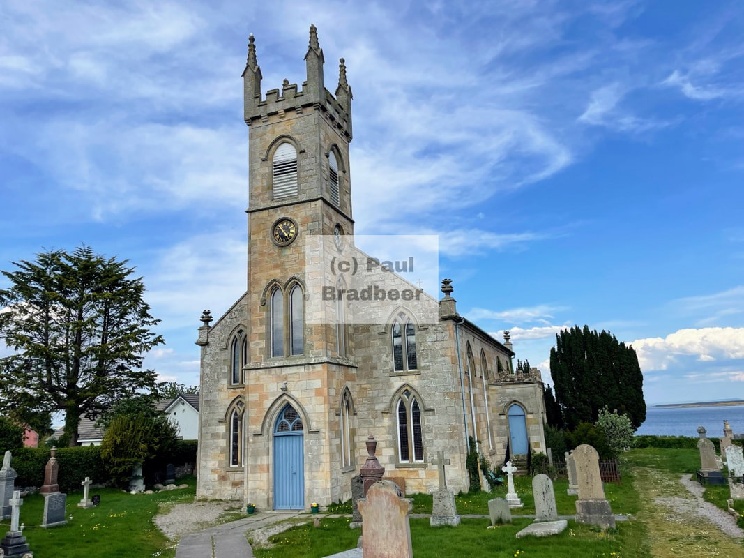
My destination - The Black Isle - a peninsula on the East coast located just North of Inverness, is neither black nor an island! It is surrounded on three sides by the sea - the Cromarty Firth to the North, the Beauly Firth to the South, and the Moray Firth to the East. The name is thought to allude to its dark, fertile soil and its appearance in winter, where it contrasts starkly against the snow-covered hills surrounding it, making it look black.
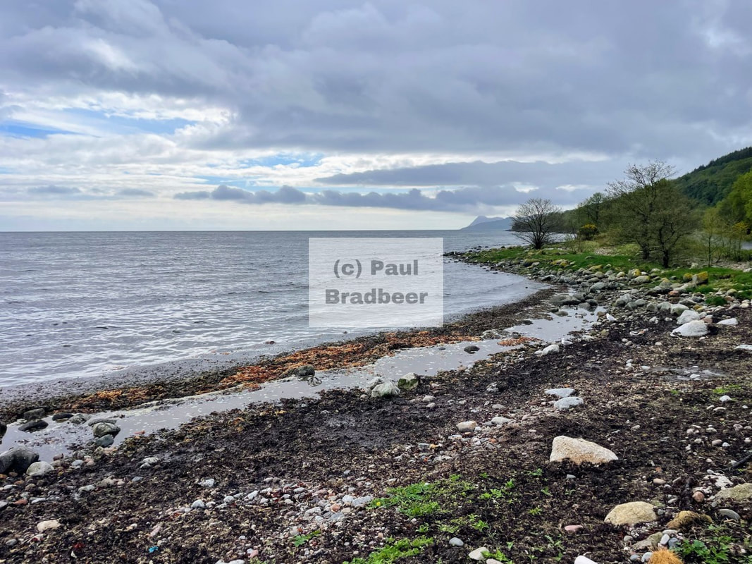
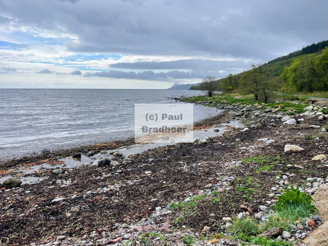
The campsite alongside the beach at Rosemarkie bay was great. Recommended.
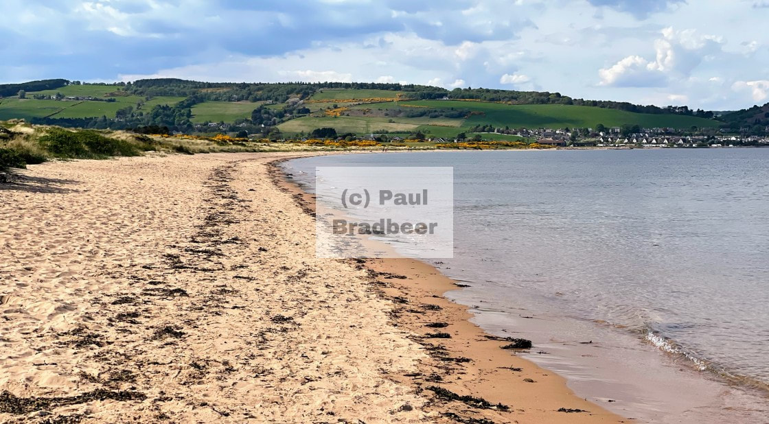
The coastline next to Rosemarkie was lovely and provided a great beachfront location to camp, and a decent 1.5 mile walk end to end. The village of Rosemarkie was host to a Spar and a very good eatery called The Crofters which I can recommend for both sit down food and take away coffee.
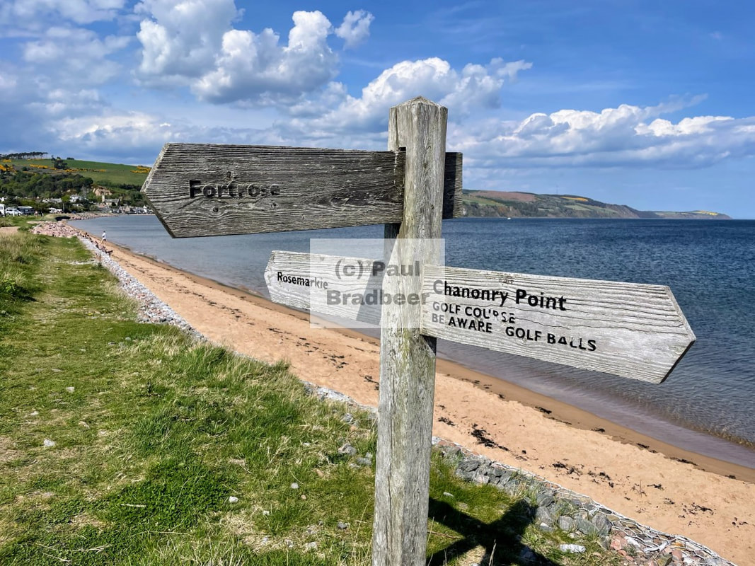
At its most Easterly is Chanonry Point which is famously one of the best locations to see bottlenose dolphins at close range in the UK. I decided to stay on the Black Isle as a staging post for heading to the far North, an opportunity to see the coastline here and hopefully catch some sightings of the dolphins. I was not dissappointed, and watched a pod of three dolphins making their way into the Moray Firth.

Overlooking the Moray Firth, Rosemarkie Church was built in 1821. Rectangular with tall windows and a pinnacled square tower at the west end
Falling asleep to the drifting sounds of the ocean breaking against the beach front was a memorable camping experience. The morning was peaceful and I looked out to a fantastic light show of crepuscular rays (aka sunbeams) out at sea. Magic!
On the return leg I camped on the other side of the peninsula, a couple of miles away, in Melrose. A decent camp site but with a much more pebbled and rocky shore line. In between the two places lay Fortrose and Rosemarkie golf club. Its claim to fame was being “The 15th oldest recorded club in the world” - I assume they mean golf club and not just any club :) I don’t play myself but it looked a lovely course and a beautiful location to while away a few hours walking, talking and hitting balls. For those taking part it looked a serious business, and some I met had travelled here especially for the golf.
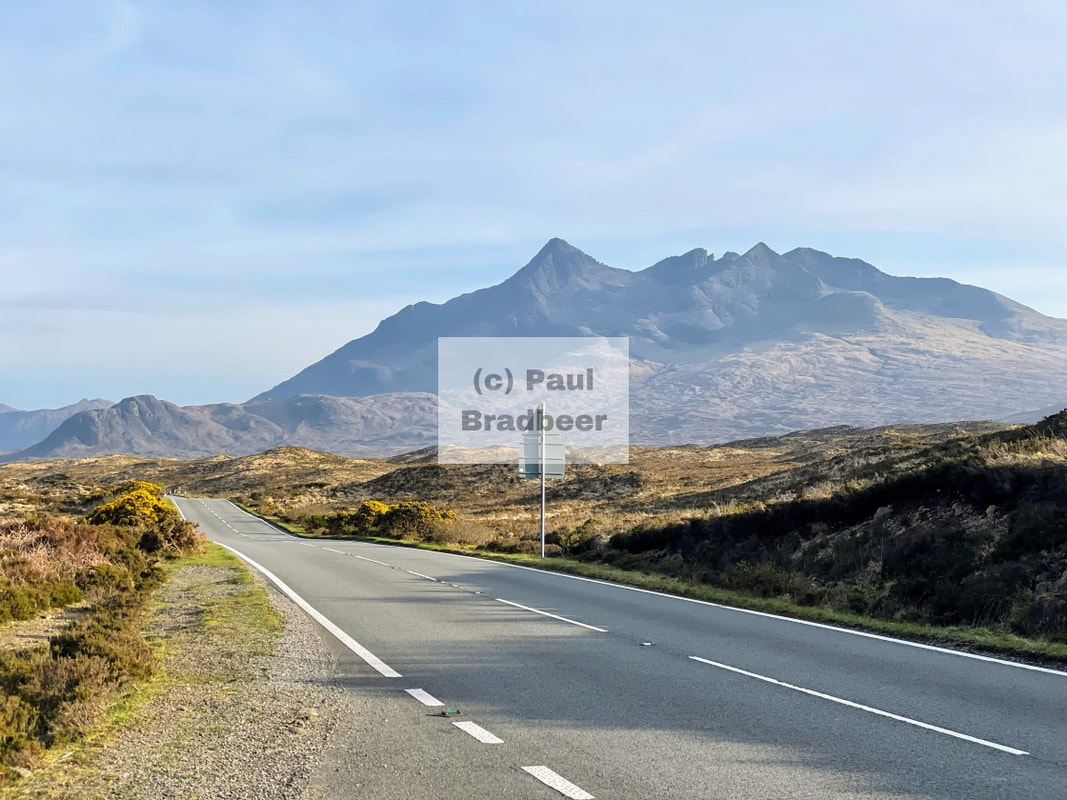
April 2025 - The Isle of Skye
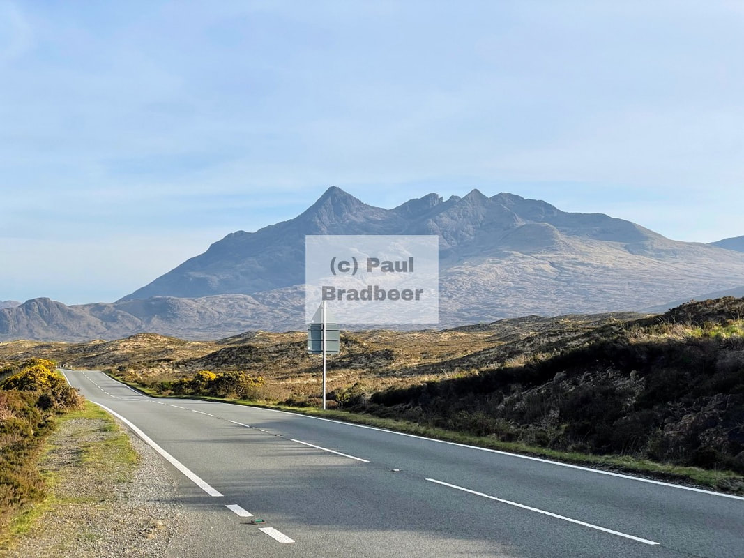
After lunch at Fort William it was time to do the 80 miles to the Isle of Skye, heading a little further North on the A82 and then West along the A87, a magnificent roller coaster of a ride which just seemed to get better and better the nearer to Skye I got. Blessed with good weather, some of the views were incredible.
It struck me on entering the island at the Kyle of Lochalsh just how good the road system was here. High quality tarmac all the way with wide and fast roads. This investment must be demand led and I imagine high traffic volumes in the summer months. Right now the roads were quiet for me. Speed!
The good A road heads West through Broadford where I was staying and then all the way to Portree where it then became more of a single track mountain road - a route I would etch out that evening getting a flavour of the North West coast and the far West of the island.
The community run camp site at Broadford is one of the best I’ve stayed at, with terraces specially designed for purpose and high quality facilities. Many campers here were just staying for one night.
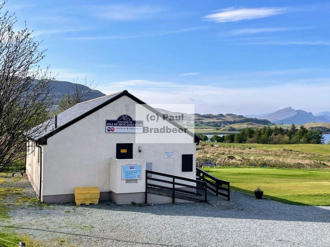
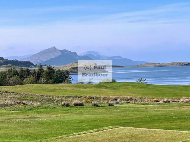
Heading West out of Broadford the roads were good and the views were spectacular. I don't play golf, but you can't help but think the Isle of Skye Golf Club has one of the most enviable vistas against which to enjoy an outdoor sport. The quantity of fair weather days may be a different lens through which to look at things, but for today at least, the sun was shining brightly and the riding was fantastic - gratitude.
Continuing North the main road was a solid surface to be enjoyed; no wild curves or anything, just relaxed riding without complaint of pot holes, ruts or gravel which are the energy vampires of riding. Even much further West into the mountains, while the road significantly narrowed, the surface quality was decent.
I've been a huge Lord of the Rings fan since I read the trilogy in my early youth. I felt like the landscape had transported me directly into one of the novels.
More landscapes from the North Western exploration. Portree was a busy town with a lot of tourist activity, many more vehicles and congested as a result. With plenty of shops, restaurants and bars available to service the demand. Out of Portree is the mountain road which is noticeably thinner and becomes single track in places further on. Some climbing. The Old Man of Storr was clearly visible as the distinctive landmark of the area and a premier hiking attraction of the Trotternish Peninsula. No time for walking up there today and mores the pity.
I barely had time to scratch the surface here and I could easily come back for a week with a pair of hiking boots and the dogs and not get bored.
A pleasant evening back at camp and an early start to ride East through the mountains to the Black Isle.
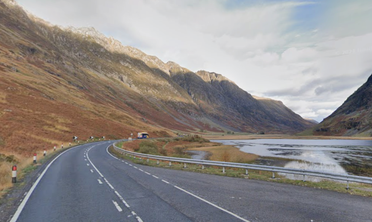
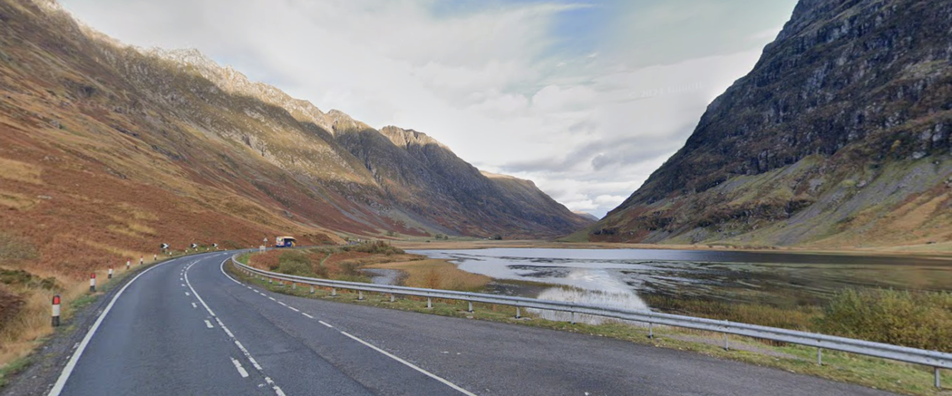
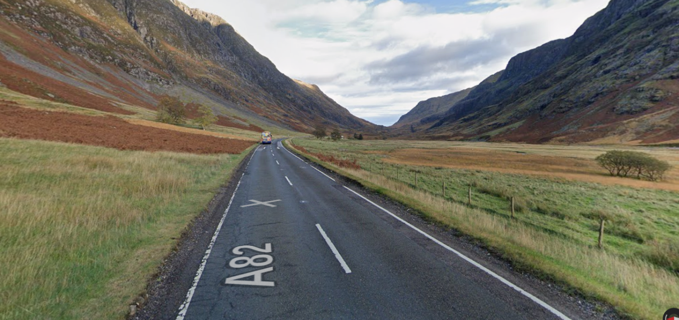
April 2025 - Glencoe, Fort William, Glenfinnan
Leaving the camp site relatively early, it was destination Coop for fruit and coffee for breakfast and then a cool blast up the Glencoe Valley heading East along the A82. Now this was awesome. Steep rising land masses on either side of the decently surfaced A82. Exercising some genuine restraint I managed to slow myself down and while I took on some fun overtakes I resisted others - there were a lot of hikers, cyclists and other traffic around on the roadside and sometimes crossing, and junctions at car parks presented real hazards. The A82 is a known fatalities hotspot for motorcyclists - primarily involving collision with cars. Notwithstanding the risks, what an absolutely epic piece of road slicing through this amazing landscape. I didn't get any good pictures as I didn't stop anywhere except at a turning point at the end of the valley to return, but below are some grabs from google maps.
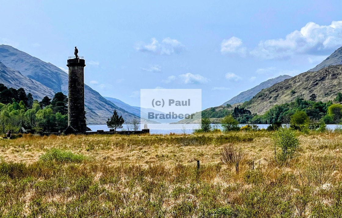
I leave Glencoe heading North towards Skye stopping in Fort William; primarily for fuel and Costa (a rarety in these parts and much amiss!). I took a minor detour along the Mallaig road to have a wee look see at the Glenfinnan viaduct of Harry Potter fame.
Glenfinnan is about halfway between Fort William and Mallaig on the picturesque West Highland Railway. Sir Robert McAlpine constructed the Glenfinnan Viaduct between 1897 and 1898. The structure, which is built entirely out of concrete, has 21 arches with spans of 15 m (49 ft) and reaches a height of 30 m (100 ft) above the valley. To commemorate the viaduct's centenary in 1997, a plaque was unveiled at the base of one of its arches.
The landscape in which the viaduct is located has made it popular with film producers. In 1969, it was used in Ring of Bright Water, starring Bill Travers and Virginia McKenna. It has since come to prominence in the cinematic releases of the Harry Potter series. The Hogwarts Express, is filmed crossing the viaduct in several of the films beginning with Harry Potter and the Chamber of Secrets in 2002. The train filmed is the Jacobite Steam-Locomotive Train, a tourist train.
If you're thinking of visiting ensure you anticipate the demand at the time of year. It's a really busy place for parking (chargeable) and once at capacity they close the gate until people leave. There is a visitor centre with toilets and souvenirs gallore. If you don't like commercialised tourism, don't go.
Returning to Fort William, I pick up the final leg of the day to the much anticipated Isle of Skye.
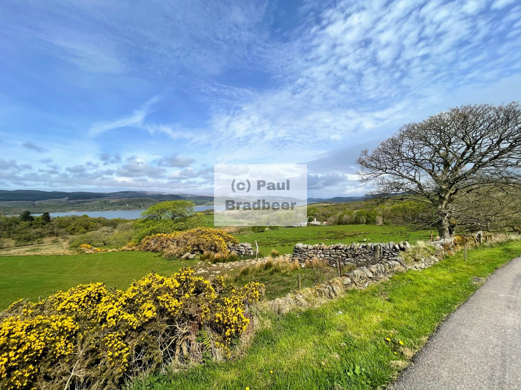
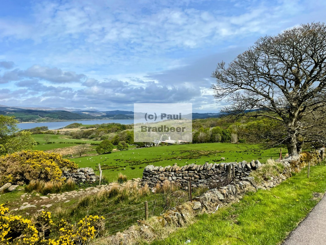
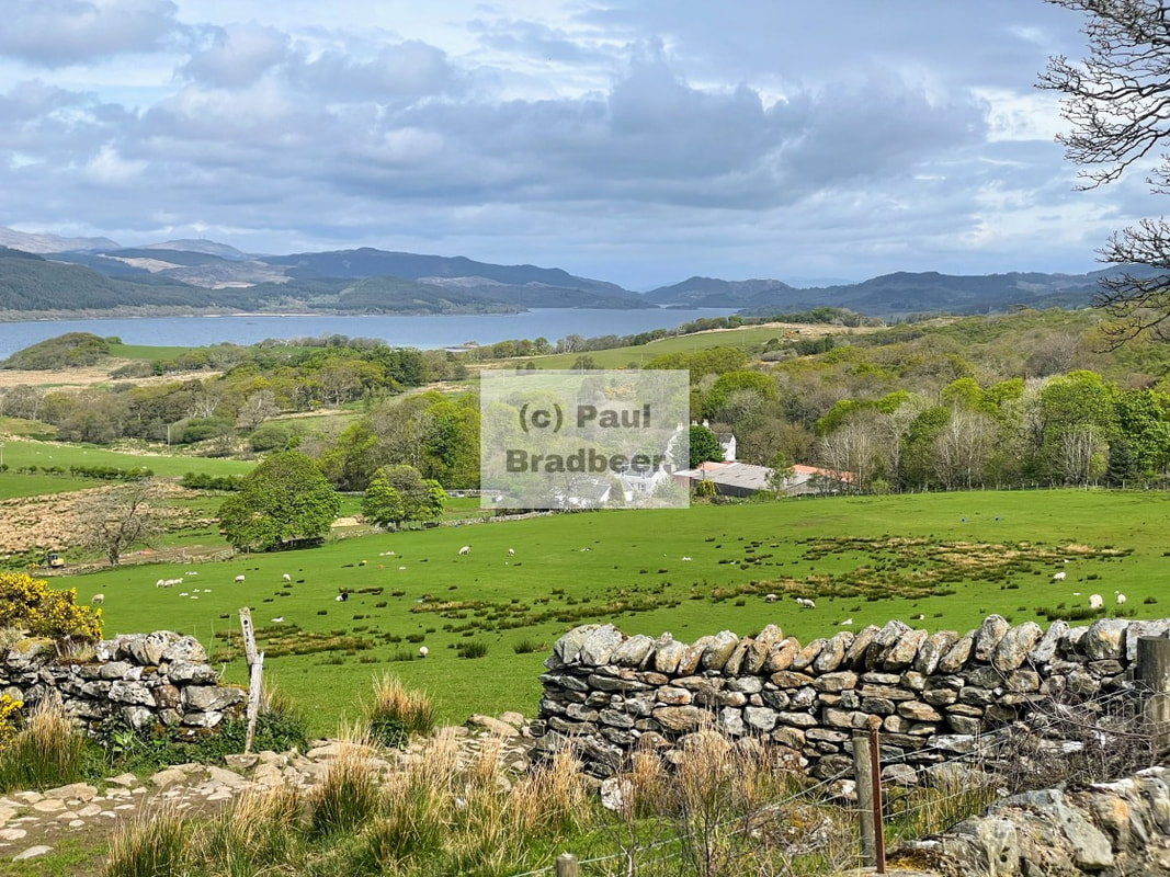
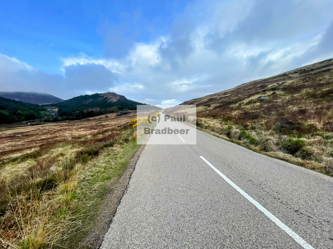
April 2025 - The Kintyre Peninsula
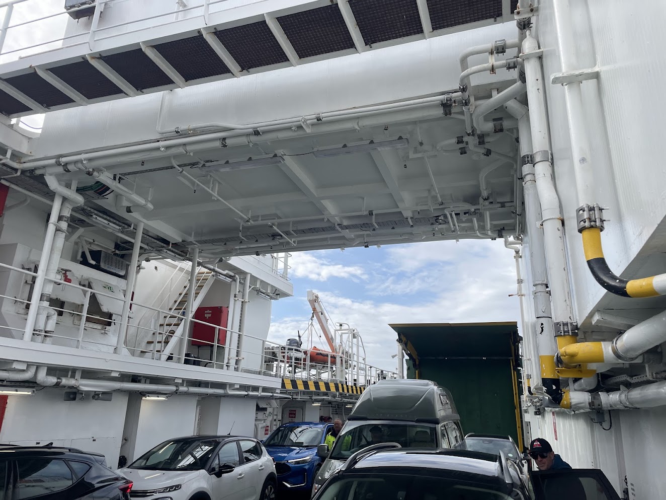
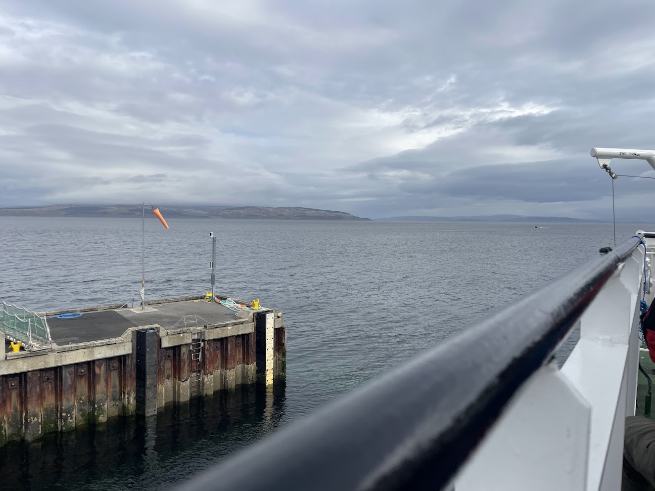
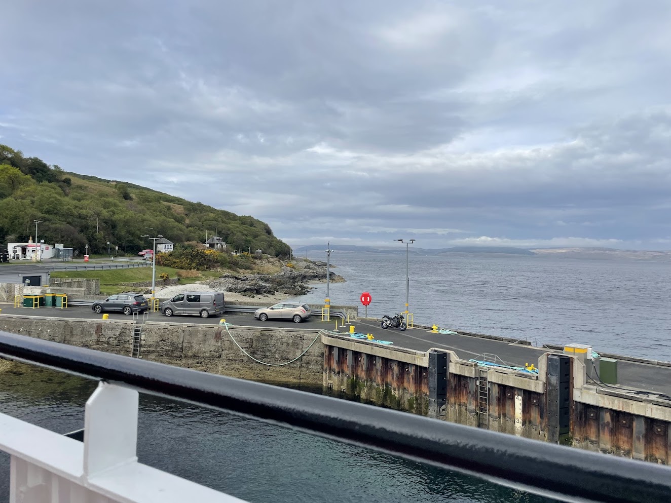
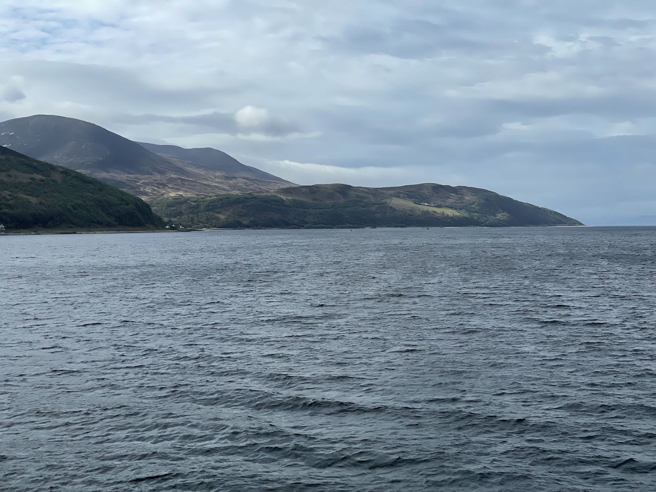
An early decamp and a final ride East along The String for breakfast and coffee at the Coop in Brodick. Then a leisurelty ride through the Northern hills of the island to arrive at Lochranza in good time for the ferry West to the mainland. The ferry heads across the Kilbrannan Sound, a Western arm of the Firth of Clyde. It was an easy and comfortable crossing, sitting out on deck with pleasant views over the receding Island. A really good mobile signal throughout the crossing was an added bonus.
The Kintyre peninsula is situated on the dramatic Atlantic Seaboard of Scotland’s Highlands and Islands. It comprises a long arm of hilly country about 45 miles long and 8 miles wide and is the southernmost point of the county of Argyll.
The name Kintyre comes from the Gaelic phrase ‘ceann-tire’ which translates into English as ‘headland’. There are strong connections with Paul and Linda McCartney and the band Wings in the area; Paul purchased High Park Farm in 1966 purportedly as a means to avoid taxes and in time used it as a second home with his wife Linda. Campbeltown is host to the Linda McCartney Memorial garden, and further South the Mull of Kintyre is the inspiration for the popular Wings song of the same name.
The local economy has traditionally been powered by farming, whisky, cheese and butter production, and wind power component production, although much of this has declined significantly over the years creating challenges for local populations and their government.
It's a beautiful area. I rode down the tiny single track road facing Arran from the ferry terminal at Claonaig to Campbeltown. Views over Arran open up in a number of places. With a few switchbacks on hills, this was an interesting stretch to ride. Amazing how many people are prepared to take fairly large motorhomes down single track lanes, although in fairness most were polite enough to pull over and let a motorbike overtake.
Campbeltown had plenty of activity with a harbour and a decent selection of eateries and shops. Refuelling of man and machine took place. Unfortunately the causeway to Davaar Island was covered at the time of my passing through so I was unable to cross to it and explore. Watch out for the highland coos!
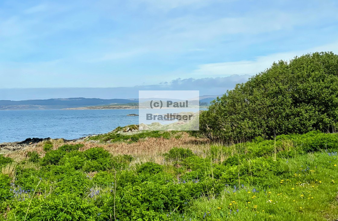

The ride up the Western shore was much faster, and stunningly beautiful in the glorious sunshine now illuminating the coastline. Long sweeping curves with new vistas painted in blues and greens appearing around each corner it seemed. Further North up the peninsula afforded clear views over the isles of Gigha, Islay and Jura. Simply stunning landscapes. No photographs can capture the experience of being there. This became a recurring theme for me with the vast mountainous landscapes that awaited me in the rest of the highlands. The human experience which integrates all the senses, not just sight, simply cannot be captured, it has to be experienced.
At the North end of the Peninsula is Tarbert, a pictoresque town complete with picture postcard views. Ideal for an ice cream stop in what was glorious sunshine. Recommended.
The name Tarbert comes from the Gaelic word tairbeart which translates literally to "carrying across" and refers to the narrowest strip of land between two bodies of water over which goods or whole boats can be dragged or carried, otherwise known as portage. In the case of Tarbert this allowed boats and their cargoes to avoid having to sail right around the Mull of Kintyre.
Leaving Tarbert I had many miles North still to do through the large port of Oban, a busy place, and then onwards to a campsite just outside of Glencoe.
April 2025 - The Isle of Arran
Arran is a beautiful island off the west coast of Scotland and includes miles of coastal pathways, numerous hills and mountains, forested areas, rivers, small lochs and beaches.
Often referred to as "Scotland in Miniature", the Island is divided into highland and lowland areas by the Highland Boundary Fault. I toured the island over a couple of days in April 2025.
A very friendly place with a strong sense of community. A local population of circa 5000 swells multiple times in high summer thanks to a booming tourist industry. April/May is a great time to visit. In terms of motorcycling, it is an interesting place to tour, but obviously the size of the island necessarily restricts the miles of road available. I circumnavigated the whole island once in a day.
Travelling to Brodick by ferry from Troon, a decent crossing, I arrive greeted by heavy rain. The sensible course of action should have been "pull over immediately and don full waterproofs, or perhaps just wait it out in Brodick". Nope, far too sensible. Instead it was "Turn left from the ferry terminal, keep riding, get soaked through, and struggle with visibility in heavy rain". Yeah, every day's a school day.
The campsite I was staying at was around 9 miles West of Brodick down a stretch of road called "The String" which climbs the side of a valley across the island affording views over the valley itself and some of the hills in the North. A dramatic and enjoyable ride with some speed possible with care - although be warned there are some patches of worn out and rutted tarmac in places, with pot holing and patchwork repairs, just to keep things entertaining!
The site was bijoux. I was able to reserve a pitch with a hard area for parking the bike, although I always carry a plastic puck for under the side stand on softer ground; a squashed beer can is said to do the job equally well.
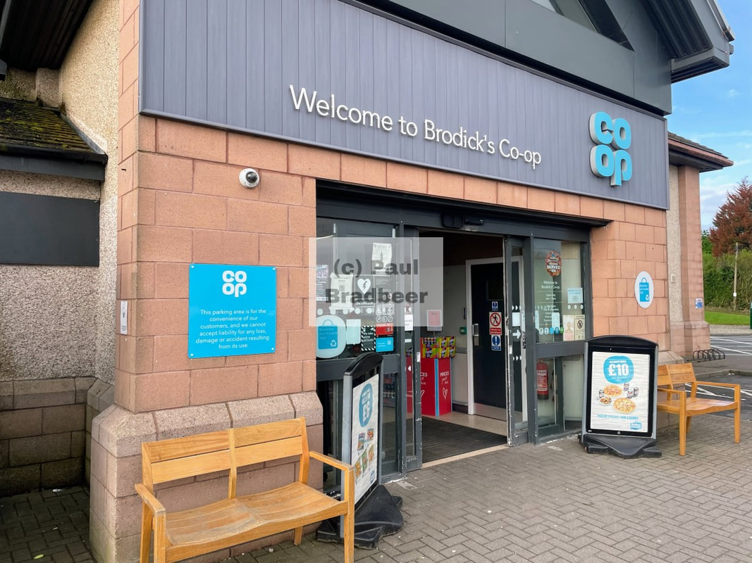
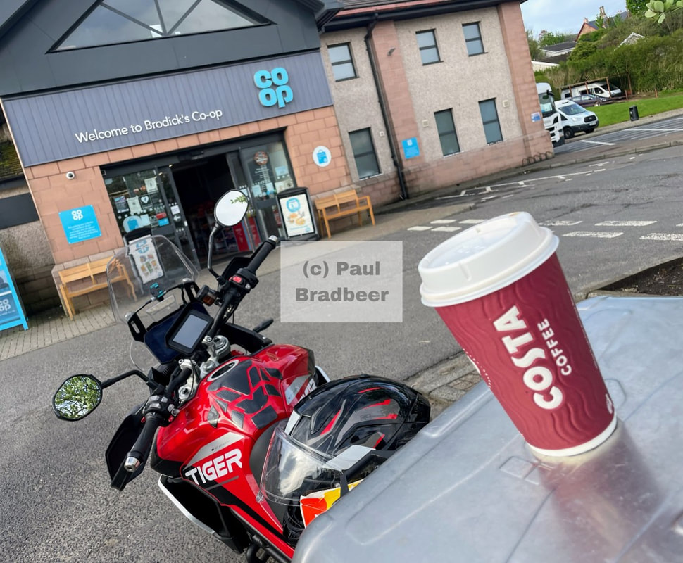
The Coop in Brodick was my essential supplies store, stocking a range of sandwiches and wraps, fruit, a Costa coffee machine and a surprisingly good selection of low or no alcohol beers. The bare necessities!
The road out of Brodick heading North through the hills (Goat Fell etc…) was the most dramatic and has a convenient stop at the Lochranza Distillery; the cafe there is recommended (great scotch broth) and very friendly staff.
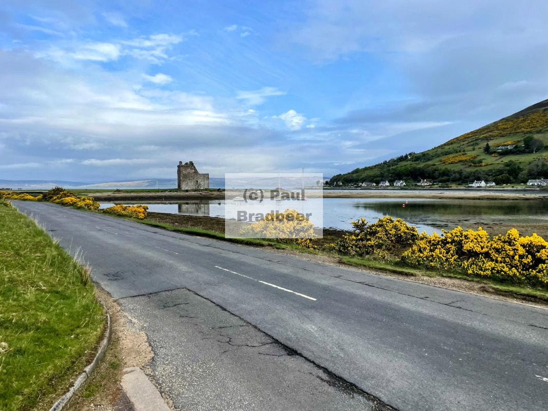
Further North and West is Lochranza. The village is set on the shore of Loch Ranza, a small sea loch.
A somewhat unusual claim to fame is that Lochranza is said to have the fewest hours of sunshine of any village in the United Kingdom, and is the most shaded village in the entire world according to world climate experts, since it lies in a North facing glen on an island with a particularly high level of rainfall. The streets do not have any street lights so it can be dark in the winter months.
I saw the sun shine - honest!
The castle dates from the 13th century. It is believed that Robert the Bruce landed at Lochranza in 1306 on his return from Ireland to claim the Scottish throne. Through a chain of various owners, the castle eventually fell into disuse and was abandoned in the 18th century. The castle is now in the care of Historic Scotland.
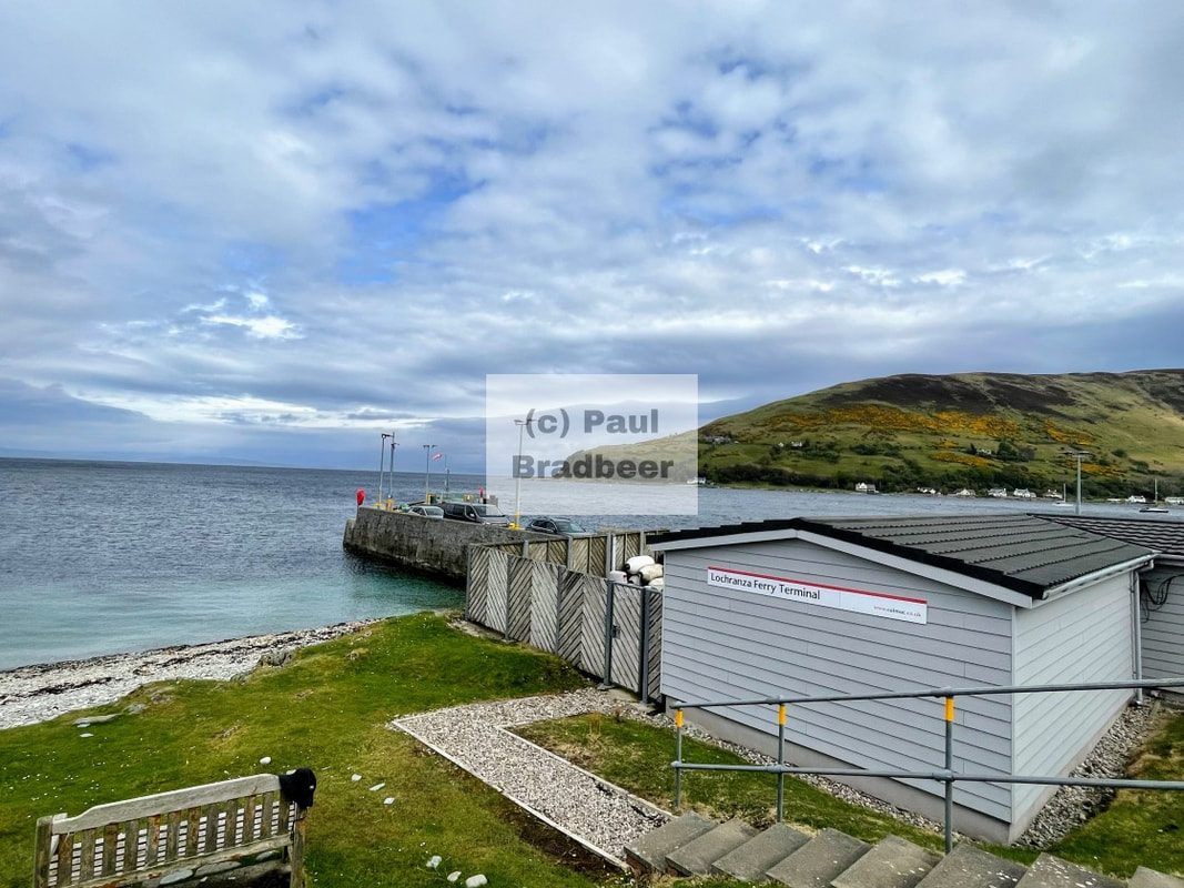
A reccy at the Lochranza ferry terminal to double check on sailing times for my forthcoming crossing to the Kintyre Peninsula.
The road heading back South out of Lochranza on the Western side is the fastest with some overtaking possible with care. The half circuit from Blackwaterfoot heading South was very scenic and the roads interesting, but they were mainly twisted and narrow, neither speed nor overtaking seemed sensible.
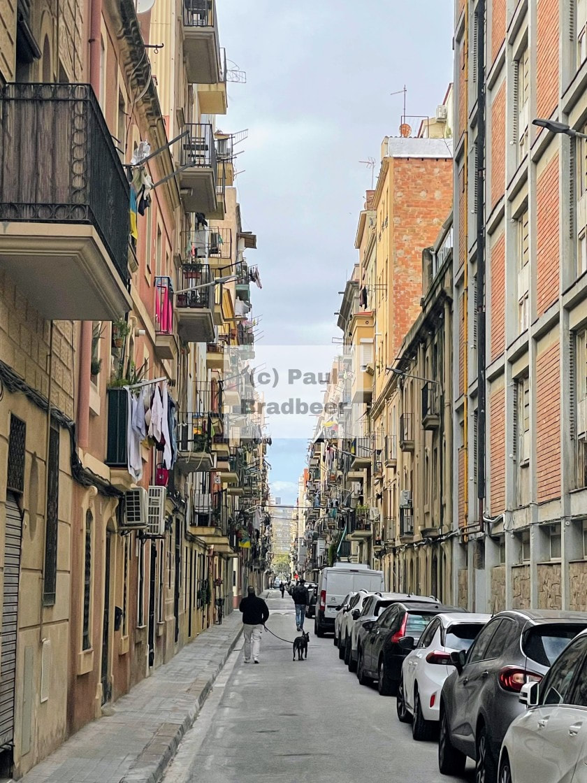
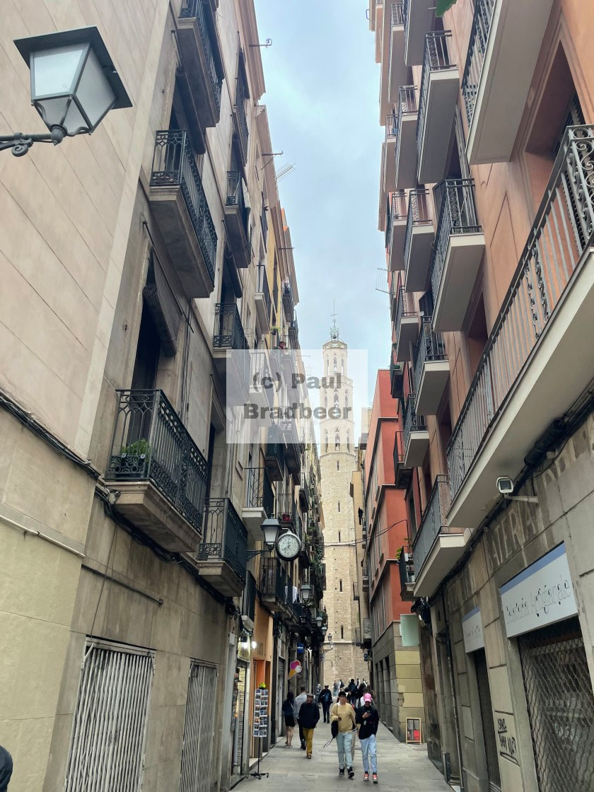
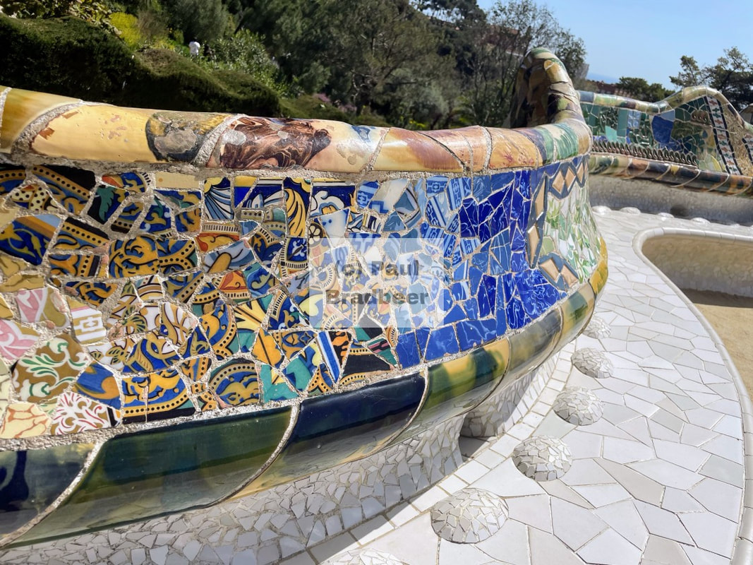
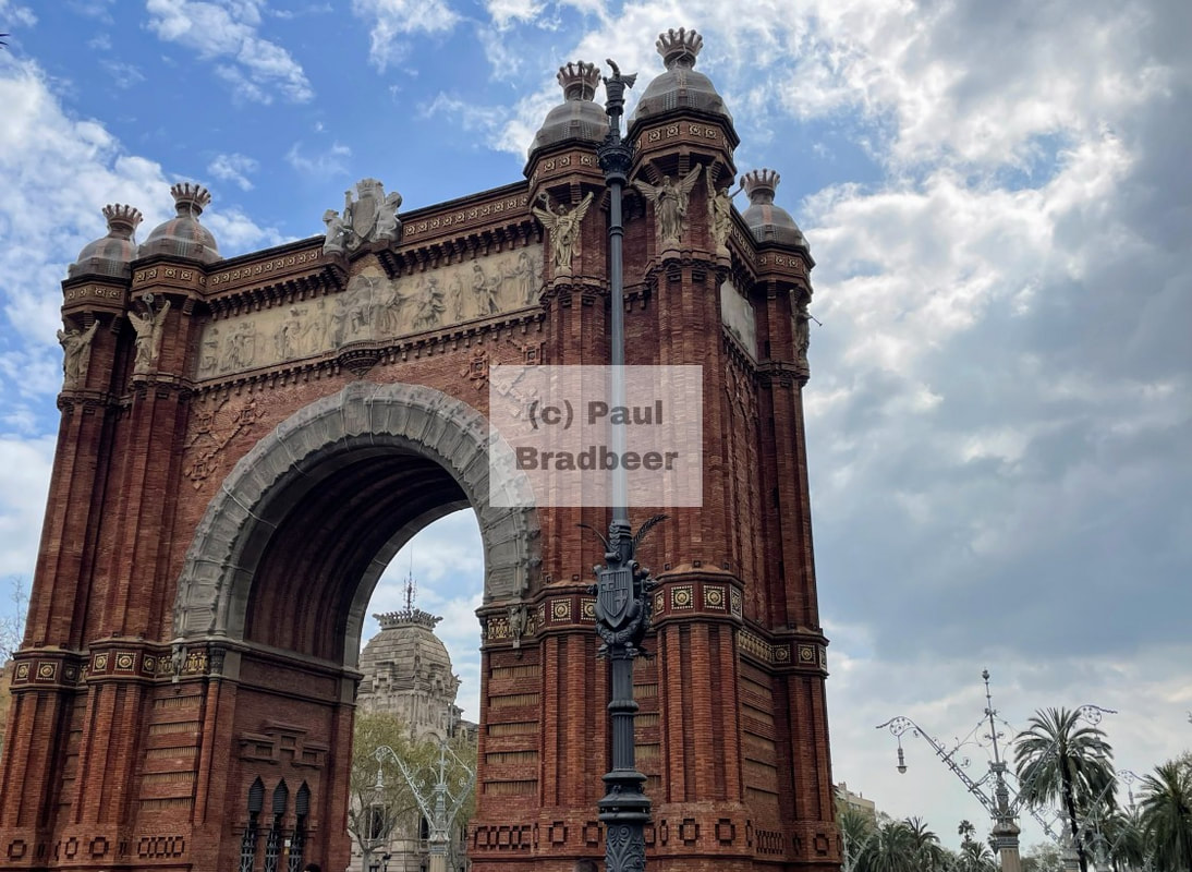
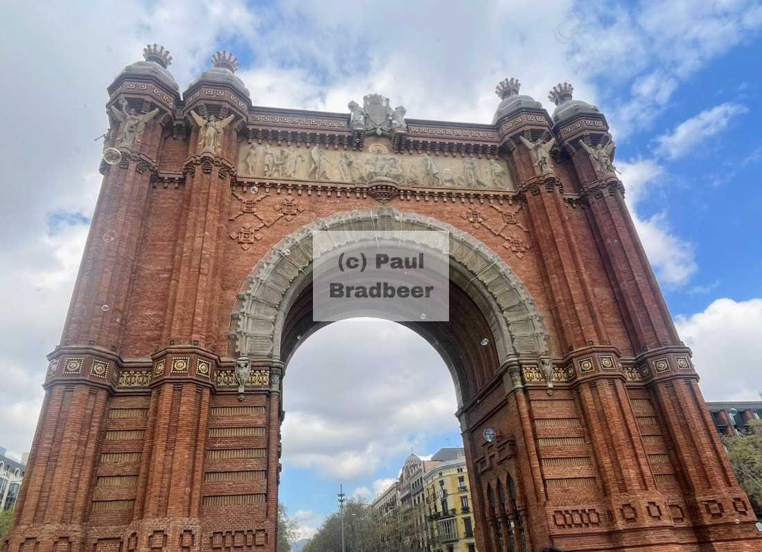
April 2025 - Barcelona - Competition Is For Losers
A few days in April sampling the creative delights of Barcelona; somewhere I'd not visited before and as well as seeing the sights and relaxing, it served as an opportunity to gain a flavour of a location near to the Pyrenees - a potential target for future motorcycle touring!
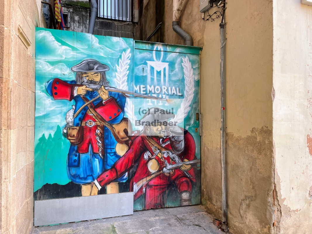
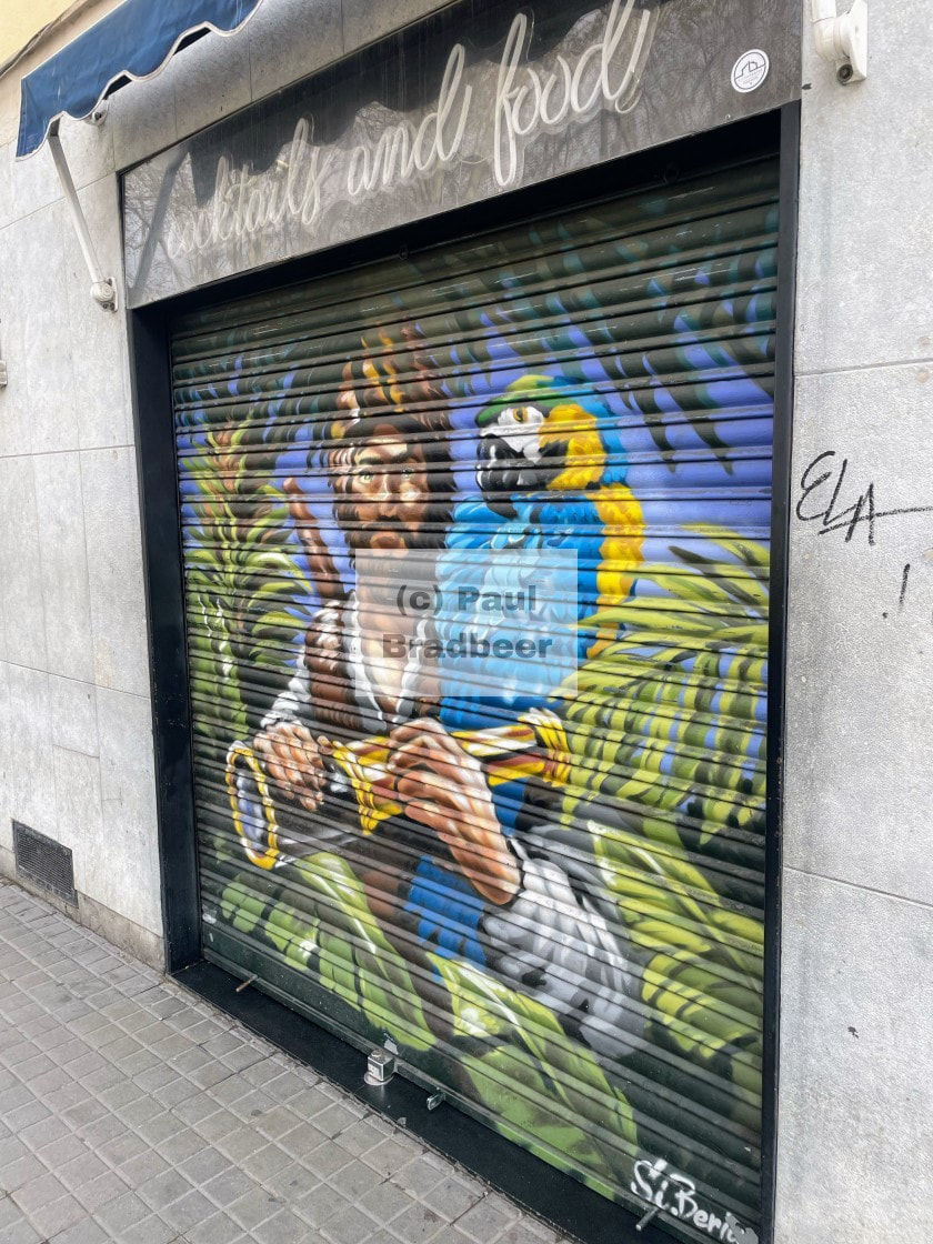
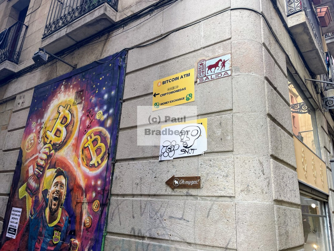
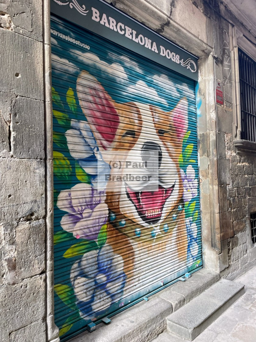
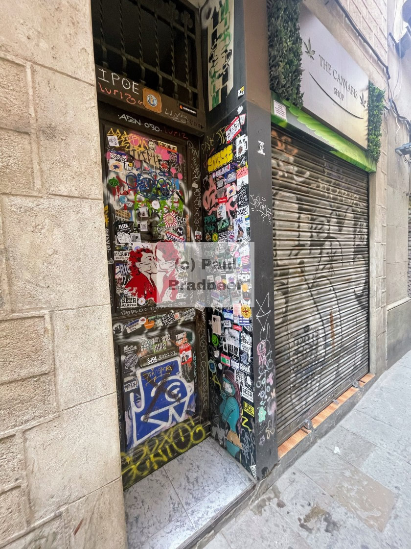
One of the things which first struck me wandering around the centre was the creativity. The city hums with an energy of originality, not comparison. The street art is unapologetic and isn’t asking for approval or awards. It exists because someone had something to say - not because they were trying to win something. The graffiti and artworks scene has roots in a historically permissive culture during the 1980s. Since 2006 there have been fines for street art on public walls and a special cleaning unit tours the streets, erasing recent renderings. This has led to "shutter art" on private doorway shutters which are not covered by the laws.
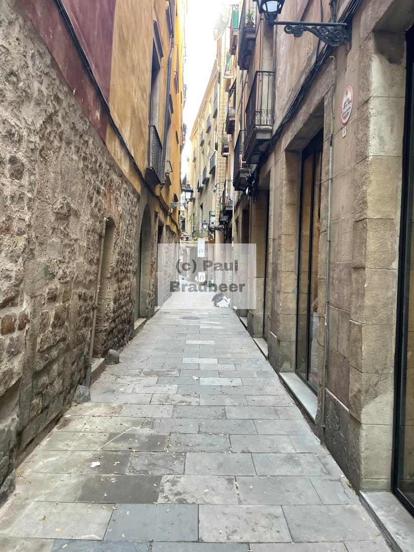
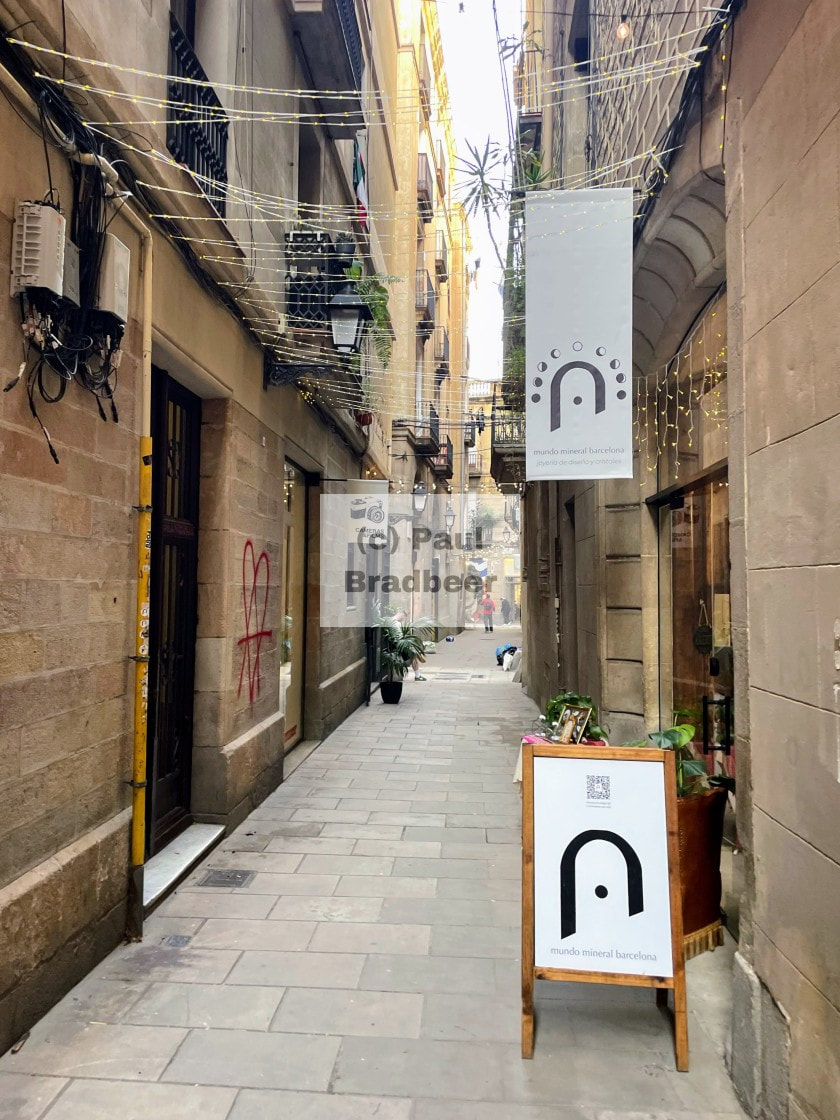
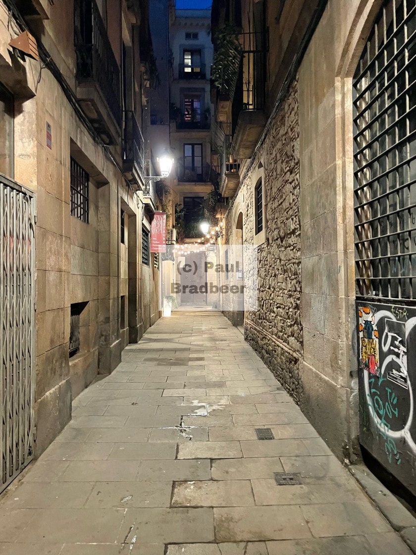
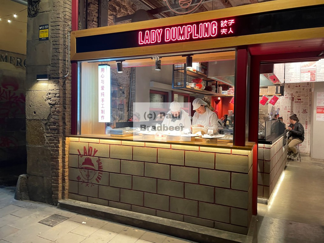
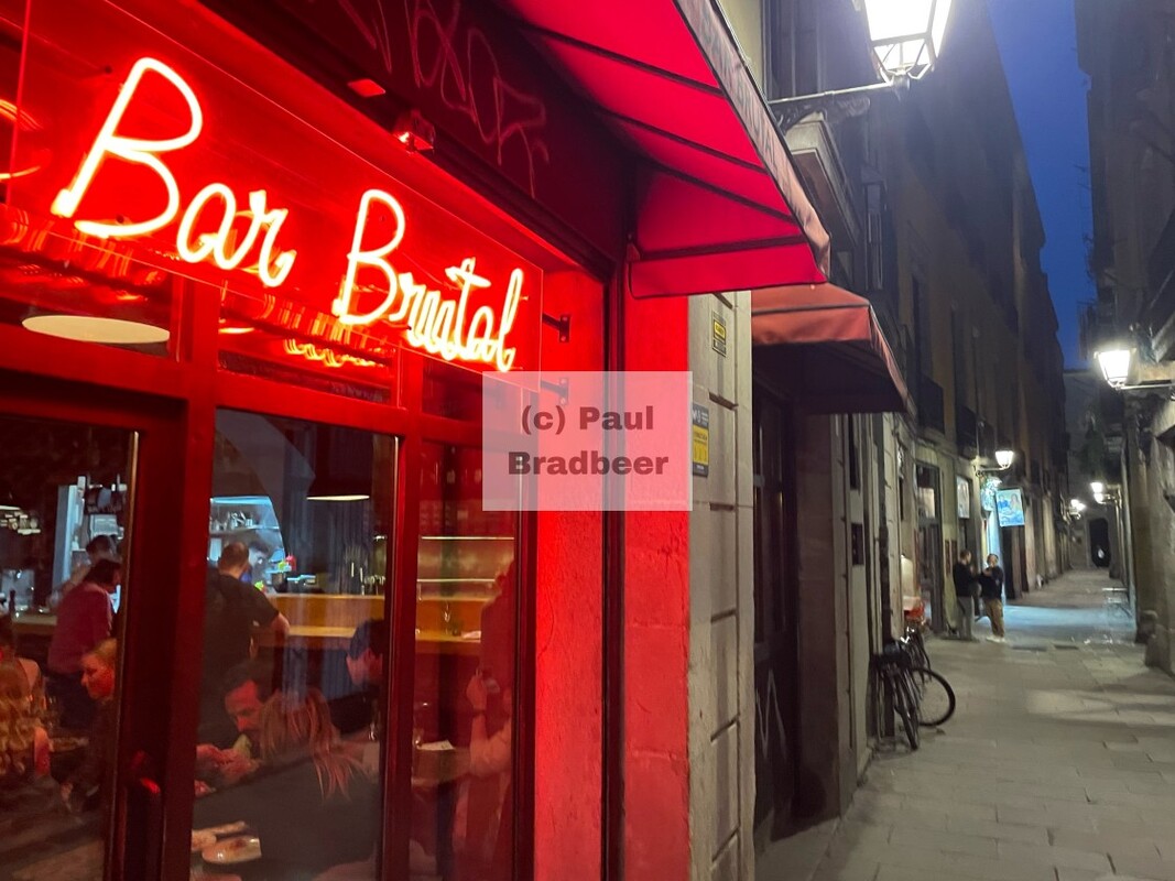
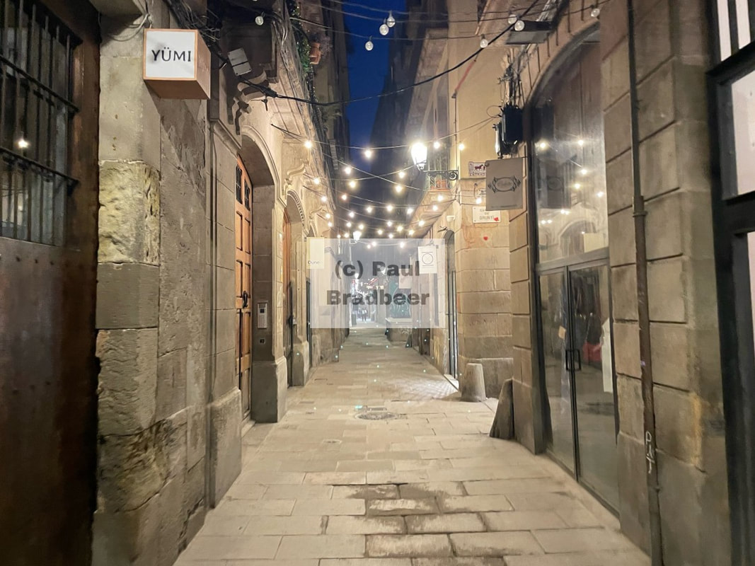
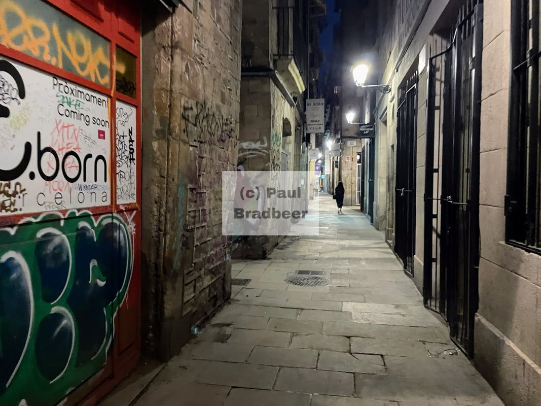
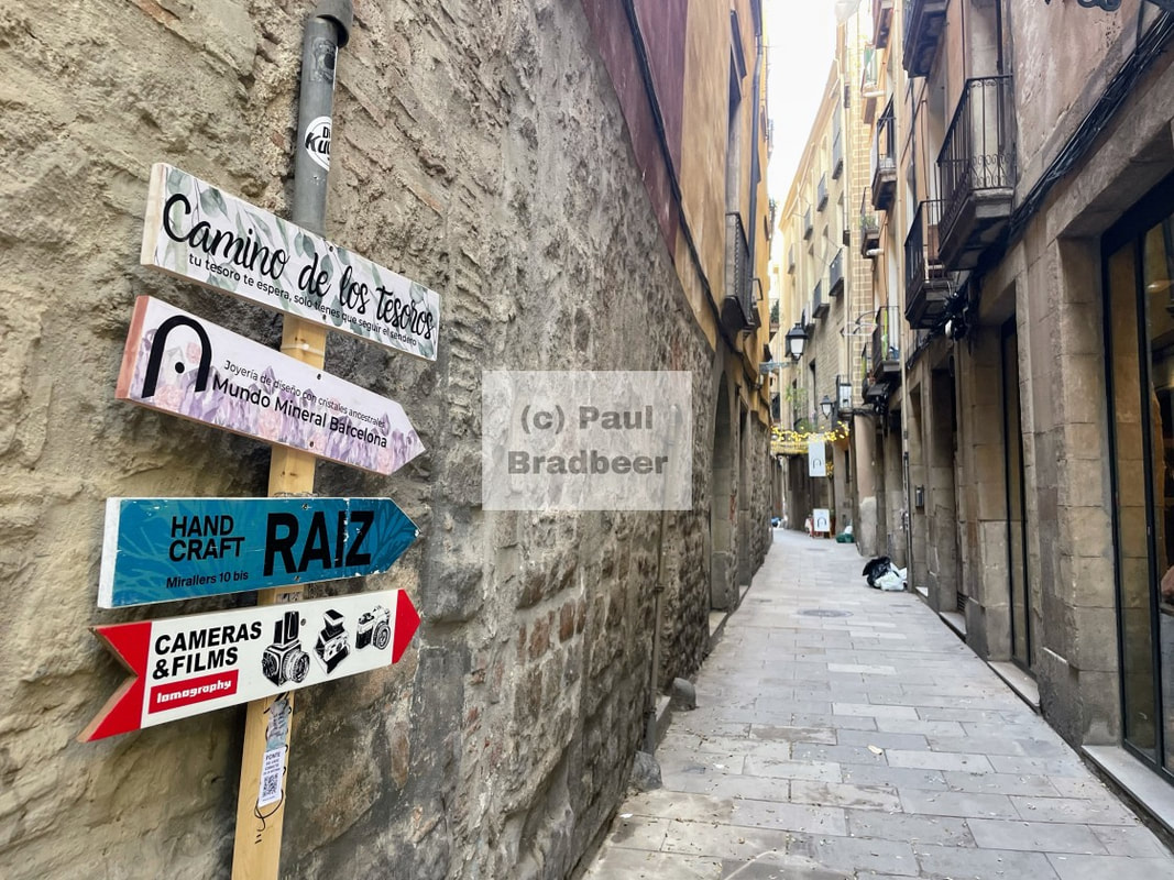
Back streets with character, with many independent outlets featuring art works or other creative pursuits.
The busy harbour area - lots of good eateries and a decent walk of an evening.
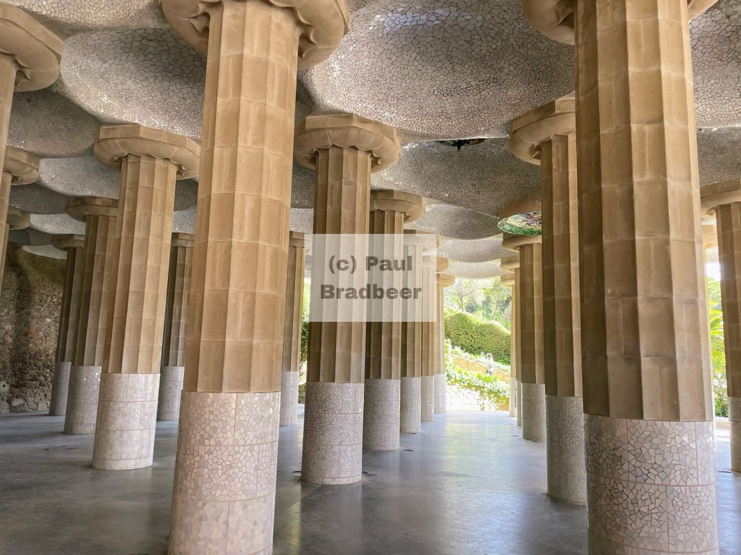
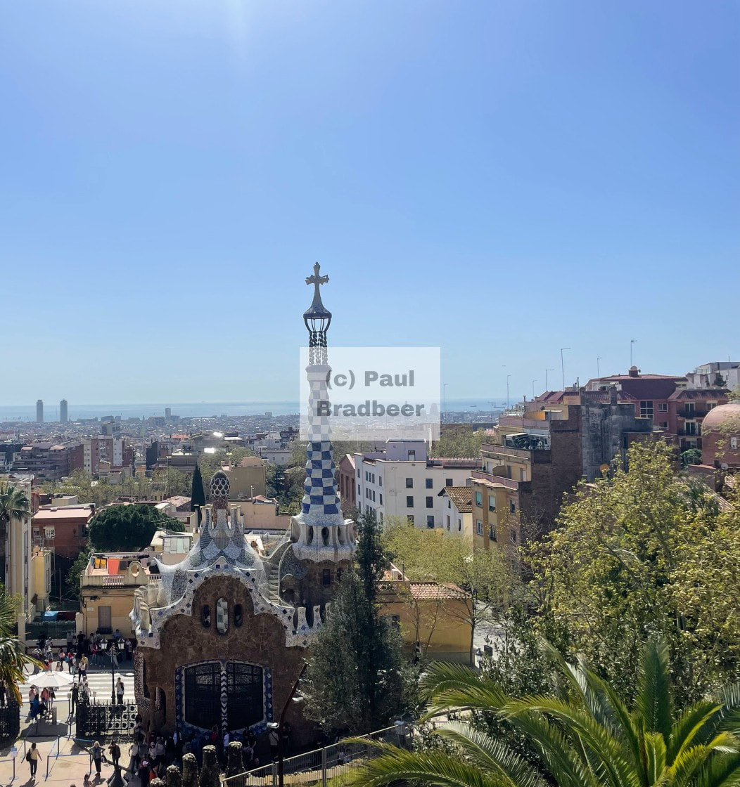
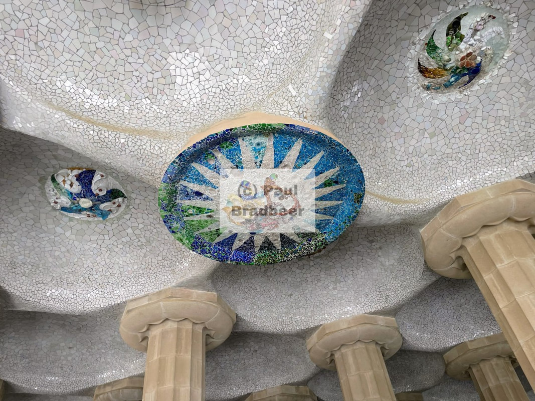
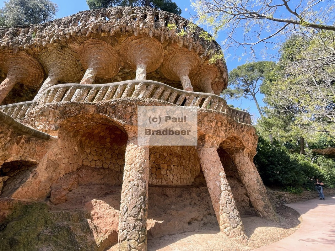
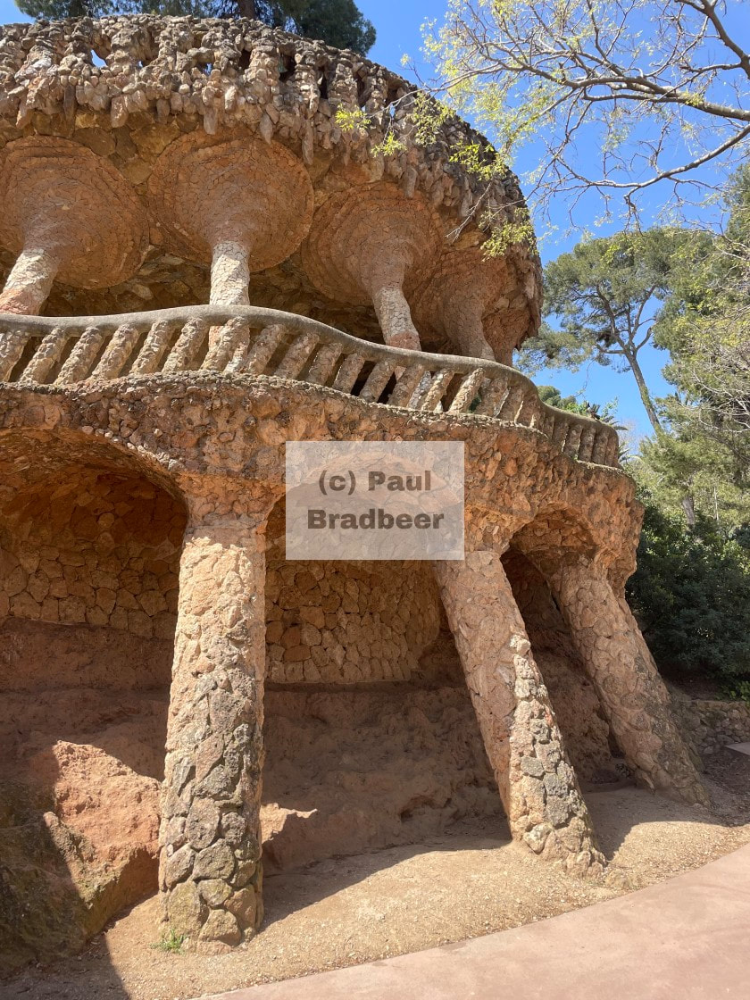
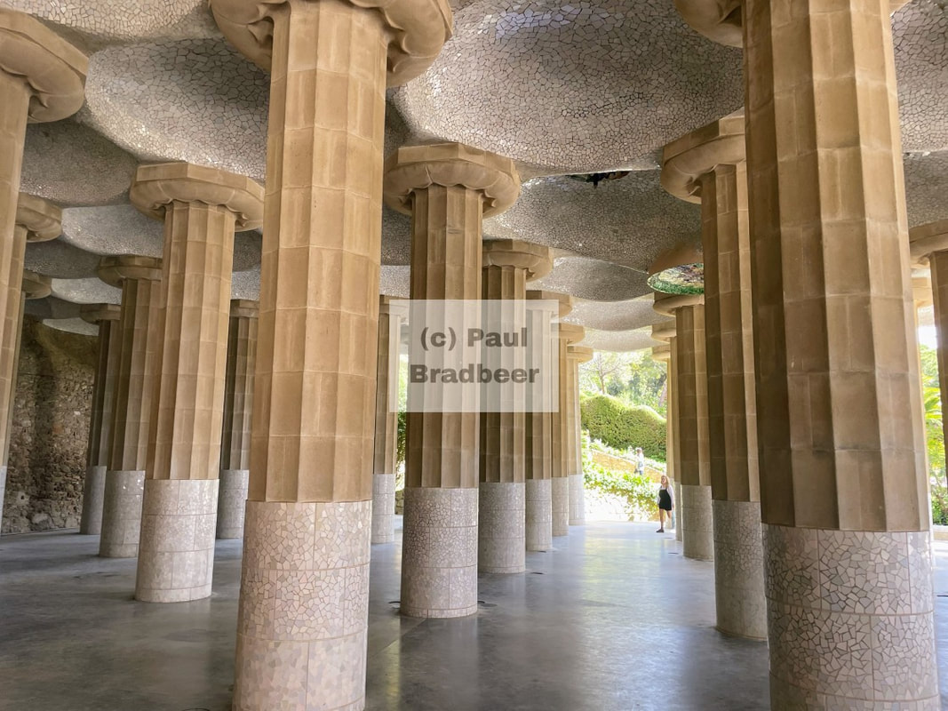
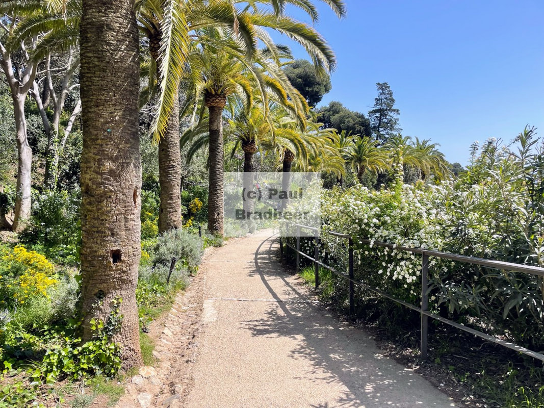
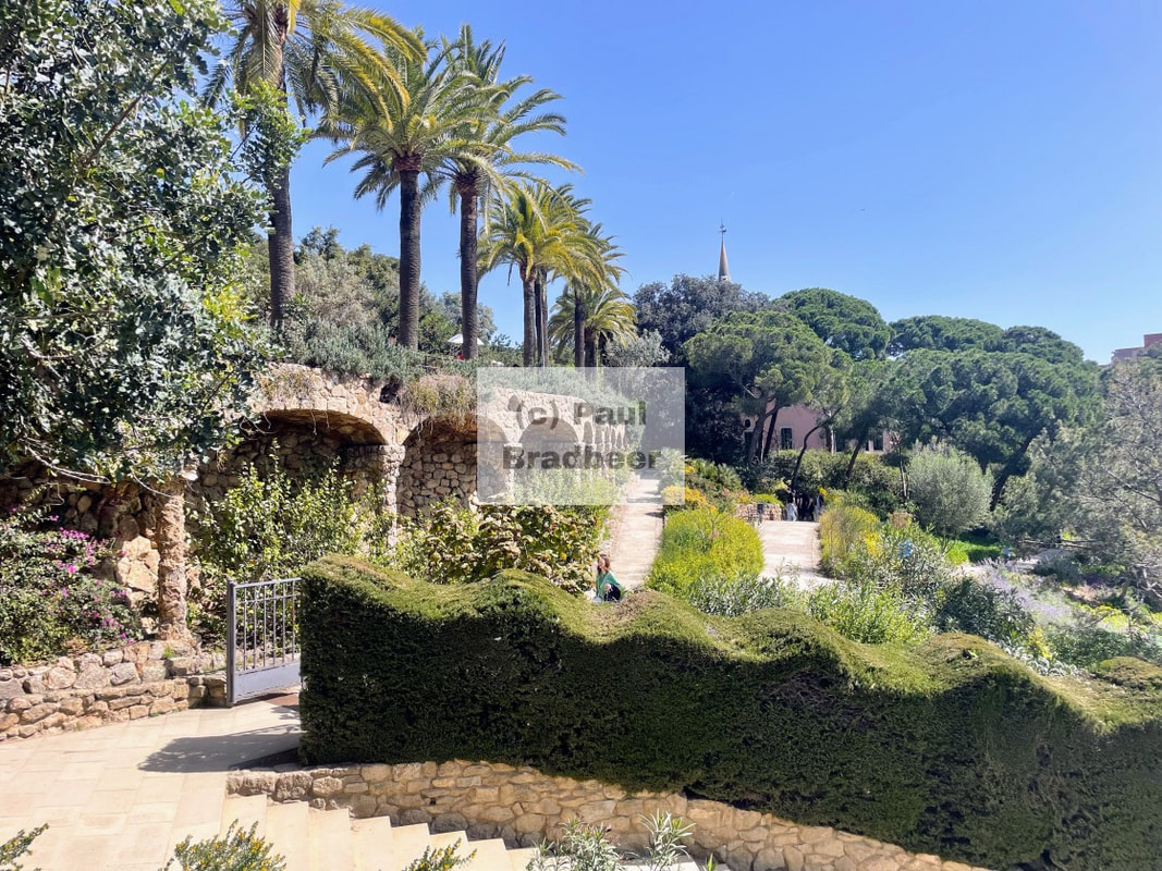
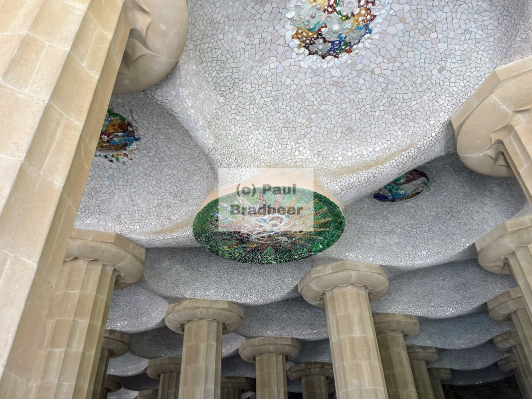
A half day visit to Park Guell on the outskirts is well recommended. Paying the extra for the guided tour gives additional context and insight and I found worthwhile. The park is a reworking of a failed vision for a housing project designed by architect Antoni Gaudi who was commissioned by Guell.
Gaudi was in his naturalist phase where he studied natural and organic forms and translated them into architecture. The vision and scope were huge, but it failed due to its remote location from the city, it's unconventional styling for the wealthy elite being targetted, and high cost of construction. It is easy to be critical and say these issues could be foreseen with a bit of testing the market and understanding the target audience, but from an artistic perspective you have to admire the scale and vision of the designs, and the creative mould Gaudi was trying to bring to the table. The park definitely feels like a rebellion against straight lines and safe design. It proves that imagination, not rivalry, is what creates something unforgettable - despite its lack of financial viability.
After a long period of mothballing, the park was eventually opened to the public, with admission by a paid ticket which is best bought in advance. It's well worth the visit, with some interesting history and insights into Gaudi's style as an artist and creator, and also some wonderful views over the city.
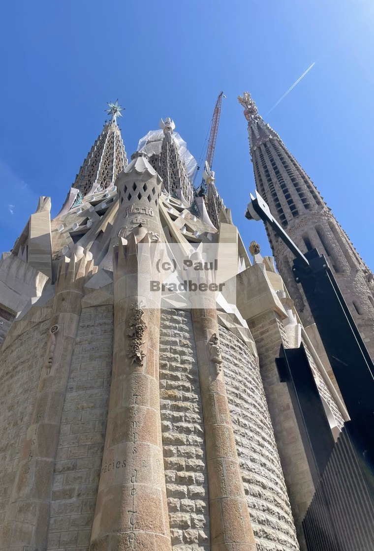
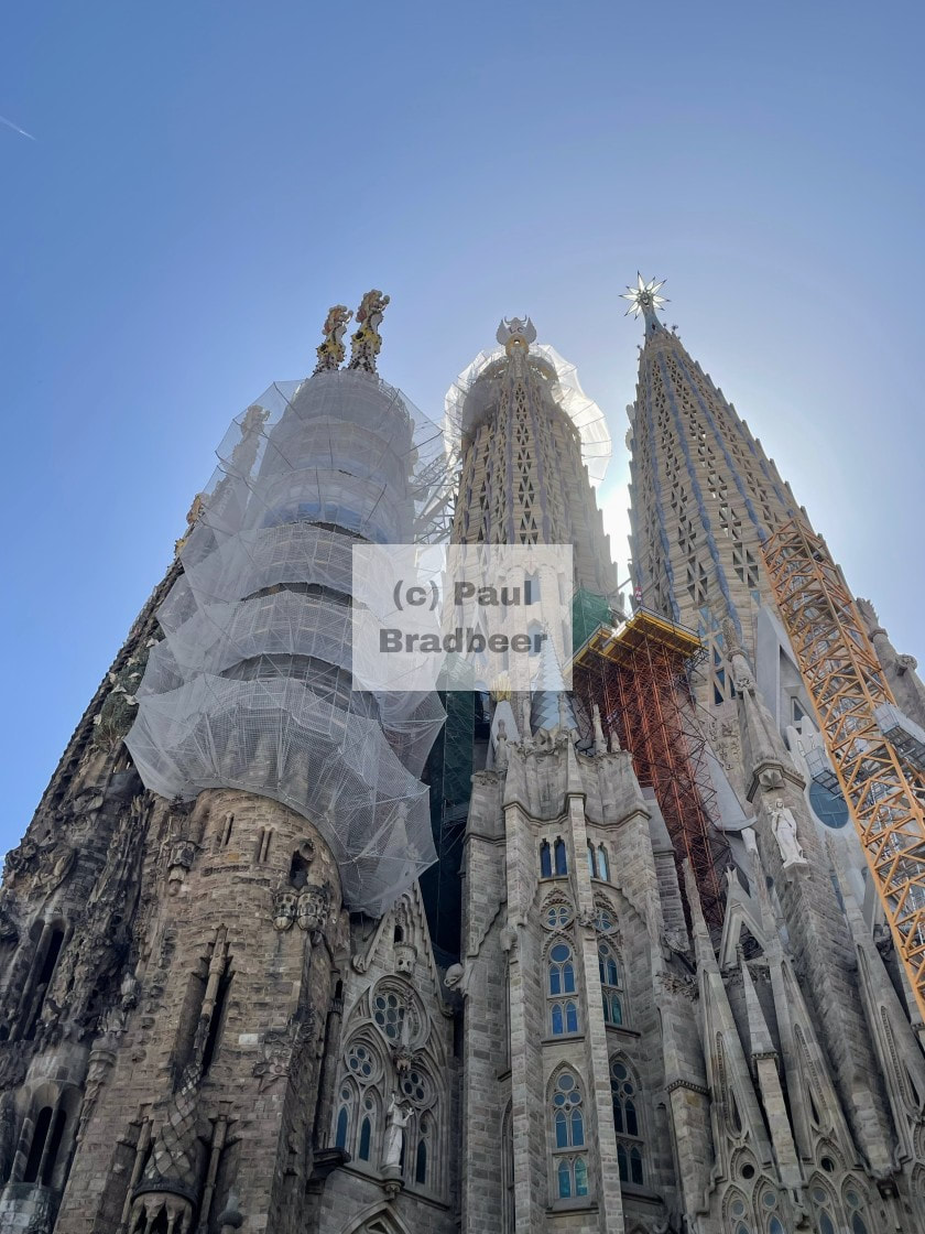
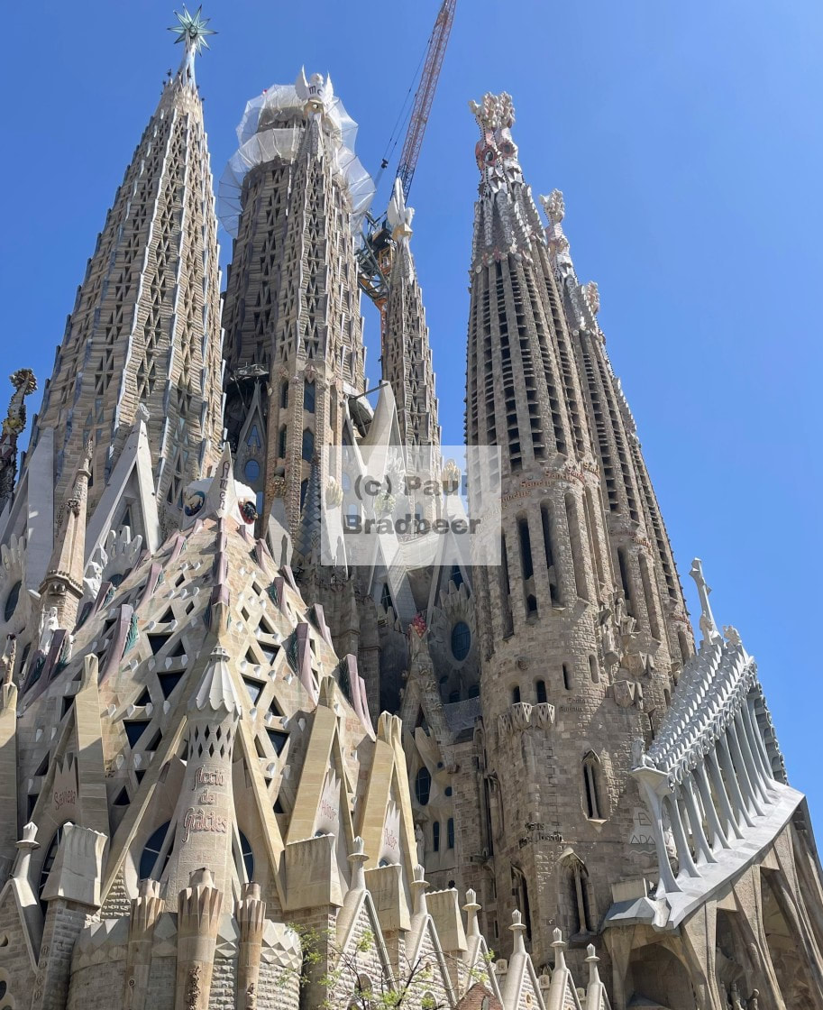
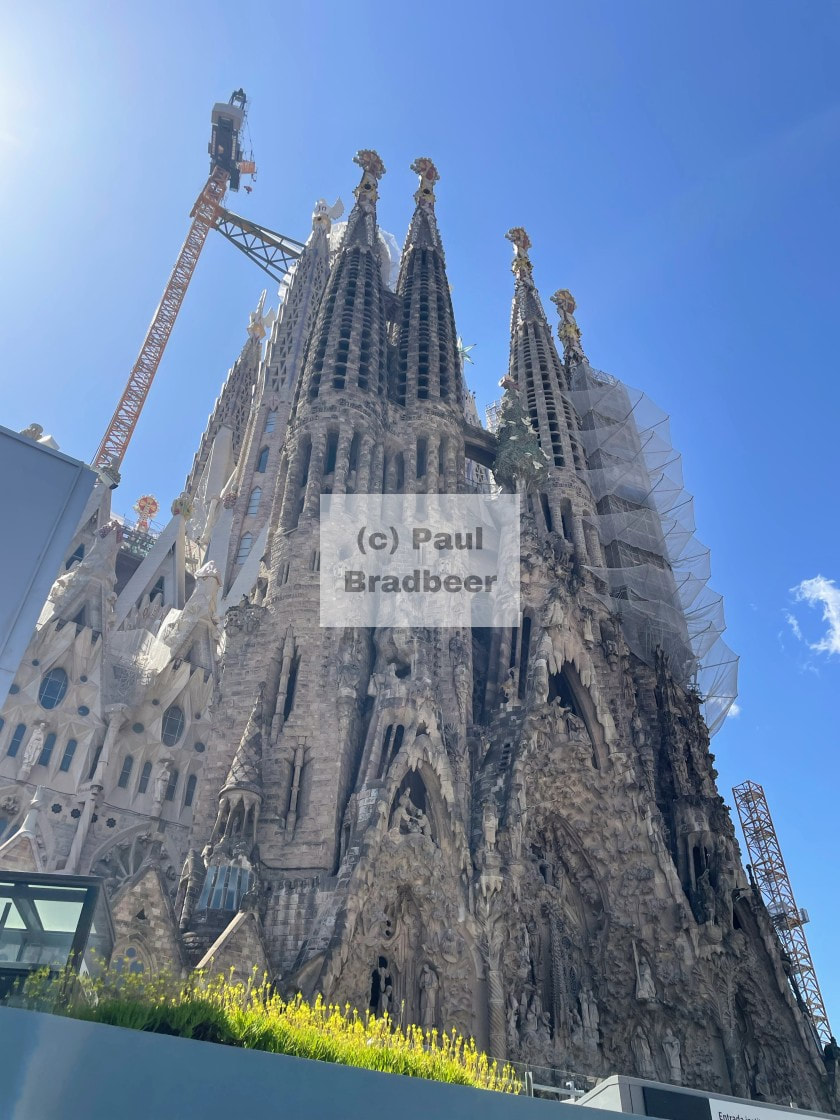
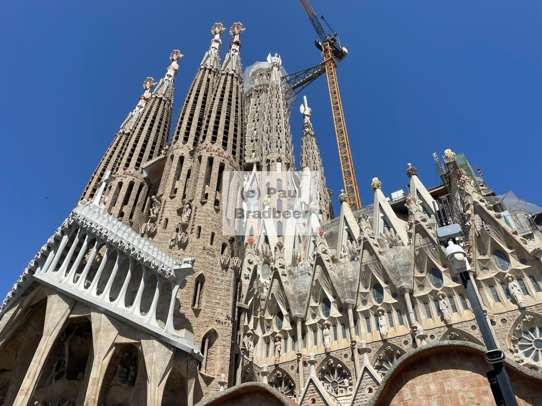

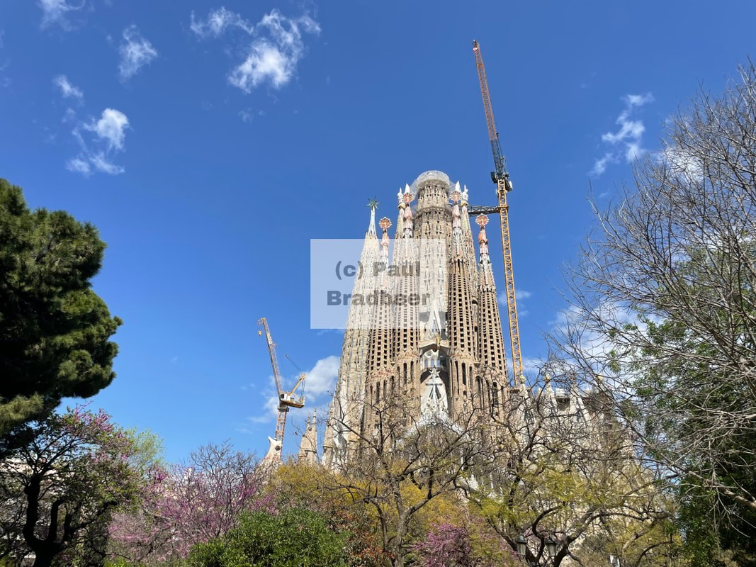
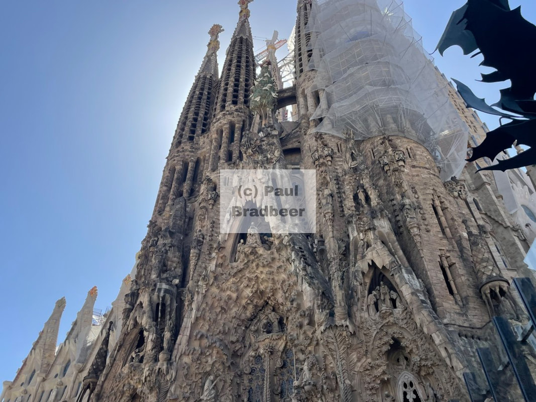
Walking down the hill towards the city centre you can visit the Sagrada Familia, another famous Gaudi creation and one which consumed a large part of his life's energy and finances.
Gaudi wasn’t trying to beat another architect, he was building something no one else could imagine. It’s not an "improved" church - it’s a completely different idea of what a church could be. He was a devout Catholic and when he took on the project in the 1880s he became more spiritually focussed. By the 1910s he dedicated himself almost exclusively to the work on this project. He saw the church as a way to glorify god through architecture, a bible in stone that would teach christian stories visually. Around the outside of the church you can see the detailed "stories" carved out in scenes with massive amounts of detail.
Looking into the history, it seems the project was controversial and criticised at the time of its inception - it simply was not traditional enough. Construction was really slow due to financial constraint which was primarily driven by private donations. This project did not make him rich by any means and indeed later in his life he personally struggled financially. He knew he was very unlikely to see its completion. Today it is still not finished!
It's evidence of a spiritual mission, lifelong religious dedication and an artistic expression of faith.
Today both Park Guell and Sagrada Familia are UNESCO World Heritage sites as a testament to Gaudi's grand vision and distinctive artistic style which effortlessly blends nature and architecture in a unique way. You can stand before them both today and marvel at the scale and brilliance of these wonderful creations.
Gaudí’s work reminds us that true creativity often transcends profit or approval - it leaves a legacy that endures long after the world catches up.
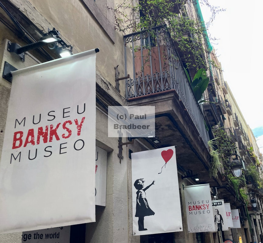
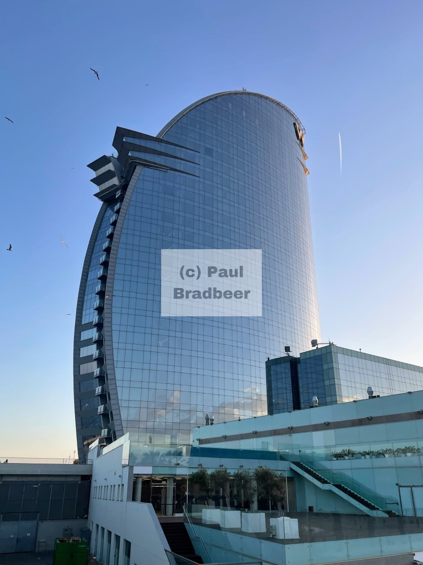
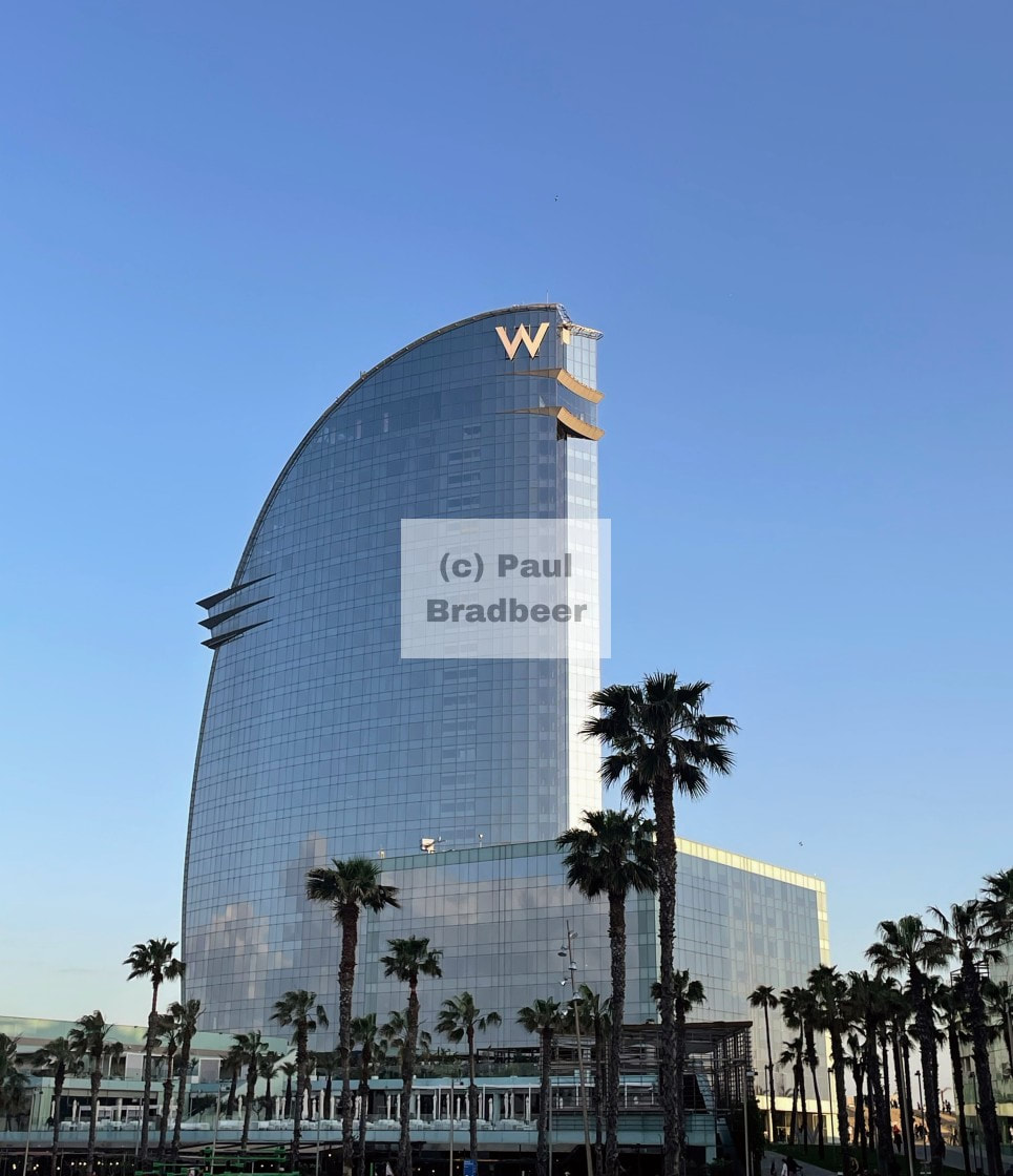
Some pictures of other landmarks and architecture around the city. A visual feast!
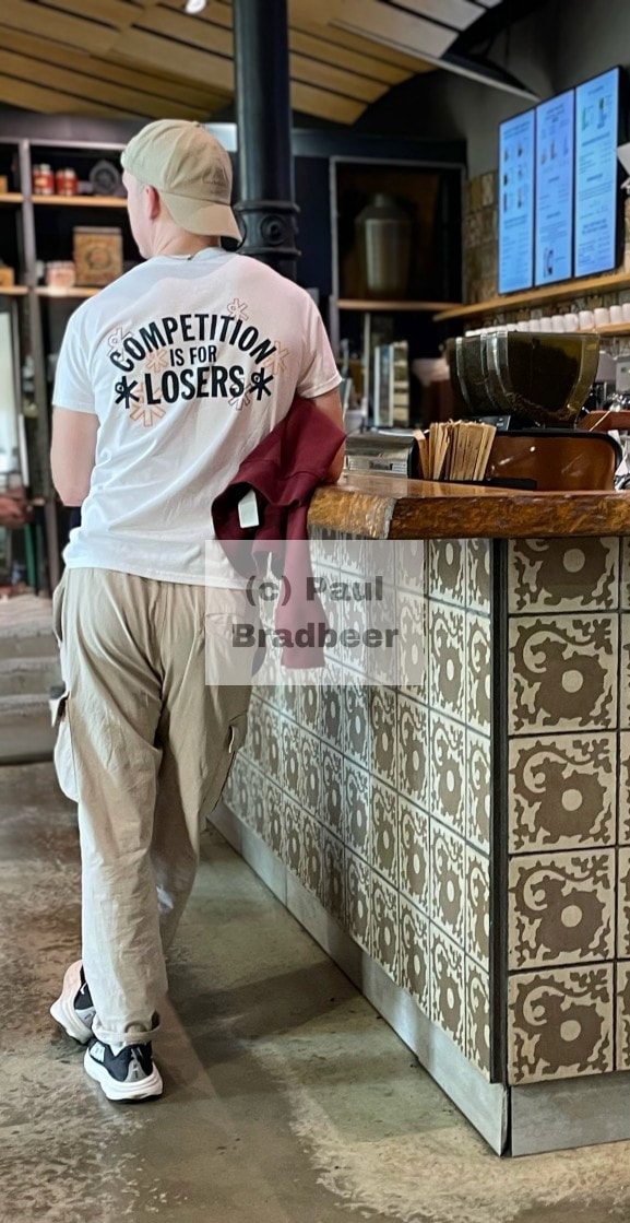
"Competition is for Losers". A phrase popularised in the business world by Peter Thiel in his 2014 treatise.
Monopolies win by being unique and authentic - build what no one else is building. When people or companies compete, they end up polishing the same ideas instead of creating new ones. There's nothing wrong with competition to optimise for the fastest, cheapest, biggest, "best" etc... but the real breakthroughs come from those who step sideways, not forward in the same race.
As Neil Peart reminds us in the Rush song Grand Designs, the truly original work often comes "against the run of the mill…breaking the surface tension with wild kinetic dreams". This is exactly the spirit that drives true innovation, creating something timeless, regardless of immediate approval or externalities. Not competition against others, but authenticity of the self.
"A to B —
Different degrees…
So much style without substance
So much stuff without style
It’s hard to recognize the real thing
It comes along once in a while
Like a rare and precious metal
Beneath a ton of rock
It takes some time and trouble
To separate from the stock
You sometimes have to listen to
A lot of useless talk
Shapes and forms
Against the norms —
Against the run of the mill
Swimming against the stream
Life in two dimensions
Is a mass production scheme
So much poison in power
The principles get left out
So much mind on the matter
The spirit gets forgotten about
Like a righteous inspiration
Overlooked in haste
Like a teardrop in the ocean
A diamond in the waste
Some world-views are spacious —
And some are merely spaced
Against the run of the mill
Static as it seems
We break the surface tension
With our wild kinetic dreams
Curves and lines —
Of grand designs…"
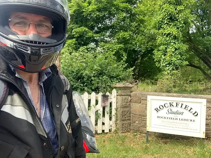
June 2024 - The Magic of Rockfield
I had heard a couple of days earlier that Lisa Ward, Studio Manager at Rockfield Studios would be able to meet me and potentially show me around, dependent on what has happening on the day.
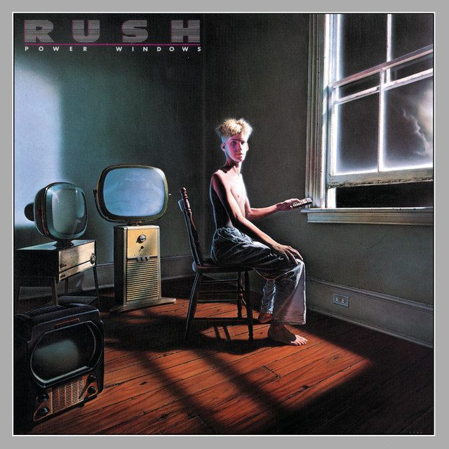
My adolescent years and twenties were spent endlessly messing on with electronics, recording equipment, valve amplifiers, guitars, drum machines and all manner of analogue boxes of tricks (home made spring reverbs, pre-amps, WEM copycat echo tape loop, effects pedals) - all against a backdrop of 70s and 80s rock music created by many of the same bands who recorded at Rockfield, including Rush who recorded A Farewell to Kings and Hemispheres there in 1977 and 1978 respectively. This visit was very personal. Robert Plant, Queen and Oasis all have significant history here.
Rockfield is well documented elsewhere and so I won't waste time duplicating at any length here. Here is a decent sound-on-sound article which covers something of the history and talks a bit about the equipment.
There's also a great BBC documentary about Rockfield called "Rockfield: The Studio on the Farm"
Further history and current information can be acquired from the studio webpages and any number of other web sources. Just hit up your favourite search engine.
The day was going to be a hot one and already at half nine in the morning the sun was pumping out a steady heat through an azure blue sky.
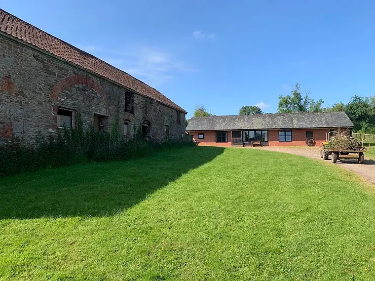
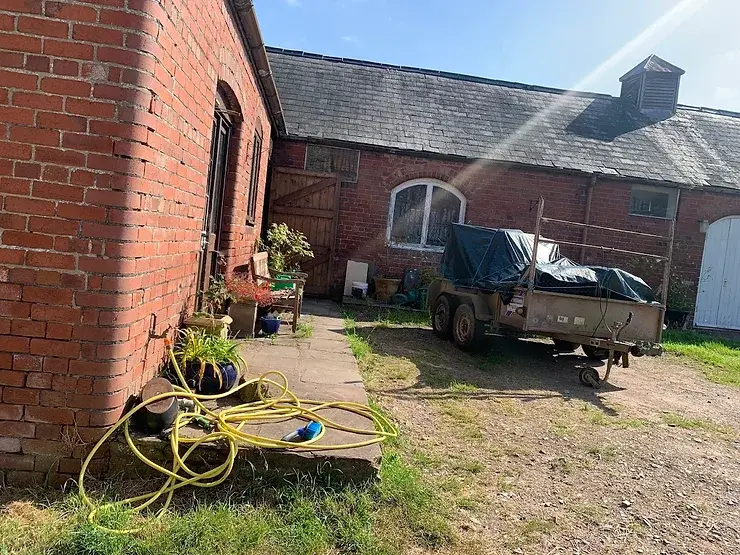
I arrive a little early and parked my bike in the main courtyard and went to introduce myself. Arrangements were very informal and friendly, and I couldn't have hoped for better hospitality. Lisa was incredibly knowledgeable both in terms of the history of Rockfield, the current operation and the equipment (a lot of it original analogue kit which is distinctive and unique).
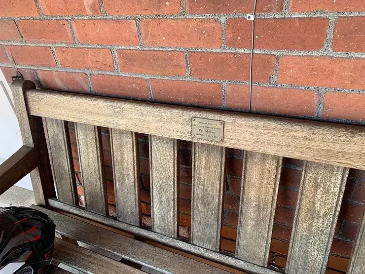
A bench I spotted in the courtyard dedicated to the memory of Pat Moran, a record producer and engineer who had undertaken notable work at the studio.
Taken from this obituary written by his brothers Brien and John Moran,"He was the assistant engineer on Queen's 1975 album A Night at the Opera and was engineer on the 1977 Rush album A Farewell to Kings. He produced Iggy Pop's Soldier (1980), Hawkwind's Choose Your Masques (1982), Robert Plant's The Principle of Moments (1983) and Big Country's No Place Like Home (1991)."
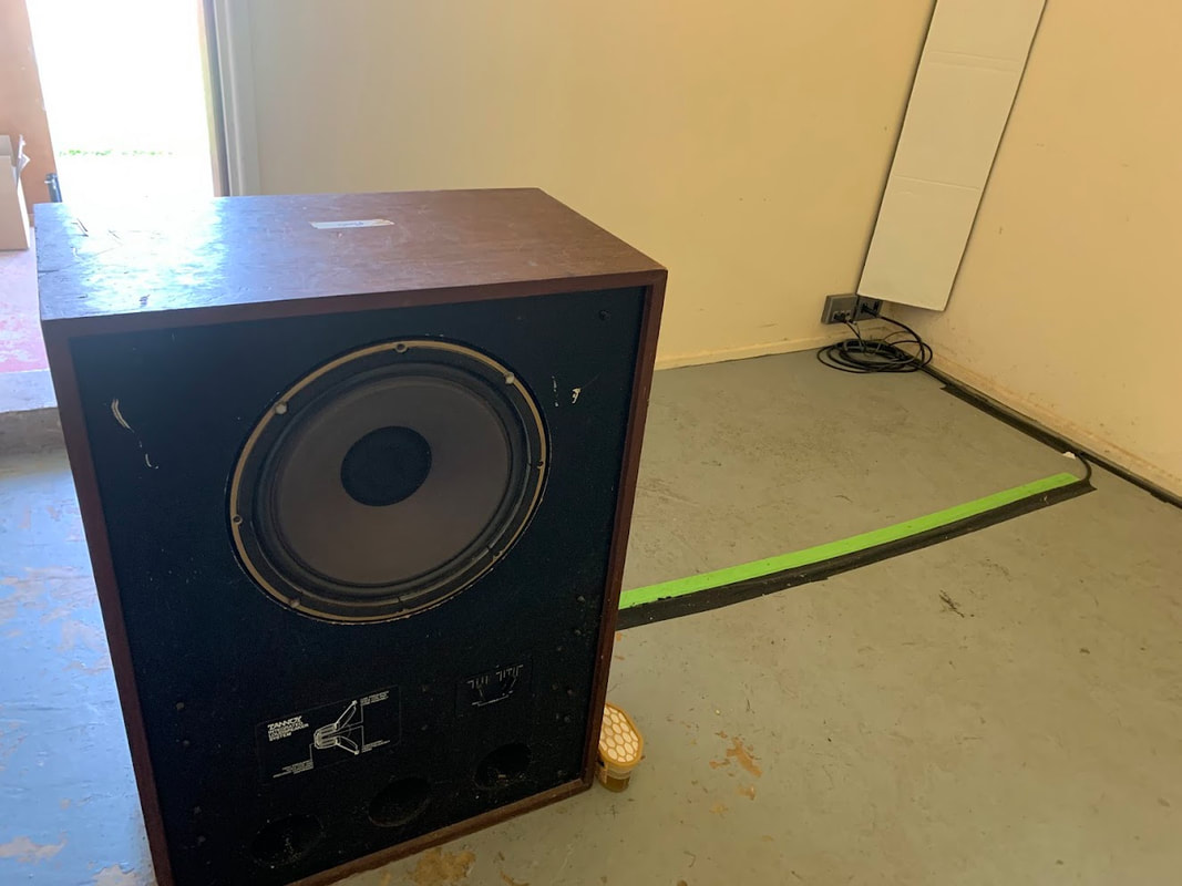
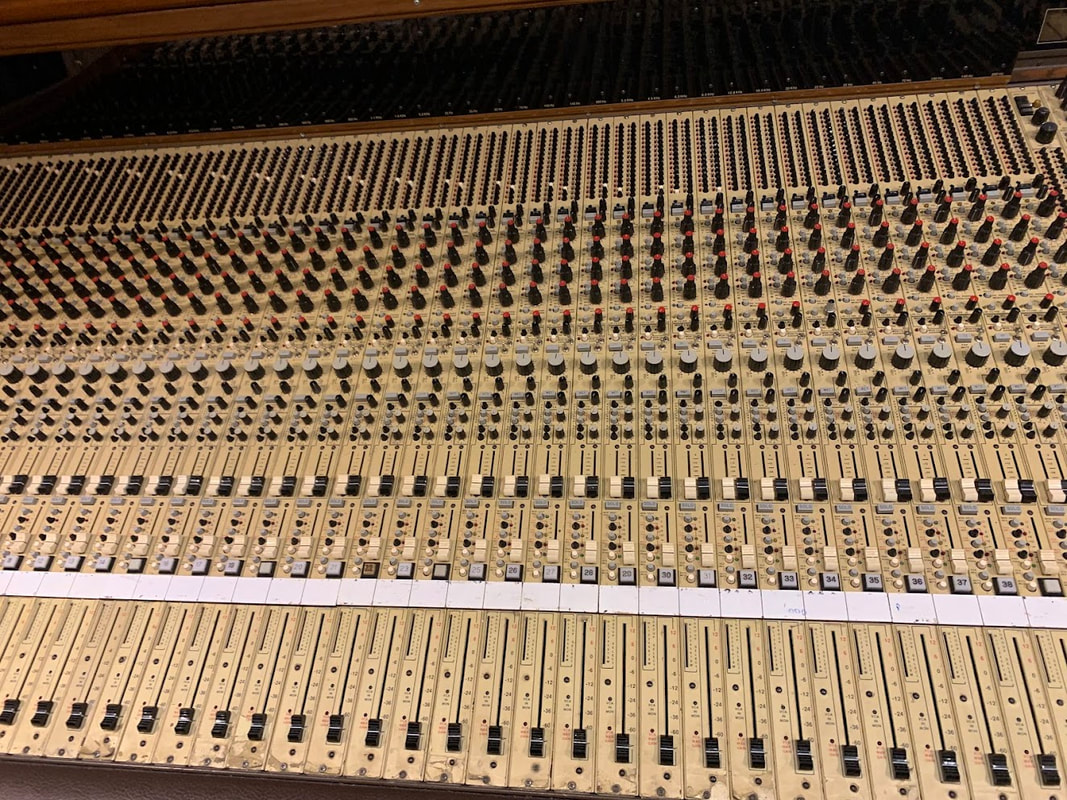
I toured one of the original reverb rooms. Not many studios can provide such authenticity choosing instead to fully rely on a digital kit bag. Rockfield can provide both.
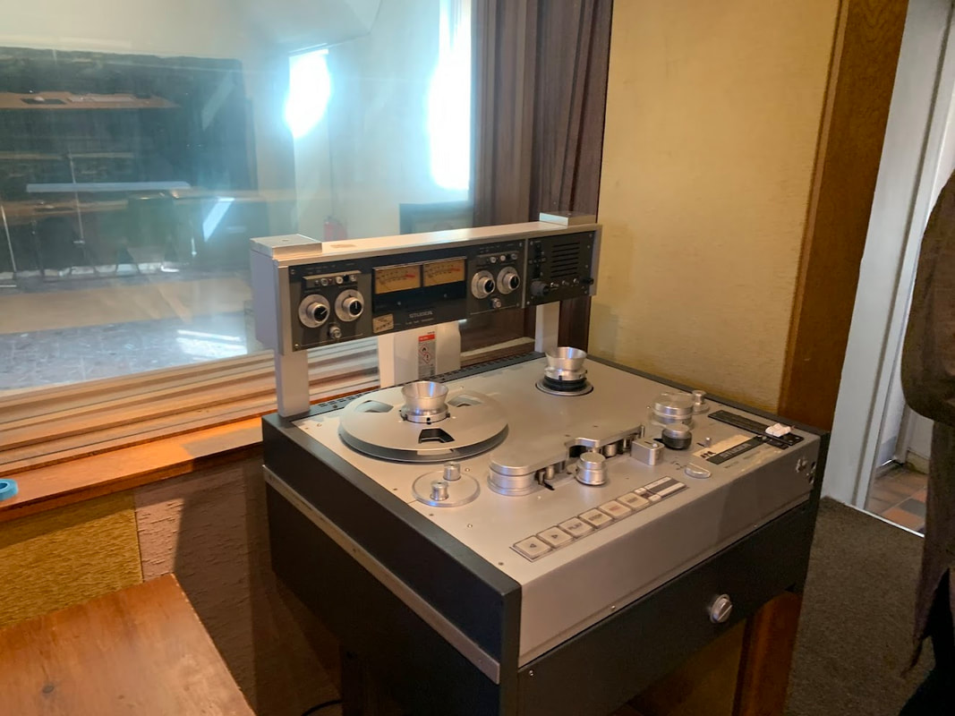
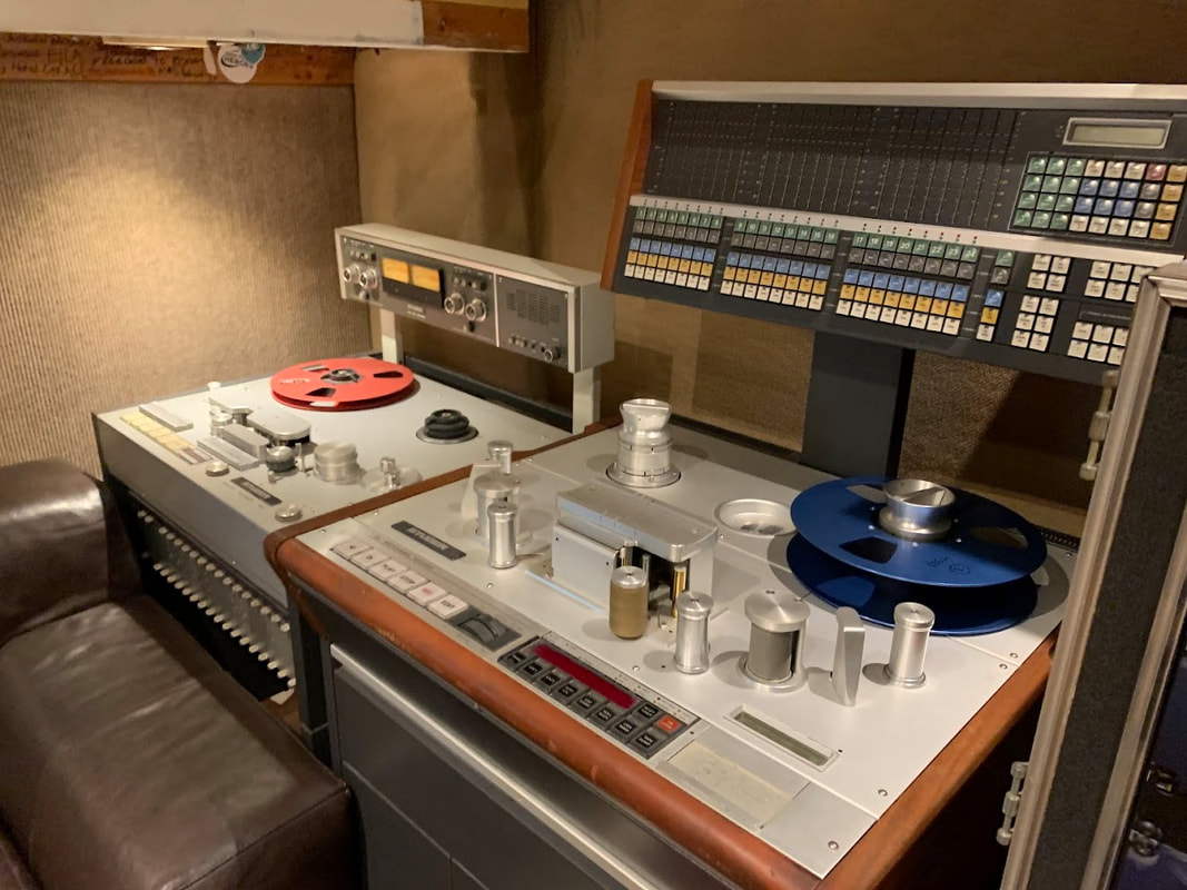
Some original multi-track reel to reel recorders. The mag tape can be difficult to source and often needs to be imported at high cost.
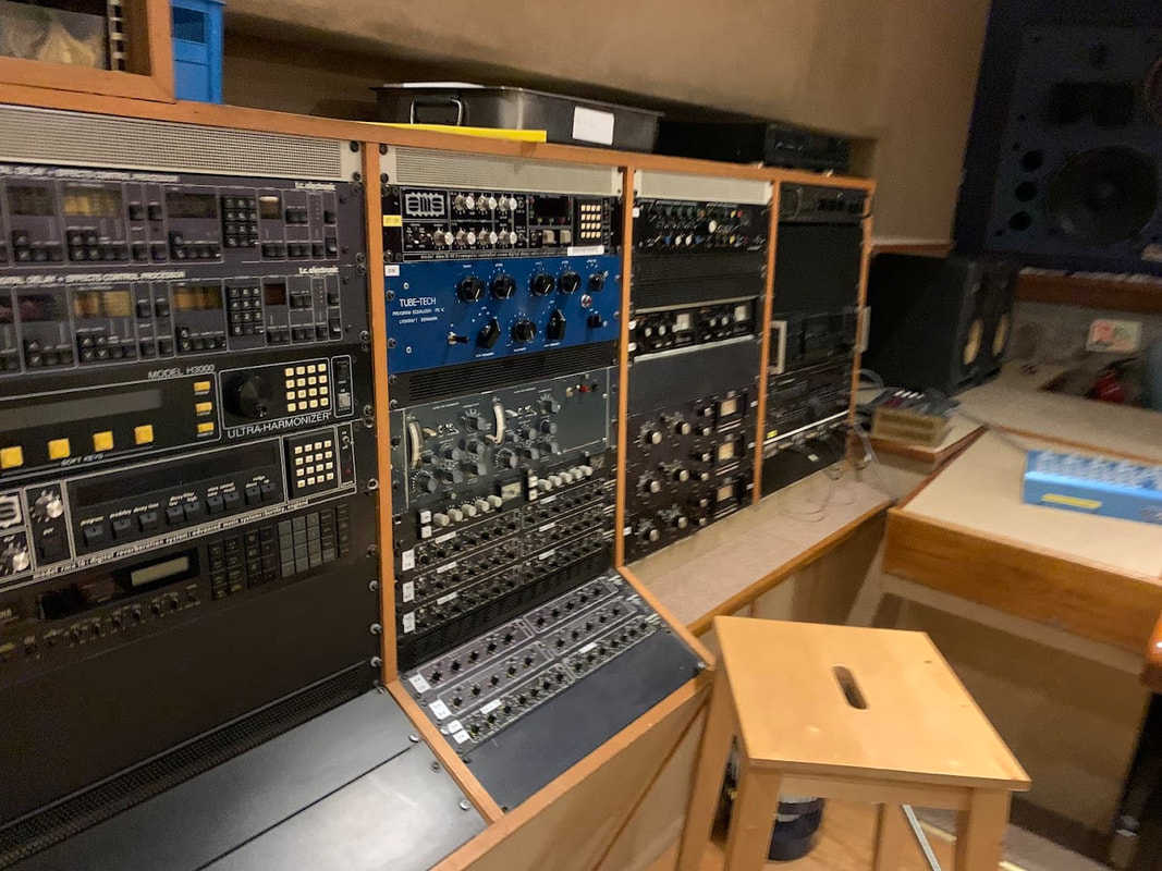
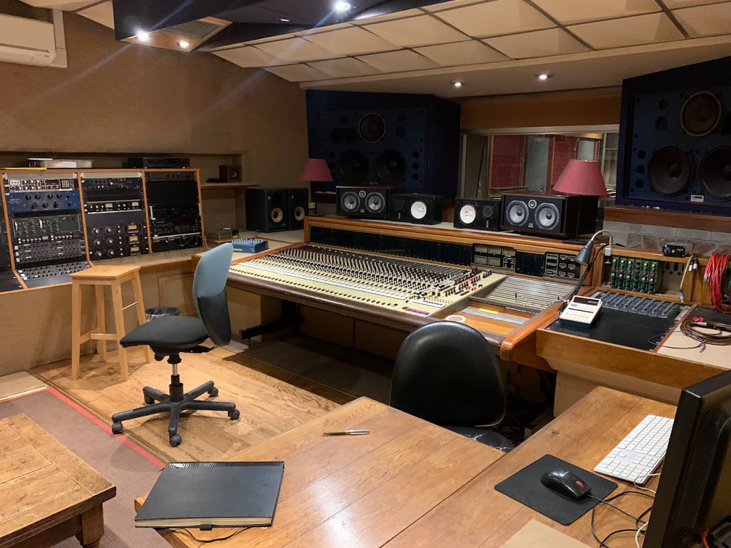
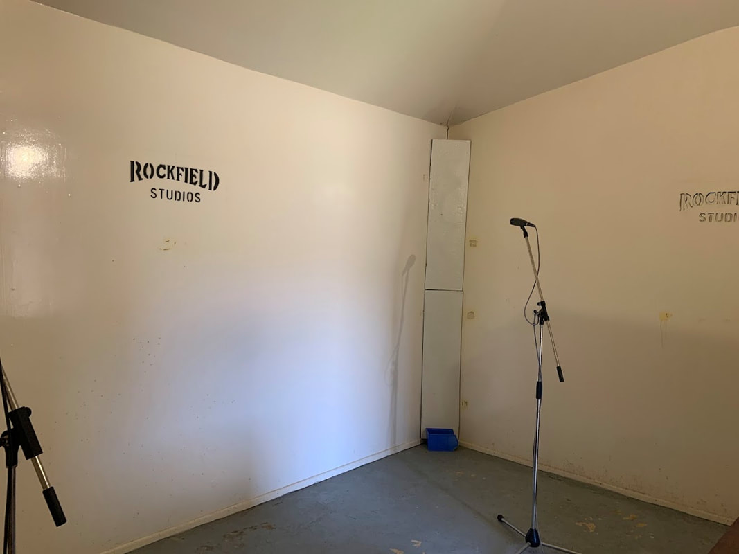
The studio where Rush recorded A Farewell to Kings and Hemispheres. I'm like a kid in a sweet shop at this point.
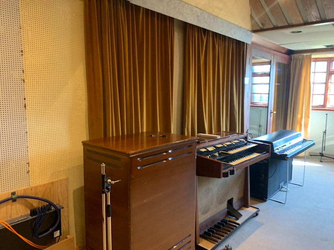
Corridors and rooms are littered with mic stands, keyboards, and other musical paraphernalia.
One of the other studios (coach house I believe)
The facility has clearly been recognised over the years with many accolades. (pictured is just a sample of what is on show).
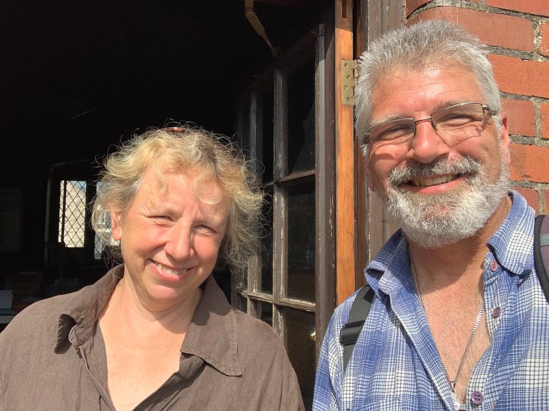
A massive thank you to Lisa for her incredible hospitality and sharing some of her experiences and knowledge with me. Gratitude! What a great place.
Goodbye Rockfield. Onward to some magnificent scenary in the Brecon Beacons